Map size in jpg-format: 1.8327MiB
Click to open in high resolution (open in new tab).
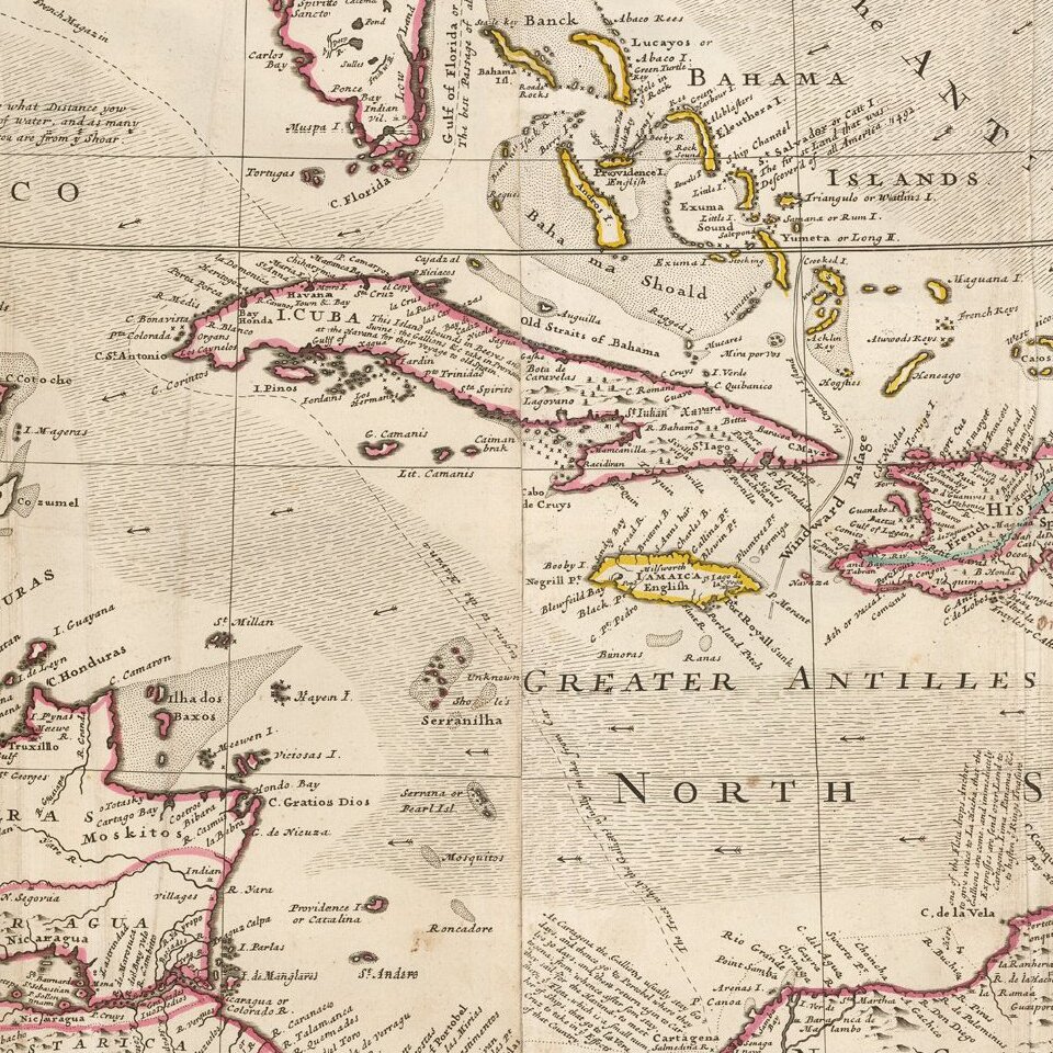
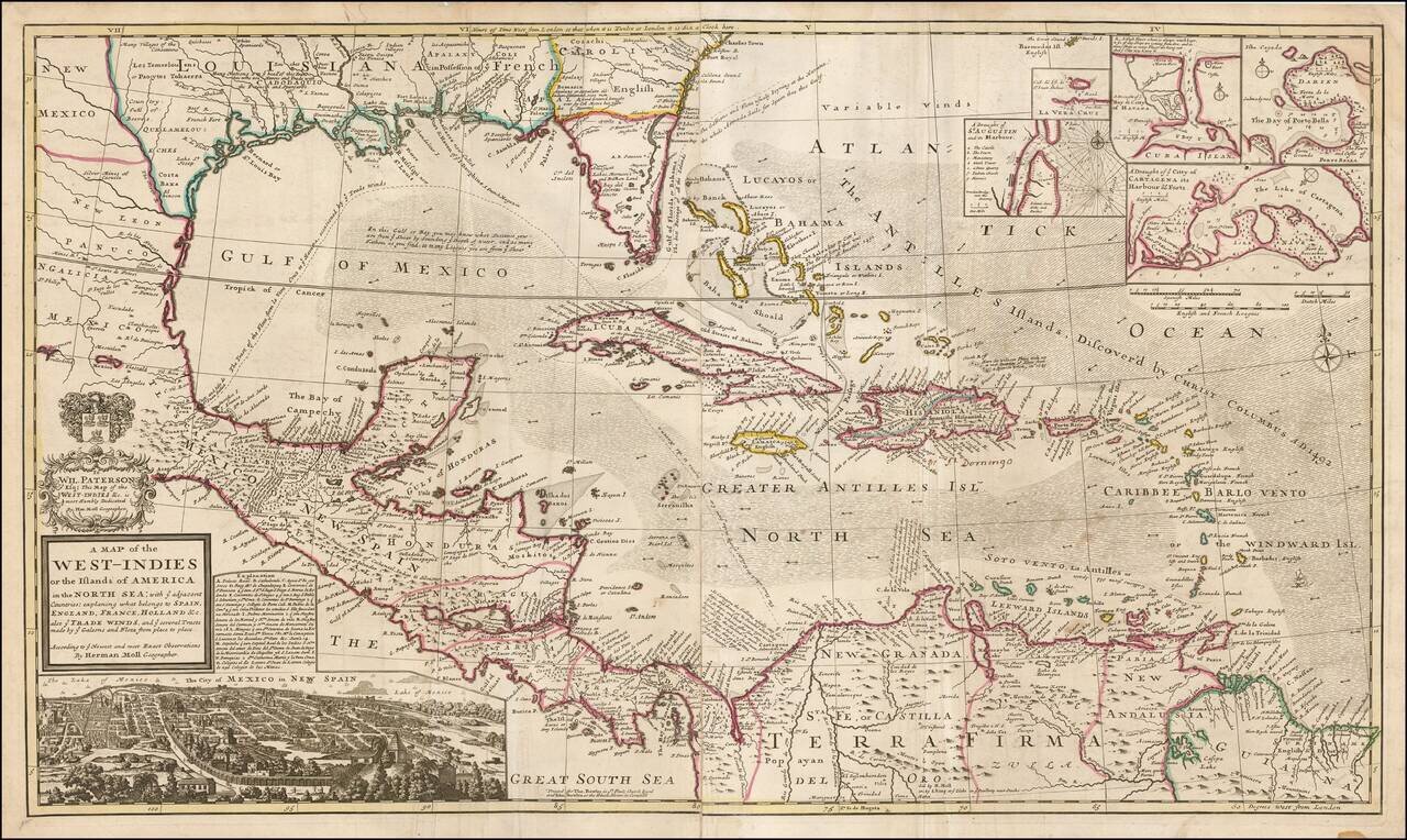
Highly detailed and decorative large format engraved map of the Caribbean by Herman Moll.
Moll's map was the most popular large English map of the Caribbean, Florida, the Gulf Coast, Texas, and Central America in its day. It was a central image in the British understanding of Spanish activity in the Caribbean, as the note at Cartegena illustrates:
At Cartagena the Gallions usually stay 60 days, and thence go to Portobel where they lye 30 days, and then return again to Cartagena; from whence they sail for the Havana, to meet there ye Flota, which is a finall number of Ships that go to la Vera Cruz to take in ye Effects of that Country.The map includes insets of the harbors at St. Augustine, Vera Cruz, Havana, Porto Bella and Cartagena and a gorgeous view of Mexico City.
The map includes numerous annotations throughout. Curiously shaped Florida, which is unusually wide. Good internal cartography in Florida, Texas and the Gulf Coast, with interesting notes regarding the Spanish fort at Pensacola, the trade conducted between the Indians and the French and Spanish in Texas, and a white Spaniard settlement in Texas on the Sivoras River.
A note in western Florida mentions Colonel James Moore's 1704 raid into the heart of Apalachee province. James Moore (c. 1650 – 1706) was the English governor of colonial Carolina between 1700 and 1703. He is best known for leading several invasions of Spanish Florida during Queen Anne's War, including attacks in 1704 and 1706 which wiped out most of the Spanish missions in Florida. He captured and brought back to Carolina as slaves thousands of Apalachee Indians.
In this state, the imprint line reads:
Printed for Tho. Bowles in St. Pauls Curch Yard and John Bowles at the Black Horse in Cornhill.Thomas Bowles II and John Bowles were brothers, sons of the founder of the Bowles publishing house, Thomas Bowles I. John operated from the Black Horse from around 1733, dating this state to after that point.
If you are a student, write to us in telegram: @antiquemaps and indicate what material you need and for what work you need a map in high detail. We are ready to provide material on special terms. For students only!


