logo

1635. Insulae Americanae in Oceano Septentrionali cum Terris adiacentibus

  • Insulae Americanae in Oceano Septentrionali cum Terris adiacentibus

Insulae Americanae in Oceano Septentrionali cum Terris adiacentibus information:

Year of creation: 
Resolution size (pixels): 
 13686x10311 px
Disk Size: 
 34.6901MiB
Number of pages: 
 1
Place: 
 Amsterdam
Author: 

Print information. Print size (Width x height in inches):
Printing at 72 dpi 
  190.08 х 143.21
Printing at 150 dpi 
 91.24 х 68.74
Printing at 300 dpi 
 45.62 х 34.37

An example of detailing the file of this map of in a printable high-resolution:

Click to open in high resolution (open in new tab).
Attention! this is just the central piece (central area 960x960 px) of the map file!
This is an example, so that you can see and study the level of detail of a given map. The entire Map will be fully available after payment!

Insulae Americanae in Oceano Septentrionali cum Terris adiacentibus

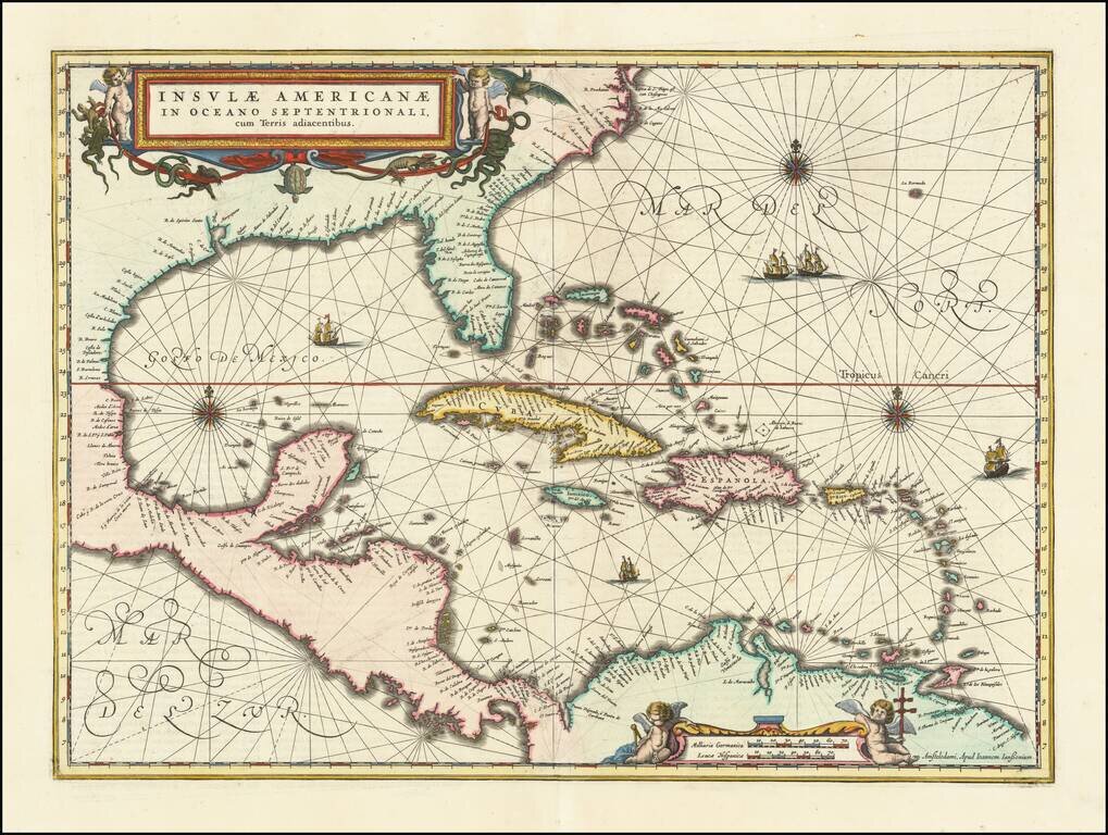
Finely colored example of Jansson's edition of Hessel Gerritsz' rare chart of 1631.

The area covered is exactly the same as the original Gerritsz map, except for the addition of the west coat of Central America. The nomenclature in North America is virtually identical, other than the addition of Virginia on this map. It reflects the first hand knowledge of Gerritsz during his voyage to South America and the West Indies undertaken in 1628.

A nice example in full color, with rhumb lines, sailing ships, compass rose and fine cartouches.

Burden 248

Special conditions for students!

If you are a student, write to us in telegram: @antiquemaps and indicate what material you need and for what work you need a map in high detail. We are ready to provide material on special terms. For students only!

Item information:

Year of creation:
Size:
13686x10311 px
Disk:
34.6901MiB
Number of pages:
1
Place:
Amsterdam
Author:
Jan Jansson.
$14.99

Related item