
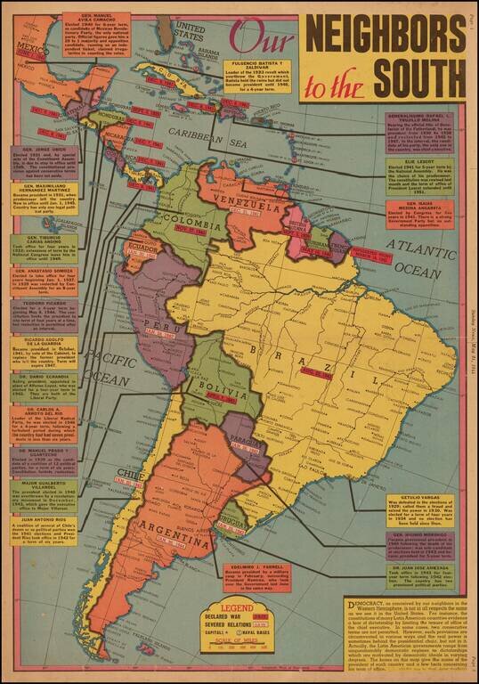
Latin American Democracy --"The Real Power Is Sometimes Behind The Presidential Chair, But Not In it." Scarce New York Sunday News map of the Pacific Theater, drawn by Edwin L. Sundberg. A graphic look at the various presidents and other leaders of...
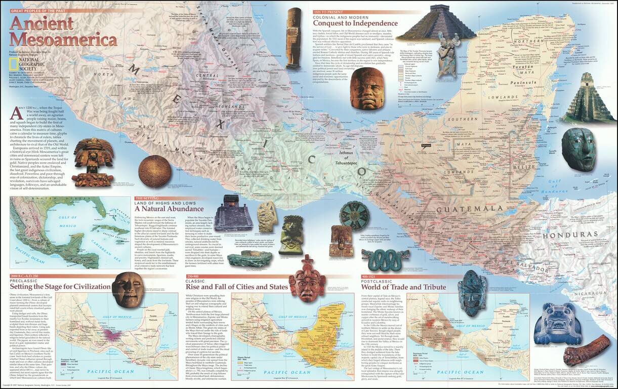
Fascinating pictorial map that portrays the pre-colonial history of Central America from southern Mexico to Nicaragua. Map itself shows the region, with information on cities, trade routes, topography, and the economies of each area. Insets detail the...
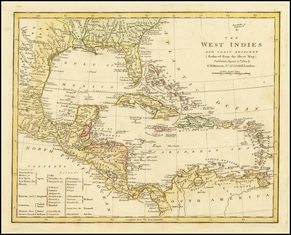
Marvelous map of the West Indies, Florida, the Gulf Coast, Texas and Central America, published by Wilkinson. Includes a key showing the various colonial possessions of Spain, England, the United States, France, Holland, Denmark and Sweden, along with...
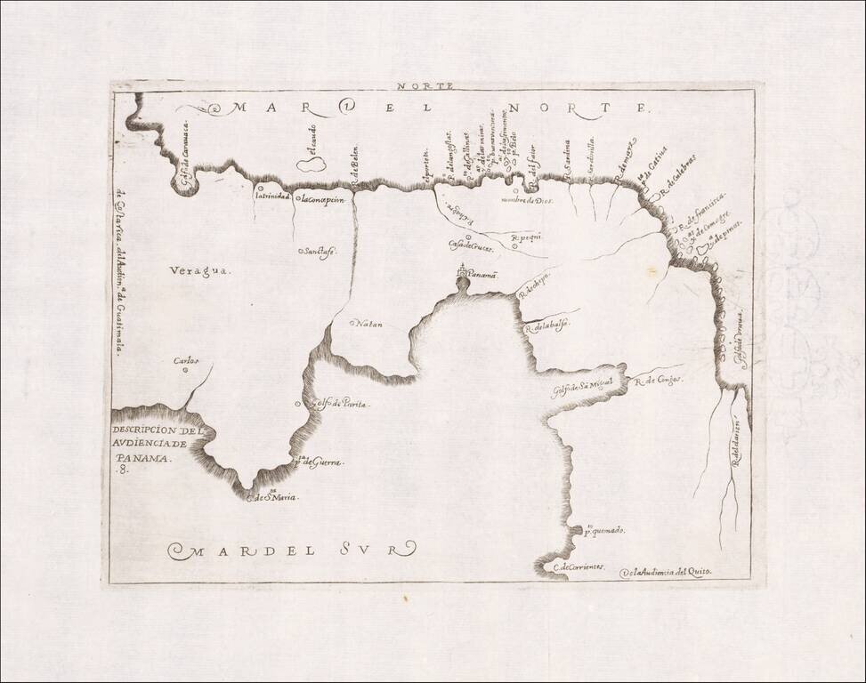
Rare early map of the Audiencia of Panama, locating rivers and settlements. The earliest map to include information from the previously secret manuscript maps of the Spanish cosmographer, Juan López de Velasco.
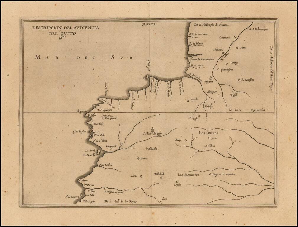
Amsterdam edition of Antonio de Herrera y Tordesillas' map of the Audiencia of Quito, from his Descripcion de las Indias Occidentalis, first published as part of his Historia General, in Madrid in 1601. This map is the earliest printed Spanish map to...
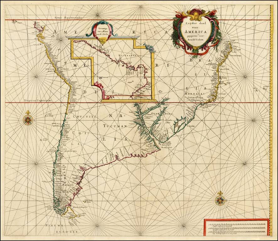
Fine example of Arnold Colom's rare and highly important sea chart of most of South America, first published circa 1656. Colom's map is one of the earliest obtainable Dutch Sea Charts to show the Sea Coasts of South America and the rarest of the early...
![[Panama - Silver Trade - Pirates] De Cust van Westindien, Tusschen Punta St. Blaes, en Punta d Naes. . .](/map/small/63779.jpg)
Spanish Silver and Pirates Extremely rare early sea chart by Arent Roggeveen, showing the Panamanian Coastline, between Bahia St. Blaes and and Punta de Naes, centered on Nombre de Dios and Porta Bella. Oriented with south at the top, the map shows...

Finely executed map of a portion of Central America, extending from the East Coast of Nicaragua and Costa Rica in the northwest to Cartagena and Santa Martha in modern Columbia in the East, and centered on the Isthmus of Darien and Gulf of Panama....
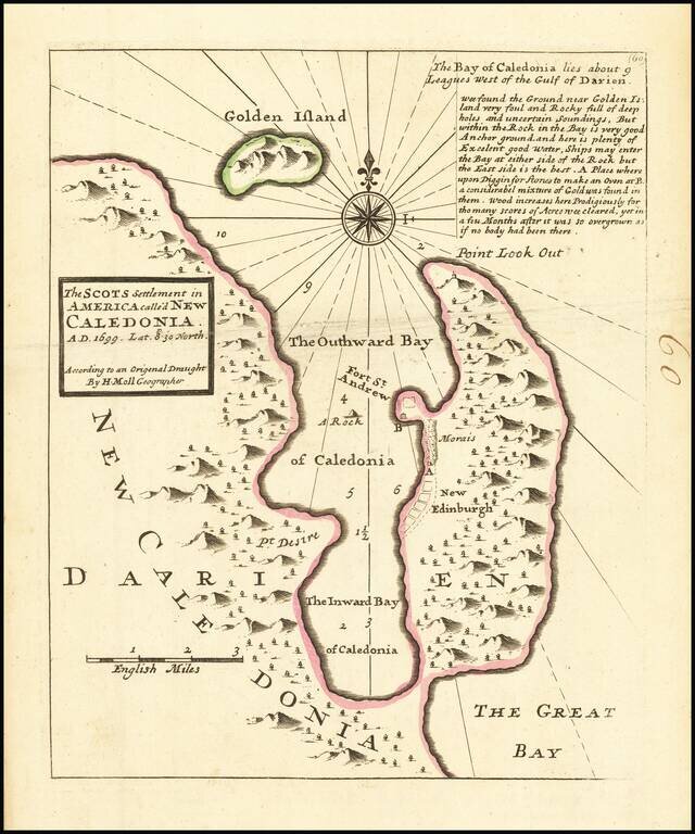
Interesting map depicting the site of the short-lived Scottish colony of New Edinburgh. In 1698, William Paterson, Scottish Governor and founder of the Bank of England, proposed a plan to create a colony in modern day Panama. The Company of Scotland...
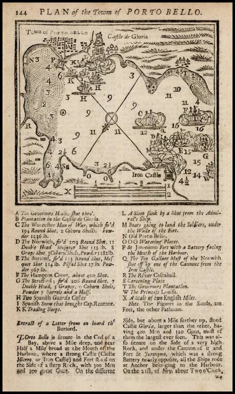
Fine example of the map of Porto Bello with a key showing points of interest. This is a very early map for the Gentleman's Magazine, the first year in which maps illustrated the book.
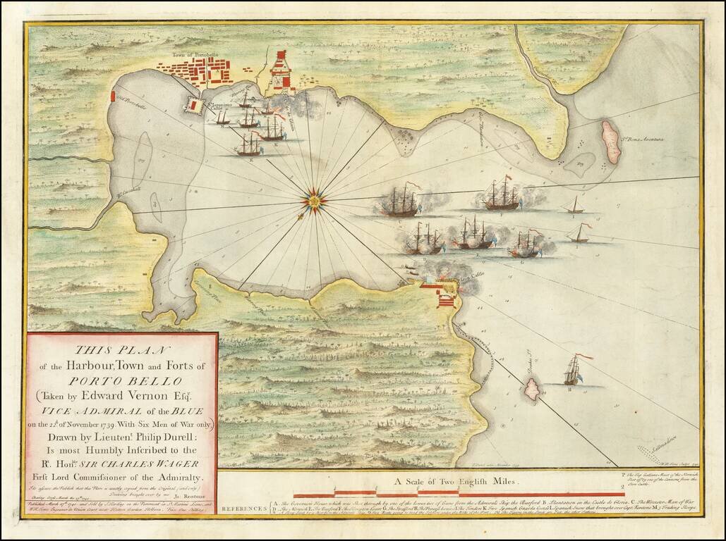
One of the First Maps of the Battle of Portobelo— First Plate Example Rare and highly influential plan of Portobelo, Panama based upon the sketch of Phillip Durrell, then a Lieutenant in the British Navy, and brought to London by Captain James...
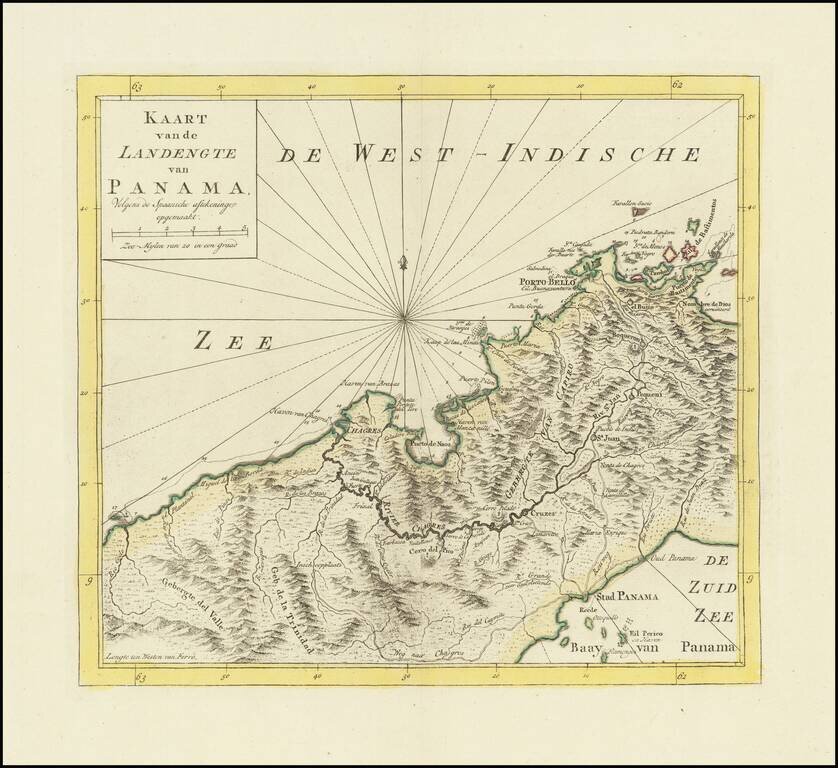
Detailed map of Panama, published in Amsterdam by Isaak Tirion. Extends from Panama City at the southeast, Chagres at the northwest and Porto-Bello at the northeast. Several missions are also located. Roads and the Chagres River connect them all.
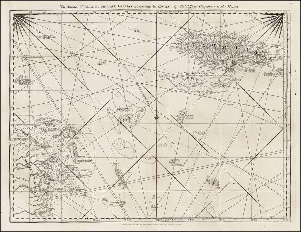
Detailed map of the Island of Jamaica and the Mosquito Coast, with the islands and shoals between, from Jefferys West India Atlas.
![[Belize] A Map of A Part of Yucatan or of that Part of the Eastern Shore within the Bay of Honduras Allotted to Great Britain for the Cutting of Logwood, in consequence of the Convention Signed with Spain on the 14th July 1786. By a Bay-Man . . . 1787 [](/map/small/60976.jpg)
First Modern Map of Northern Belize, with Text from the Logwood Treaties between Britain and Spain Rare, separately published 1787 logwood map of Honduras and modern-day Belize printed by William Faden, Geographer to the King. This is the first...
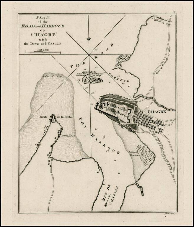
Rare plan of Chagres Harbor. The map includes a plan of the Castello del San Lorenzo, town plan, roads, customes house and other features. One of the earliest obtainable plans of the harbor.
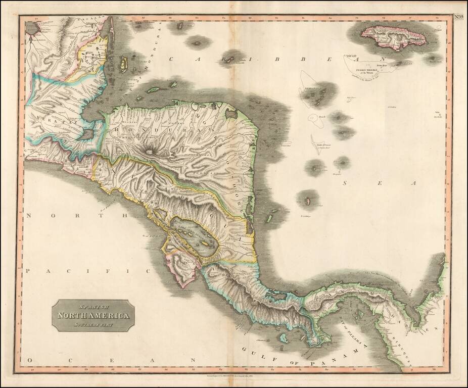
Attractive map of the region from the Bay of Honduras to Panama and the Gulf of Darian, extending to Jamaica.