

First Edition of the Second World Atlas Published in America. A landmark atlas from the American school of mapmaking. Carey's General Atlas is the second edition of Carey's 1795 General Atlas For Carey's Edition Of Guthrie's Geography, which was the...
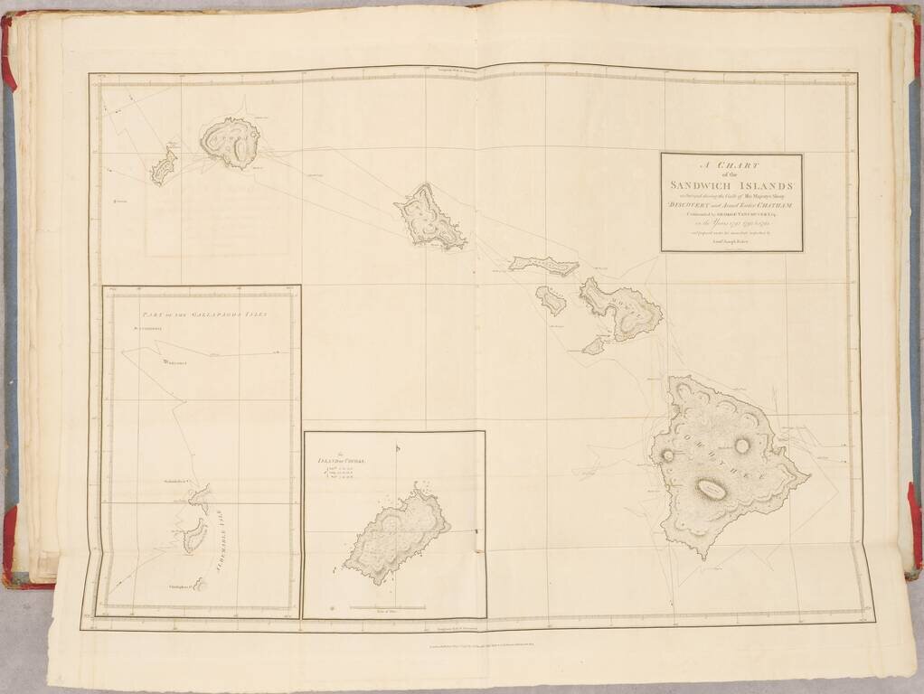
First Edition of Vancouver's Voyage of Discovery with Atlas, Containing Influential Charts of Hawai’i and the Pacific Northwest Fine, complete four-volume set of Vancouver’s A Voyage of Discovery to the North Pacific Ocean, and Round the World...

Restructuring Germany Two rare German regional atlases, published by J.C. Lange in Leipzig in 1803 and 1804. The collation of the first work is very difficult. The title calls for 12 maps, but only 11 map sheets are present. All but the first map...

Beautiful example of John Cooke's unusual and rare miniature atlas for children, with its complement of circle-framed maps copper-engraved maps. Cooke chose to diverge from almost all other mapmakers of the time in framing all of his maps in circular...

A Dane Eyes the East Coast of Britain. First edition of this very rare Danish atlas of the North Sea. Paul de Löwenörn (1751-1826) was a Danish mariner, later Adjutant-General, Captain-Lieutenant, and Director of the Royal Danish Marine Archives,...

Rare Edition in Handsome Original Outline Hand-Color. A beautiful example of this very rare edition of Carey's General Atlas, published in Philadelphia in 1817, one year before the final edition of 1818. This is the 58-map version of the atlas; there...
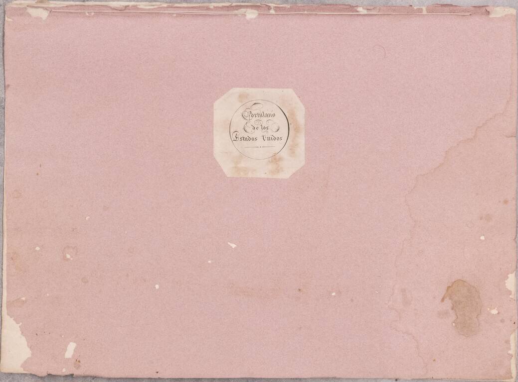
José Joaquín de Ferrer y Cafranga's sea atlas, the 'Portulano de los Estados Unidos', published in Madrid in 1818. Nice example of the 1818 edition of José Joaquín de Ferrer y Cafranga's Portulano de los Estados Unidos. Ferrer's sea atlas...
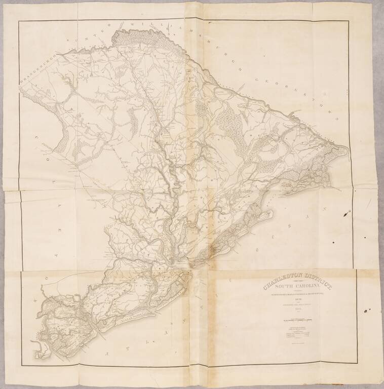
The First Atlas of an American State With An Important South Carolina Provenance First edition. Small folio. 29 maps, comprising a map of the state and 28 maps of districts, many folding. The map bears the ownership inscription of John Rutledge Abney...
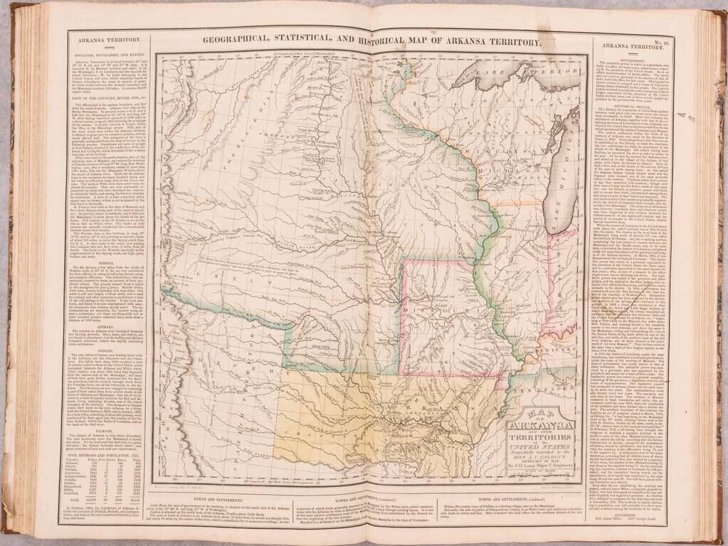
An indispensable American atlas, representing the beginning of the hand-colored commercial atlas business in the United States. Includes Stephen H. Long's seminal map of the American West. Unusually clean and bright throughout. A truly handsome...

A nice early American atlas in the Malte-Brun vein, containing 40 engaged maps in original hand-color. 14 of the maps relate to the Americas, 4 to Africa, 9 to Asia, and the rest to Europe and the World.

The First Atlas Printed In India. Rare early school atlas, lithographically printed in Calcutta by pioneer mapmaker Jean-Baptiste Tassin. The School Atlas was likely created in part due to the demand for educational material created by the General...
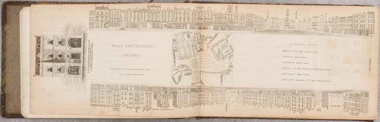
A Nice Set of Tallis's London Views That We Can Find Having Come to the Market. An impressive run of 47 parts (of 88) of John Tallis's fantastic project to provide a view of every major street in London during the late 1830s. This set includes views...
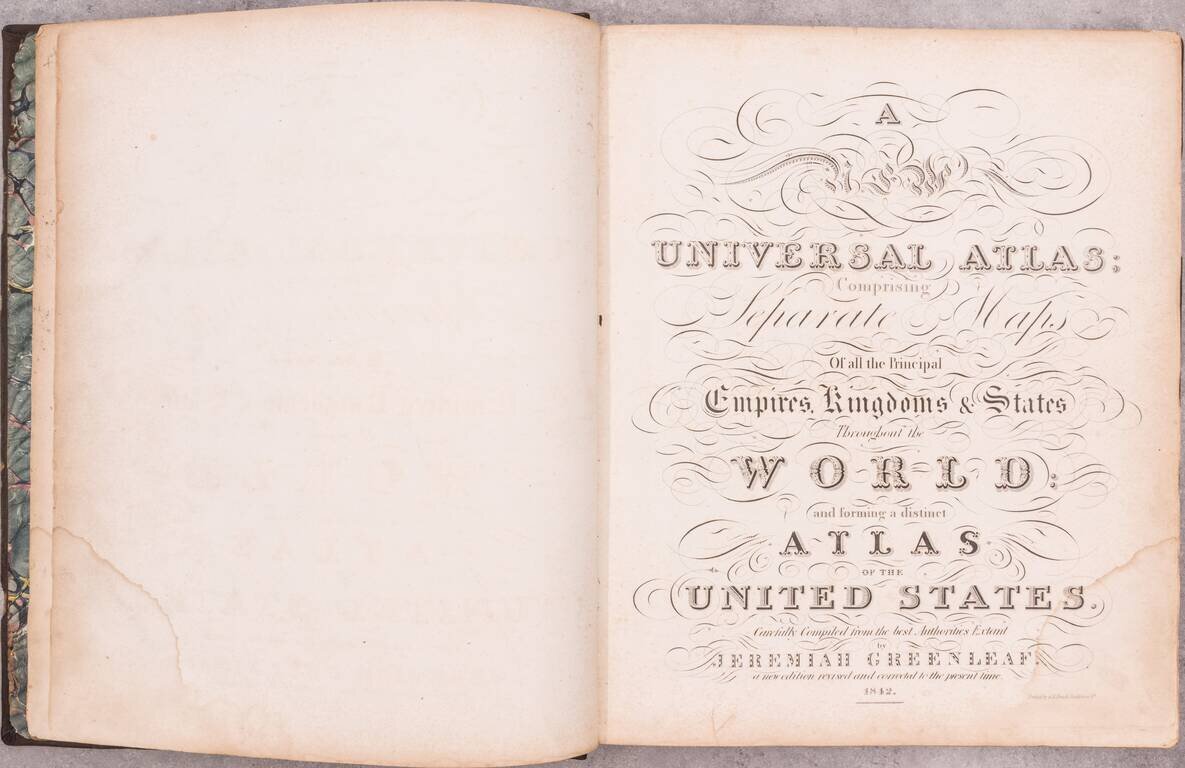
Including Maps of the Republic of Texas and Oregon Territory An important and elegantly colored American Atlas, published by Jeremiah Greenleaf in Brattleboro, Vermont. Jeremiah Greenleaf's Universal Atlas is the continuation of the work of David...

"Republic of Texas" Edition. A nice example of the 1842 edition of Lizars's Edinburgh Geographical General Atlas, with two maps labeling the "Republic of Texas" within the map image. Almost all maps from the Republic of Texas period simply label the...

Unique Stencil Color Example of Morse & Breese's Cerographic Atlas of the United States, bound with Morse's Cerographic Bible Atlas. The Cerographic Atlas of the United States was the first printed atlas to employ the use of cerography, a printing...
![[French Composite Sea Atlas Focusing on Colonization in Southeast Asia]](/map/small/68228.jpg)
Composite Atlas of French Sea Charts Chronicling Jean-Baptiste Cecille’s Attempts to Extend the French Empire in Asia. 35 engraved or lithographed charts mounted on tabs, all but one double-page. Large folio (26x20 inches). Contemporary...