logo

1803. Neuer Indemnisations- und Grenz-Atlas von Teutschland : in 12 speciellen illuminirten Blättern, welche die neuen Besitzungen der Chur- und Fürstlichen Häuser und der Reichsstädte, nebst den Entschädigungen nach dem definitiven Reichs-Deputations-Schlusse

  • Neuer Indemnisations- und Grenz-Atlas von Teutschland : in 12 speciellen illuminirten Blättern, welche die neuen Besitzungen der Chur- und Fürstlichen Häuser und der Reichsstädte, nebst den Entschädigungen nach dem definitiven Reichs-Deputations-Schlusse
  • Neuer Indemnisations- und Grenz-Atlas von Teutschland : in 12 speciellen illuminirten Blättern, welche die neuen Besitzungen der Chur- und Fürstlichen Häuser und der Reichsstädte, nebst den Entschädigungen nach dem definitiven Reichs-Deputations-Schlusse
  • Neuer Indemnisations- und Grenz-Atlas von Teutschland : in 12 speciellen illuminirten Blättern, welche die neuen Besitzungen der Chur- und Fürstlichen Häuser und der Reichsstädte, nebst den Entschädigungen nach dem definitiven Reichs-Deputations-Schlusse
  • Neuer Indemnisations- und Grenz-Atlas von Teutschland : in 12 speciellen illuminirten Blättern, welche die neuen Besitzungen der Chur- und Fürstlichen Häuser und der Reichsstädte, nebst den Entschädigungen nach dem definitiven Reichs-Deputations-Schlusse

Neuer Indemnisations- und Grenz-Atlas von Teutschland : in 12 speciellen illuminirten Blättern, welche die neuen Besitzungen der Chur- und Fürstlichen Häuser und der Reichsstädte, nebst den Entschädigungen nach dem definitiven Reichs-Deputations-Schlusse information:

Year of creation: 
Resolution size (pixels): 
 8986x6832 px
Disk Size: 
 11.5482MiB
Number of pages: 
 34
Place: 
 Leipzig
Author: 

Print information. Print size (Width x height in inches):
Printing at 72 dpi 
  124.81 х 94.89
Printing at 150 dpi 
 59.91 х 45.55
Printing at 300 dpi 
 29.95 х 22.77

An example of detailing the file of this map of in a printable high-resolution:

Click to open in high resolution (open in new tab).
Attention! this is just the central piece (central area 960x960 px) of the map file!
This is an example, so that you can see and study the level of detail of a given map. The entire Map will be fully available after payment!

Neuer Indemnisations- und Grenz-Atlas von Teutschland : in 12 speciellen illuminirten Blättern, welche die neuen Besitzungen der Chur- und Fürstlichen Häuser und der Reichsstädte, nebst den Entschädigungen nach dem definitiven Reichs-Deputations-Schlusse

Restructuring Germany

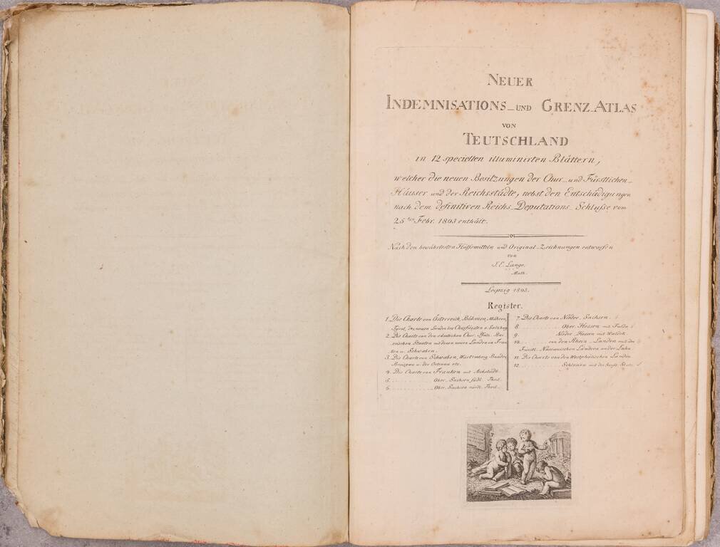
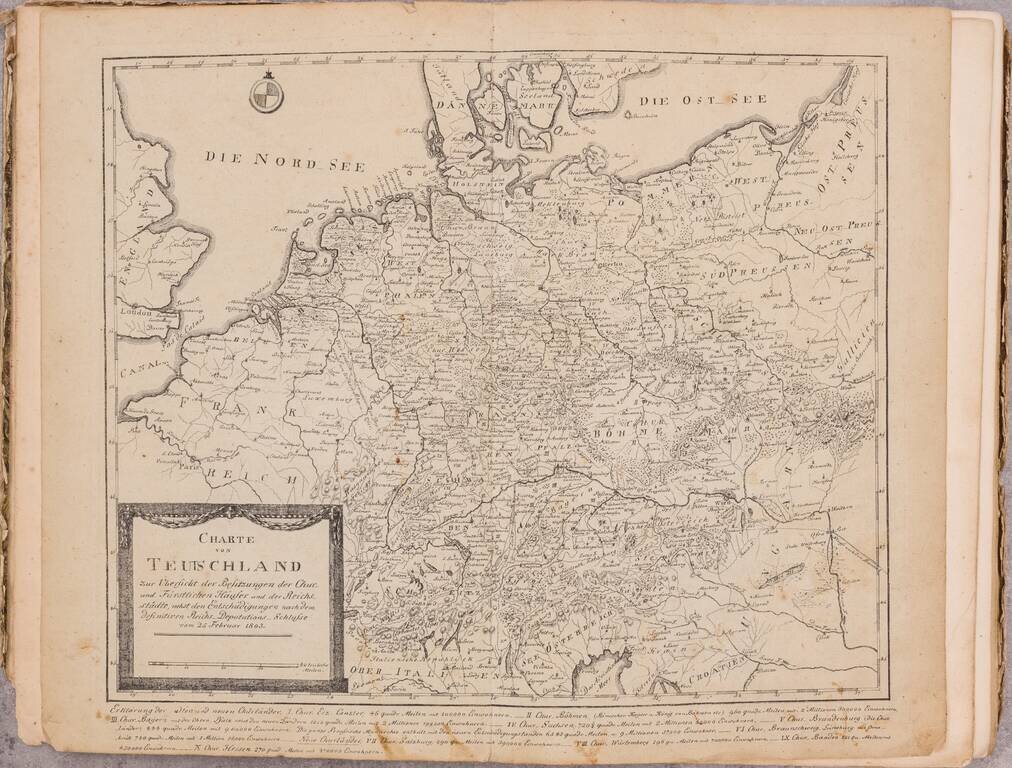
Two rare German regional atlases, published by J.C. Lange in Leipzig in 1803 and 1804.

The collation of the first work is very difficult. The title calls for 12 maps, but only 11 map sheets are present. All but the first map present are number in German, beginning with the number "Erstes" on the second map, with one of the maps number 8-9. Two maps are sequentially missing 3 (Schwaben) and 11 (Westphalien Landen).

Our comparison of this first atlas to the University of Lausanne copy (which has 4 maps out of order, but is otherwise complete).

Restructuring Germany - February 25, 1803

These two atlases were published shortly after the Final Recess of February 1803.

The Final Recess of the Imperial Deputation (German: Reichsdeputationshauptschluss) of February 1803 is commonly referred to as the Imperial law that brought about the territorial restructuring of the Empire by reallocating the ecclesiastical states and the imperial cities to other imperial estates.

In reality, neither the Final Recess nor the Imperial Deputation which drafted it played a significant role in the process since many key decisions had already been taken behind closed doors in Paris before the Deputation even started its work. The Final Recess was nevertheless indispensable since it bestowed a constitutional seal of approval on the major territorial and political restructuring that would otherwise have lacked legitimacy.


Special conditions for students!

If you are a student, write to us in telegram: @antiquemaps and indicate what material you need and for what work you need a map in high detail. We are ready to provide material on special terms. For students only!

Item information:

Year of creation:
Size:
8986x6832 px
Disk:
11.5482MiB
Number of pages:
34
Place:
Leipzig
Author:
Johan Elias Lange.
$24.99

Related item