
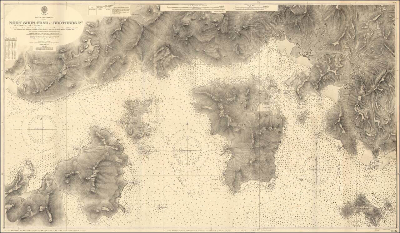
Impressive Chart of Park Island, Tsing Yi, and western Hong Kong Harbor. A very detailed chart of the section of water west of Hong Kong Harbor. The chart was first published in 1908, based on the surveys of Commander C.E. Monro of H.M.S. Rambler,...
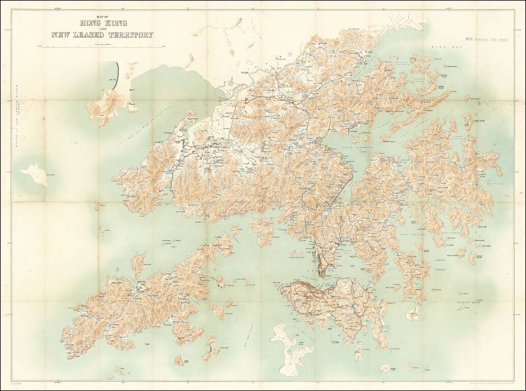
For Official Use Only. A Large Map of Hong Kong During the 1911 Revolution. Large antique map of Hong Kong Island and the region north to the Sham Chun River. The map was prepared by the Royal School of Military Engineering in concert with the...
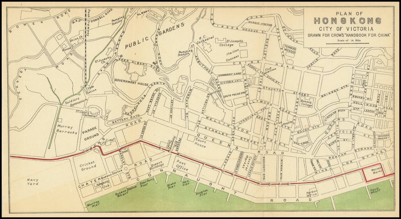
Nice antique map of Victoria, Hong Kong, published by Carl Crow in Shanghai, circa 1917. The map covers what is now central Hong Kong, from the harbor south to Government House and Robinson Road. All the major roads, and some of the major public...

Western Approaches To Hong Kong Harbor (Red Lined By An Early Harbor Planner) A large-scale and detailed sea chart of the western approaches to Hong Kong Harbor, issued by the British Admiralty, including all of Victoria (Central), western Kowloon...
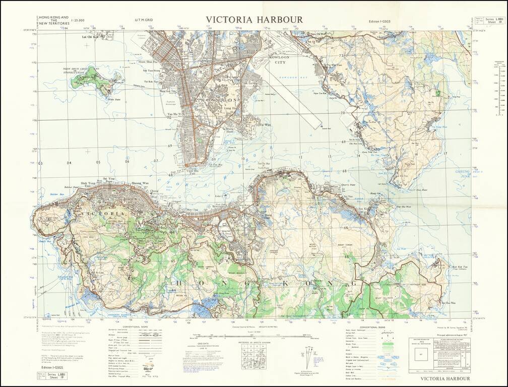
Detailed map of Victoria Harbour produced by D Survey, War Office and Air Ministry in 1957. There is a diversity of information communicated by the map including built-up areas, villages, "temporary native quarters", and isolated buildings in some...
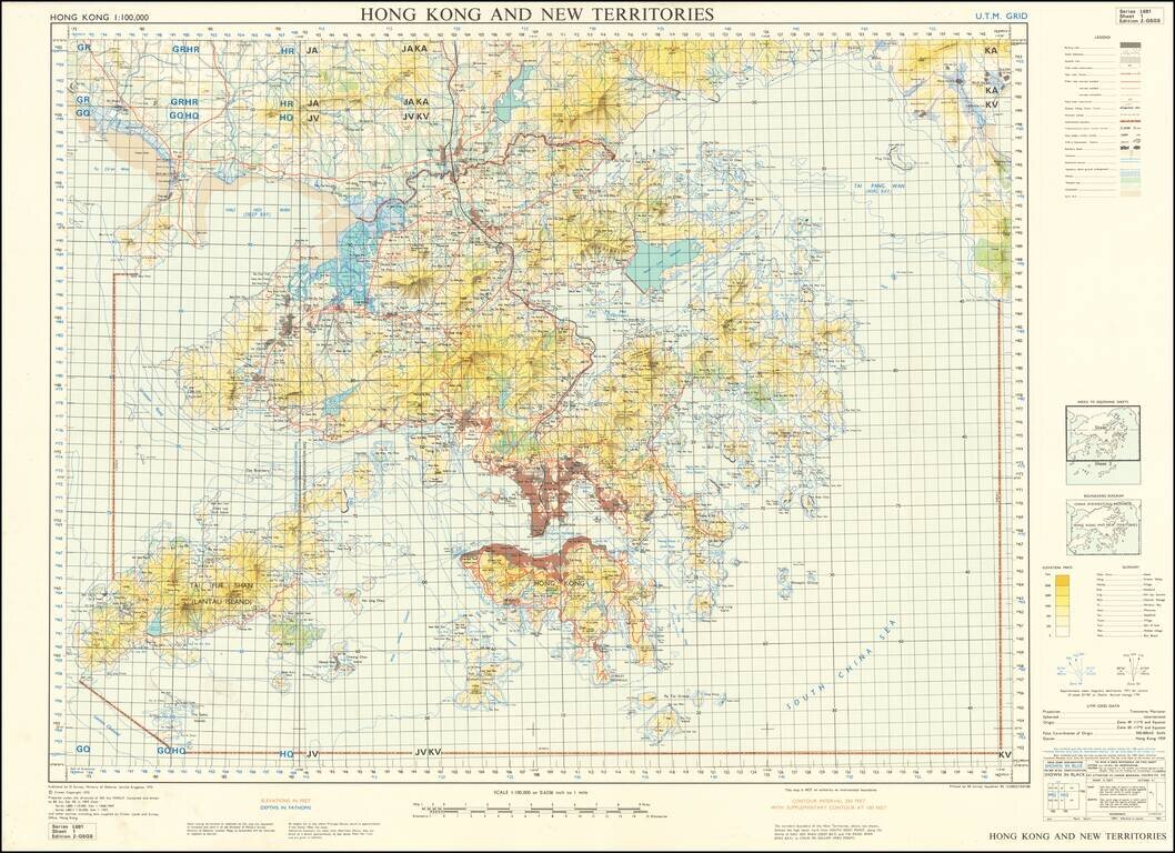
Detailed War Office and Air Ministry Two-Sheet Chart of Hong Kong. Detailed British military mapping of Hong Kong, published in two sheets (here joined as one), in 1958. The sheets are labeled first editions and have as their sources RAF Air Survey...
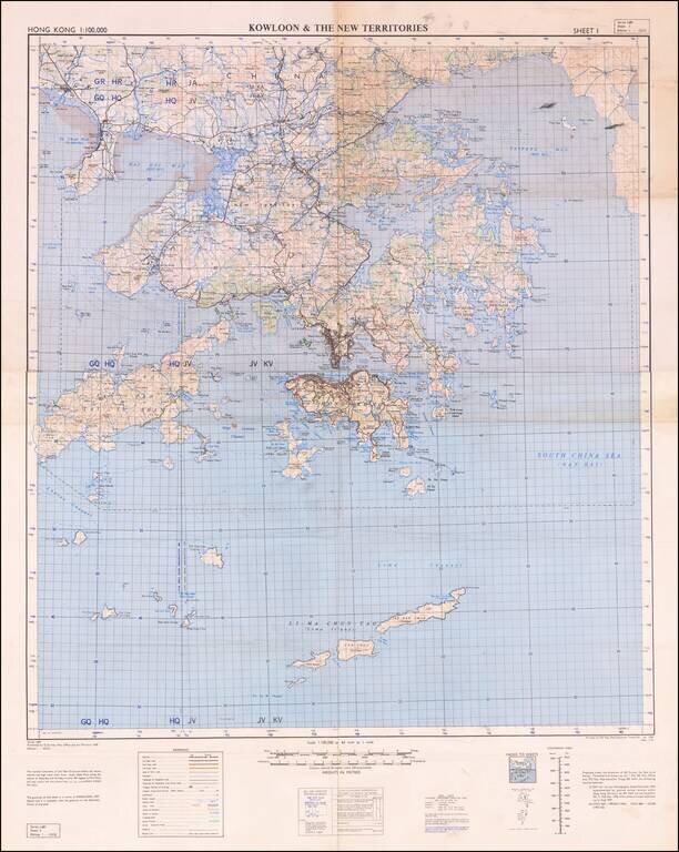
Scarce United Kingdom Ministry of Defence map of Hong Kong and New Territories. Published by the MOD in 1970 based on surveys from 1957 and 1968-69. Built-up areas, "squatter areas", areas under construction, topography, roads and tunnels, railroads,...
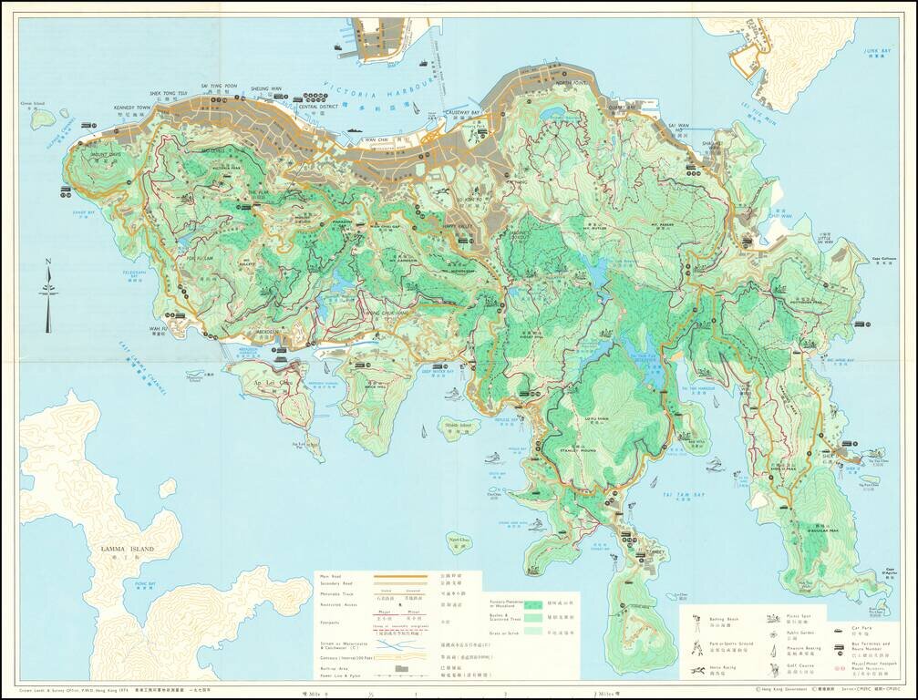
Detailed bi-lingual folding map of Hong Kong Island, with inset maps of The Peak Area, Aberdeen Reservoir Area, and Tai Tam Reservoir Area. The map uses small illustrations to show Bathing Beaches, Park or Sports Ground, Picnic Spots, Public Gardens,...
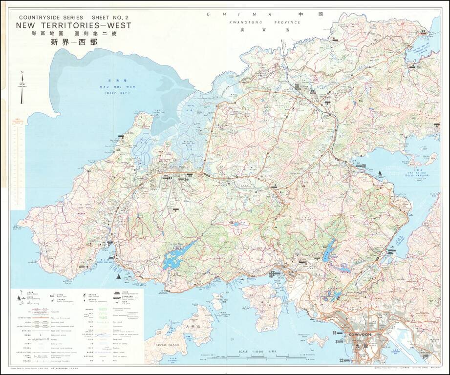
Detailed bi-lingual folding map of Hong Kong New Territories showing Kowloon, etc. The map uses small illustrations to show Bathing Beaches, Park or Sports Ground, Picnic Spots, Public Gardens, Horse Racing, Pleasure Boating, Golf Courses, etc.
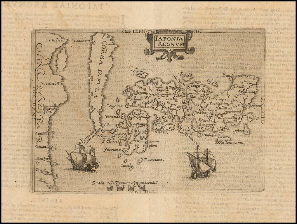
One of the Earliest Obtainable Maps of Japan and Korea The Metellus map of Japan and Korea is the earliest obtainable printed map of the region, after the Teixeira / Ortelius map. The landmark Ortelius prototype was derived from the Portuguese...
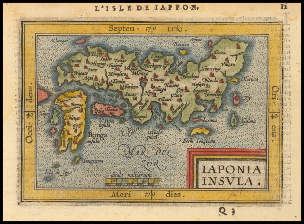
Nice full color example of Ortelius' miniature map of Japan, from the first edition of Ortelius Epitome published by Giovanni Battista Vrients. One of the earliest obtainable separate maps of Japan. J.B. Vrients purchased the rights and plates for...
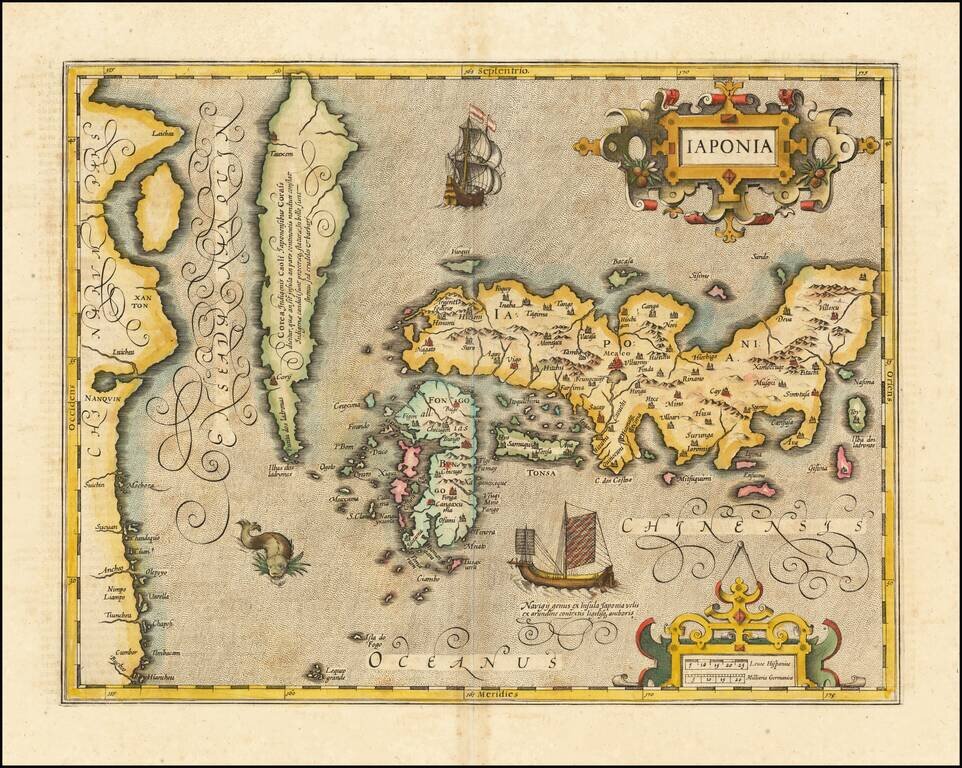
Fine full example of Hondius' map of Japan & Korea. One of the finest early Dutch maps of the region, first published in 1606 as one of the 37 new maps engraved for Jodocus Hondius' expanded Dutch edition of the Mercator Atlas. The map is based...
![Iaponiae Nova Descriptio [Korea as an island]](/map/small/56910.jpg)
Jansson’s Early Map of Japan, Showing Korea as an Island Fine example of one of the earliest European atlas maps of Japan, which also shows Korea as an island. The Jansson Japan is a delicate and skilled reworking of the Mercator-Hondius atlas map...
The Map of Japan Based Upon The Jesuit Maps of Inacio Moreira and Christopher Blancus Fine example of the first state of Robert Dudley's rare map of Japan, first published in 1646. This is one of the two maps of Japan created by Dudley for his Dell'...
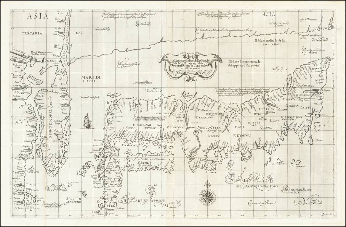
Robert Dudley's Monumental Map of Japan and Korea. The Most Important Map of the "Sea of Korea." Fine example of the first state of Robert Dudley's rare map of Japan and Korea, first published in 1646. This is the larger of two maps of Japan created...
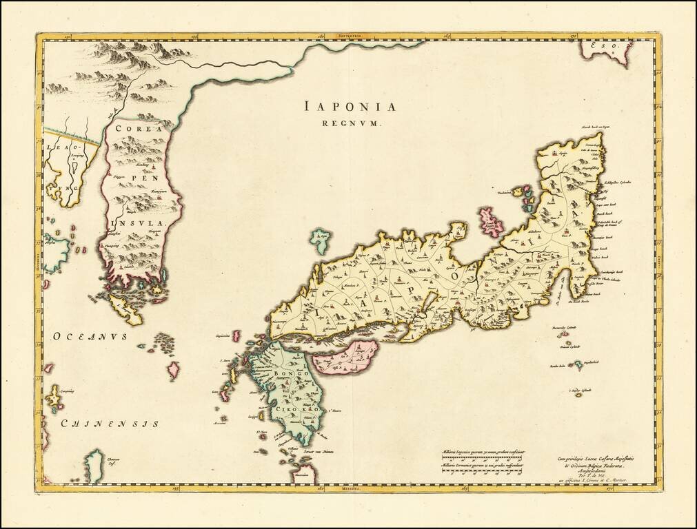
Striking Blaeu Map of Japan, Showing Korea as a Peninsula Fine, old-color example of Joan Blaeu's map of Japan and Korea from his renowned Atlas Sinensis. While titled as a map of Japan, perhaps the single most noteworthy feature of this map is that...