
![郑成功的北伐 [Zheng Chenggong's Northern Expedition]](/map/small/36678.jpg)
Remarkable Series of Taiwanese Classroom Hanging Maps Covering the Modern History of China Striking series of maps, The Modern History of China Hanging Map Series [中國近代史挂圖], published in the 1960s in Taipei. The colorful and...
![庚子拳乱与八国联军之役 [The Boxer Uprising and the Deployment of the Eight-Nation Army]](/map/small/36705.jpg)
Remarkable Series of Taiwanese Classroom Hanging Maps Covering the Modern History of China Striking series of maps, The Modern History of China Hanging Map Series [中國近代史挂圖], published in the 1960s in Taipei. The colorful and...
![中法战争 [The Sino French War]](/map/small/36697.jpg)
Remarkable Series of Taiwanese Classroom Hanging Maps Covering the Modern History of China Striking series of maps, The Modern History of China Hanging Map Series [中國近代史挂圖], published in the 1960s in Taipei. The colorful and...
![日本对华之侵略 [Japan's Invasion of China]](/map/small/36706.jpg)
Remarkable Series of Taiwanese Classroom Hanging Maps Covering the Modern History of China Striking series of maps, The Modern History of China Hanging Map Series [中國近代史挂圖], published in the 1960s in Taipei. The colorful and...
![明末的疆域形势 [High Qing Borderland Situation]](/map/small/36696.jpg)
Remarkable Series of Taiwanese Classroom Hanging Maps Covering the Modern History of China Striking series of maps, The Modern History of China Hanging Map Series [中國近代史挂圖], published in the 1960s in Taipei. The colorful and...
![中日甲午战争 [The First Sino-Japanese War]](/map/small/36679.jpg)
Remarkable Series of Taiwanese Classroom Hanging Maps Covering the Modern History of China Striking series of maps, The Modern History of China Hanging Map Series [中國近代史挂圖], published in the 1960s in Taipei. The colorful and...
![国父领导之十次革命 [The Ten Uprisings Led by the Father of the Nation, 1894-1911]](/map/small/36674.jpg)
Remarkable Series of Taiwanese Classroom Hanging Maps Covering the Modern History of China Striking series of maps, The Modern History of China Hanging Map Series [中國近代史挂圖], published in the 1960s in Taipei. The colorful and...
![辛亥各省之光复 [The Nation-Wide Return to Glory through the Xinghai Revolution]](/map/small/36710.jpg)
Remarkable Series of Taiwanese Classroom Hanging Maps Covering the Modern History of China Striking series of maps, The Modern History of China Hanging Map Series [中國近代史挂圖], published in the 1960s in Taipei. The colorful and...
![明初的疆域形势 [Early Ming Borderland Situation]](/map/small/36675.jpg)
Remarkable Series of Taiwanese Classroom Hanging Maps Covering the Modern History of China Striking series of maps, The Modern History of China Hanging Map Series [中國近代史挂圖], published in the 1960s in Taipei. The colorful and...
![八年抗战之经过 [The Experience of the Eight-Year War of Resistance]](/map/small/36700.jpg)
Remarkable Series of Taiwanese Classroom Hanging Maps Covering the Modern History of China Striking series of maps, The Modern History of China Hanging Map Series [中國近代史挂圖], published in the 1960s in Taipei. The colorful and...
![南明之抵抗 [The Southern Ming Resistance]](/map/small/36695.jpg)
Remarkable Series of Taiwanese Classroom Hanging Maps Covering the Modern History of China Striking series of maps, The Modern History of China Hanging Map Series [中國近代史挂圖], published in the 1960s in Taipei. The colorful and...
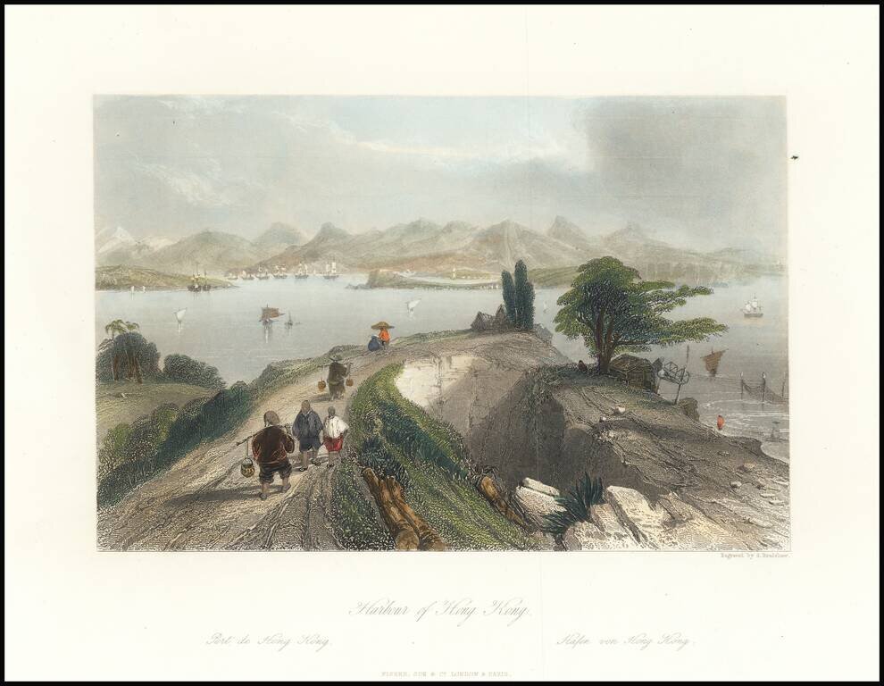
This is an attractive antique view of Hong Kong harbour, drawn by an Englishman in the first half of the 19th century. The view shows the harbour in the distance, framed by tall mountains. In the foreground, merchants and peasants dressed in...
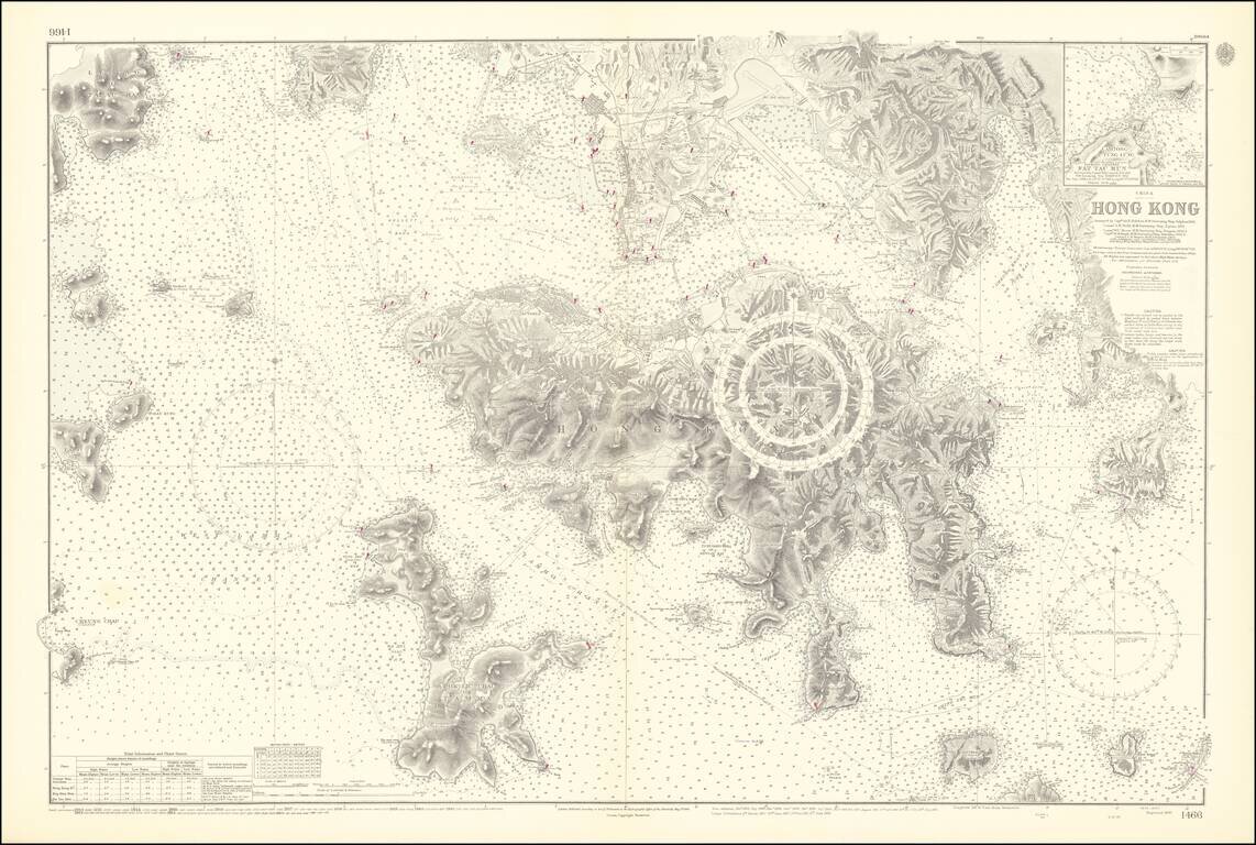
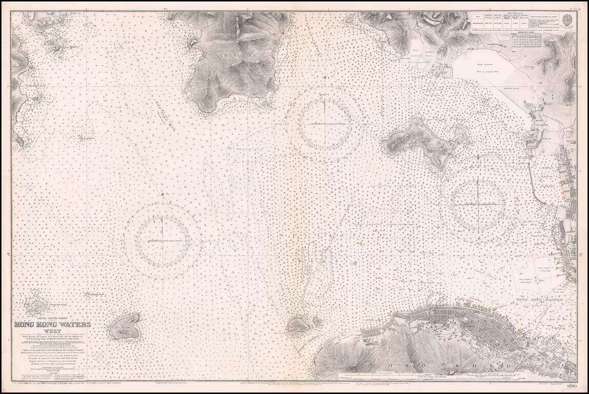
An Exceptional Post-World War II Chart of Hong Kong and Environs -- The First British survey of Hong Kong Harbor, updated to 1953 / 1964 Remarkably detailed British Admiralty Sea Chart of Hong Kong, first published in 1843, based upon the surveys of...
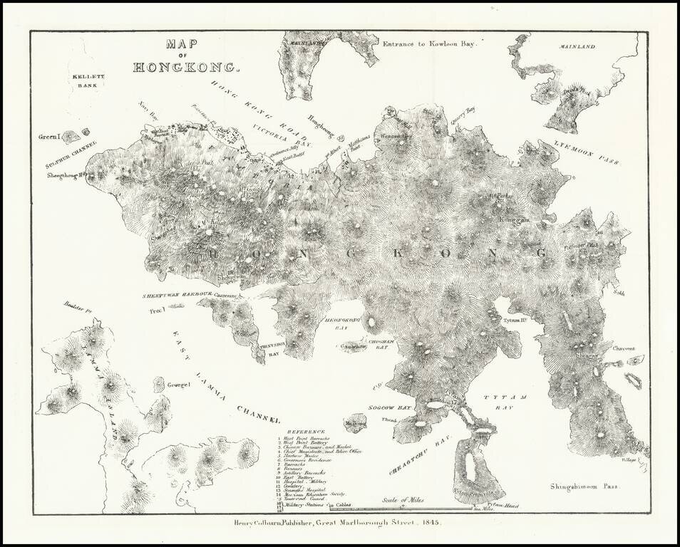
Very early lithographed map focusing specifically on Hong Kong, published in London in 1845. The map is one of the earliest obtainable mappings of Hong Kong after it was ceded to Great Britain in the Treaty of Nanking in 1842. The map derives in large...
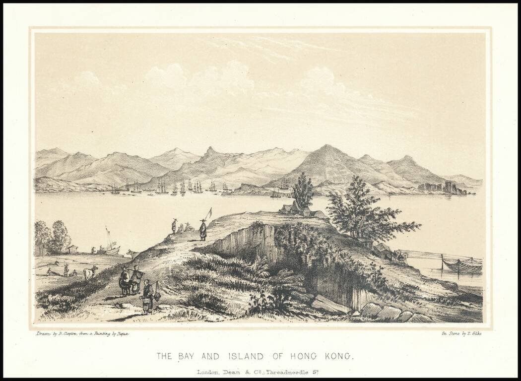
Fine early lithographic view of Hong Kong, "Drawn by B. Clayton from painting by Piqua."
Western Approaches To Hong Kong Harbor A large-scale and detailed sea chart of the western approaches to Hong Kong Harbor, issued by the British Admiralty, including all of Victoria (Central), western Kowloon and extending westwards to Lantau...