Map size in jpg-format: 43.8708MiB
Click to open in high resolution (open in new tab).
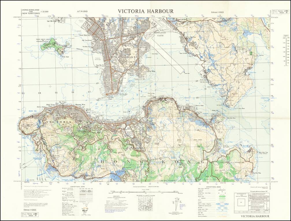
Detailed map of Victoria Harbour produced by D Survey, War Office and Air Ministry in 1957.
There is a diversity of information communicated by the map including built-up areas, villages, "temporary native quarters", and isolated buildings in some cases. Post offices, telegraph offices, and joint offices are shown.
The map shows the Kai Tak Airport with the extension to runway 13/31, which was completed in 1957, the same year as the map.
This is I-GSGS Series L8811 Sheet 19
If you are a student, write to us in telegram: @antiquemaps and indicate what material you need and for what work you need a map in high detail. We are ready to provide material on special terms. For students only!

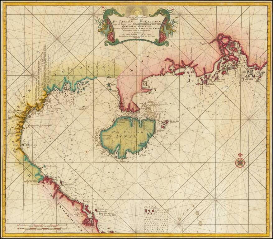
![[ Hong Kong / Macao / Canton ] Iunnan, Queicheu, Quangsi et Quantun, Provinciae Regni Sinensi Praefecturae dictae](/map/small/55800.jpg)