
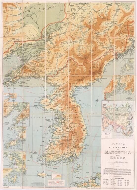
Russo-Japanese War Map of Manchuria and Korea. Detailed color-lithographed folding map of Korea and Manchuria, published in London for coverage fo the Russo-Japanese War. The Russo-Japanese War was fought during 1904–1905 between the Russian Empire...
![[Gansu & Ningxia] Kansu](/map/small/61498.jpg)
Fine regional map of Gansu & Ningxia, from the Atlas of the Chinese Empire; Prepared by Mr. Edward Stanford for the China Inland Mission. The work was published by Morgan & Scott, Ltd., London. Lanchowfu (Lanzhou), the Great Wall of China,...
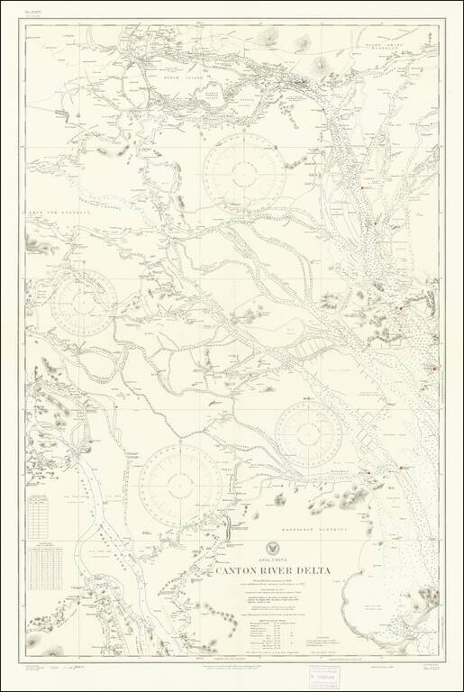
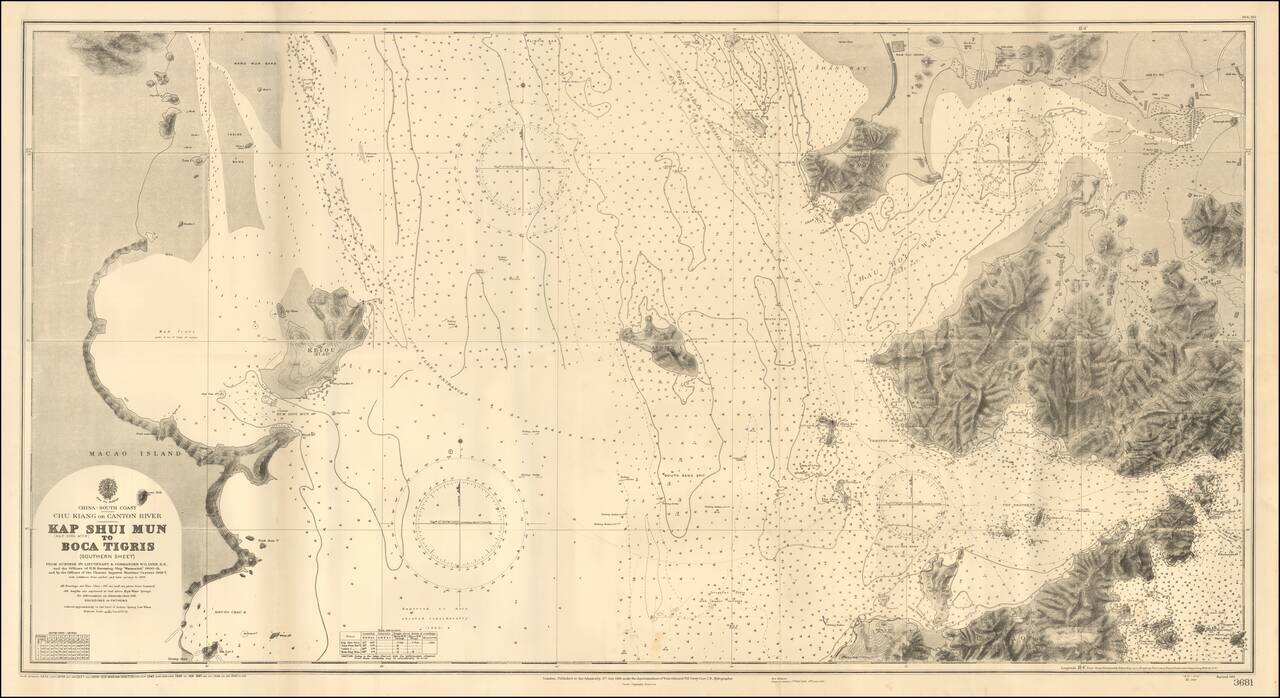
Detailed chart of the Pearl River (Zhujiang) Delta, published by the U.S. Navy Hydrographical Office based on a British Admiralty Chart published in 1909 and here updated to 1930s. The map provides significant detail of the area between Canton...
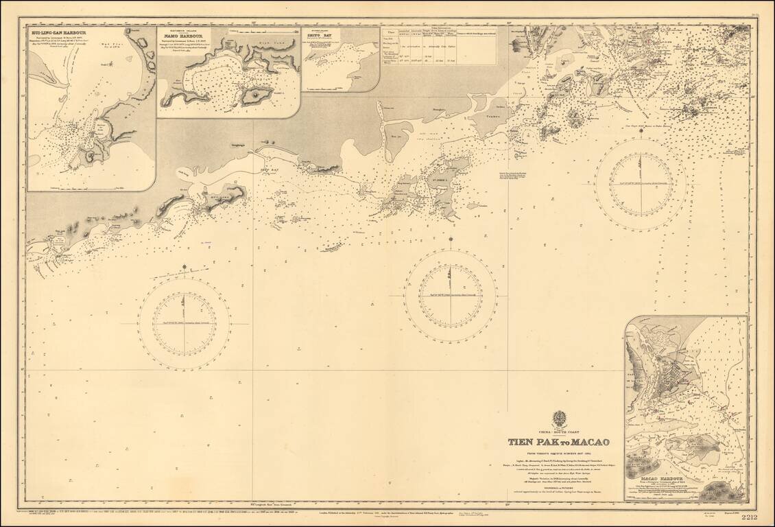
Scarce map of the the region from Macau to the west, published by the Hydrgraphic Office of the British Admiralty. Shows the South China Sea from Dianbai to Macau, centered on Hailing Island (then St. John Island). Includes insets of Macau Harbor,...
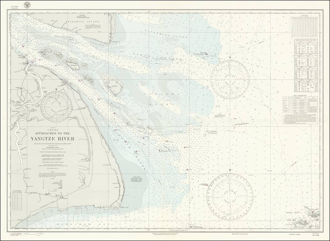
World War II-era hydrographical chart of the entrance to the Yangtze River and the Shanghai Region. Shanghai is shown at the left of the map, with details such as the railroads and their stations, the International Settlements, and local hamlets and...
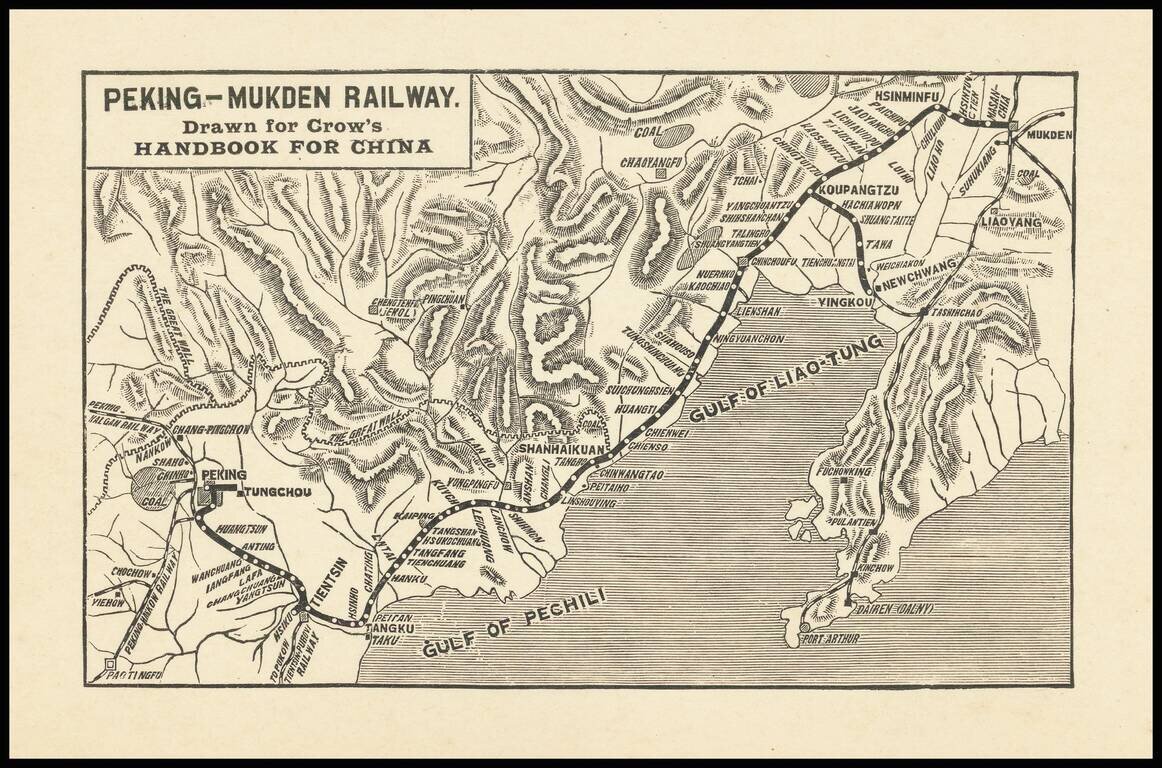
Small map covering northeastern China from Beijing to Shenyang (Mukden), covering the extent of the Peking-Mukden Railway. The so-called Jingha Railway first reached Mukden in 1912. The route was known as the Peking-Mukden Railway from 1907 to 1928,...
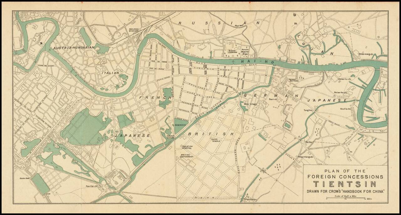
Attractive color-printed plan of the foreign concession area of Shanghai, published for Carl Crow's handbook on China in the early 1920s. As the map shows the Austria-Hungarian section, it probably predates the end of World War I and the fall of the...
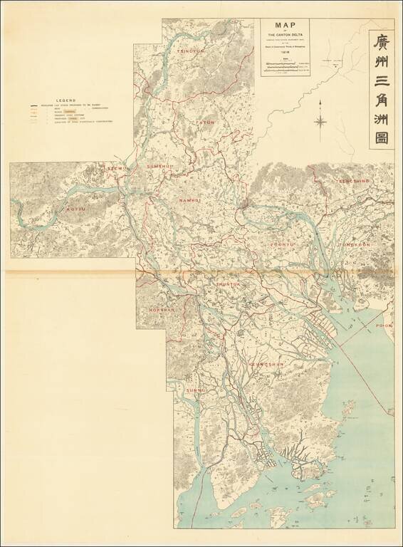
Controlling the Rivers Feeding the Canton Delta and Zhujiang Estuary Large detailed bilingual wall map tracking the course of the Canton Delta, and the Xi River and Bei River, Zhujiang River and Estuary and the area around Guangzhou and Foshan. The...
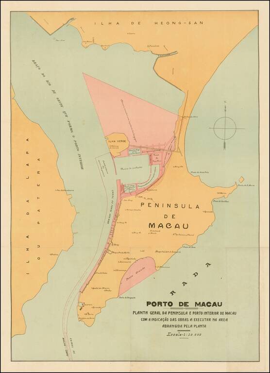
Rare and decorative large plan of the Peninsula of Macau, showing the beginnings of the significant man-made changes to the Portuguese colony. This artistically virtuous map employs attractive pastel colors and a transitional Art Nouveau-Art Deco font...
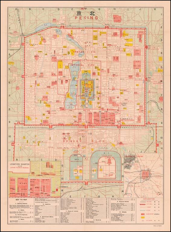
Finely detailed map of Peking, published for Japanese Tourists. At the center of the map is the Forbidden City Palace, Imperial City, Tartar City, with the Chinese City below. The Temple of Agriculture and Temple of Heaven appear at the bottom,...
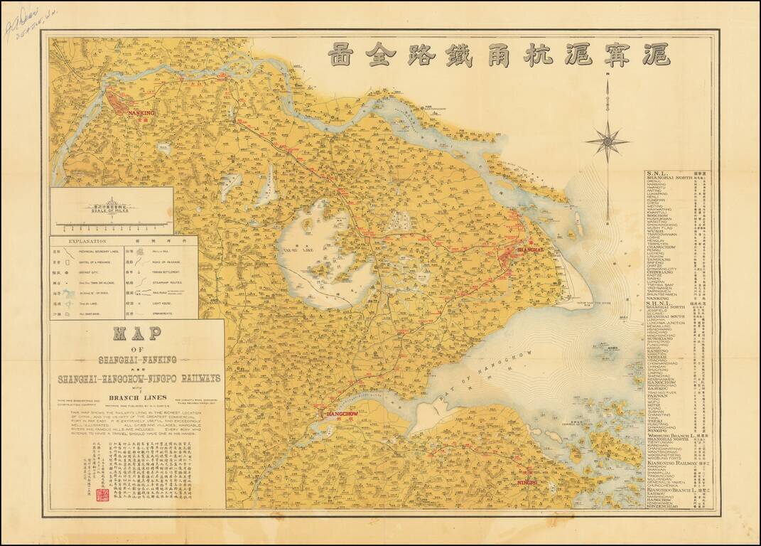
Very rare bilingual (English and Chinese) map of the Shanghai region, focusing on local railroad connections of 1927. The three-stone color lithographed map was made by the Civil Engineer M.H. Chih for the Ming Hao Engineering and Construction...
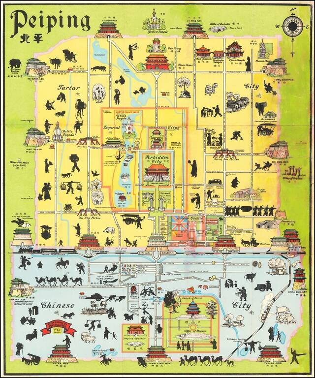
Early State of Kirk Sewall's Scarce Map of Peiping (Beijing). Pictorial map of central Beijing, published in Beijing by the Peiyang Press. Sewall's map is richly embellished with illustrations of landmark buildings and black silhouettes of workers,...
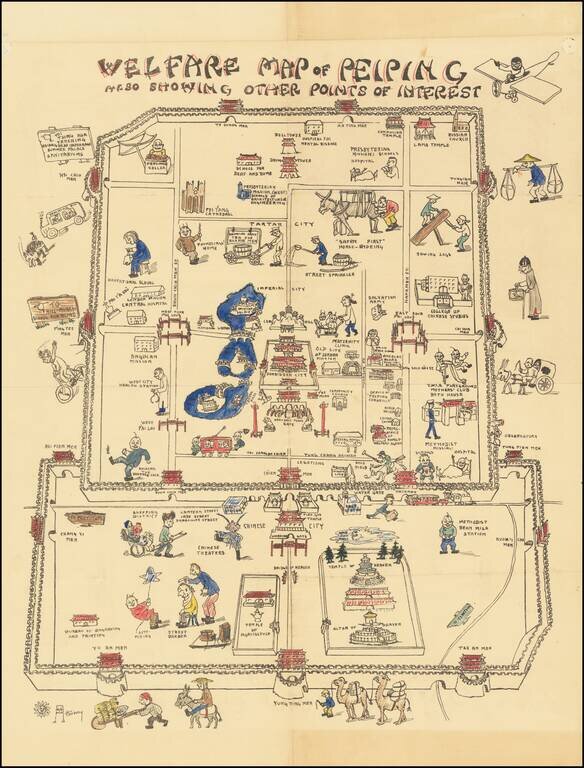
A Beijing Pictorial Rarity – The Welfare Map Whimsically-designed and colored example of an extremely rare pictorial map of China, made by an American missionary woman born in Tianjin. The map takes the viewer on a cartoonish tour of Beijing, or...
An Early Look At Shenzen Bay & Hong Kong Gold Coast Fine large format sea chart of the region between the western most part of Hong Kong, Shenzen, Macao and Lantao Island, published by the British Admiralty. The areas shown in Shenzen and Hong...
![[Shanghai]](/map/small/68131.jpg)
An attractive map of Shanghai, dating to just before or during the Japanese invasion. The map focuses on the International Settlement and the French concession, and extends into the "Chinese City." Shanghai is large, but far from the metropolis it...
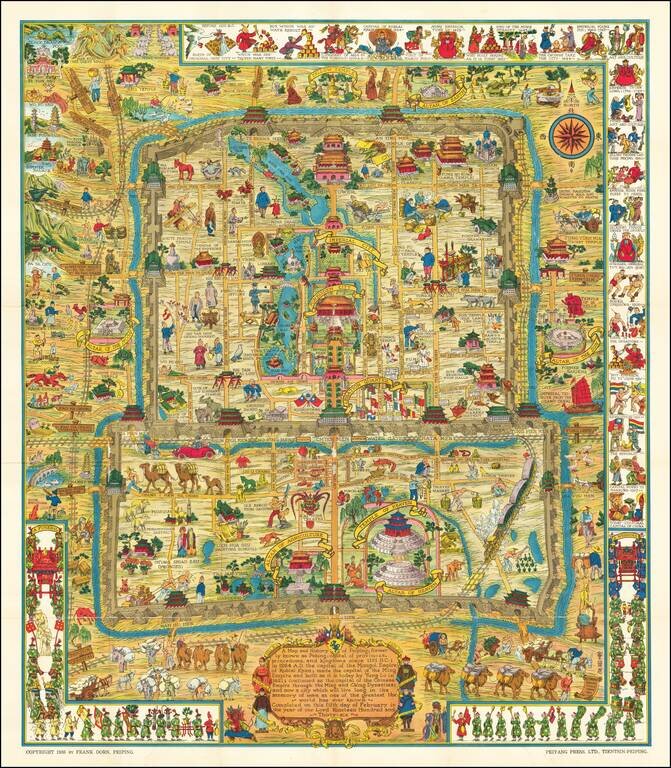
Scarce Variant Edition -- Different German Flag Finely executed pictorial map of Beijing, published by Frank Dorn and the Peiyang Press. Ltd. of Tientsin and Peiping, in 1936. The present example is a variant edition, with the flag of Germany being a...