
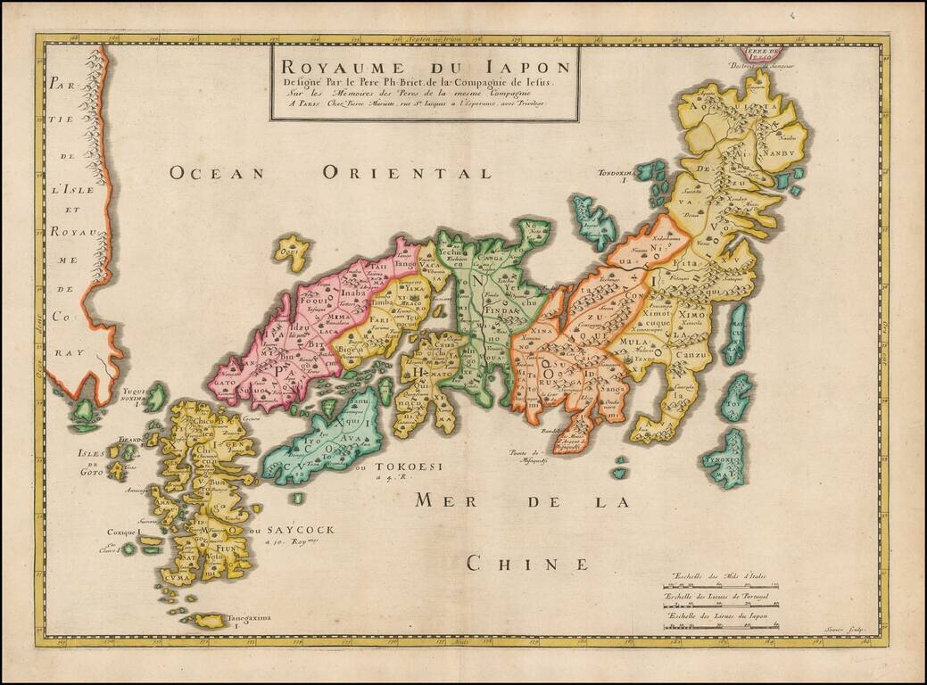
Striking early map of Japan and Korea. Briet's map follows the Blancus/Moreira model, and looks very similar to the Christophoros Blancus unpublished map of 1617. The map shows a well-shaped Japan with named provinces, and major cities including Tokyo...
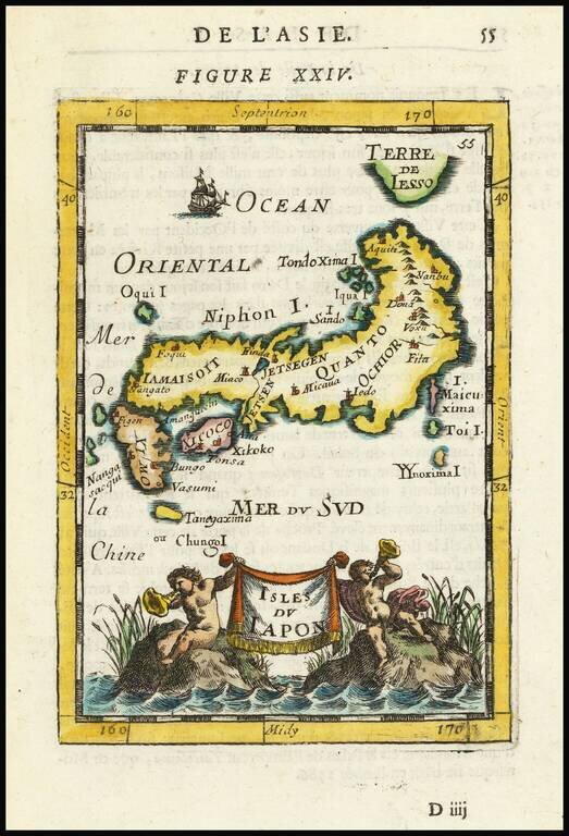
Decorative miniature map of Japan, from the first edition of Mallet's monumental work. Includes decorative cartouche, sailing ships and an early interesting projection of Japan.
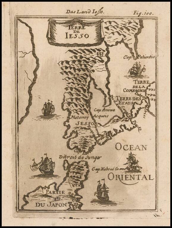
Decorative miniature map of the Land of Eso (Hokkaido) and the north part of Japan, from the first German edition of Mallet's monumental work. Includes sailing ships.
Rare early map of Japan and Korea, which includes some fascinating mythical information. Hokkaido is shown as being connected to Korea. Nice example of this scarce map.
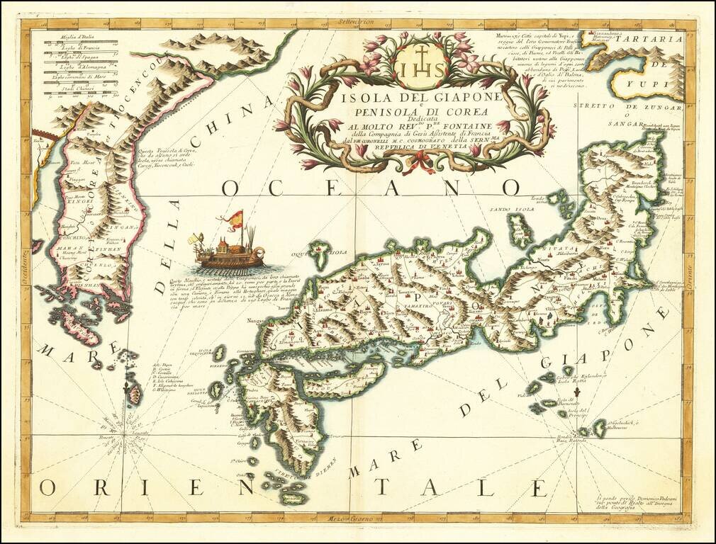
Nice example of Coronelli's important map of Japan and Korea, published in Venice. Ezo named 'Tartari de Yupi'. In the sea between Japan and Korea is a vignette of a boat described as a Japanese vessel capable of crossing the 220 French miles between...
![[Japan and Island of Korea] William Adams Reystogt na Oost-Indien; Avontuurlyle door de Straat Magellaan in't Keyzerryk van Iapan Voleyndigd](/map/small/69763.jpg)
Fine example of this decorative map of Japan and Corai Insula (Korea). The map was used to illustrate the Dutch translations of the account of the voyage of William Adams to Japan in 1600. The cartouche depicts Adams' reception at the Court of the...
![Les Isles Philippines Molucques et de La Sonde [Japan inset]](/map/small/51609.jpg)
Detailed map of part of Southeast Asia and the Philippines, with a large inset of Japan.
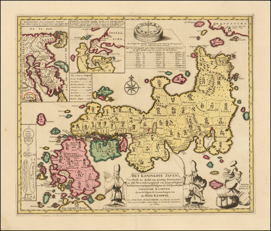
Fine old color example of Kaempfer's scarce map of Japan, which appeared in the 1729 Dutch edition of Kaempfer's History of Japan. The map was prepared by Johann Caspar Scheuchzer from the maps brought back from Japan by Kaempfer. The decorative...
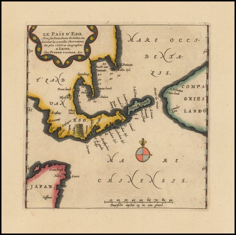
Rare map of the Land of Eso (Hokkaido), which appeared in Vander Aa's Galerie Agreable du Monde. The map illustrates the northern tip of Japan, Hokkaido and the neighboring Compagnie's Land.
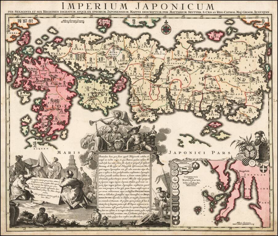
Nice example of Matthaus Seutter's edition of Adrien Reland's seminal map of Japan. Adrien Reland's map of Japan is the first map to use Sino-Japanese characters on a European printed map and represents a radical departure from prior European maps of...
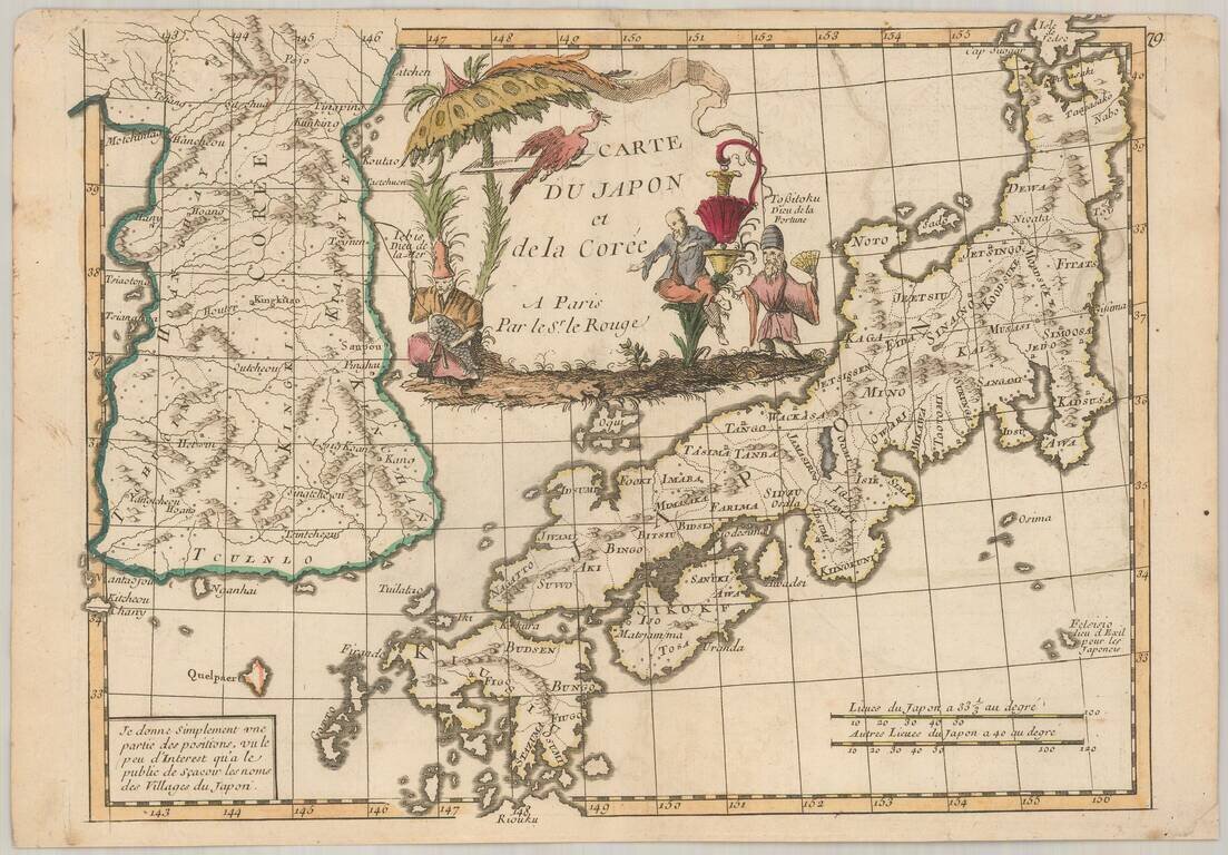
Scarce map of Japan and Korea, from Le Rouge's Atlas Nouvel Portatif . . . , first issued in Paris in 1748. Japan is divided into its provinces, with mountains, lakes and rivers named. Korea includes major cities, lakes, rivers and mountains....
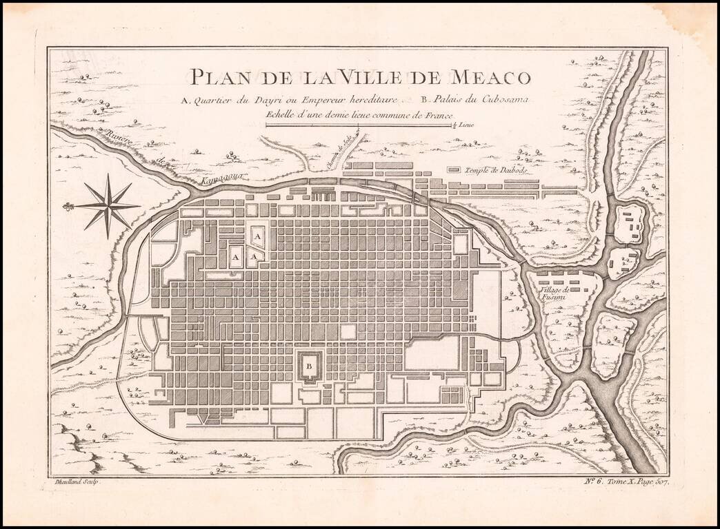
Detailed plan of Kyoto, from Bellin's Petit Atlas Maritime. The five volume work covered all the known areas of the world and is considered to be one of the finest and well produced marine atlases during the period. This map show the city of Kyoto...
Fine early map of Japan and Korea published in Venice by Francois Santini. The sea between Japan and Korea is prominently labeled Mer de Coree. The map is one of the best large format maps of Japan and Korea to appear in a commercial atlas. One of...
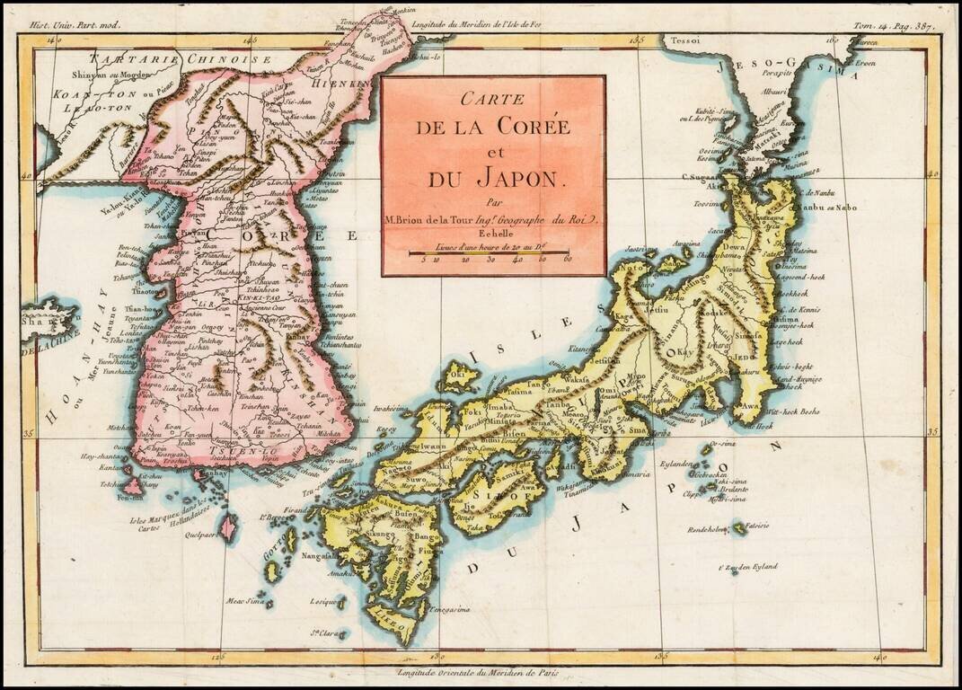
Excellent map of Japan and Korea, showing the towns, rivers, mountains, islands and other major features of each. Based upon the D'Anville model, according to Lutz Walter, who was unable to identify the source of the work from which this map came.
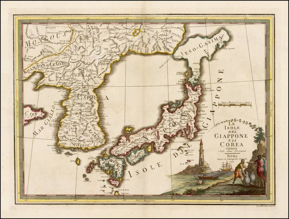
Fascinating early map of Korea and Japan, from Nuovo Atlante Geografico Universale. published by Cassini, in Rome. It has a very unusual, almost triangular, representation of 'Jeso-Gasima', the semi-mythical island to the north of Japan. The title is...
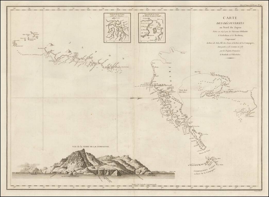
Important Chart of Northern Japan Illustrating Early Dutch Discoveries as Recorded by the Lost La Perouse Expedition Oriented with west at the top, this chart shows the discoveries made by the Dutch ships Kastrikum ( Castricum) and Breskens in 1643...