logo

1970. Hong Kong and New Territories

  • Hong Kong and New Territories

Hong Kong and New Territories information:

Year of creation: 
Resolution size (pixels): 
 20567x14925 px
Disk Size: 
 83.9358MiB
Number of pages: 
 1
Place: 
 Hong Kong

Print information. Print size (Width x height in inches):
Printing at 72 dpi 
  285.65 х 207.29
Printing at 150 dpi 
 137.11 х 99.5
Printing at 300 dpi 
 68.56 х 49.75

An example of detailing the file of this map of in a printable high-resolution:

Click to open in high resolution (open in new tab).
Attention! this is just the central piece (central area 960x960 px) of the map file!
This is an example, so that you can see and study the level of detail of a given map. The entire Map will be fully available after payment!

Hong Kong and New Territories

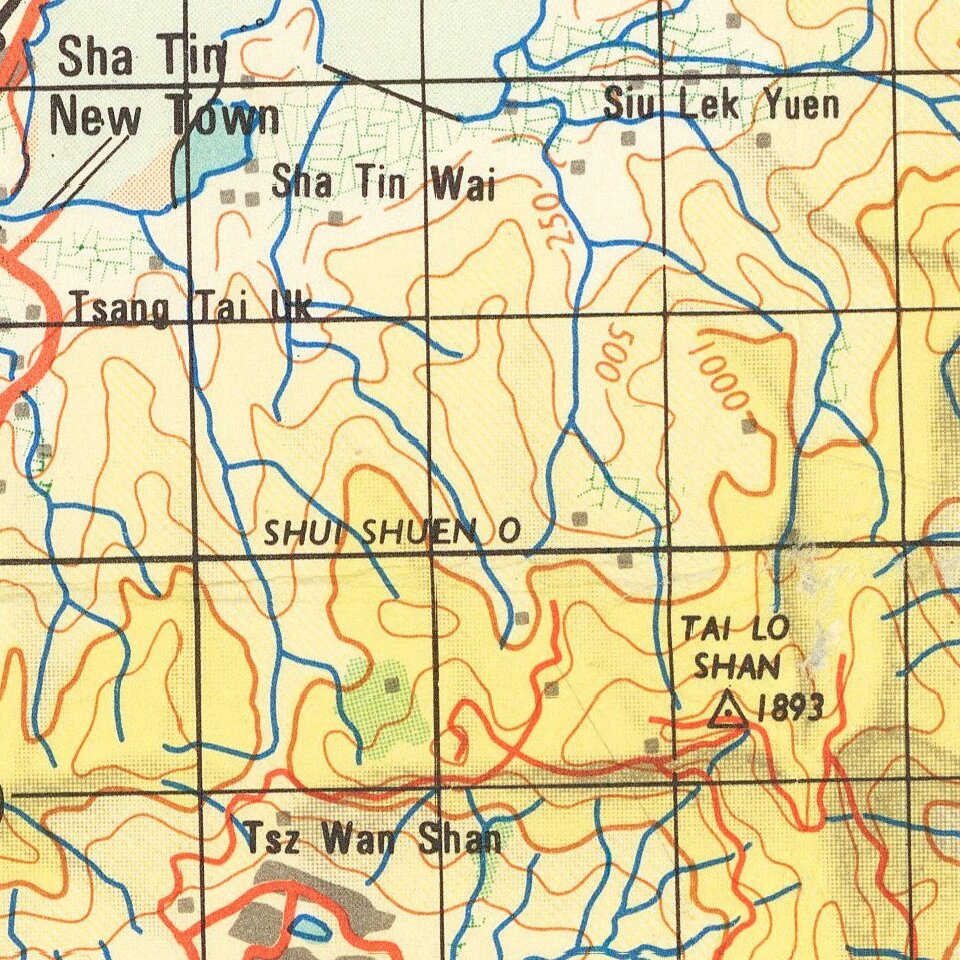
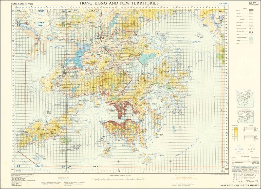
Scarce United Kingdom Ministry of Defence map of Hong Kong and New Territories.

Published by the MOD in 1970 based on surveys from 1957 and 1968-69.

Built-up areas, "squatter areas", areas under construction, topography, roads and tunnels, railroads, are all shown.


Special conditions for students!

If you are a student, write to us in telegram: @antiquemaps and indicate what material you need and for what work you need a map in high detail. We are ready to provide material on special terms. For students only!

Item information:

Year of creation:
Size:
20567x14925 px
Disk:
83.9358MiB
Number of pages:
1
Place:
Hong Kong
Author:
U.K. Ministry of Defence.
$21.99

Related item