logo

1917. Plan of Hongkong City of Victoria Drawn for Crow's "Handbook for China"

  • Plan of Hongkong City of Victoria Drawn for Crow's

Plan of Hongkong City of Victoria Drawn for Crow's "Handbook for China" information:

Year of creation: 
Resolution size (pixels): 
 7080x3873 px
Disk Size: 
 7.41405MiB
Number of pages: 
 1
Place: 
 Shanghai
Author: 

Print information. Print size (Width x height in inches):
Printing at 72 dpi 
  98.33 х 53.79
Printing at 150 dpi 
 47.2 х 25.82
Printing at 300 dpi 
 23.6 х 12.91

An example of detailing the file of this map of in a printable high-resolution:

Click to open in high resolution (open in new tab).
Attention! this is just the central piece (central area 960x960 px) of the map file!
This is an example, so that you can see and study the level of detail of a given map. The entire Map will be fully available after payment!

Plan of Hongkong City of Victoria Drawn for Crow's

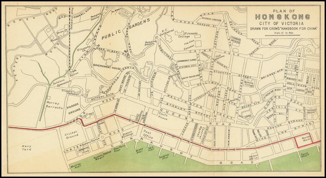
Nice antique map of Victoria, Hong Kong, published by Carl Crow in Shanghai, circa 1917.

The map covers what is now central Hong Kong, from the harbor south to Government House and Robinson Road.

All the major roads, and some of the major public buildings are listed, including a mosque and Italian convent.


Special conditions for students!

If you are a student, write to us in telegram: @antiquemaps and indicate what material you need and for what work you need a map in high detail. We are ready to provide material on special terms. For students only!

Item information:

Year of creation:
Size:
7080x3873 px
Disk:
7.41405MiB
Number of pages:
1
Place:
Shanghai
Author:
Carl Crow.
$14.99

Related item