Map size in jpg-format: 99.6097MiB
Click to open in high resolution (open in new tab).
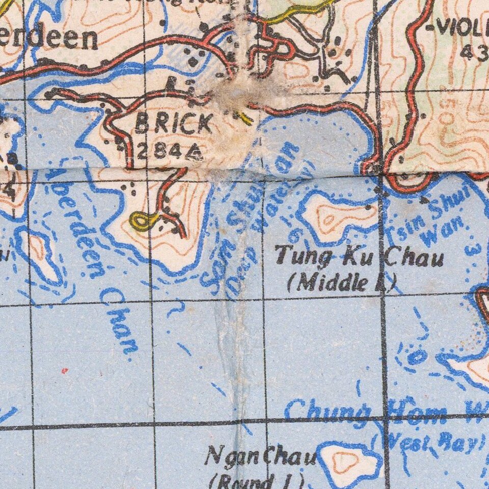
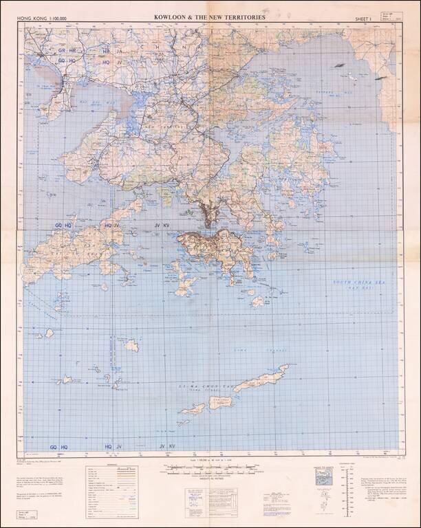
Detailed War Office and Air Ministry Two-Sheet Chart of Hong Kong.
Detailed British military mapping of Hong Kong, published in two sheets (here joined as one), in 1958.
The sheets are labeled first editions and have as their sources RAF Air Survey photography from November 1954, supplemented with ground survey revisions through August 1957. And, probably as the base map, the GSGS 3691 1:80,000 (1946) mapping of Hong Kong and the GSGS 3861 1:20,000 (1951-52) mapping.
As was the tradition at the time, the map's key differentiates between different kinds of roads, telegraph and telephone lines, villages, hamlets, etc., different land cover, and some bathymetric information.
If you are a student, write to us in telegram: @antiquemaps and indicate what material you need and for what work you need a map in high detail. We are ready to provide material on special terms. For students only!

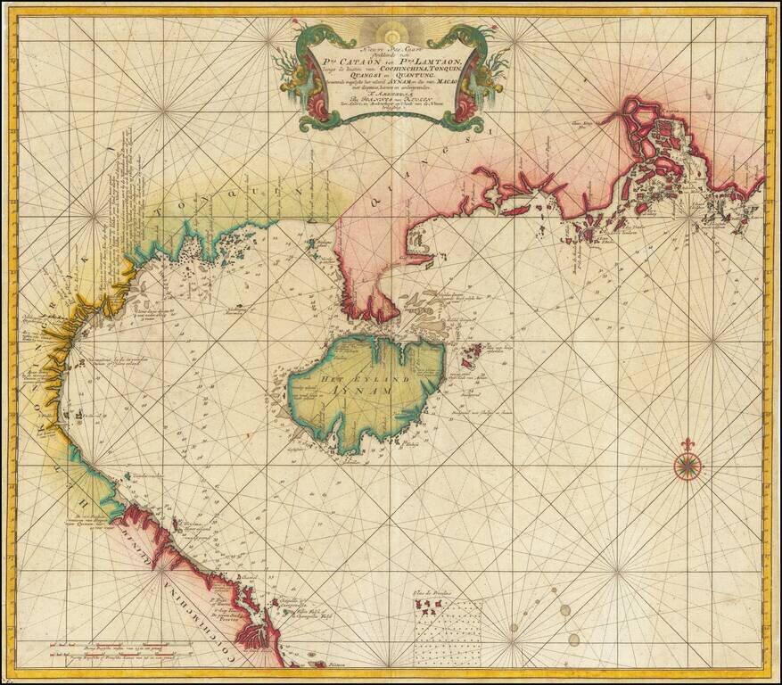
![[ Hong Kong / Macao / Canton ] Iunnan, Queicheu, Quangsi et Quantun, Provinciae Regni Sinensi Praefecturae dictae](/map/small/55800.jpg)