
![[China invasion detailed map]](/map/small/57053.jpg)
A detailed map of eastern China, showing parts of the densely populated Jiangsu, Zhejiang, and Anhui provinces. Includes an inset map of both Nanjing and Shanghai. The map shows topography, roads, major cities, and more around this area. Printed...
![[Shahai senkyoku zenzu] War Situation Map of Shanghai](/map/small/65558.jpg)
Detailed map of the international concessions area of Shanghai Settlement, published as a supplement to Osaka Asahi Shinbu on August 23, 1937. The map was published weeks after the Marco Polo Bridge incident on July 7, 1937 and 10days after the Battle...
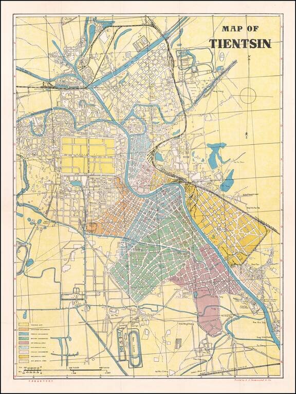
Large large-format map of Tianjin, China, Detailing the Foreign Concessions at the Time of the Japanese Occupation of Tianjin Finely executed city map with a large key identifying the foreign concessions, including: Japanese Concession French...
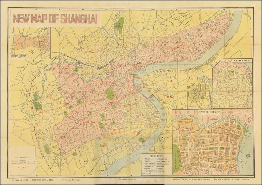
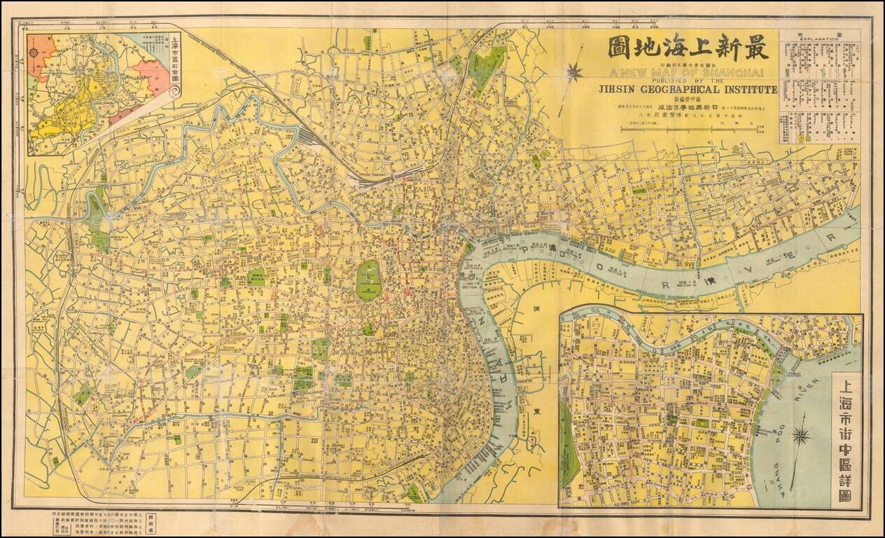
Detailed map of Shanghai, published in Shanghai by Ya Kwang Geographical Institute, drawn by Shao Cheng and edited by Ke Lang. Includes 4 inset maps: Shanghai Central of Municipal District Native City Central District Western District Extension...
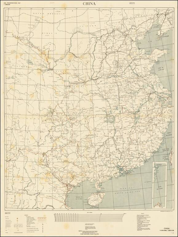
RESTRICTED - U.S. Military Mapping of China During the Final Stages of the Second World War. Color-printed separately issued map of China, part of the "Asia Transportation Map" Restricted series. This is the "Theater Edition" (i.e., for use in China)...
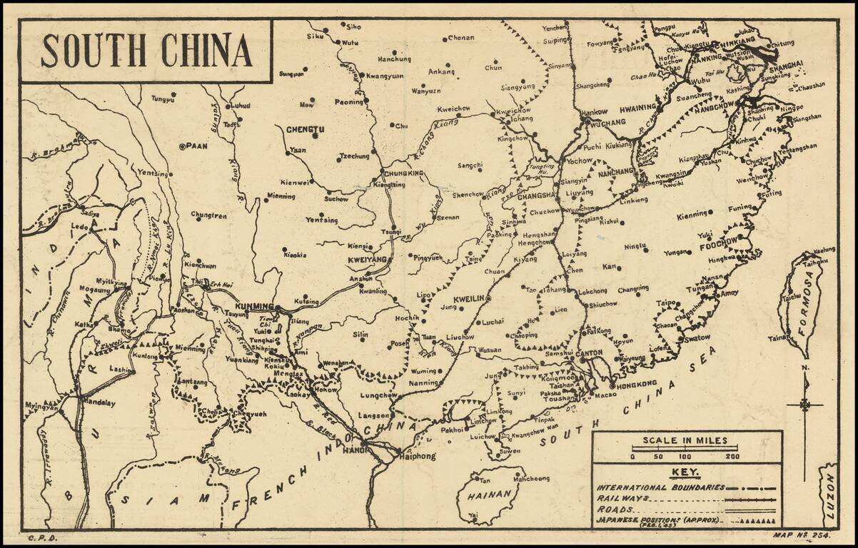
Scarce Map of the War in China -- February 1945 Detailed map of China, published in India for audiences within the British Empire, providing news of the war around the world. The present map illustrates the Japanese positions in China as of February...
Detailed Shanghai street map from the first half of the 20th century, with an inset map of central Shanghai and Bund. Labeled in Chinese and English-transliteration.
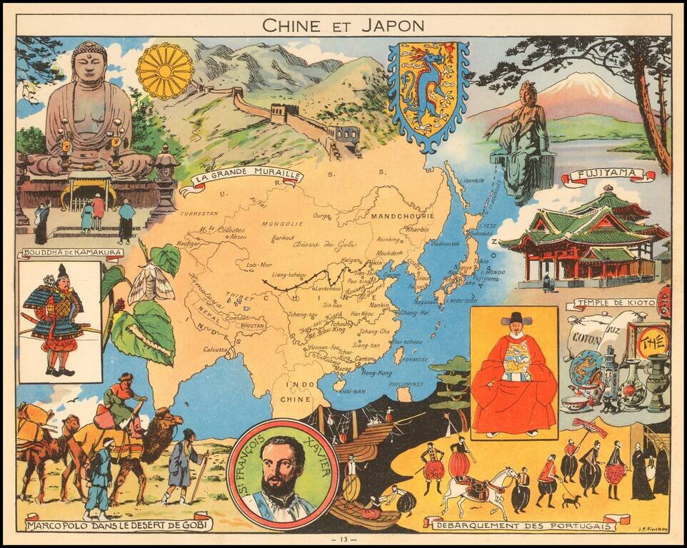
Decorative pictorial map of China, Japan and Korea, published by Children's book artist JP Pinchon.
![[Summer Palace / Longevity Hill -- Yihe Yuan park -- Beijing]. 北京颐和园万寿山全景图 /. Beijing Yihe Yuanwan shou shan quan jing tu](/map/small/65637.jpg)
Fine large view of the Summer Palace, Longevity Hill and Kunming Lake, with photographs and tourist information on the verso. Summer Palace The Summer Palace is a vast collection of lakes, gardens and palaces in Beijing. It was an imperial garden in...
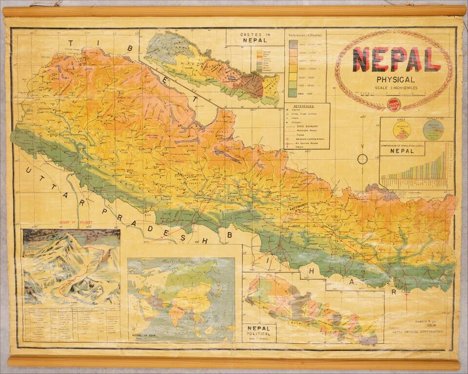
Illustrating Hillary's Ascent of Mount Everest and Prior Failed Attempts Fascinating map of Nepal, issued shortly after Sir Edmund Hillary's Ascent of Mount Everest, including a large inset map / view of the mountain, showing the route of Hillary and...
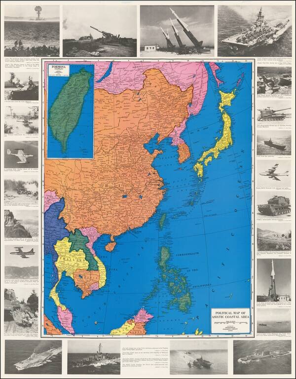
Projecting Power in the Nuclear Age Colorful Map of Southeast Asia, the Philippine Islands and China, ringed by images of American military assets. At the top left is an image of a mushroom cloud from the first atomic artillery shell. Other...
![[Hong Kong Published Fishing Map!] Bountiful fish harvest maritime map 漁獲豐收海圖](/map/small/55323.jpg)
Hong Kong Map Advertising New Skills to Fisherman Interesting fishing map extending from Hainan Islands in the southwest to Xiamen in the northeast, centered on the Hong Kong - Macau area. The map shows the fishing grounds in the area, highlighting...
![台湾自古以来是我国神圣领土的一部分![Taiwan zi gu yi lai shi wo guo shen sheng ling tu de yi bu fen]. [Taiwan is Part of the Sacred Territory of the People's Republic of China since Ancient Times!]](/map/small/68488.jpg)
Proving "Taiwan is an Inalienable Part of China" Chinese wall map of Taiwan with an outline map of Taiwan A chronology is listed on map from the late Neolithic period to the 20th century. The periods mentioned in the map are: late Neolithic period,...
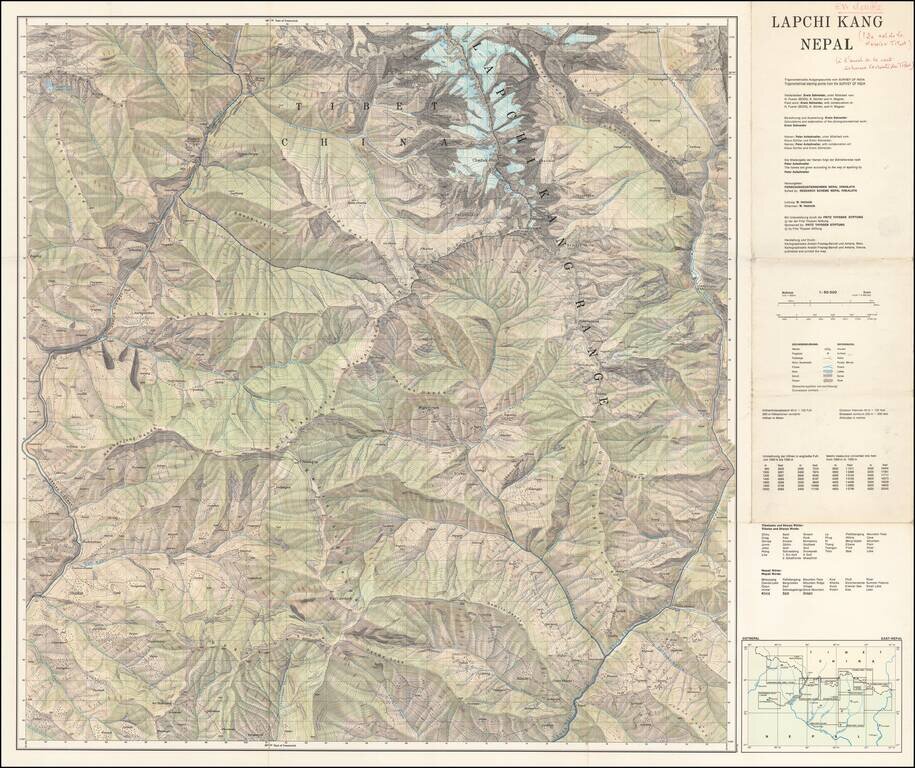
Scarce separately published map of Tibet and a section of Chinese Tibet. The map credits Peter Aufschnaiter as one of its makers. Peter Aufschnaiter (1899 - 1973) was a Tyrolean mountaineer, agricultural scientist, geographer, and cartographer. His...
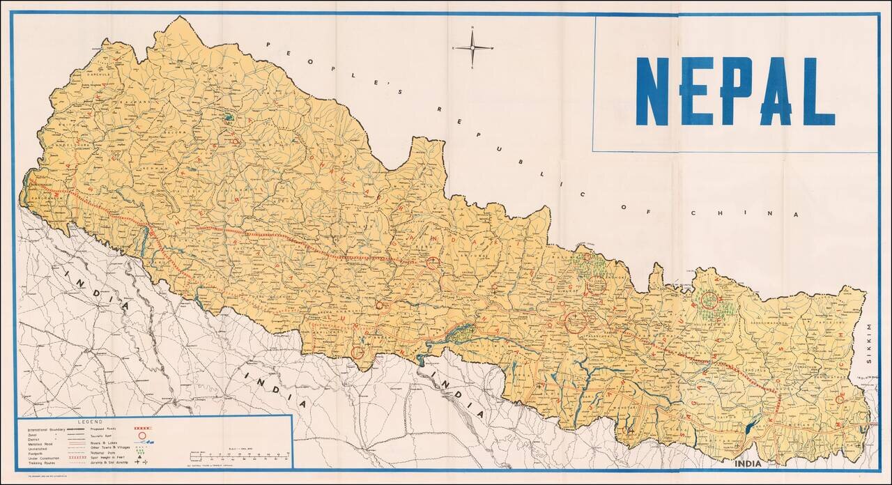
Fine large map of Nepal, published by Natraj Tours & Travels, in Katmandu. Legend notes: International Boundaries Zonal Boundaries District Boundaries Metalled Road Unmetalled Road Foot Path Trekking Routes Proposed Roads Roads Under...
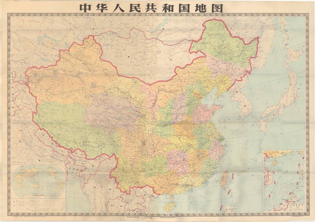
Striking large format map of the People's Republic of China.