
![(Commodore Perry) [Names of Japanese Sumo Wrestlers.] [Nihon rikishi namae]](/map/small/55567.jpg)
Woodblock kawaraban showing Japanese sumo wrestlers carrying straw rice-bags (one bag weighs about 60 kg) to the American ship. At the second visit by Commodore Perry in 1854 the Edo government gave Perry 200 bags of rice. On this occasion, the Edo...
![[The United States in North America | Russian Empire in Europe] [Kita-Amerika-nai Gasshukoku | Yoroppa-nai teikoku Roshia]](/map/small/55548.jpg)
This kawaraban shows the portraits of two officers, an American and a Russian, with explanatory text printed around these figures it reflects the interest in these two powerful countries following their arrival in Japan in 1853. It seems likely that...
![[American Lady] [Amerika fujin] | [Chinese Man from Nanjing] [To Daishin Nankin-jin]](/map/small/55554.jpg)
Kawaraban Illustration of a 19-year-old American Woman. Interesting woodblock kawaraban illustrating a 19-year-old American woman named "Arikisanteru" [Alexandra], and a Chinese man from Nanjing kneeling at here feet suggesting he may be her...
![[On Europe: Dutch Man, English Man, Russian Man, North American Man, and French Man] [Yoroppa no bu: Oranda-jin, Igirisu-jin, Furansu-jin, Kita-Amerika-jin, Roshia-jin]](/map/small/55553.jpg)
Hand-colored woodblock kawaraban of five western men in military uniforms. Counter-clockwise from the top right they are: Dutch, French, American, English, and Russian. The accompanying text largely focuses on Dutch seaborne trade.
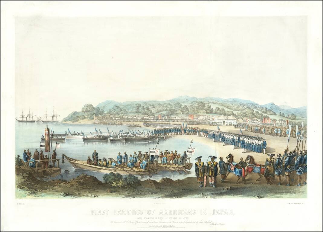
The Most Dramatic Image of Commodore Perry Landing on Japanese Soil. Exceptional antique lithograph of Perry's first landing in Japan. The print is the most dramatic of Perry's first landing in Japan, and shows a flotilla of American barges, with all...
![[USS Powhatan Carrying the First Japanese Embassy to America.]](/map/small/55550.jpg)
The First Japanese Embassy to the United States. Woodcut kawaraban sheet showing the USS Powhatan serving in its role transporting the first Japanese Embassy to the United States in 1860. First Japanese Embassy to the United States The Japanese...
![[Concerning the Names of the [Japanese] Delegates to America.] [America-koku gojoshi on'namae duke]](/map/small/55555.jpg)
Treaty of Amity and Commerce between Japan and the United States. This image shows two ships with the Japanese delegates on board leaving Yokohama in January 1860 bound for the United States. Their mission was to exchange the instruments of...
![Taisei Kyō Saiken Ezu [Detailed and illustrated map of Kyoto]](/map/small/58218.jpg)
Detailed map of Kyoto, published in 1864. The map was prepared for tax administration and locates imperial properties, noble properties, temples and commoners.
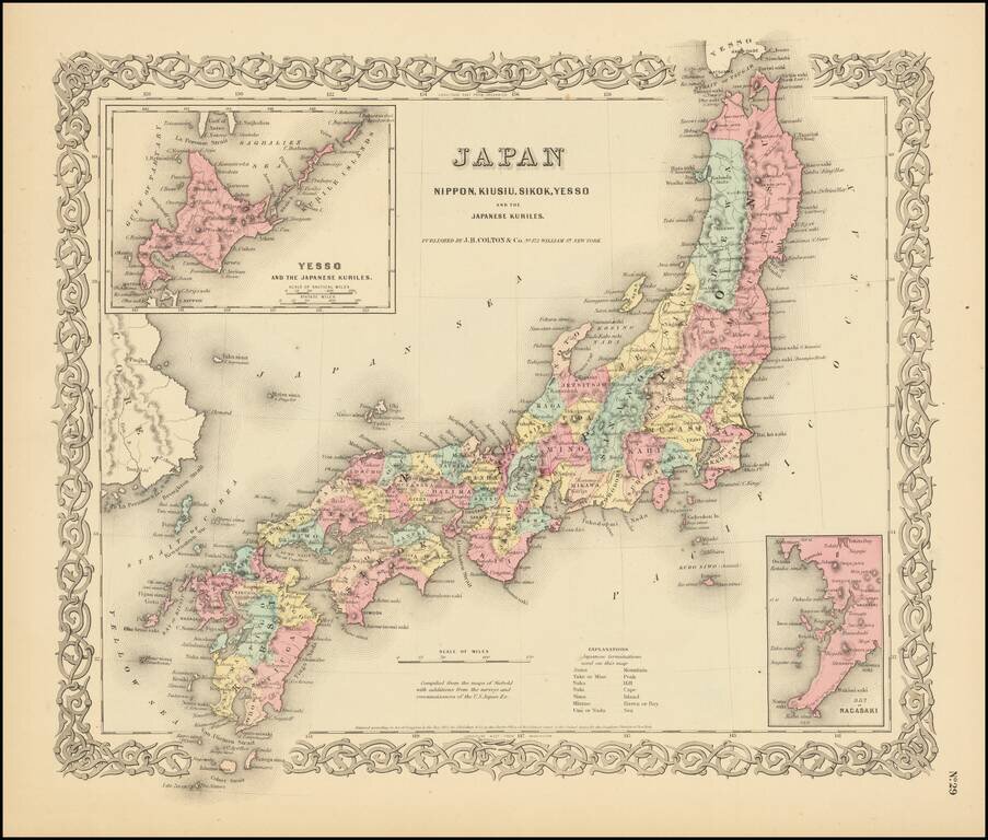
Detailed map of Japan, colored by Prefecture, with insets of Nagasaki and Yesso. Shows towns, rivers, lakes, mountains, islands, etc. A terrific regional map from J.H. Colton, one of the most prolific American mapmakers of the mid-19th century....
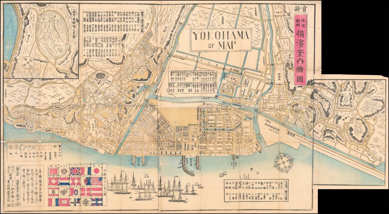
Wonderful Richly Illustrated Map of Yokohama, Featuring Flags of Foreign Nations and a Wonderful Malapropism "Yokohama of Map". Color woodblock map of the trading port of Yokohama, highlighting trade with foreign nations that flourished under the...
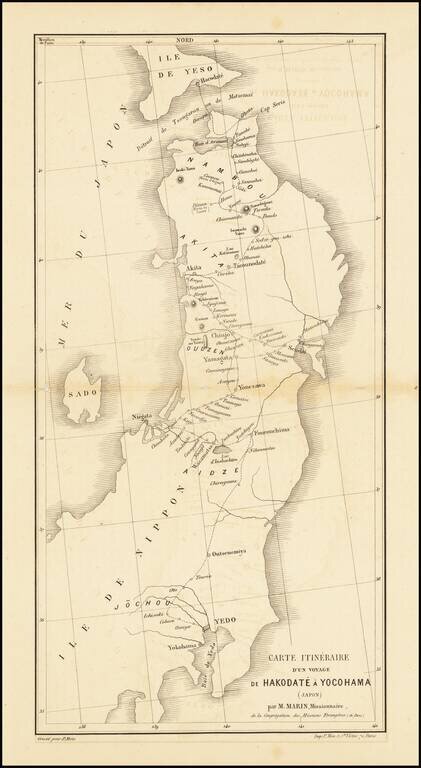
Scarce missionary map showing a portion of Japan, published in Paris. Includes the route taken by the Missionary Marin through Yokohama and Hokkaido.
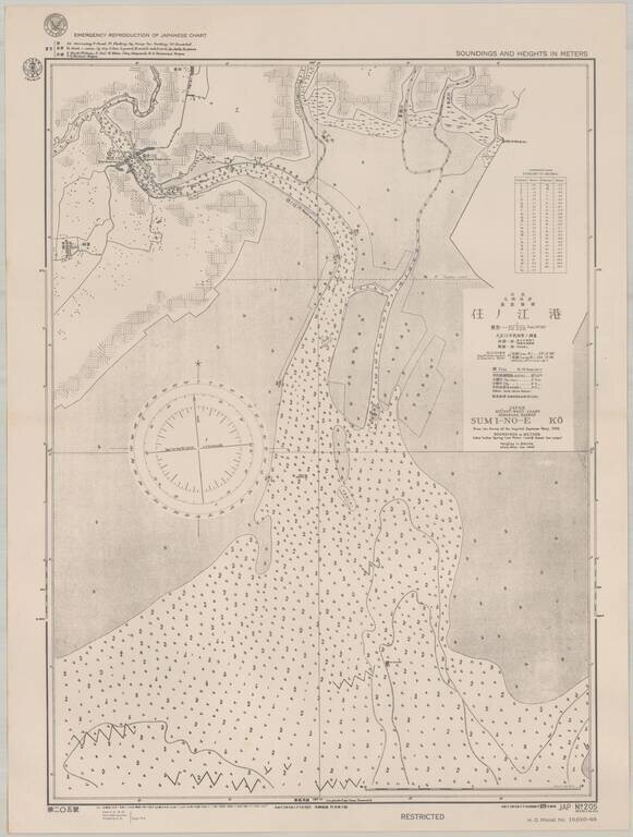
Scarce sea chart of part of the west coast of Kyushu, providing a fascinating insight into U.S. efforts to produce maps of Japan during World War II. The map, which was published by the Navy in September 1944, shows an area on the west coast of Kyushu,...
![(Second World War - Okinawa) [Large Battlefield Composite Map of Okinawa]](/map/small/63896.jpg)
6.5-Foot-Tall Battle-Used Map of Okinawa. Impressive battlefield composite map of Okinawa, composed of numerous sections of SECRET Army Map Service sheets cut and pasted together to form one large image. The map covers all of Okinawa, but for a small...
![(Second World War - Okinawa) [Battlefield Composite Map of Southern Okinawa]](/map/small/63897.jpg)
Battle-Used Map of Okinawa. Impressive battlefield composite map of Okinawa, composed of numerous sections of SECRET Army Map Service sheets cut and pasted together to form one large image. The map covers the southern most parts of Okinawa, including...
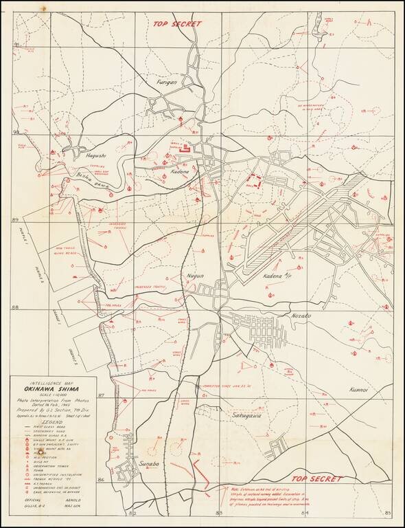
Top Secret American Map Used to Capture Kadena Airfield on Okinawa. Top Secret map of the Okinawa landing beaches Orange 1 & 2, and Purple 1 & 2, and the defenses between those beaches and Kadena airfield. The map was prepared based on...
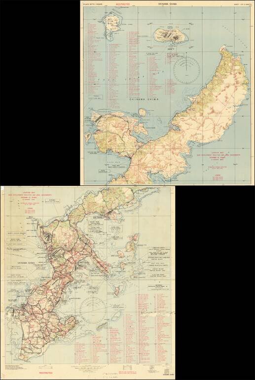
Restricted U.S. Military Map of Okinawa as it was Being Converted into a Major American Base. Color-printed map of Okinawa, produced by the 3020th Engr. Topo. Co. (Corps) on Okinawa, in September 1945, immediately after the end of World War II. The...