Map size in jpg-format: 6.20999MiB
Click to open in high resolution (open in new tab).
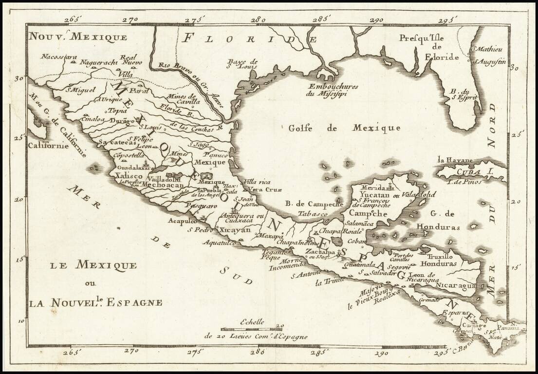
Rare map of Florida, the Gulf Coast, Texas, Central America and the Caribbean. Florida extends to the Rio Grande River.
Only a few settlements shown in Florida and none on the Gulf Coast, apparently pre-dating New Orleans.
Reminiscent of De Fer's map of the region.
Rarity
This is the second time we have seen this map in the past 25 years.
If you are a student, write to us in telegram: @antiquemaps and indicate what material you need and for what work you need a map in high detail. We are ready to provide material on special terms. For students only!

![[Wall Map] West-Indische Paskaert waer in de graden der breedde over weder zyden vande middelyn wassende so vergrooten dat die geproportioneert syn tegen hunne nevenstaende graden de lengde.](/map/small/60169.jpg)
