Map size in jpg-format: 9.78415MiB
Click to open in high resolution (open in new tab).
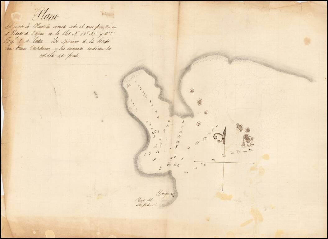
Detailed, Early Manuscript Plan of Huatulco, Oaxaca
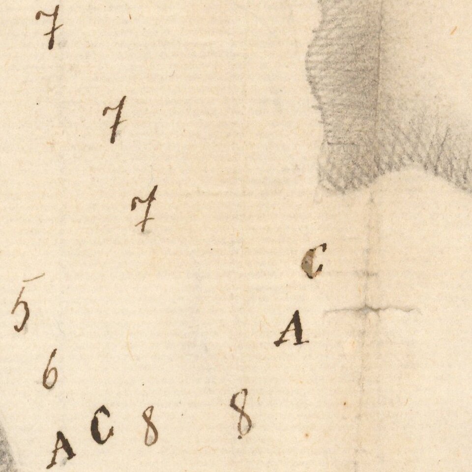
Finely-executed sketch of the port of Huatulco in the state of Oaxaca, Mexico. The north-oriented plan shows sounding depths and sea-floor quality indications, one of the earliest surveys to show the geographic feature in such useful detail.
While the bay is shown in relative simplicity, there are striking minutiae that show artistry. For example, there is a half-fleur-de-lys on the four-point compass rose. Rocks dot the outer bay, with x marks to indicate difficulty landing for ships. To the south is a structure, near the Punto del Bufadero, or Blowhole Point.
The text in the upper left reads in Spanish:
Plano del Puerto de Huatulco situado sobre el mar pacifico en el Estado de Oajaca en la Lat. N. 15 ° 46' y 90 ° 7' Long/d 0 de Cadiz. Los Numeros de la Sonda son brazas Castellanas, y las iniciales indican la calidad del fondo.
In English:
Plan of the Port of Huatulco situated on the Pacific Ocean in the state of Oaxaca in the Lat[itude] N[orth] 15°46' and 90°7' Long[itu]d[e] 0 de Cadiz. The numbers of the sounding are Castilian leagues, and the initials indicate the quality of the bottom.
The map is on paper with the watermark of Giovanni Cini, which commenced business in 1807.
Huatulco
The bays near Huatulco have long been inhabited by local indigenous groups, including the Toltecs, Zapotecs, and Mexicas. Hernan Cortes made the feature a central port in his post-invasion New Spain. It was used as a point of distribution for the entire Pacific coast, as well as a protective harbor for the famed Spanish galleons. This importance drew marauding privateers, including Francis Drake and Thomas Cavendish.
After this initial fame, Huatulco became a quiet region known for coffee agriculture and for a cross that was supposedly deposited on a beach nearby by a bearded man, perhaps Saint Thomas, 1500 years before the arrival of the Spanish. In 1612, the cross was sent to the cathedral in Oaxaca, where it was splintered into smaller crosses and sent to important Catholic sites around Mexico and in the Vatican. Since the 1980s, the area has become a domestic tourism hub.
If you are a student, write to us in telegram: @antiquemaps and indicate what material you need and for what work you need a map in high detail. We are ready to provide material on special terms. For students only!


![Map of Mexico, Central America, and the West Indies [Insets of Bermuda, Sandwich Islands, Jamaica and Panama Railroad]](/map/small/69133.jpg)