Map size in jpg-format: 12.4957MiB
Click to open in high resolution (open in new tab).
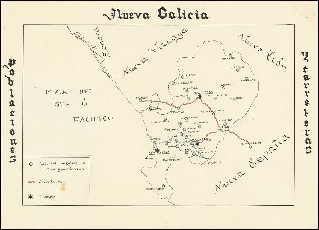
Hand drawn thematic map of the Nueva Galicia, centered on Zacatecas, showing primary roads and population centers.
The date is estimated.
If you are a student, write to us in telegram: @antiquemaps and indicate what material you need and for what work you need a map in high detail. We are ready to provide material on special terms. For students only!


![Map of Mexico, Central America, and the West Indies [Insets of Bermuda, Sandwich Islands, Jamaica and Panama Railroad]](/map/small/69133.jpg)