![[Windward & Leeward Islands -- Puerto Rico to Trinidad]](/map/small/36239mb.jpg)
Map size in jpg-format: 741484B
Interesting untitled sea chart of the Windward and Leeward Islands, extending from Puerto Rico to Trinidad.
The chart shows signs of use around the Virgin Islands, with navigational lines apparently shown for transit thorough the islands from St. Thomas to St. Kitts. The chart is quite detailed, with the topography of the major islands shown with relatively fine precision.
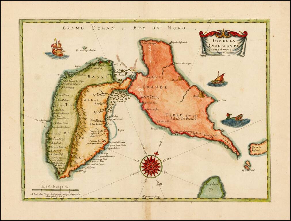
The modern use of Guadeloupe for both Basse Terre and Grand Terre," is unusual, because most maps in 1800s referred to Basse Terre (only) as "Guadeloupe", separate from Grande Terre.
The chart is not signed, but bears a similarity to the charts of John Stratton Hobbs, who produced a number of fine sea charts for the Wilson and Norie firm in the mid-19th Century. The attention to topographical detail and general style of the map are reminiscent of Hobbs.
If you are a student, write to us in telegram: @antiquemaps and indicate what material you need and for what work you need a map in high detail. We are ready to provide material on special terms. For students only!
![Cuba Insula [with] Hispaniola Insula [with] Insula Jamaica [with] Ins. S. Ioannis [with] I.S. Margareta Cum Confiniis](/map/small/70194.jpg)