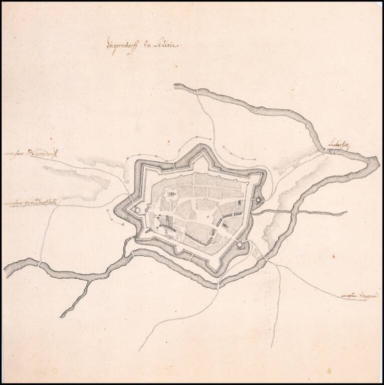
Fine Manuscript Plan of the Walled City of Krnov Striking, finely drawn map of Old City of Krnov, now in the Czech Republic, and previously a part of Austrian Silesia. It shows the walled portion of the city, which sits at the conjunction of two...
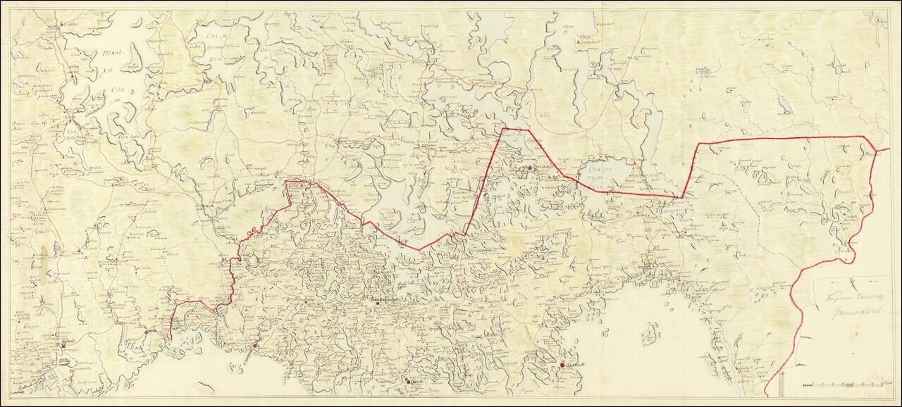
Imperial Russian Manuscript Map of the Russia-Finland Border, circa 1810. Pavlovsk Palace Library Provenance. Large Imperial Russian manuscript map of the Russia-Finland border as it existed between 1743 and 1812. The Russian side of the border...
![[Plan of the City of Moscow] Планъ Города Москвы](/map/small/61305.jpg)
Detailed color-printed antique map of Moscow, published in 1881. The map divides Moscow into a grid with 127 sections (though not all are shown). It is signed by the Major General in charge of the Moscow City Police. At the top of the map is the Coat...
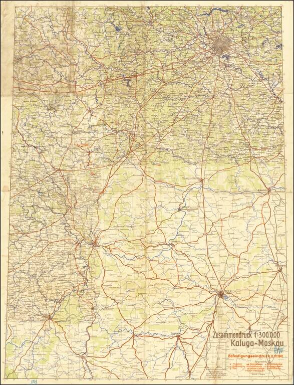
The Scene of the Wehrmacht Defeat Outside Moscow. Rare German plan of military positions and strategic landmarks between Kaluga and Moscow, published on the 8th of October, 1941, during the Battle of Moscow. The map shows the front as it existed in...
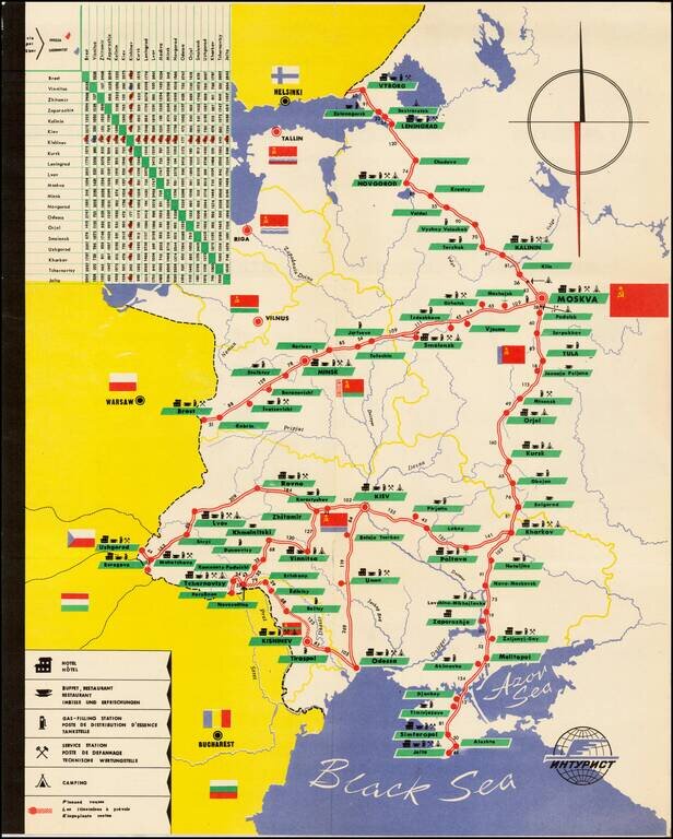
Decorative tourist map of Russia, showing the bus lines throught the country. An interesting Soviet era tourist item.
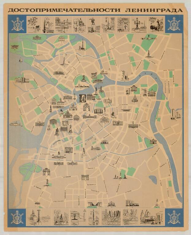
Fine Soviet-era pictorial tourist map of Leningrad (St. Petersburg), published in the former Soviet Union. The map illustrates over 90 points of interest, with 16 inset views at the top and bottom of the map. Extensive descriptive text and additional...
![КАРТА ВСЕГО АЗОВСКАГО МОРЯ сочинена съ описи, вновь учиненной 1803 года, на компасъ имѣющей склоненіе 8, Западное. Глубииa моряозначена футами. [Map of the Whole Azov Sea...]](/map/small/56511.jpg)
Detailed Map of the Sea of Azov, issued Upon the Creation of the Taurida Governate by Alexander I. Separately issued Russian engraved map of the Sea of Azov, published in 1803, after a period of improved surveying of the body of water. The map far...
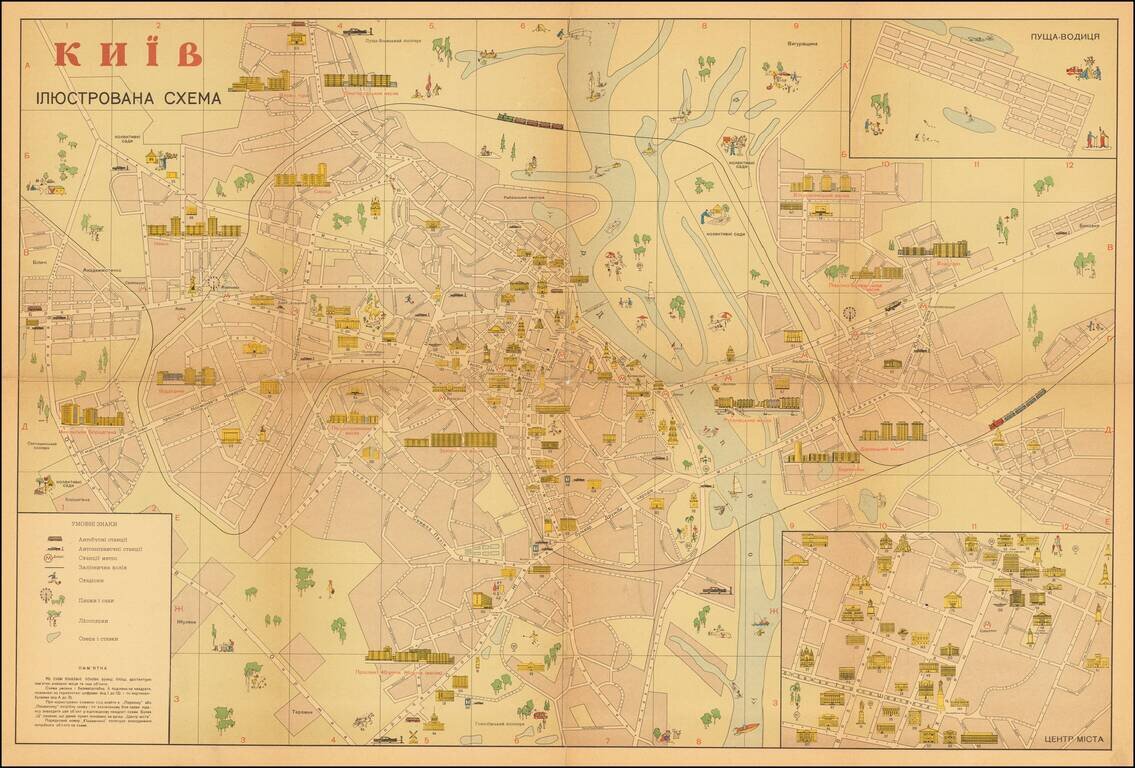
Attractive illustrated Soviet-era map of Kiev, with text in Ukrainian, especially highlighting areas of interest to tourists. The inset at the lower right shows the "ЦЕНТР МІCТА" (Downtown), the inset at upper right shows...
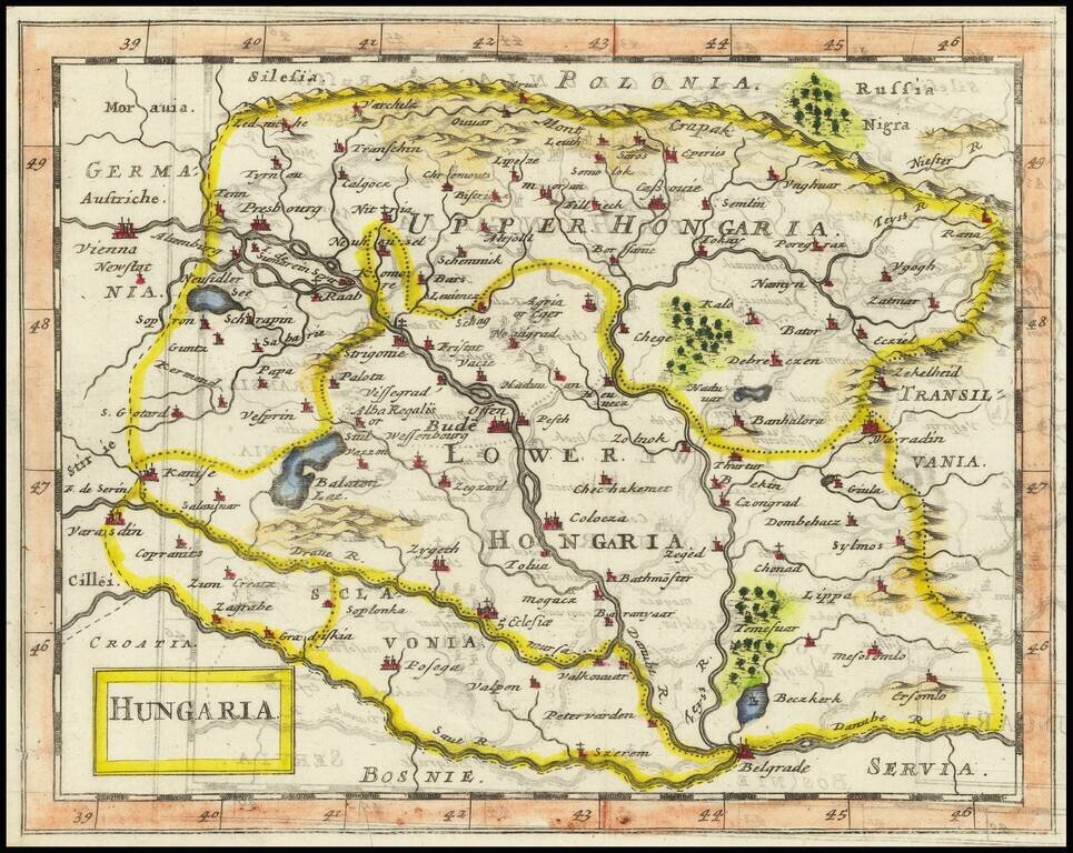
Rare second edition of this small map of Hungary, which appeared in the 11th edition of Kurtze, erlauterung . . . published in Berlin in 1795. Detailed table below.
![[Part of Hungary]](/map/small/0009gh.jpg)
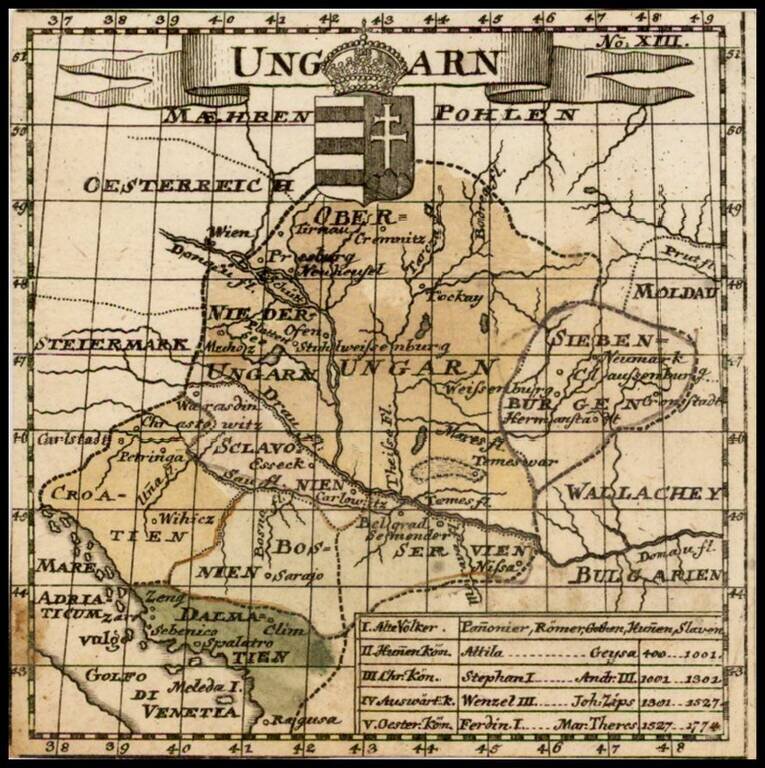
One sheet from a larger map, covering Hungary in remarkable detail. The map bears the stamp of a German Jesuit Library and may have been from a map of the Austro-Hungarian Empire.
![[Tighina / Bender, Moldavia -- Dniester River] Plan von der Festung Bendern am Dniester Flus, zwischen der Moldau, westlichen Nogai und Bessarabien an einen Morast gelegen](/map/small/61819.jpg)
Finely Illustrated Map of the Bendery Fortress in Moldova with Ottoman Punishment Scene Excellent rendition of the area near present-day Bender (Tighina), Moldova showing military and topographical landmarks with a fascinating accompanying...
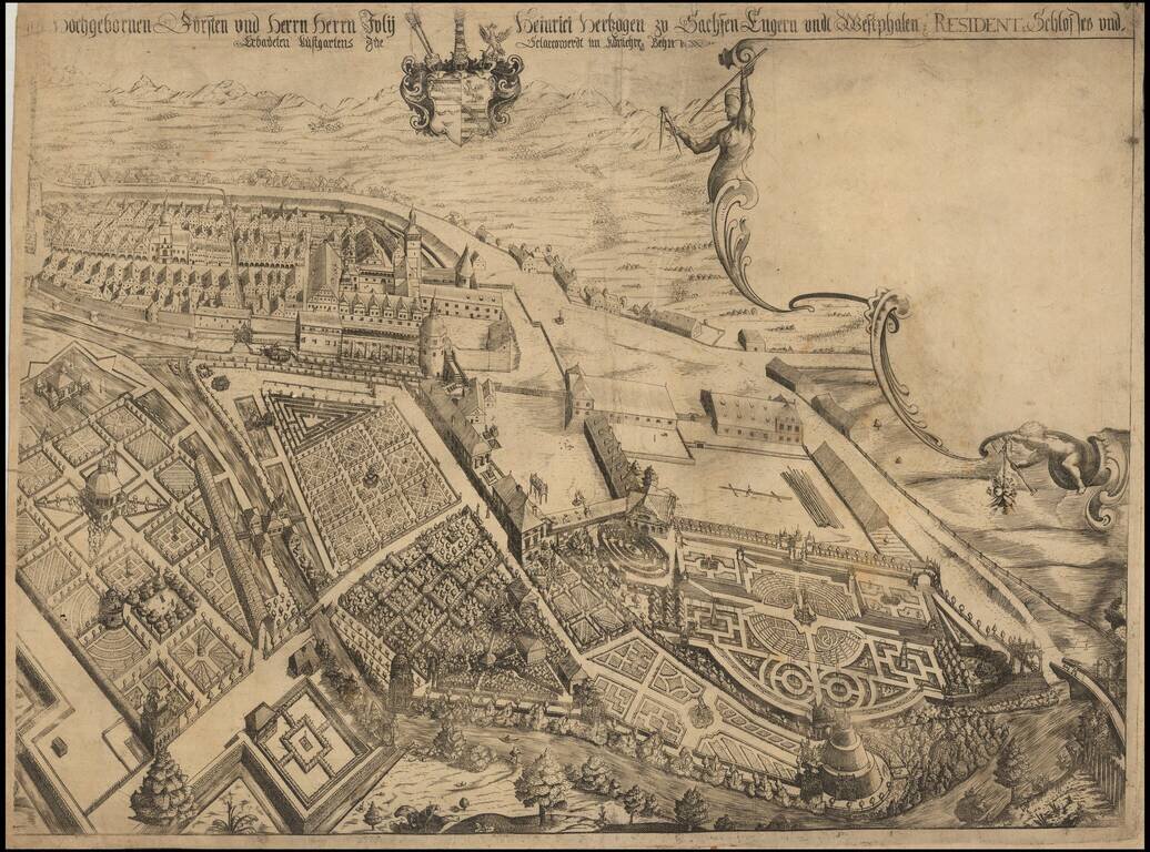
Rare separately published view of Ostrov nad Ohrí (German Schlackenwerth), in northwest Bohemia. We have not been able to locate an example of this view, but we have identified a smaller contemporary view by Merian, which suggests that a portion of...
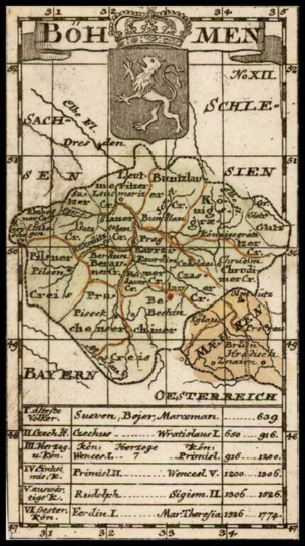
Rare second edition of this small map of Bohemia, which apeared in the 11th edition of Kurtze, erlauterung . . . published in Berlin in 1795.
![[Austrian Army Positions in Moravia, May 1758] . Plan du Campe de L'Armee Imperiale dans les Environs de Chotze le 4me May 1758.](/map/small/59816.jpg)
Chocen, Hemze and Bestovice, Czechia -- May 1758 -- Positions of the Austrian Army Under The Command of Count von Daun Finely executed map illustrating the Austrian military positions, likely under the Command of Field Marshall Count Leopole Josef von...
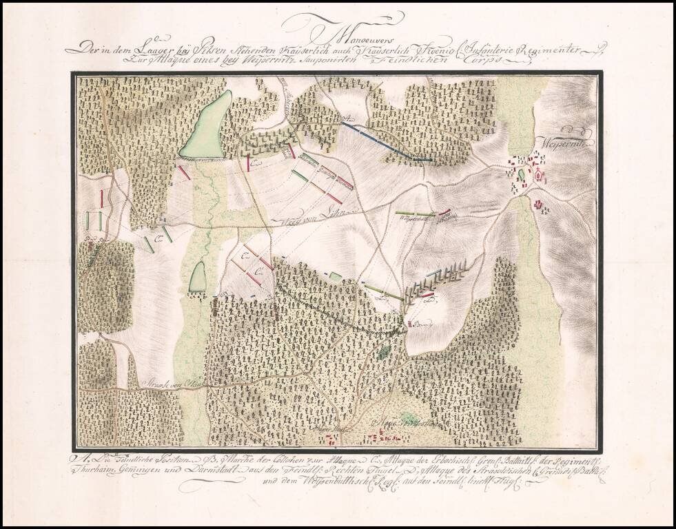
Manuscript Battle Plan of the area around Vejprnice, Czechia. Finely executed battle plan showing the troop positions to the west of the town of Weipernitz (Vejprnice), about 4 miles west of Pilsen (Plzen) in the northern part of the Czech Republic....