![[Marseille] Marsilia](/map/small/61341sb.jpg)
An Important 16th Century View of Marseille Extremely rare bird's-eye anonymously published view / plan of Marseille from above "Le Fort de Notre Dame de la Garde". The view includes a coat of arms of the city of Marseille. Text description of...
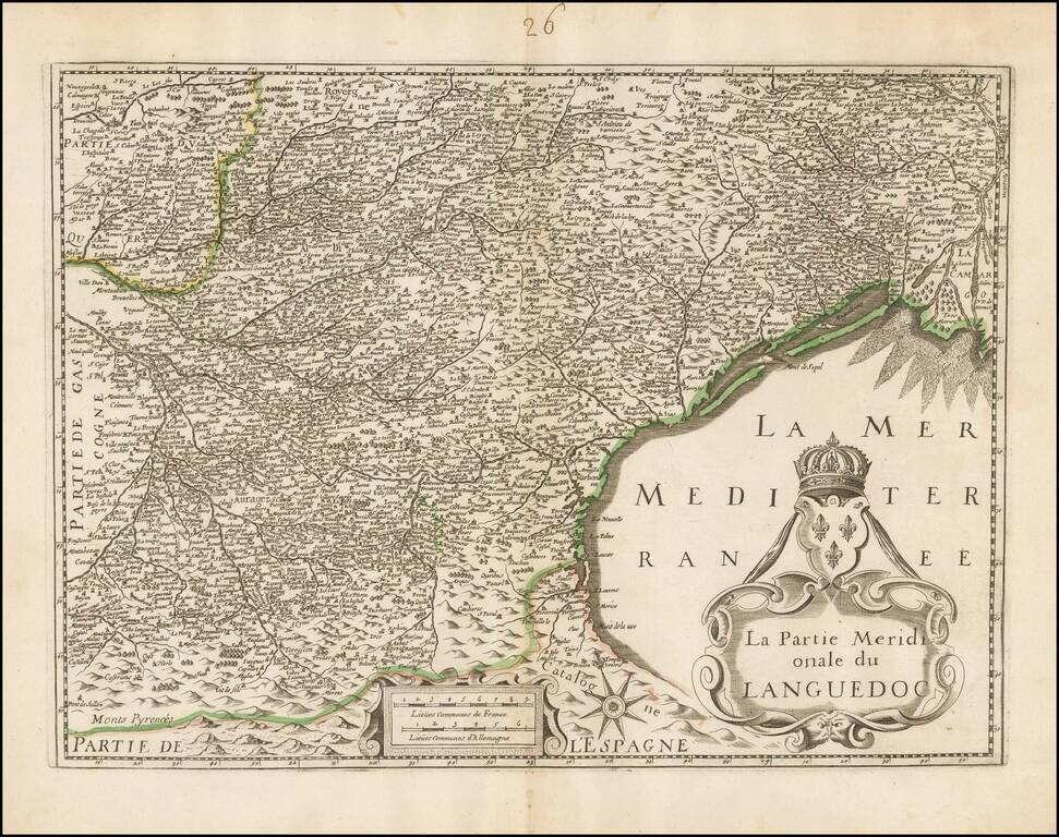
Unrecorded map of the southern part of Languedoc, based upon Henricus Hondius's map of the same region. Our research of the map turns up no source information. The example in the National Library of France is attributed to Hondius, but this is clearly...
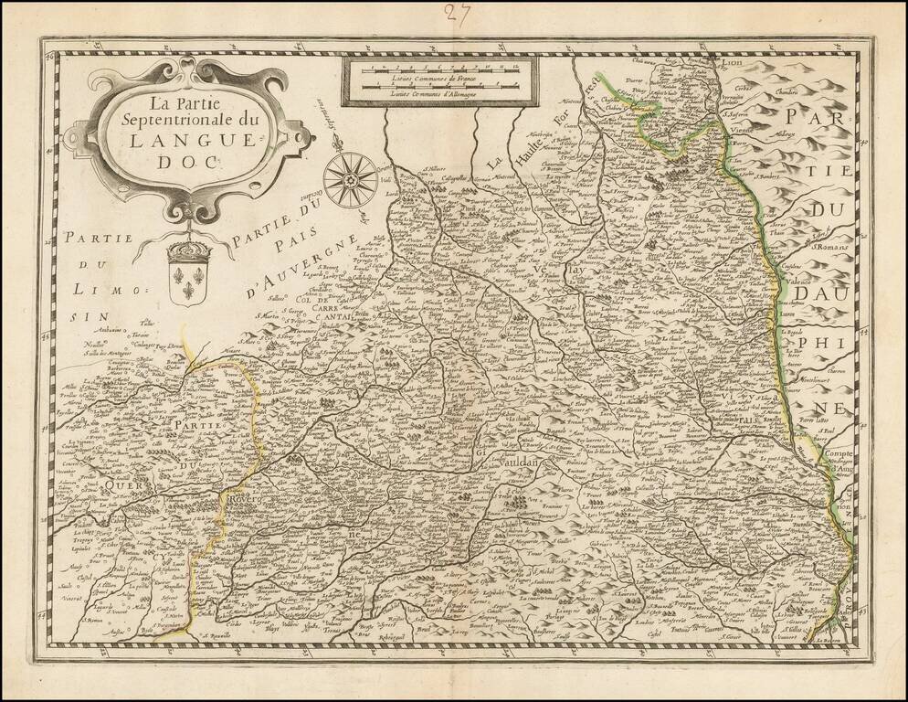
Unrecorded map of the northern part of Languedoc, based upon Henricus Hondius's map of the same region. Our research of the map turns up on source information. The example in the National Library of France is attributed to Hondius, but this is clearly...
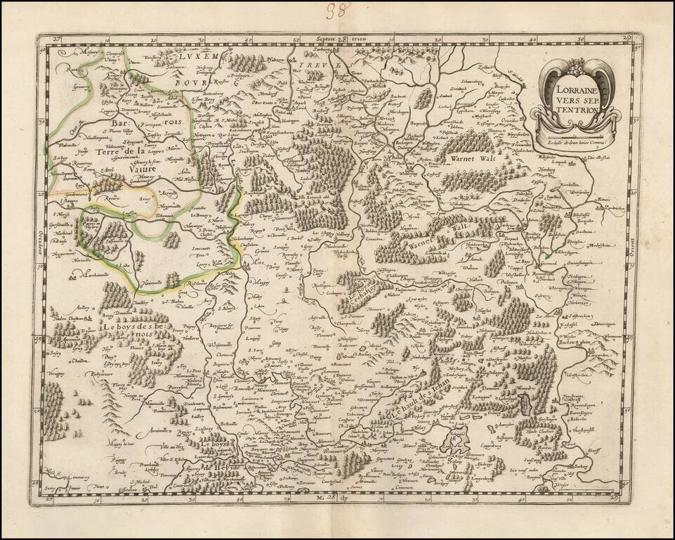
Rare late edition of Francois Bougereau's map of Lorraine region, first published in 1594. The map shows the northern part of Lorraine, based upon an earlier map by Mercator. This edition has the credit of Bougereau (and later imprint of Le Clerc)...
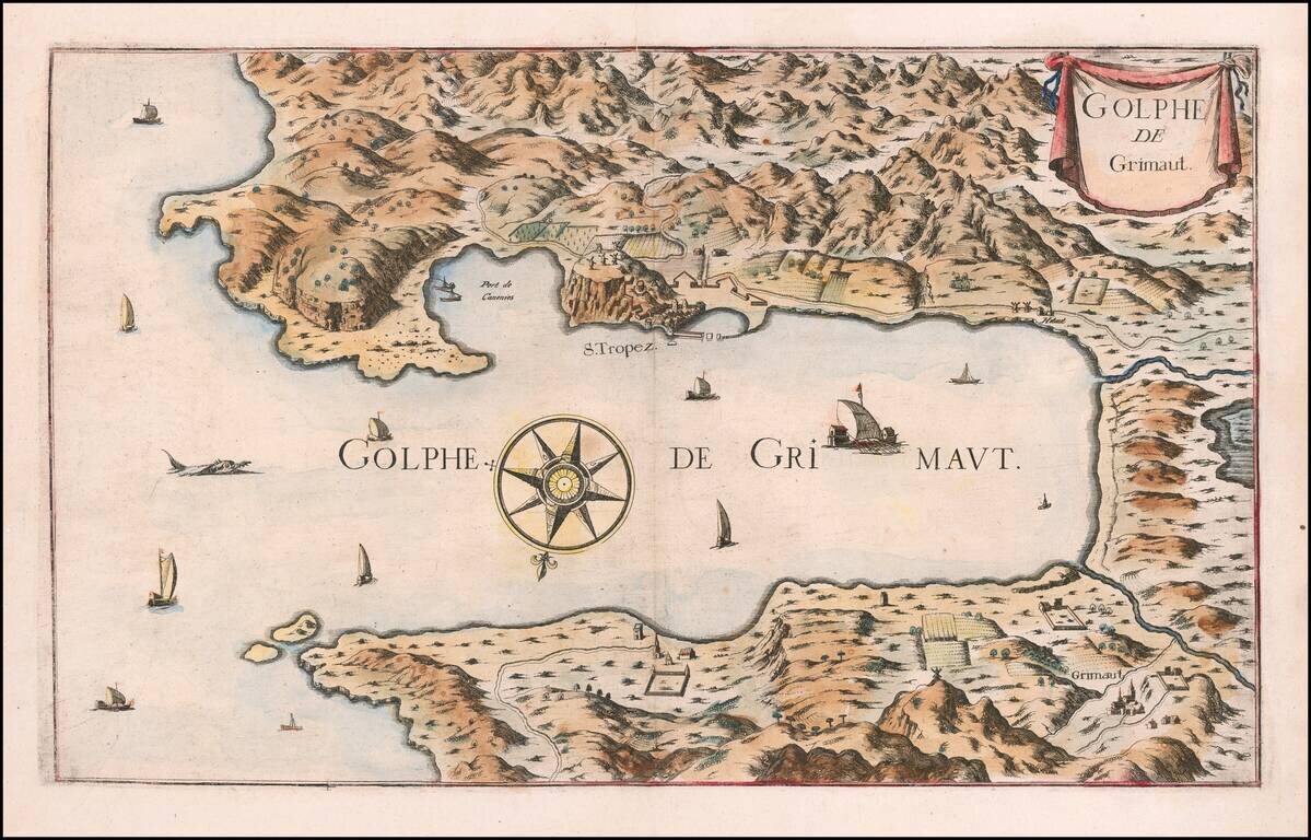
Rare map of the Gulf of Grimault, oriented with south at the top. The map shows San Tropez and environs, with sailing ships a compass rose and other embellishments.
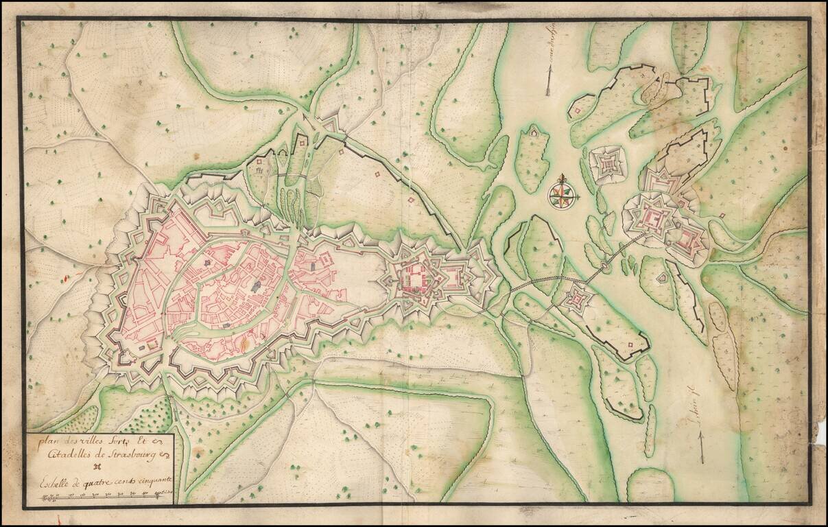
Manuscript Plan of Strasbourg and Environs, including the fortifications at Kehl. Detailed hand drawn plan of Strasbourg, focusing on its fortifications in the Vauban style.
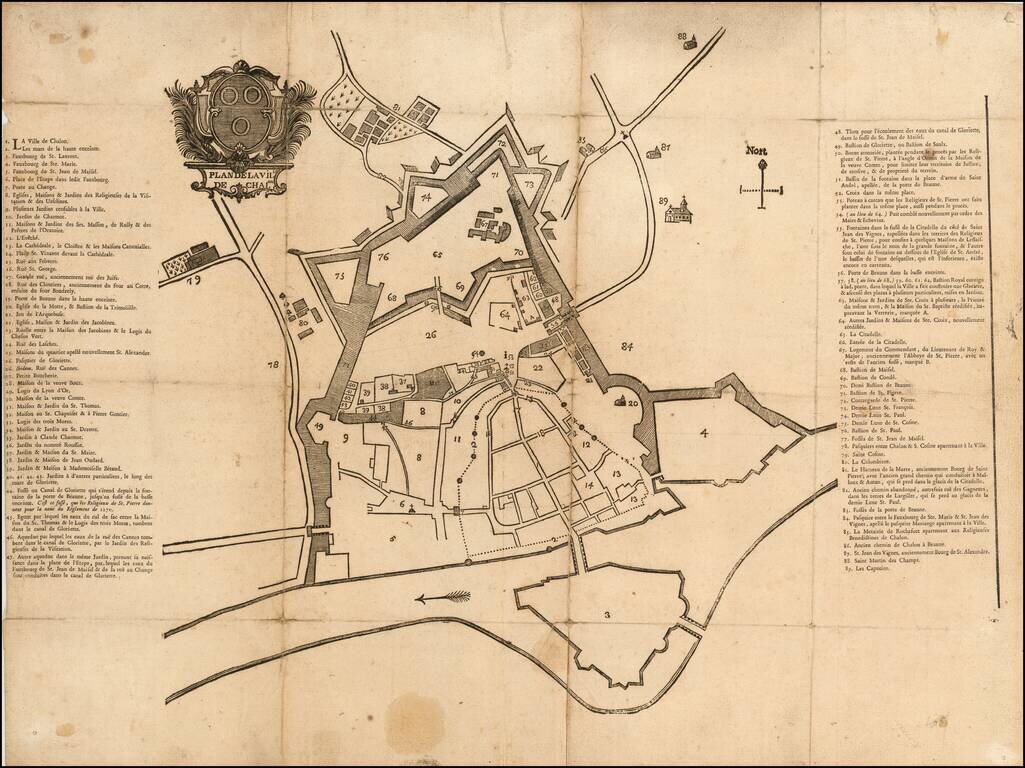
Fine early map of Chalone-sur-Saone, likely one of the earliest printed maps of the city. The map is surmounted by a large coat of arms above the title. Item #17 is Grande rue, anciennement rue des Juifs (Great street, formerly street of the Jews)....
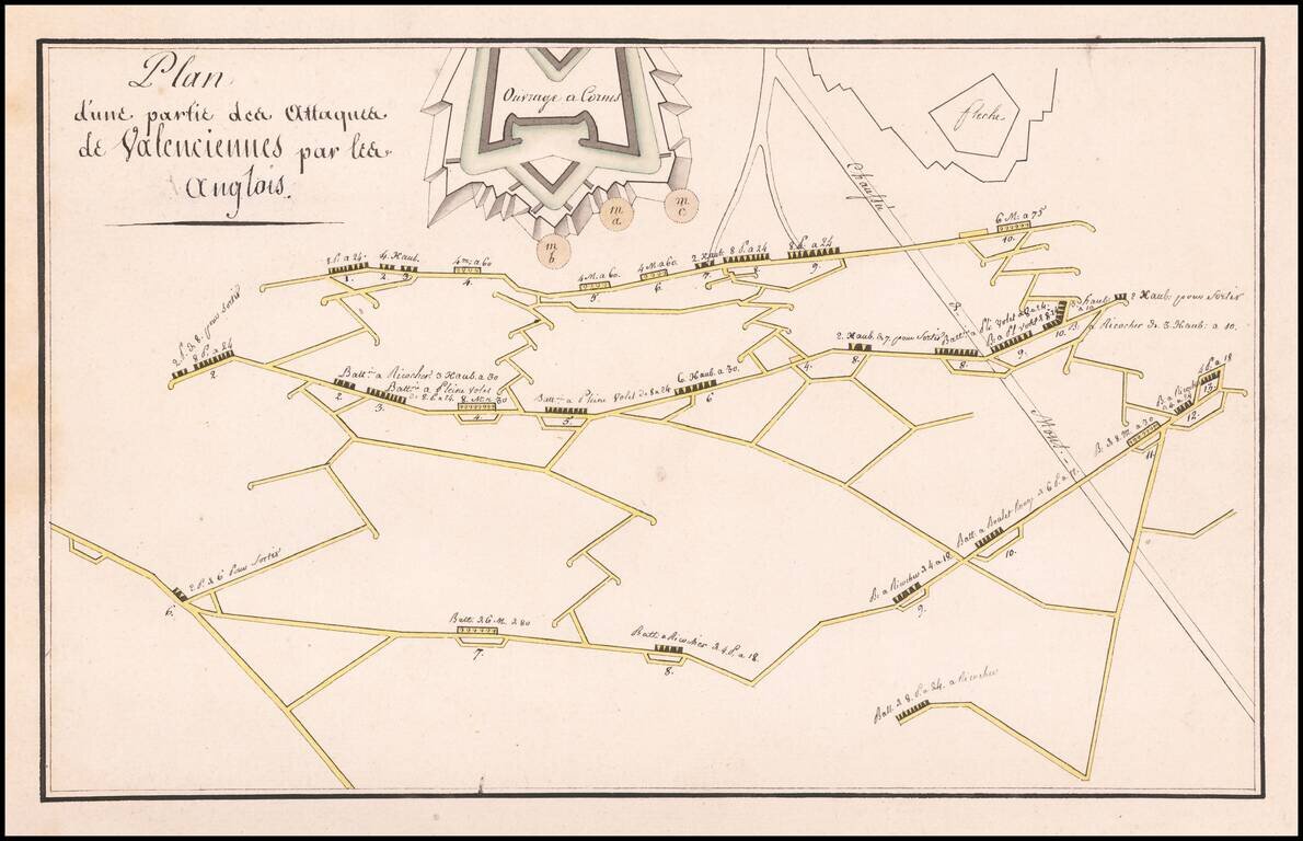
Finely illustrated manuscript plan illustrating the defenses and batteries around Valenciennes.
![Carte Choroghique des 6 départemens du piémont formant la 29ime. division militaire territoriale. Ou Se trouve repartie la 28ime. Légion de gendarmerie nationale composée de 3[?] cadrons, 6 compagnies 18. Lieutenance[?] et 126 Brigades dont 63 apied, et 6](/map/small/60835.jpg)
Manuscript Administrative Map At The End of the Subalpine Repubic Prepared For General de Moncey A superlative Napoleonic military map of northwestern Italy, showing the former territory of the Subalpine Republic after it was folded into the French...
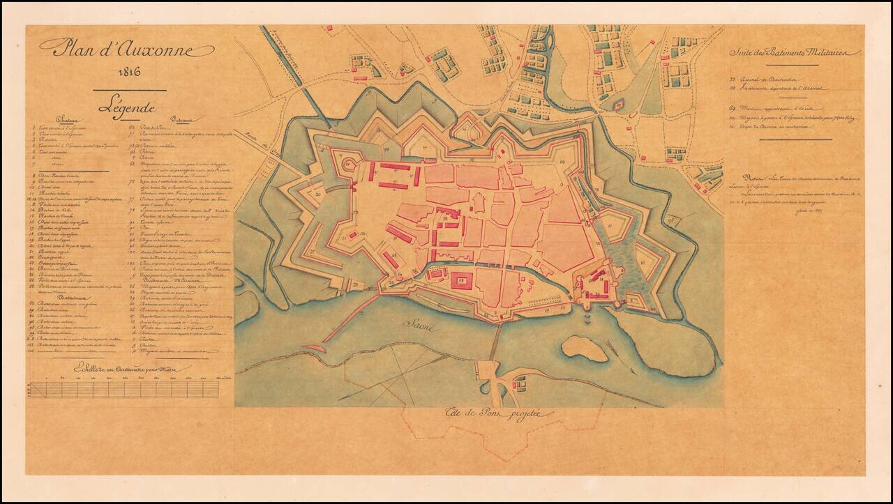
Detailed Plan of Auxonne, where Napoleon Studied to Become a Gunner Fine plan of Auxonne, a Burgundian fortification on the banks of the Saône. The stronghold, which housed an artillery school for France’s army, had Napoleon as a student and...
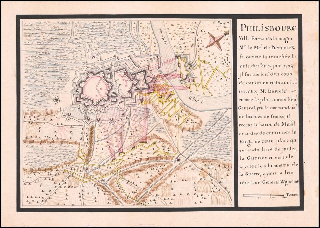
Manuscript Plan of The Siege of Philippsburg - June 1-July 18, 1734 Finely executed battle plan, illustrating the Siege of Philippsburg in 1734. The map and description at the right provide an excellent retrospective explanation of the Siege,...
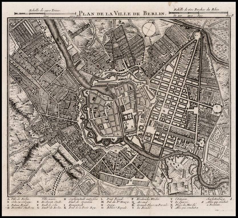
Detailed map of Berlin, with a key at the bottom showing approximately 25 place names.
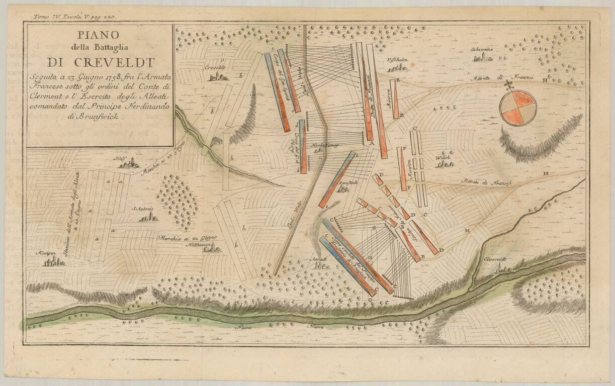
Scarce Italian language battle plan of the Battle of Krefeld, fought in Krefeld, present-day North Rhine-Westphalia on June 23, 1758, during the Seven Years War. The Hanoverian army led by Ferdinand, brother of the duke of Brunswick, had driven the...
![[Spandau] Spandow](/map/small/58956.jpg)
A Napoleonic Era French Map of Spandau Detailed manuscript map of the fortifications around Spandau and its Citadel, including French text, almost certainly indicating that it was prepared during the French occupation of the region, between 1806 and...
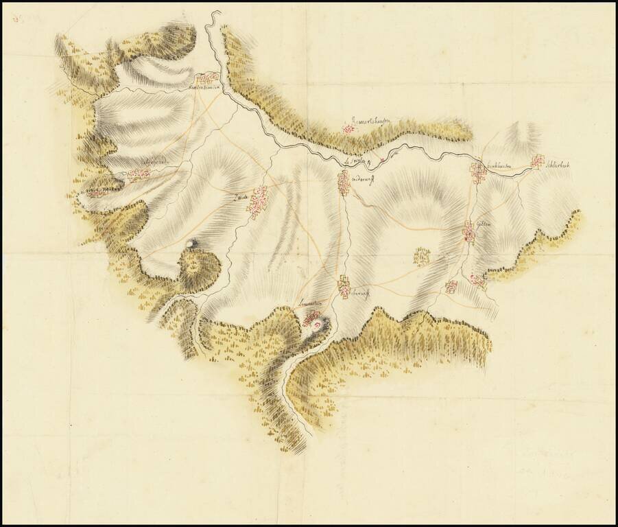
Manuscript Map Showing Land in the German State of Hessen Finely-wrought topographic manuscript map showing the Schwalm-Eder-Kreis, or the Schwalm-Eder district. The document, on the verso, is titled “Gorge de Karlenhausen,” the name of one of...
![(Second World War - Eastern Front) [The Soviet Encirclement of Konigsberg]](/map/small/65659.jpg)
Color-printed German map of East Prussia, with extensive manuscript additions in a Soviet hand noting the troop movements during the East Prussia Offensive and encirclement of Konigsberg. The Red Army movements are shown in red pencil, Wehrmacht...