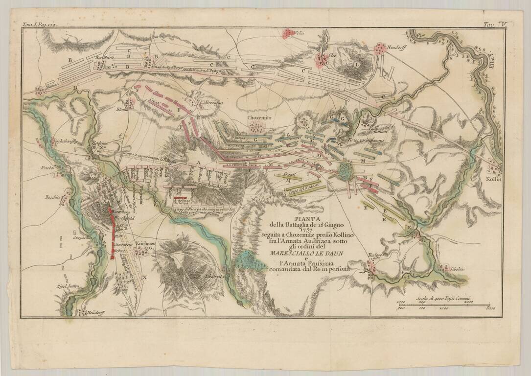
Detailed Italian language battle plan of the Battle of Kolin, fought to the east of Prague on July 18, 1757, during the Seven Years War. The Battle of Kolín saw 44,000 Austrians under Count von Daun, defeat 32,000 Prussians under Frederick the...

Czech-Published Map Celebrating the Victories of the 575th Motor Ambulance Company, Published in Pilsen in 1945. Fascinating separately issued map of Western Europe focusing on the movements and exploits of the American 575th Motor Ambulance Company,...
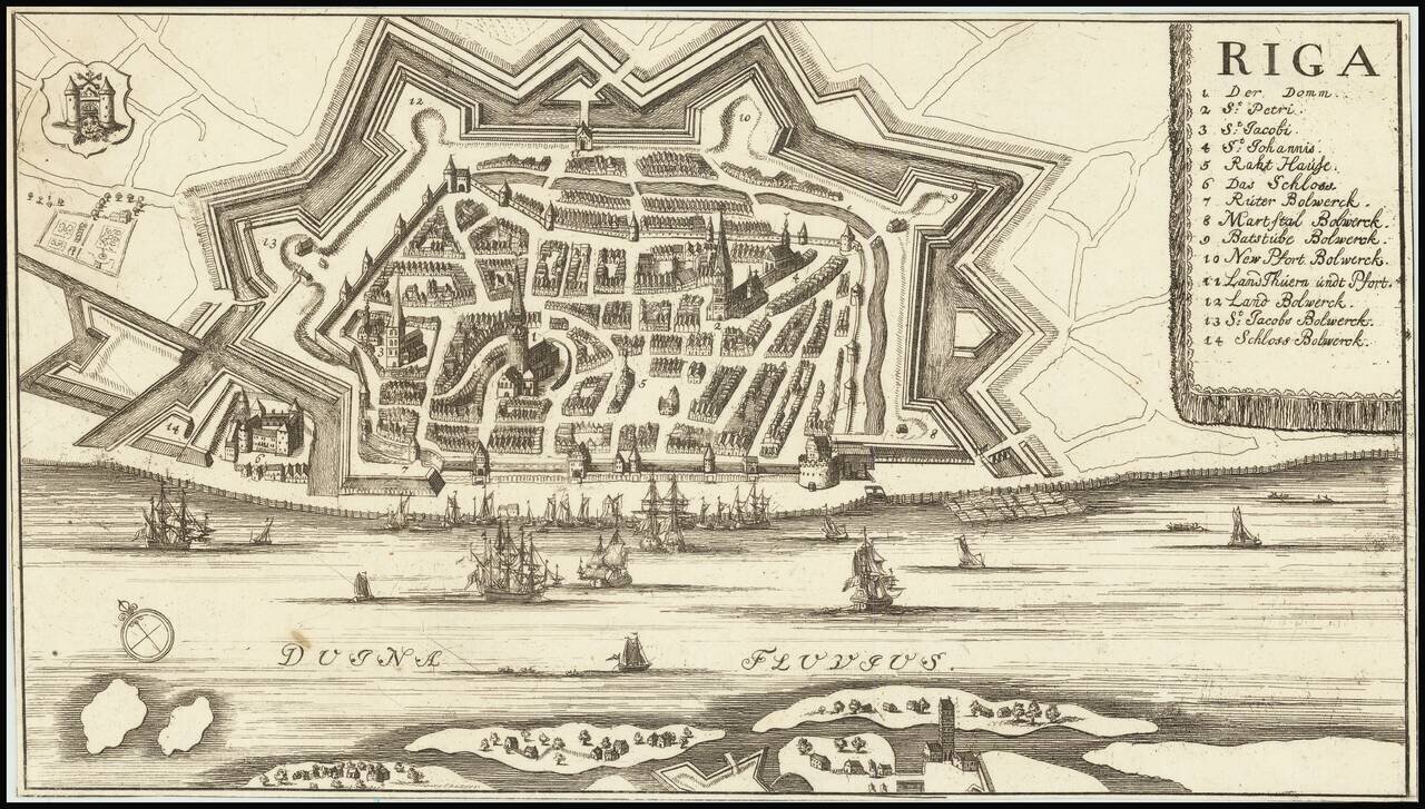
Detailed plan of Riga, with a key locating 14 points of interest. The map is in the style of several other 17th Century maps of Riga, but we were not able to determine a maker.
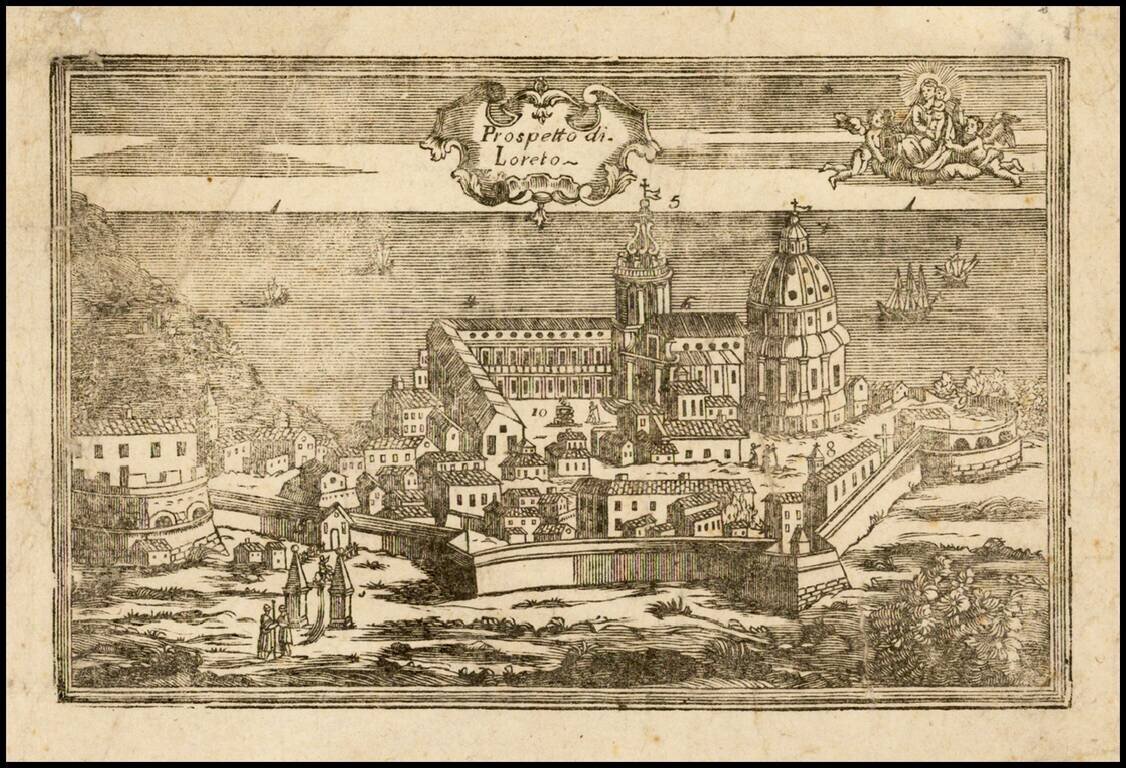
Very rare view of Loreto (Ancona) and the Basilica della Santa Casa, apparently a wood cut, prepared to illustrate a pilgrimage between Nazareth, Tersatto (Trast, Croatia) and the Basilica della Santa Casa, in Loreto (Ancona) on the Adriatic...
![Plan Des [Ersten?] und Lezten Theil Der Affeire Des Feldmarschal Konigseg in Tyrol](/map/small/51959.jpg)
Attractive 18th-century manuscript map in ink and watercolor. The map proclaims to show the first and last parts of the action of "Fieldmarschal Konigseg" in Tyrol. That being said, the map seems largely imaginary. The Brenta River is certainly real,...
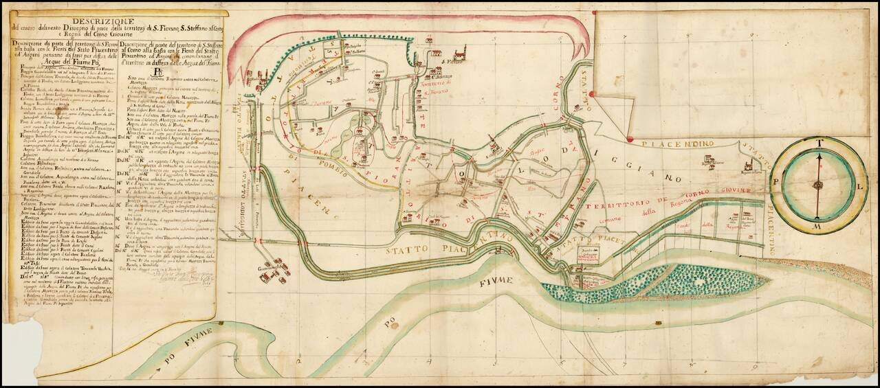
Fascinating map showing Piacenza on the Po River, with a number of canals, roads, public buildings, churches and other places of interest. The map is apparently oriented with south at the top. We have not learned much about the map--it is probably...
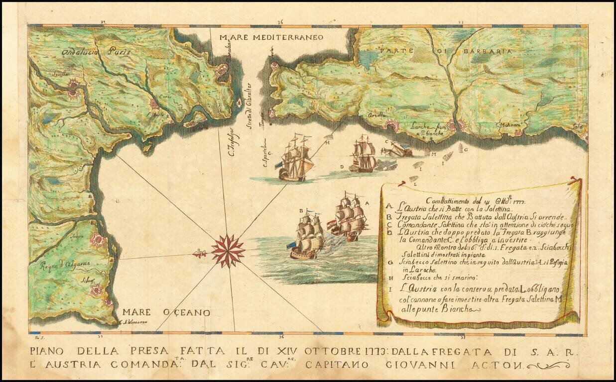
Map illustrating a battle between the Tuscan Navy and the Barbary pirates. The Tuscans, aboard the S.A.R. Austria, were led by Captain Giovanni (John) Acton. The key at the right provides details of the battle. Sir John Francis Edward Acton VI,...
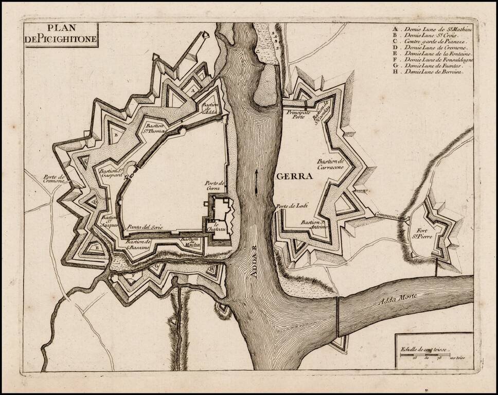
Rare plan of Pizzighettone and Gera, showing the fortifications of these two towns on the Abba River. The plan of the fortifications was likely printed at or about the time of the Siege of Pizzighettone, the first major military engagement of the...
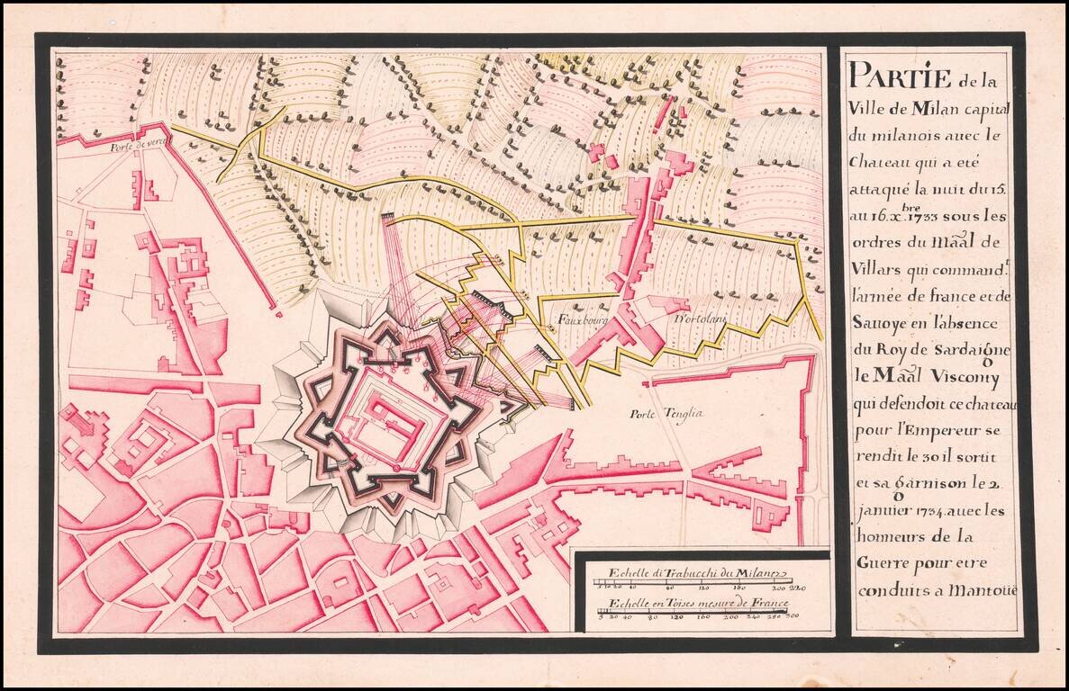
Siege and Surrender of Milan October 1733 to January 1734 Detailed map of the area around Milan, showing the entrenchments of the French soldiers around the Chateau of Milan in October 1733. The map shows Milan at the time is was occupied by Charles...
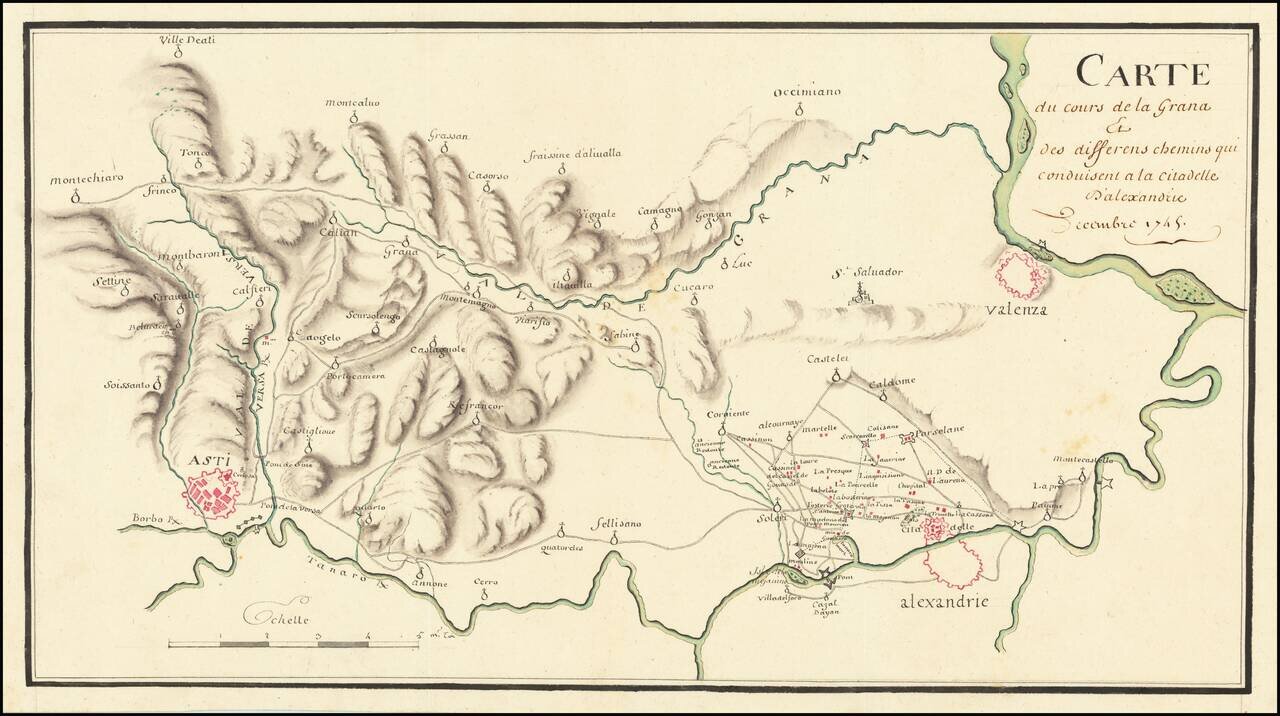
The Italian Campaign -- War of Austrian Succession Fine manuscript map of the area between Allesandria, Asti, Valenza and the Val de Grana, illustrating the theater of war during the War of Austrian Succession. The map illustrates the theater of war...
![[Savona Province and Environs]](/map/small/65400.jpg)
Detailed manuscript map of the Savona Province of Italy, drawn during the War of Spanish Succession. The map was drawn during the period when the region and all of the Republic of Genoa was overrun by Charles Emmanuel III. Italian Campaigns - War of...
![[Manuscript cadastral map of the area of Strevi in the Province of Alessandria, in Piedmont, Italy]](/map/small/57262.jpg)
Attractive early 19th-century manuscript map of Strevi, in Piedmont. The map has a patterned with fields growing different kinds of crops.
![[Manuscript cadastral map of the area of Prasco in the Province of Alessandria, in Piedmont, Italy]](/map/small/57263.jpg)
Attractive early 19th-century manuscript map of Prasco, in Piedmont. The map has a patterned with fields growing different kinds of crops.
![[Manuscript cadastral map of an area in the Province of Alessandria, in Piedmont, Italy]](/map/small/57264.jpg)
Attractive early 19th-century manuscript map of Tresobbio, in Piedmont. The map has a patterned with fields growing different kinds of crops. A note in the left margin translates: "ABCDEFG [indicates] the new stretch of county road open to the...
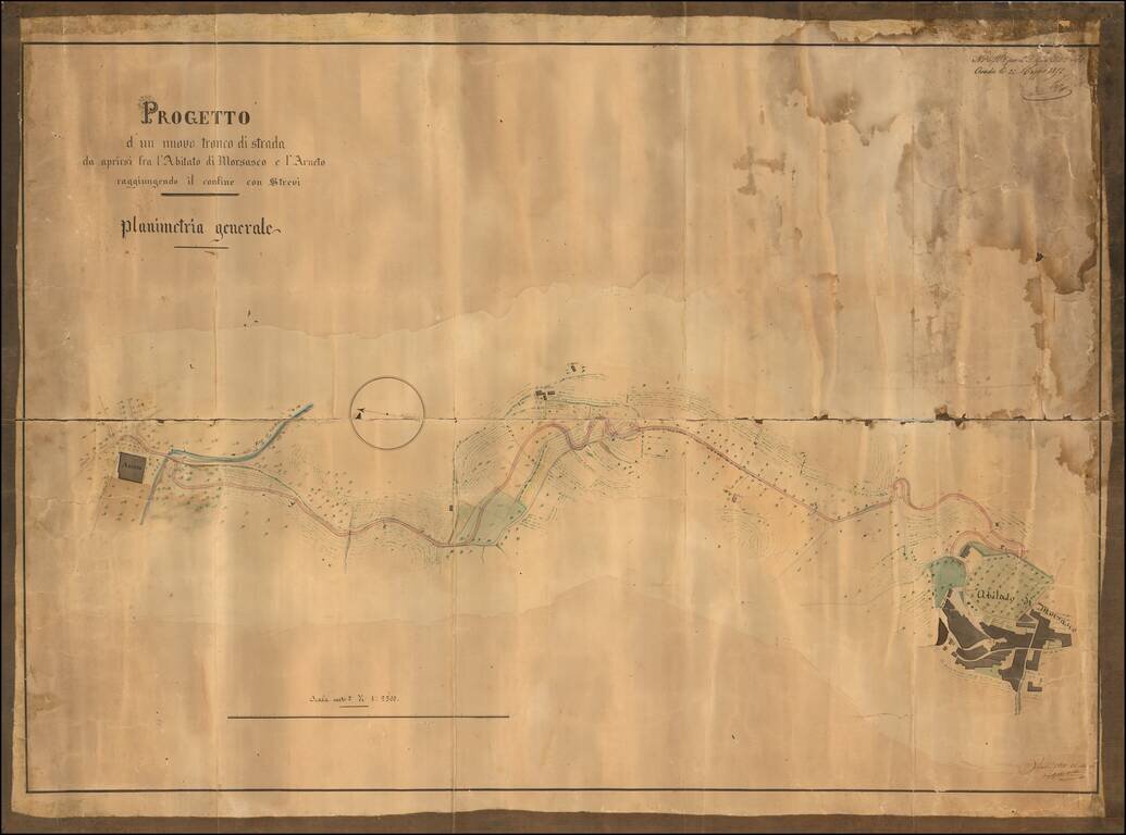
19th-century manuscript map showing a project for a new stretch of road to be built between the town of Morsasco and Arneto reaching the border with Strevi, in Piedmont. An example of civil engineering in the Kingdom of Sardinia, during the Napoleonic...
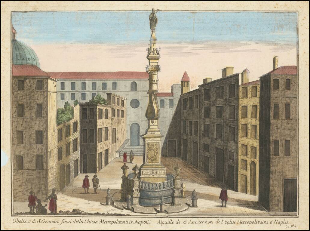
Nice early image of the Obelisk of San Gennaro in Naples. The Obelisk of San Gennaro (begun 1636, completed 1650) is located in the square dedicated to Cardinal Sisto Riario Sforza. It is the work of Cosimo Fanzago, perhaps the greatest architect of...