logo

1720. La Ville de Mexique

  • La Ville de Mexique

Map size in jpg-format: 4.78228MiB

Download "La Ville de Mexique", in high resolution.

La Ville de Mexique information:

Year of creation: 
Resolution size (pixels): 
 4232x3103 px
Disk Size: 
 4.78228MiB
Number of pages: 
 1
Place: 
 n.p.
Author: 

Print information. Print size (Width x height in inches):
Printing at 72 dpi 
  58.78 х 43.1
Printing at 150 dpi 
 28.21 х 20.69
Printing at 300 dpi 
 14.11 х 10.34

An example of detailing the file of this map of in a printable high-resolution:

Click to open in high resolution (open in new tab).
Attention! this is just the central piece (central area 960x960 px) of the map file!
This is an example, so that you can see and study the level of detail of a given map. The entire Map will be fully available after payment!

La Ville de Mexique

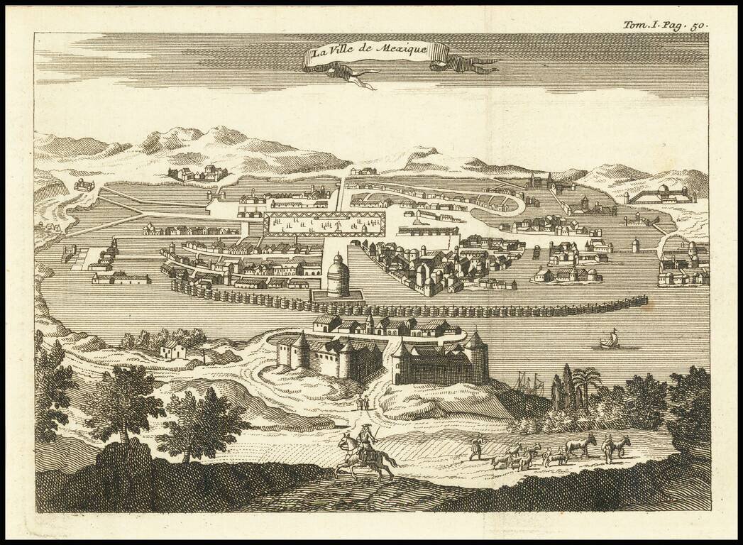
Engraved view of Mexico City, from an unidentified edition of Thomas Gage's voyages in New Spain, probably published circa 1720.

This edition of the view has the binding note "Tom. I Pag. 50" in the upper-right corner.

The city appears much as it did in the famous 16th- and 17th-century views - spread out on Lake Texcoco.


Special conditions for students!

If you are a student, write to us in telegram: @antiquemaps and indicate what material you need and for what work you need a map in high detail. We are ready to provide material on special terms. For students only!

Item information:

Year of creation:
Size:
4232x3103 px
Disk:
4.78228MiB
Number of pages:
1
Place:
n.p.
Author:
Anonymous.
$14.99

Related item