
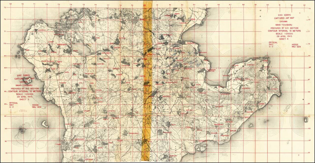
"Captured Jap Map" With Manuscript Additions by an American G.I. Important U.S. military map prepared during the invasion of Okinawa from captured Japanese maps, for use by XXIV Corps. An interesting product of wartime necessity, this map was...
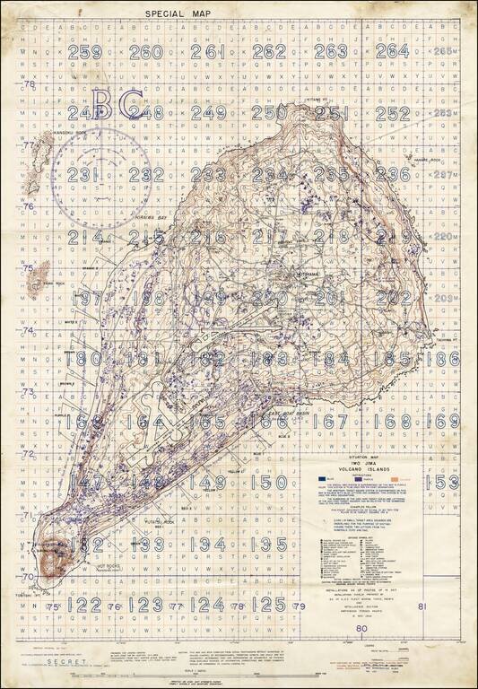
"SECRET" Situation Map of Iwo Jima Detailing the Minutiae of the Japanese Defense of the Island. A rare "Secret" situation map of Iwo Jima prepared in anticipation of the 19 February 1945 U.S. invasion of the island. The map shows the landing zones on...
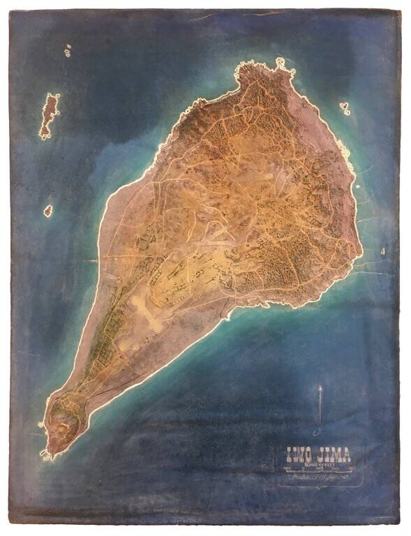
Exceptionally Rare U.S. Military Terrain Model of Iwo Jima, Made in 1945. Foam and rubber terrain model map of Iwo Jima, probably made by the U.S. Navy Reserve group "Building 14", Hawaii, which was in charge of military model making in the Pacific....
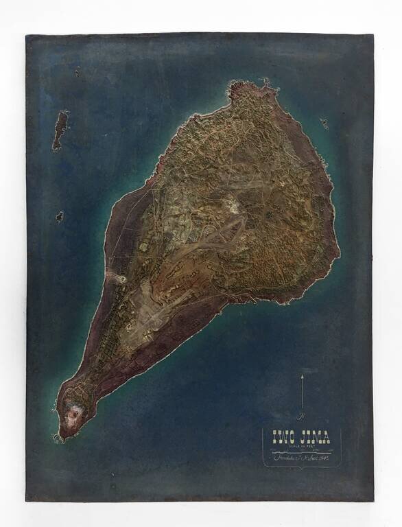
Exceptionally Rare U.S. Military Terrain Model of Iwo Jima, Made in 1945. Foam and rubber terrain model map of Iwo Jima, probably made by the U.S. Navy Reserve group "Building 14", Hawaii, which was in charge of military model making in the Pacific....
![(Second World War - Iwo Jima) Beach Diagram Southwestern Beaches, Iwo Jima Information Taken from Aerial Photographs of 4 July 1944... [with] Becah Diagram Southeastern Beaches, Iwo Jima Beach Information taken from Aerial Photographs of 4 July 1944...](/map/small/62967.jpg)
"SECRET" Beach Diagrams used for Planning and Executing the American Landings on Iwo Jima. Two very rare color-printed views of the southern beaches of Iwo Jima, the southwestern section of which served as a potential landing area for the U.S. Marine...
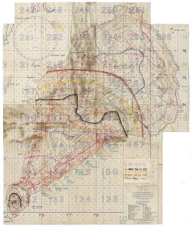
Secret Enemy Installation Map of Iwo Jima prepared for the American invasion, heavily annotated to show the progress of the battle. A rare “Secret” map of Iwo Jima, issued little more than a week before February 19, 1945 U.S. invasion. The map...
![[Fall of Berlin - Operation Clausewitz] Umgebung von Berlin](/map/small/60025.jpg)
Extraordinary Defensive Plan of Berlin, Prepared by Nazi Forces on the Eve of the Soviet Capture of the City and the End of World War II in Europe. This Map was Captured by Soviet Soldiers and Bears an Inscription in Russian in the Upper Left Corner....