
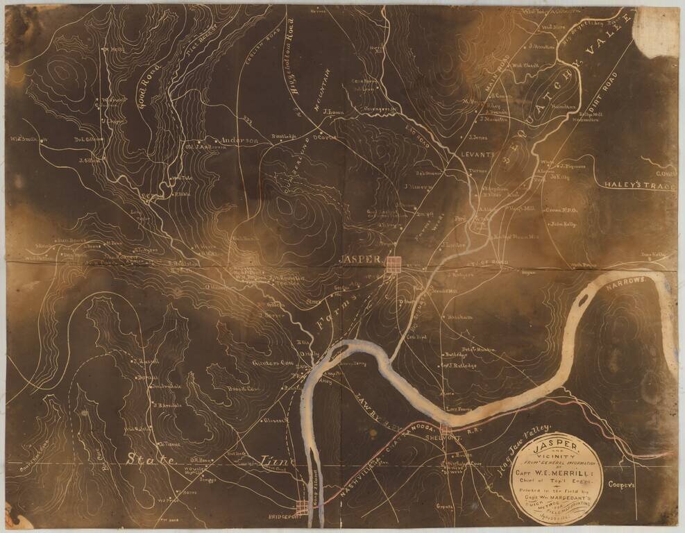
Early Photography & Battlefield Mapmaking Technology! Very rare and important Union Civil War "black map" or "sun map," printed in the field with a photographic process utilizing a mobile laboratory and darkroom. The map is centered on Jasper,...
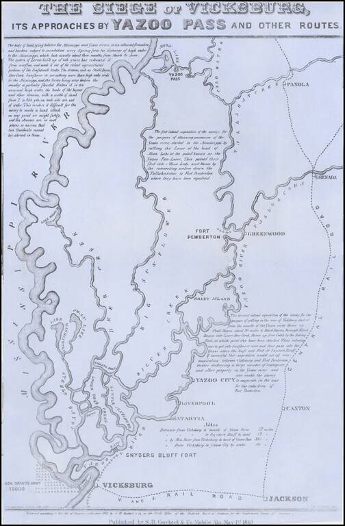
Rare broadside map of the Siege of Vicksburg, printed in Mobile, Alabama. The map was drawn by T.S. Hardee, lithographed W.R. Robertson in Mobile, Alabama and published by S.H. Goetzel & Co. The map shows the location of the Union and Confederate...
Fine uncut, unfolded example of the second edition of this rare Civil War map was created by the United States Coast Survey in 1863, under the direction of A.D. Bache. This exceptionally detailed map was prepared specifically by the US Coast Survey...
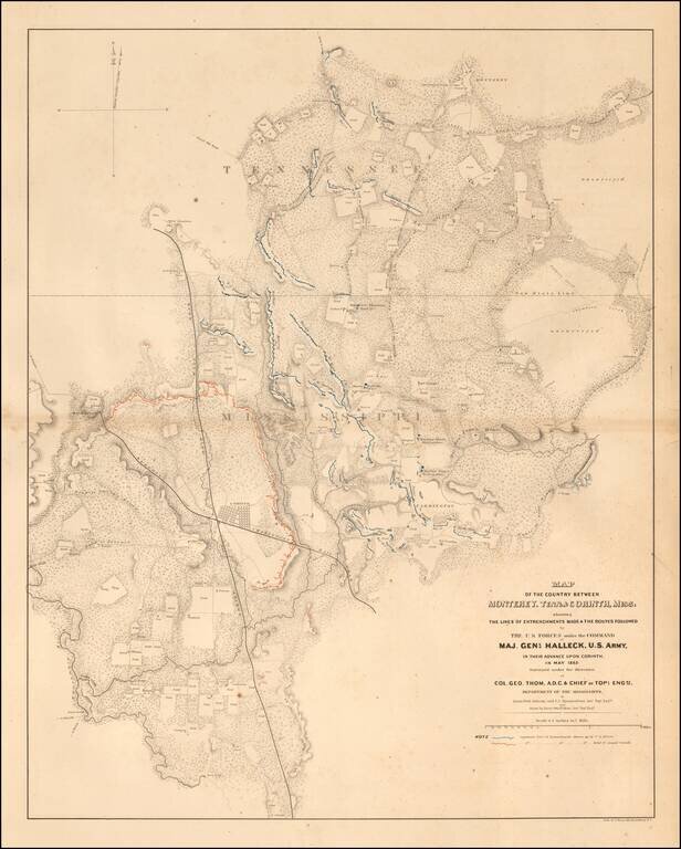
Highly detailed map showing the battlefield positions, roads, rivers, towns, etc., between Corinth and Monterrey. Full of Battlefield information, fortification information, and a host of other information utilized by the War Department during the...
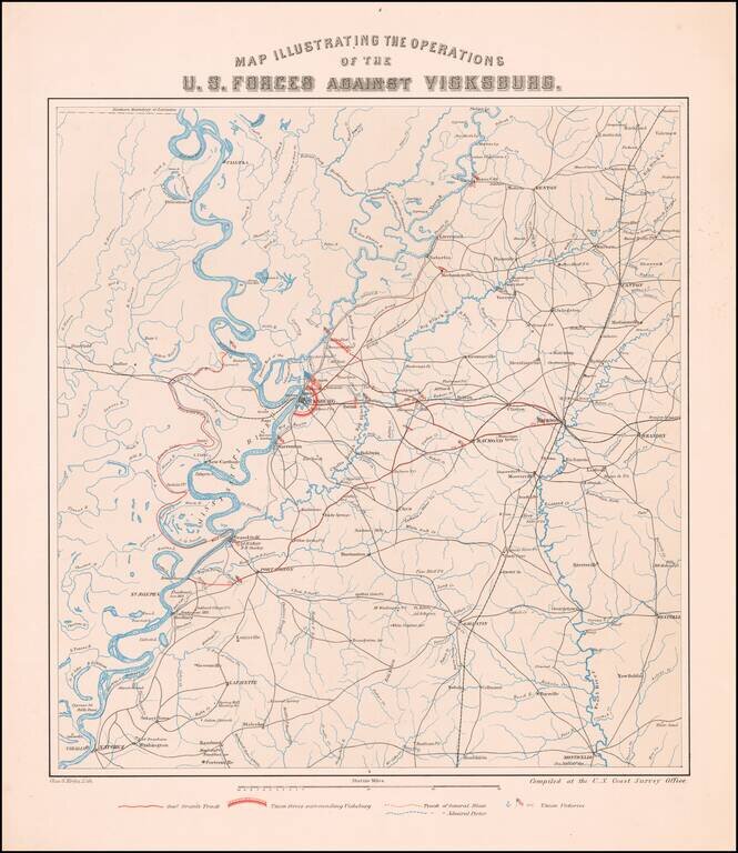
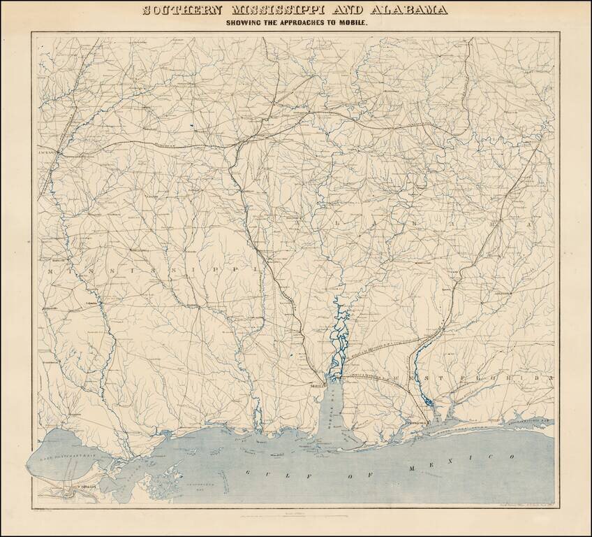
The Vicksburg Campaign Rare separately published map of the area around Vicksburg, Mississippi, showing the military operations of the Union and Confederate Armies. The map was compiled by in the offices of the United States Coast Survey, which at...
![[Siege of Vicksburg -- Manuscript Battle Map / Field Sketch]](/map/small/62795.jpg)
Hand Drawn During The Siege of Vicksburg Detailed hand drawn map / field sketch showing troop positions during the siege of Vicksburg, during the American Civil War. The map locates troop positions, Rebel Works, topographical features, bridges and...
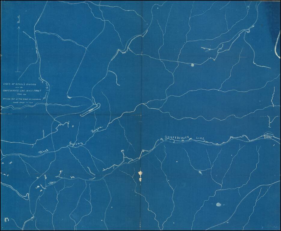
Detailed blueprint map illustrating the location of "Steel's Division" during the Siege of Vicksburg. "Steel" is Frederick Steele (1819 – 1868), a career military officer in the United States Army, who served as a major general in the Union Army...
![[Manuscript Civil War Map signed by G.K. Warren] Map of Field Occupation of Army of the Potomac. Prepared by order of Gen. Hooker from reconnaisances made under Capt. R.S. Williamson, Lt. N. Bowen, Gen. D.P. Woodbury and others. Sent from Top'l Eng'rs o](/map/small/42063.jpg)
Hand Drawn Field Map of the Theater of War in Virginia Signed By One of America's Most Important Government Surveyors For The Explorations of the West The second known example of Governor Kemble Warren's magnificent large-scale manuscript map of the...
![[Charleston] Preliminary Chart of Charleston Harbor And Its Approaches From a Trigonometric Survey . . . Published in 1858 . . . 1864](/map/small/50361.jpg)
Rare separately issued and colored example of this important chart of Charleston Harbor and the most detailed and accurate chart of the harbor to date. The present chart is called by the Library of Congress the "resurvey" chart, reflecting the...
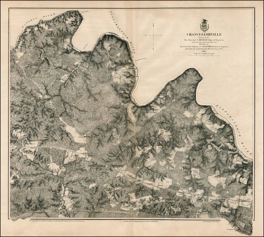
Scarce large format plan of the battle field and region around Chancellorville, showing the area south of the Rappahannock River. Shows fortifications. Highly detailed. What is most noteworthy about the map is the inclusion of dozens of land owners on...
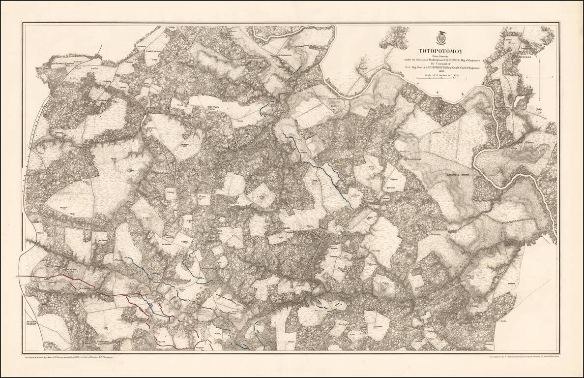
Highly detailed map of the area around Totopotomoy, Virginia, highlighting the battles fought in the area during the Civil War. The Battle of Totopotomoy Creek, also called the Battle of Bethesda Church, Crumps Creek, Shady Grove Road, and...
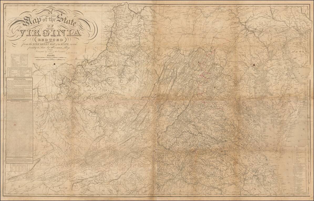
Annotated Example of the Most Important Virginia Map From Mid-19th Century, Showing The Confederate Army's Movements During the Gettysburg Campaign. Map Overview Herman Boye's map of Virginia is among the most important maps of Virginia published in...
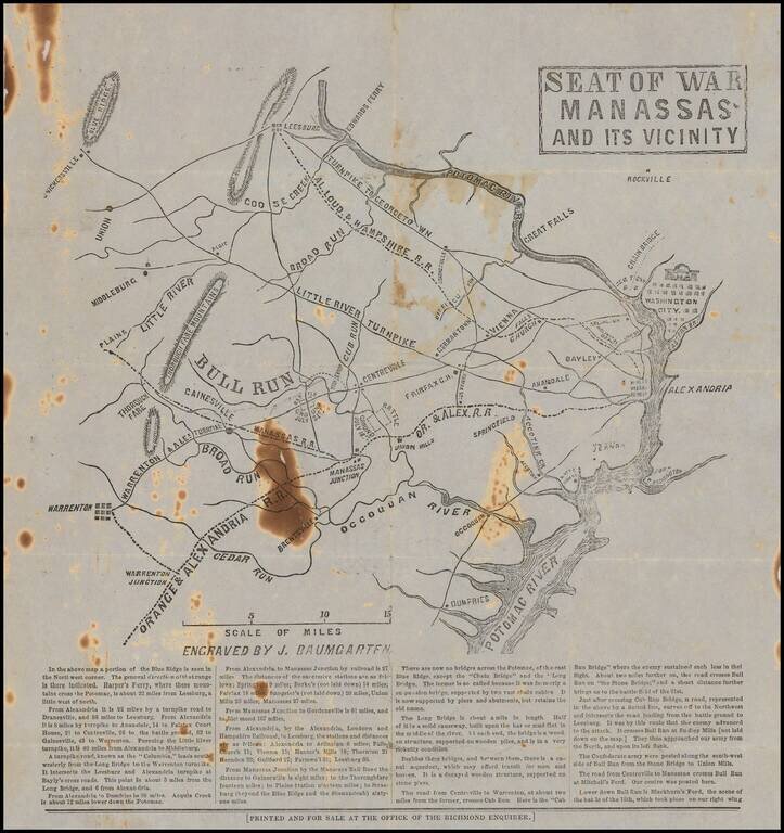
Rare Confederate broadside map related to the Battle of Bull Run, published for the Richmond Enquirer in the aftermath of the battle. Lithographed or wood-engraved map of northern Virginia, from Washington, D.C. to Warrenton. The map names Alexandria...
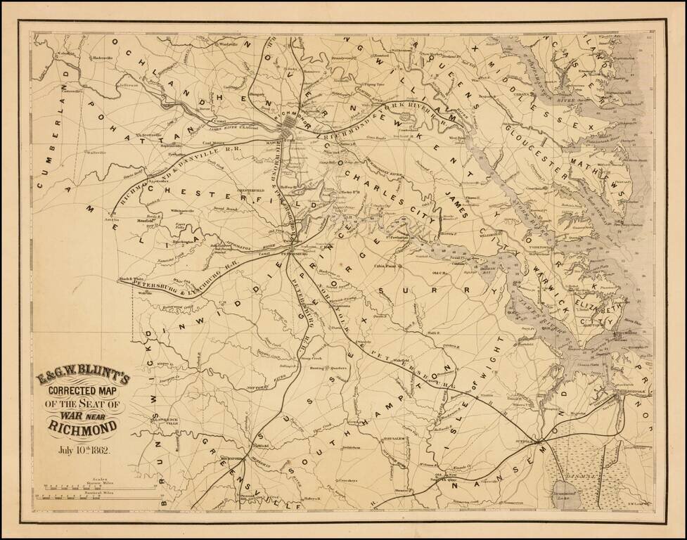
Rare separately issued map of the area around Richmond, Virginia, published by E & GW Blunt in July, 1862. The map shows Richmond and the railroad lines, canal, roads and rivers that feed into the City, including the Richmond & Danville...
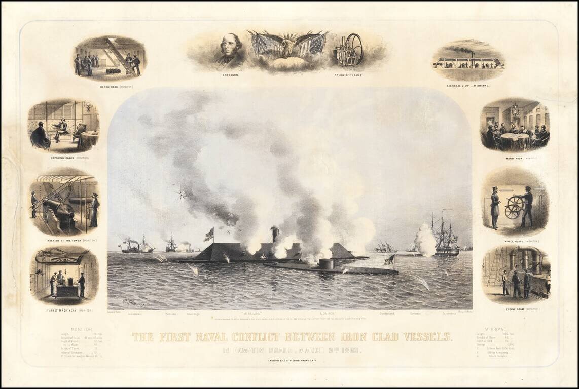
The First Battle of the Iron Clads. In a Contemporary Civil War-Era Lithograph. Three-stone color lithograph of the most famous naval battle of the Civil War; the engagement between the Iron Clads Virginia (of the CSA, a.k.a. "Merrimac") and Monitor...
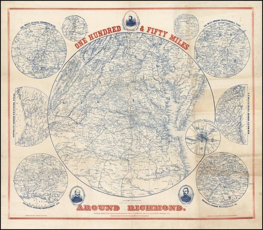
Scarce regional map of the area around Richmond, with 9 inset maps showing the 100 miles around Milledgeville, GA; 250 miles around Charleston, SC; 100 miles around Chattanooga, Tenn; Fortifications around Richmond; 200 miles around Montgomery, Ala,...