Map size in jpg-format: 5.25639MiB
Click to open in high resolution (open in new tab).
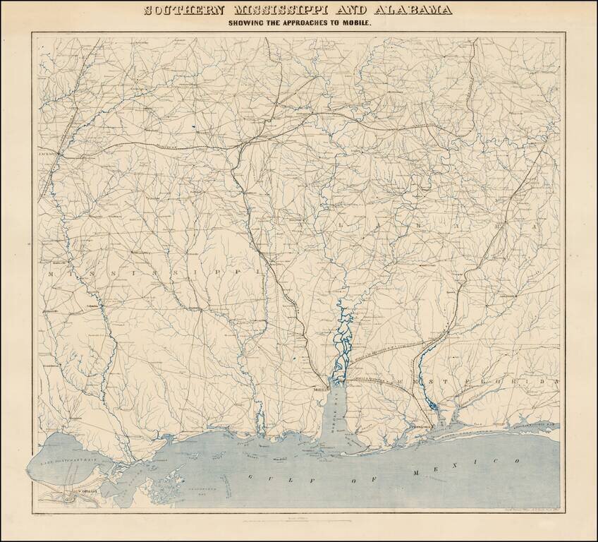
Fine uncut, unfolded example of the second edition of this rare Civil War map was created by the United States Coast Survey in 1863, under the direction of A.D. Bache.
This exceptionally detailed map was prepared specifically by the US Coast Survey for the Union Army's Campaigns in the South.
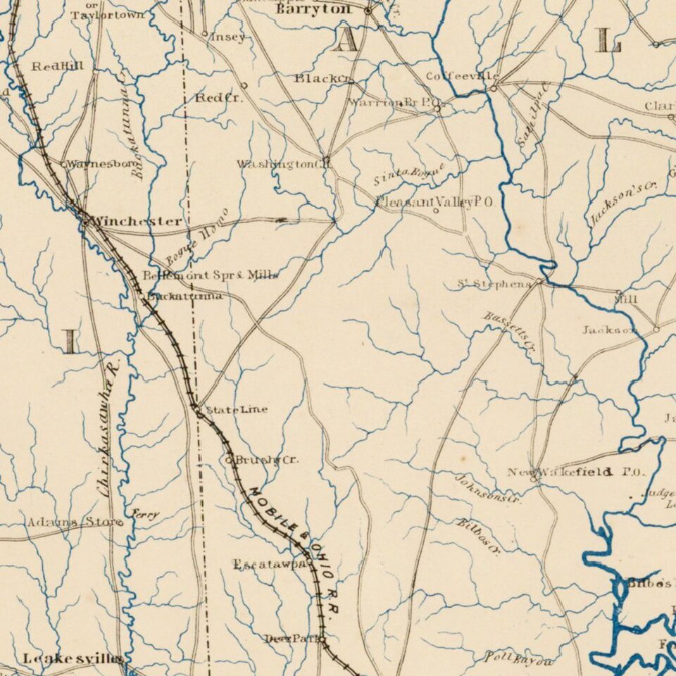
The map shows Mississippi and Alabama from Jackson to Montgomery, starting about fifty miles north of these important cities and extending south to New Orleans and the Gulf of Mexico. The map depicts the lines of important southern railroads, including:
The map also meticulously depicts the roads, towns, post offices, rivers and other important features of the region, including a Gold Mine Claim in Chilton County, Alabama, west of the Coosa River in the vicinity of Blue Creek.
There are two editions of the map, this first edition of the map, printed with two lithographic stones, and a second edition, which adds another color. With the exception of the extra color, there is apparently no difference between the maps. Both states are very rare on the market, with only a single example listed in a dealer catalog in the past 30 years.
During the Civil War, the trained engineers and hydrographers of the United States Coast Survey played an important role in the production of field maps. While established for hydrographical mapping, at the outset of the war, it quickly became apparent that infrastructure at the Coast Survey office was the best available production site for the rapid compilation and assimilation of available cartographic sources, in order to produce maps and sea charts in aid of war being waged by the Union Army and Navy. During this time period, the Coast Survey mapmakers were also responsible for a number of printing innovations that allowed for faster and more accurate printing methods, both at home and in the field. A number of important mapmakers and other historically influential Americans engaged in the production of maps for the Coast Survey from 1861 to 1865.
If you are a student, write to us in telegram: @antiquemaps and indicate what material you need and for what work you need a map in high detail. We are ready to provide material on special terms. For students only!
![The Coast of West Florida and Louisiana . . . [with] The Peninsula and Gulf of Florida or Channel of Bahama with the Bahama Islands . . .](/map/small/38977.jpg)
![The Coast of West Florida and Louisiana . . . [with] The Peninsula and Gulf of Florida or Channel of Bahama with the Bahama Islands . . .](/map/small/66344.jpg)
