logo

1862. Map of the Country between Monterey, Tenn. & Corinth, Miss; showing The Lines of Entrenchments Made & The Routes Followed by the U.S. Forces under the Command of Maj. Genl. Halleck, U.S. Army, in their advance upon Corinth in May 1862 . . .

  • Map of the Country between Monterey, Tenn. & Corinth, Miss; showing The Lines of Entrenchments Made & The Routes Followed by the U.S. Forces under the Command of Maj. Genl. Halleck, U.S. Army, in their advance upon Corinth in May 1862 . . .

Map of the Country between Monterey, Tenn. & Corinth, Miss; showing The Lines of Entrenchments Made & The Routes Followed by the U.S. Forces under the Command of Maj. Genl. Halleck, U.S. Army, in their advance upon Corinth in May 1862 . . . information:

Year of creation: 
Resolution size (pixels): 
 15680x19534 px
Disk Size: 
 54.11MiB
Number of pages: 
 1
Place: 
 New York
Author: 

Print information. Print size (Width x height in inches):
Printing at 72 dpi 
  217.78 х 271.31
Printing at 150 dpi 
 104.53 х 130.23
Printing at 300 dpi 
 52.27 х 65.11

An example of detailing the file of this map of in a printable high-resolution:

Click to open in high resolution (open in new tab).
Attention! this is just the central piece (central area 960x960 px) of the map file!
This is an example, so that you can see and study the level of detail of a given map. The entire Map will be fully available after payment!

Map of the Country between Monterey, Tenn. & Corinth, Miss; showing The Lines of Entrenchments Made & The Routes Followed by the U.S. Forces under the Command of Maj. Genl. Halleck, U.S. Army, in their advance upon Corinth in May 1862 . . .

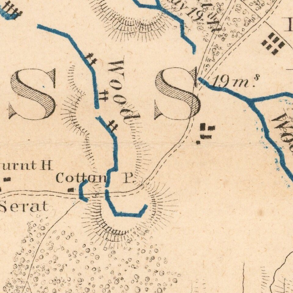
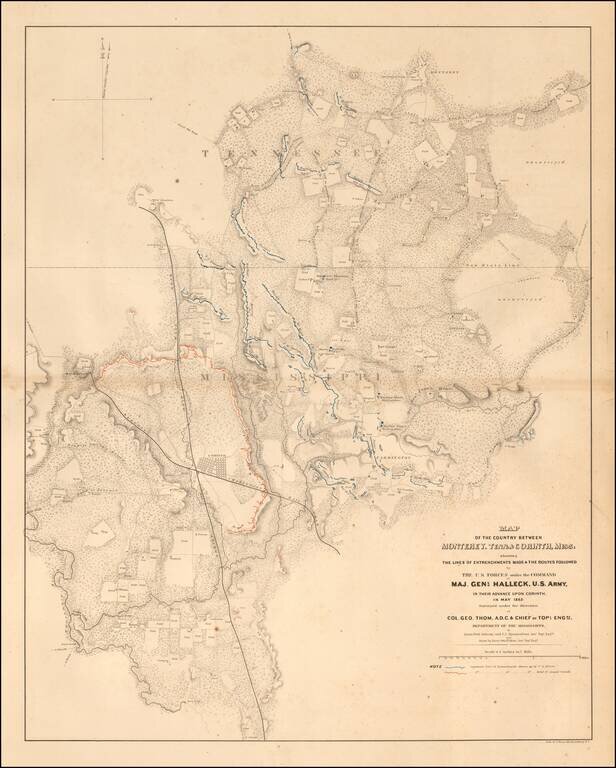
Highly detailed map showing the battlefield positions, roads, rivers, towns, etc., between Corinth and Monterrey.

Full of Battlefield information, fortification information, and a host of other information utilized by the War Department during the Civil War. Shows the lines of fortifications of both Union and Rebel forces.

Shows the area between Corinth and Monterey along the state line separating Tennessee and Mississippi, with the positions of opposing forces shown in color.

The map was later re-issued as Plate 13:6 in "Atlas to Accompany..." part of the monumental Atlas To Accompany The Official Records of the Union and Confederate Armies. 1861-1865.


Special conditions for students!

If you are a student, write to us in telegram: @antiquemaps and indicate what material you need and for what work you need a map in high detail. We are ready to provide material on special terms. For students only!

Item information:

Year of creation:
Size:
15680x19534 px
Disk:
54.11MiB
Number of pages:
1
Place:
New York
Author:
Julius Bien & Co..
$14.99

Related item