Map size in jpg-format: 2.66207MiB
Click to open in high resolution (open in new tab).
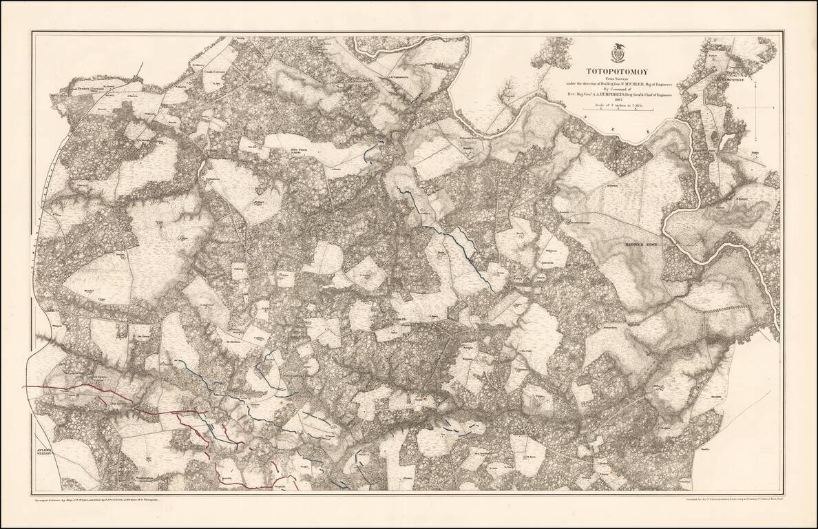
Highly detailed map of the area around Totopotomoy, Virginia, highlighting the battles fought in the area during the Civil War.
The Battle of Totopotomoy Creek, also called the Battle of Bethesda Church, Crumps Creek, Shady Grove Road, and Hanovertown, was a battle fought in Hanover County, Virginia in May 28-30, 1864, as part of Union Lt. Gen. Ulysses Grant's Overland Campaign against Confederate Gen. Robert E. Lee's Army of Northern Virginia.
As Grant continued his attempts to maneuver around Lee's right flank and lure him into a general battle in the open, Lee saw an opportunity to attack the advancing V Corps, under Maj. Gen. Gouverneur K. Warren with the Second Corps of Lt. Gen. Jubal Early. Early's divisions under Maj. Gens. Robert E. Rodes and Stephen Dodson Ramseur drove the Union troops back to Shady Grove Road, but Ramseur's advance was stopped by a fierce stand of infantry and artillery fire. Grant ordered his other corps commanders to conduct a supporting attack along the entire Confederate line, which was entrenched behind Totopotomoy Creek, but only the II Corps of Maj. Gen. Winfield S. Hancock crossed the stream; they were quickly repulsed. After the inconclusive battle, the Union army resumed its moves to the southeast and the Battle of Cold Harbor.
If you are a student, write to us in telegram: @antiquemaps and indicate what material you need and for what work you need a map in high detail. We are ready to provide material on special terms. For students only!


![[The First Maps in a la poupée Printed Color] Cartes en Couleur des Lieux Sujets aux tremblements de Terre Dans toutes les parties du Monde Selon le Sisteme de l’impulsion Solaire](/map/small/52293op.jpg)