Map size in jpg-format: 2670720B
Click to open in high resolution (open in new tab).
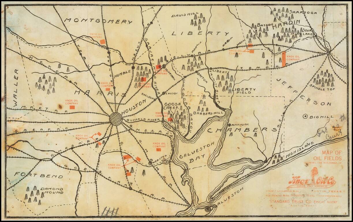
Extremely Rare Early Texas Oil Promotional Map, Featuring the First Oil Fields of the Texas Oil Industry.
Separately issued promotional map printed in black (showing geographical features including towns and railroads) and red (showing the oil leases of the Knox Oil Company). The map focuses on Houston and shows the oil field where the Texas industry began (Spindletop) and continued its early growth.
This is the most focused and illustrative early Texas oil map that we have seen. Early oil industry maps are extremely scarce on the market; we have also had this pictorial map of the East Texas Oil Field, but we have never seen another map that broadly illustrates the birthplace of Texas oil around Houston like this one does.
Oil Fields
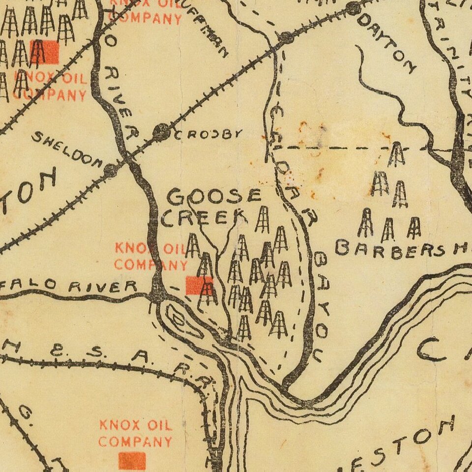
The map features the major early Texas oil fields centered around Houston. Each field is represented by a forest of derricks and is a whos-who of the first fields of the Texas oil boom. The following fields are illustrated:
Knox Oil Co
The map implies that Knox Oil Co was a major player in the Texas oil industry, with 14 leases spread across the early fields. In reality, this was not the case. Like many boomtime companies, Knox did not become a major producer and left little trace in the historical record. A newspaper article from the 1920s says that Knox Oil Co. was acquired by Roxana Petroleum, a subsidiary of Royal Dutch Shell.
Rarity
No copies located in OCLC, nor in RBH, nor in any other database searches.
If you are a student, write to us in telegram: @antiquemaps and indicate what material you need and for what work you need a map in high detail. We are ready to provide material on special terms. For students only!


