
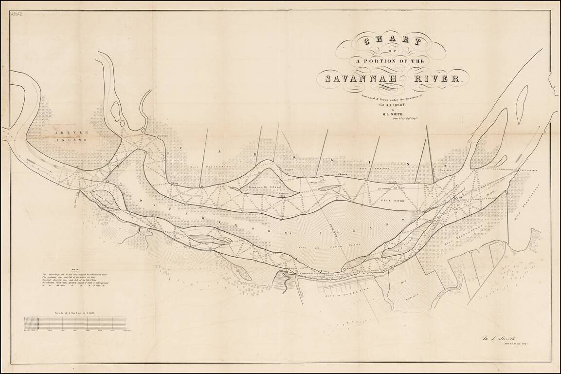
Highly detailed US Government Survey map of part of the Savannah River. Large map of the part of the Savannah River adjacent to the city of Savannah. Several islands are shown including a large Hutchinson Island. The map is filled with detail,...
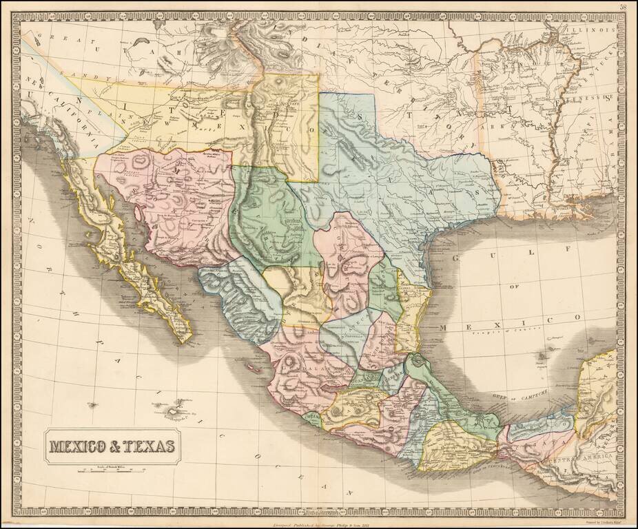
Rare map of Mexico, Texas and the Southwest, from an early edition of Philip's Imperial Atlas. This map is issued shortly before the Gadsden Purchase, and shows a very oddly configured Texas, bounded by a massive Indian Territory and New Mexico...
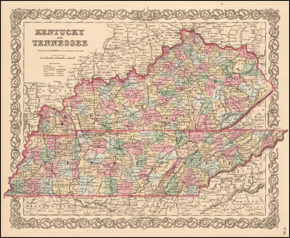
Detailed map, colored by counties and showing roads, railroads, towns, rivers, lakes, stations and a host of other details. JH Colton was one of the pre-eminent American map publishing firms in the mid-19th century.
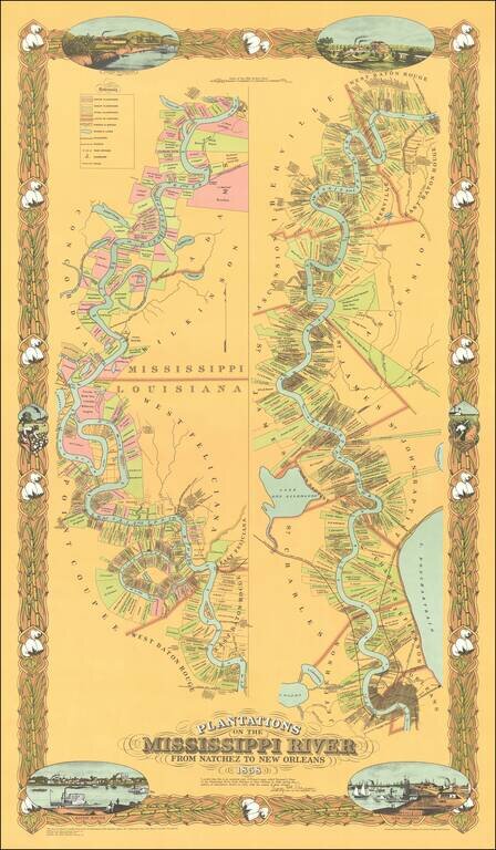
Fine limited edition copy of Norman's Chart of the Mississippi River from Natchez to New Orleans, also known as the Persac map. The map shows the divisions of land with owners’ names, vignettes of New Orleans, Baton Rouge and plantations, the...
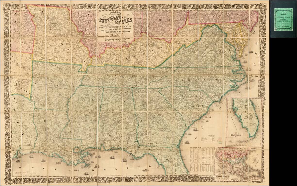
Second edition of Colton's detailed large format map of the Southern Plains and Midwestern States, at the outset of the American Civil War. Finely detailed map, one of the most commercially successful maps published by Colton during the 1860s.
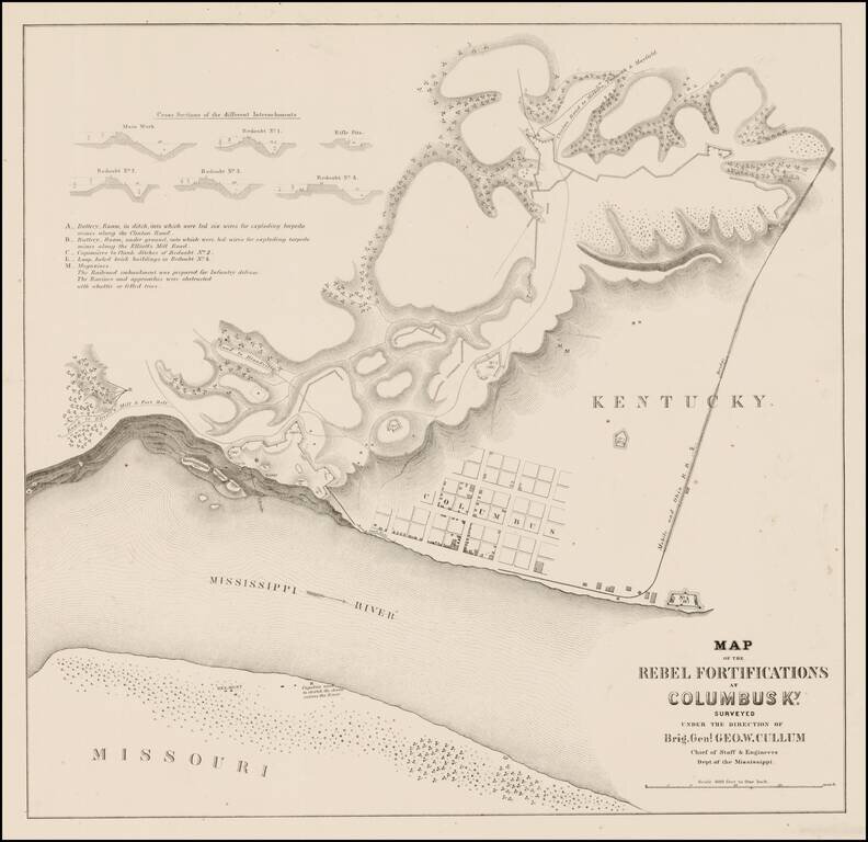
Rare plan showing the Rebel Fortifications at Columbus, Kentucky on the Mississippi River. Detail includes a town plan, tracks of the Mobile and Ohio R.R., Road to Elliott's Mill and Ft. Holt, Road to Blandville, Clinton Road to Milburn, Paducah &...
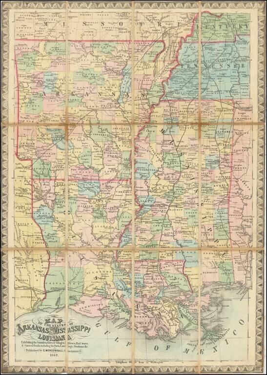
Extremely rare map of the states of the lower Mississippi, focusing on the states of Arkansas, Louisiana, and Mississippi, published by Edward Mendenhall, in Cinncinnati during the Civil War. The map labels the counties and parishes of the three...
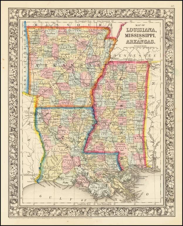
Detailed map of Louisiana, Mississippi and Arkansas, colored by counties/parishes and showing early towns, post offices, roads, rail lines, etc.
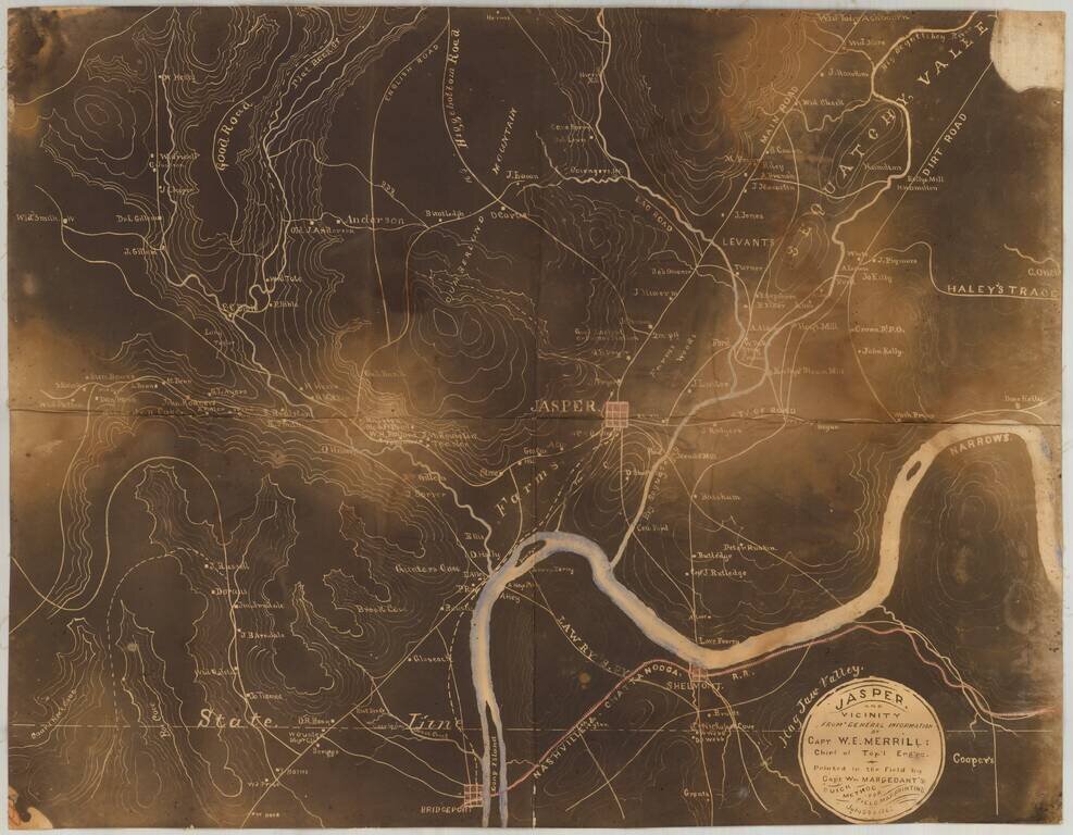
Early Photography & Battlefield Mapmaking Technology! Very rare and important Union Civil War "black map" or "sun map," printed in the field with a photographic process utilizing a mobile laboratory and darkroom. The map is centered on Jasper,...
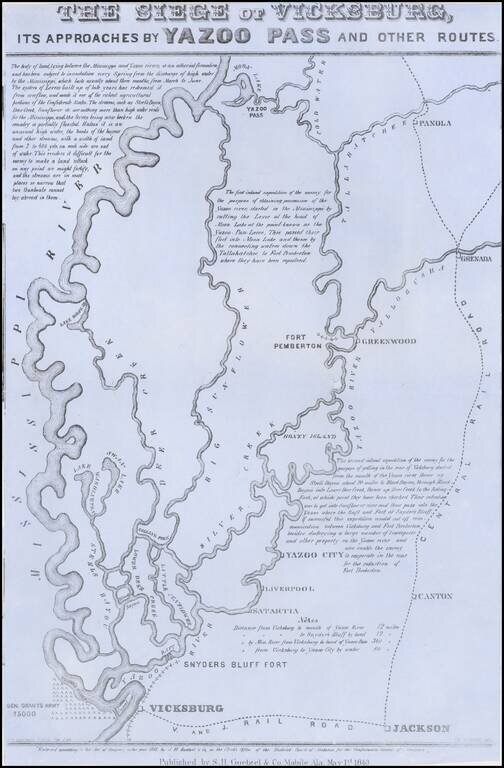
Rare broadside map of the Siege of Vicksburg, printed in Mobile, Alabama. The map was drawn by T.S. Hardee, lithographed W.R. Robertson in Mobile, Alabama and published by S.H. Goetzel & Co. The map shows the location of the Union and Confederate...

The Neutral Lands and the Race To Construct Railroad Lines from Northern Kansas to Indian Territory Unrecorded railroad map of Texas, the Southern and Mdiwestern States, published by the Missouri River, Fort Scott & Gulf Railroad and the...
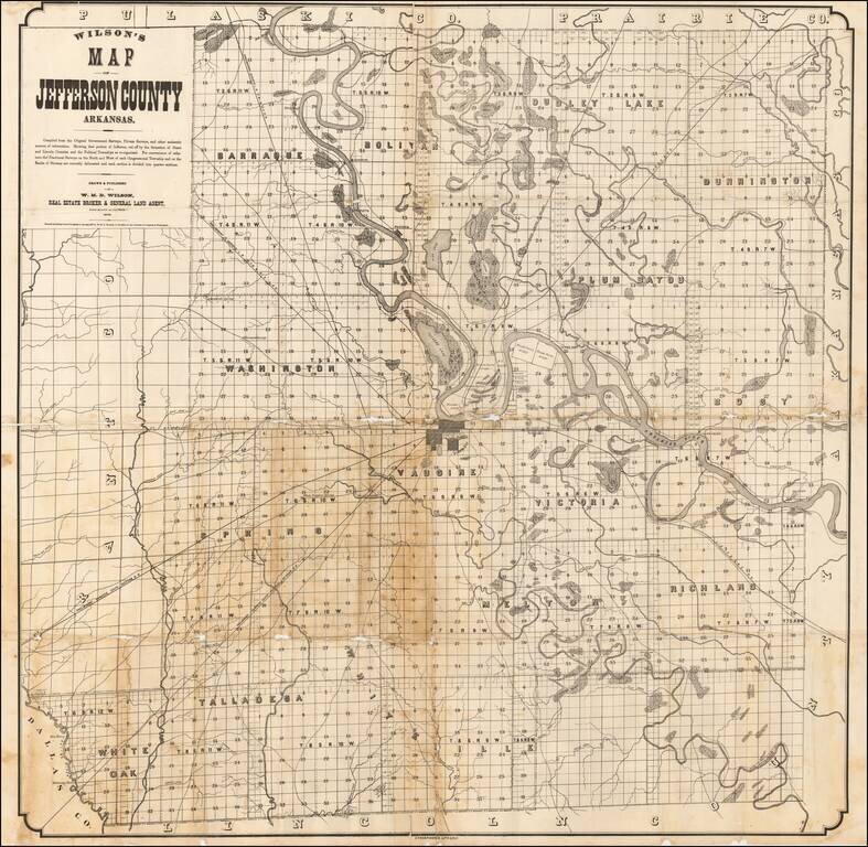
Rare separately published map of Jefferson County, Arkansas, published in Pine Bluff, Arkansas. The map is centered on Pine Bluff and tracks the course of the Arkansas River through the map. This is apparently the second edition of Wilson's map, with...
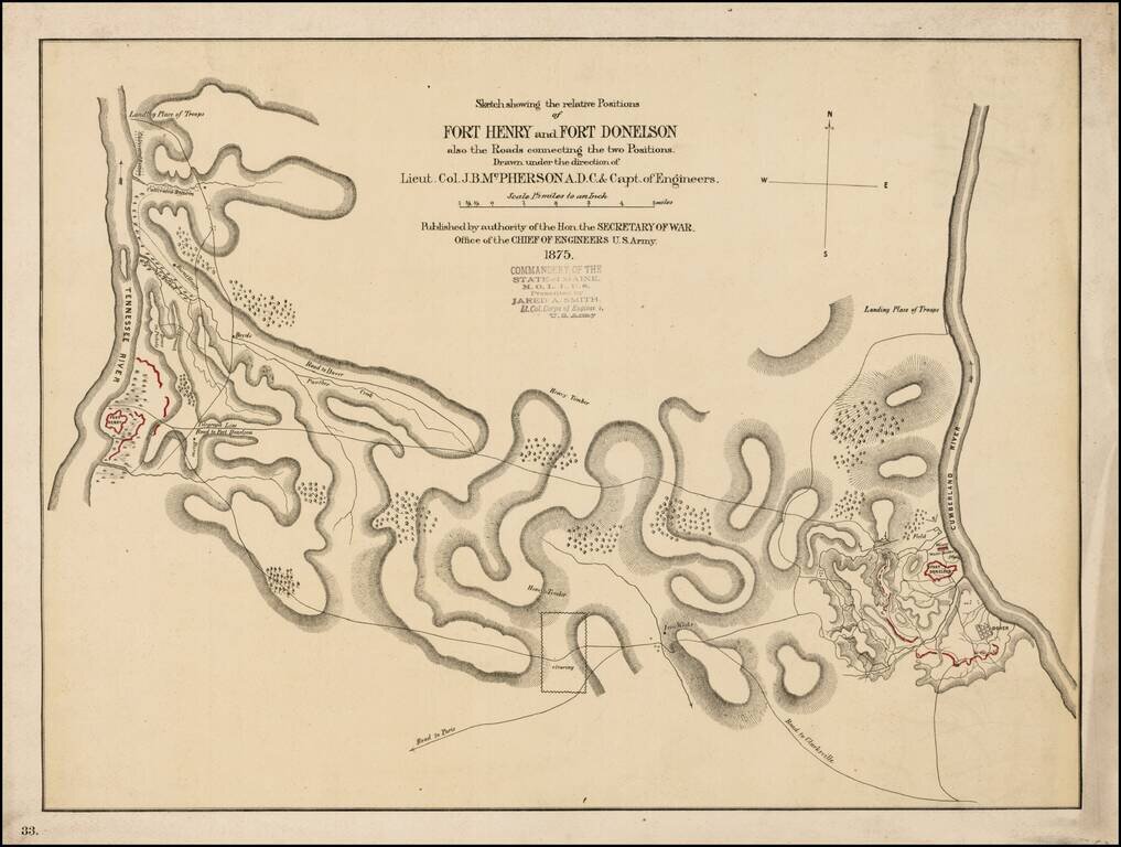
Scarce early battle plan showing the troop positions around Fort Henry and Fort Donelson, between the Tennessee River and Cumberland River. Includes fortifications in red, roads, rivers, telegraph lines and other topographical details.
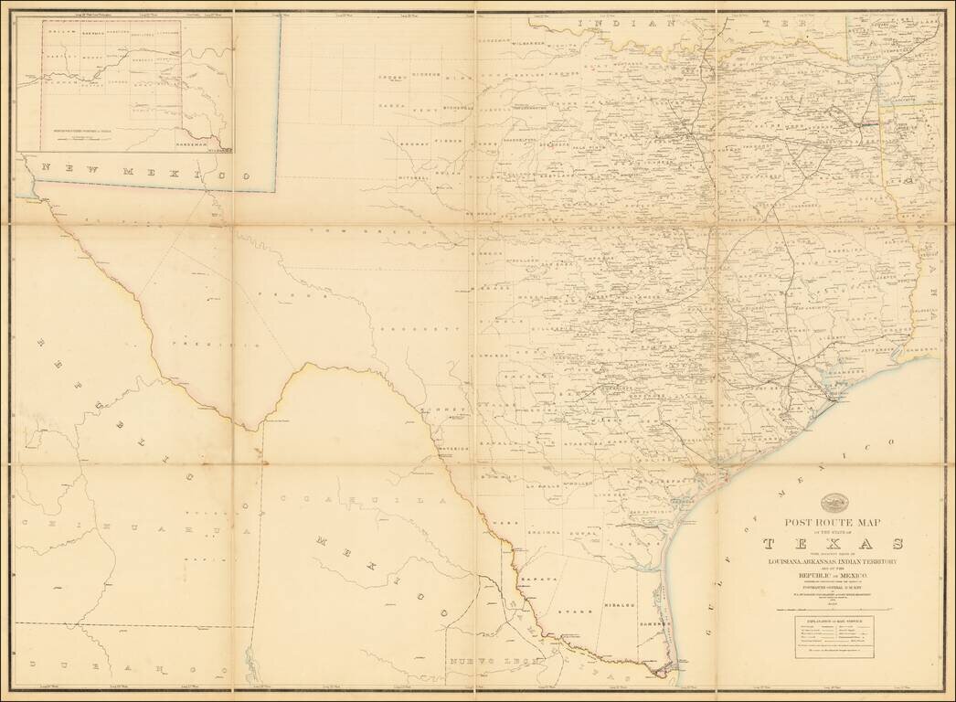
A Texas Sized Postal Map Without Post Routes! First state of this important early map showing the Official Post Offices and Postal Routes in Texas in the last decade of the 19th Century. The Key indicates that the map include Railroads, Mail...
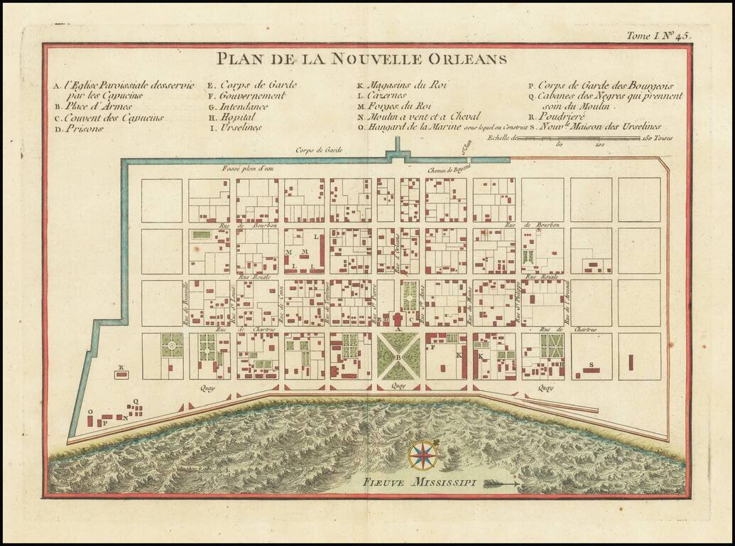
Bellin's important early map of New Orleans, first issued in Xavier Charlevoix's Histoire de la Nouvelle France. The present example is the second state of the map. The first state is distinguishable from subsequent states by the inclusion of the...
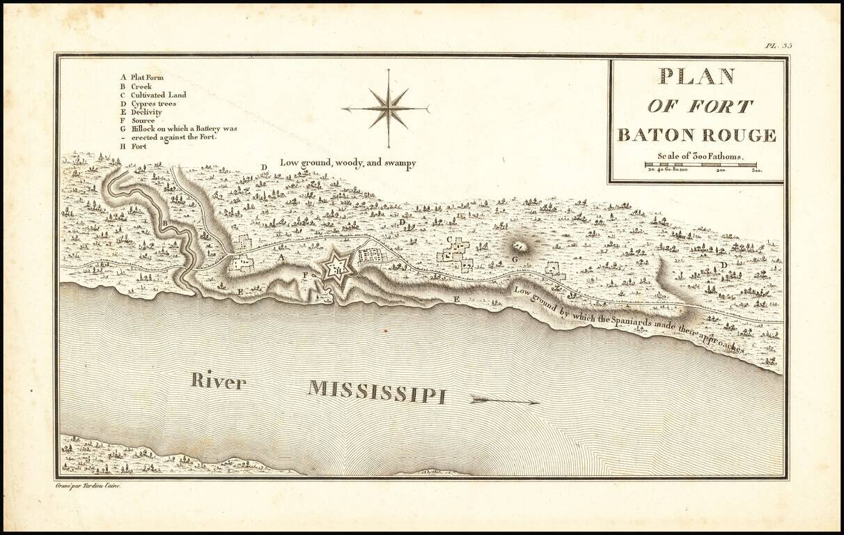
One of the Earliest European Settlements on the Mississippi River Rare engraved plan of early Baton Rouge, Louisiana (then Spanish West Florida), by famed French cartographer and spy Victor George Henri Collot. This is probably the earliest printed...