
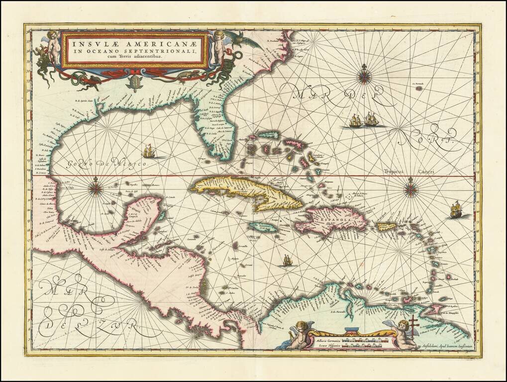
Finely colored example of Jansson's edition of Hessel Gerritsz' rare chart of 1631. The area covered is exactly the same as the original Gerritsz map, except for the addition of the west coat of Central America. The nomenclature in North America is...
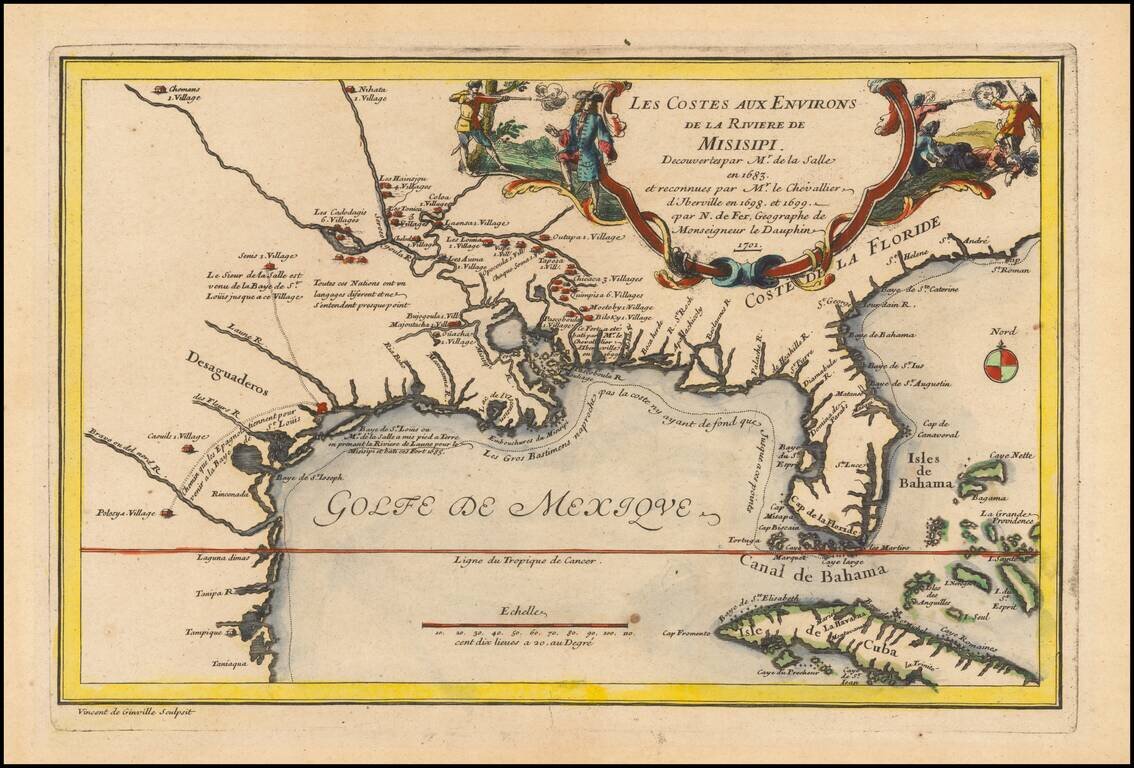
Rare 1701 First Edition Nice example of this historically important and fascinating map of the Gulf Coast and Mississippi River region, from Nicolas De Fer's Atlas Curieux. In preparing this fine map, the leading French cartographer Nicolas De Fer...
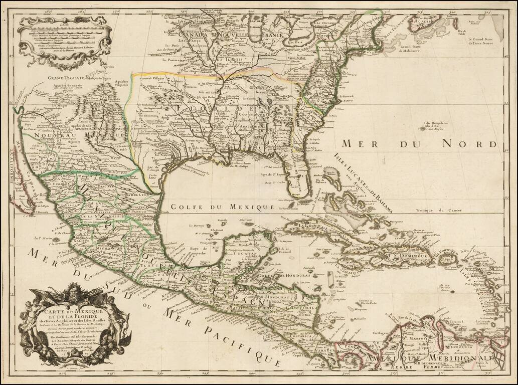
Rare Second State. Fine example of the second state of Guillaume De L'Isle's landmark map, the first printed map to accurately depict the course and mouth of the Mississippi River. De L'Isle's Carte du Mexique . . . is drawn from the reports brought...
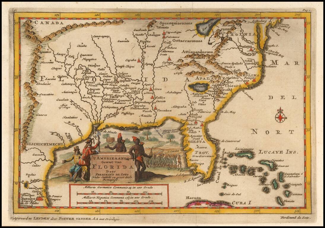
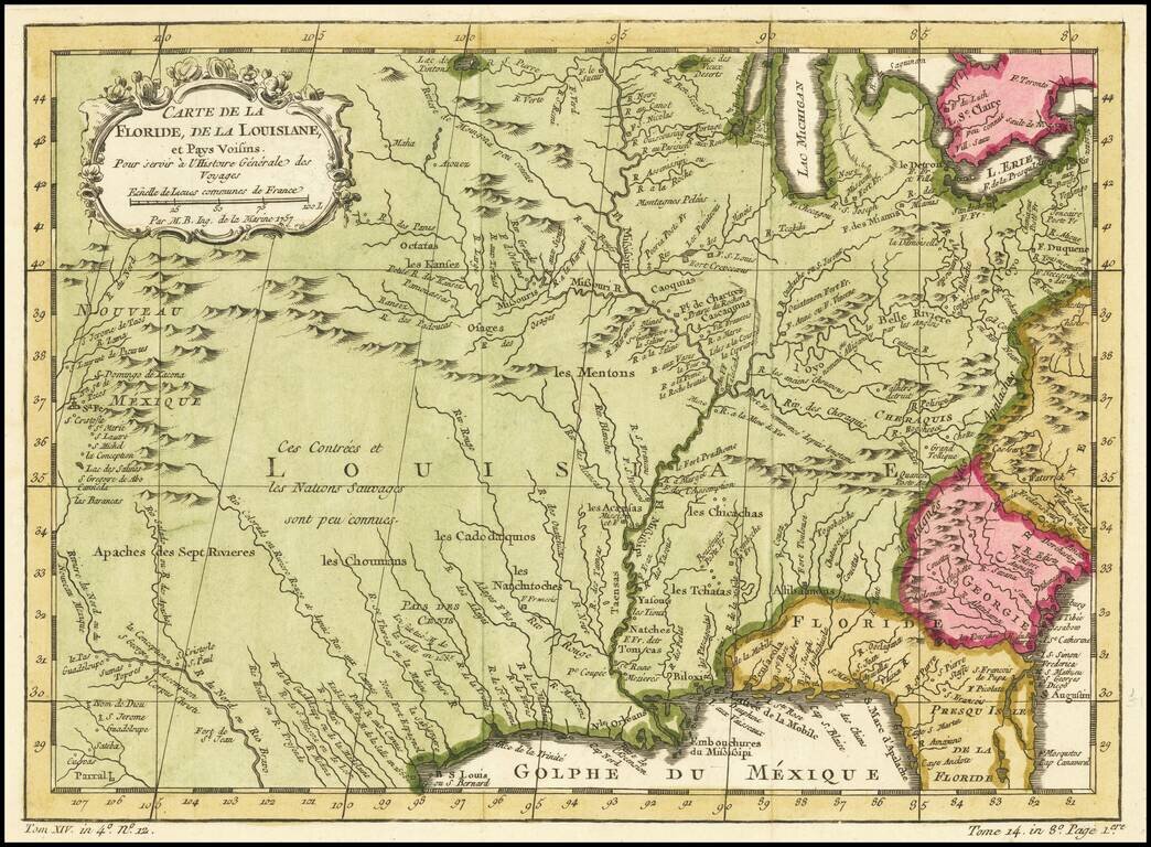
Fascinating map of the Southeastern part of the future United States, based largely upon Sanson's map of Florida from 1657. The map is intended to illustrate the expedition of Ferdinand de Soto in 1534, based upon his original accounts. Fine...
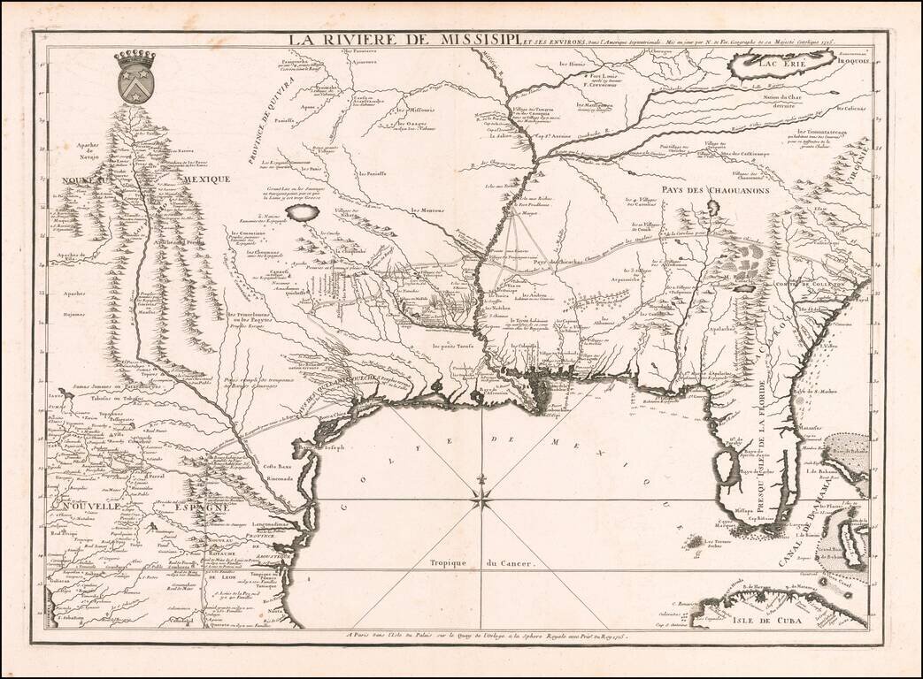
Nicolas De Fer's Landmark 1715 Map of the Mississippi River Valley and the French Regions in the Interior of North America. Fine example of De Fer's rare map of the southern part of the French regions in North America, one of the most important maps...
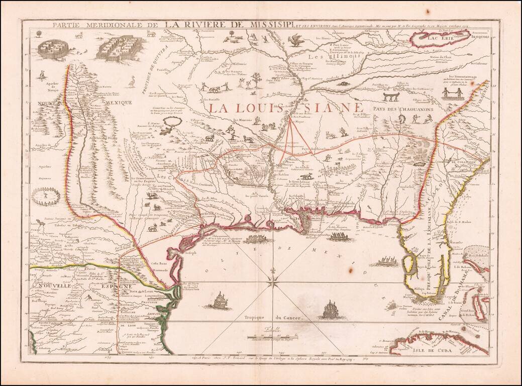
De Fer's Landmark Map of the Mississippi River Valley and the French Regions in interior of North America. Fine example of De Fer's rare map of the southern part of the French regions in North America, prepared by De Fer for the French Company of...
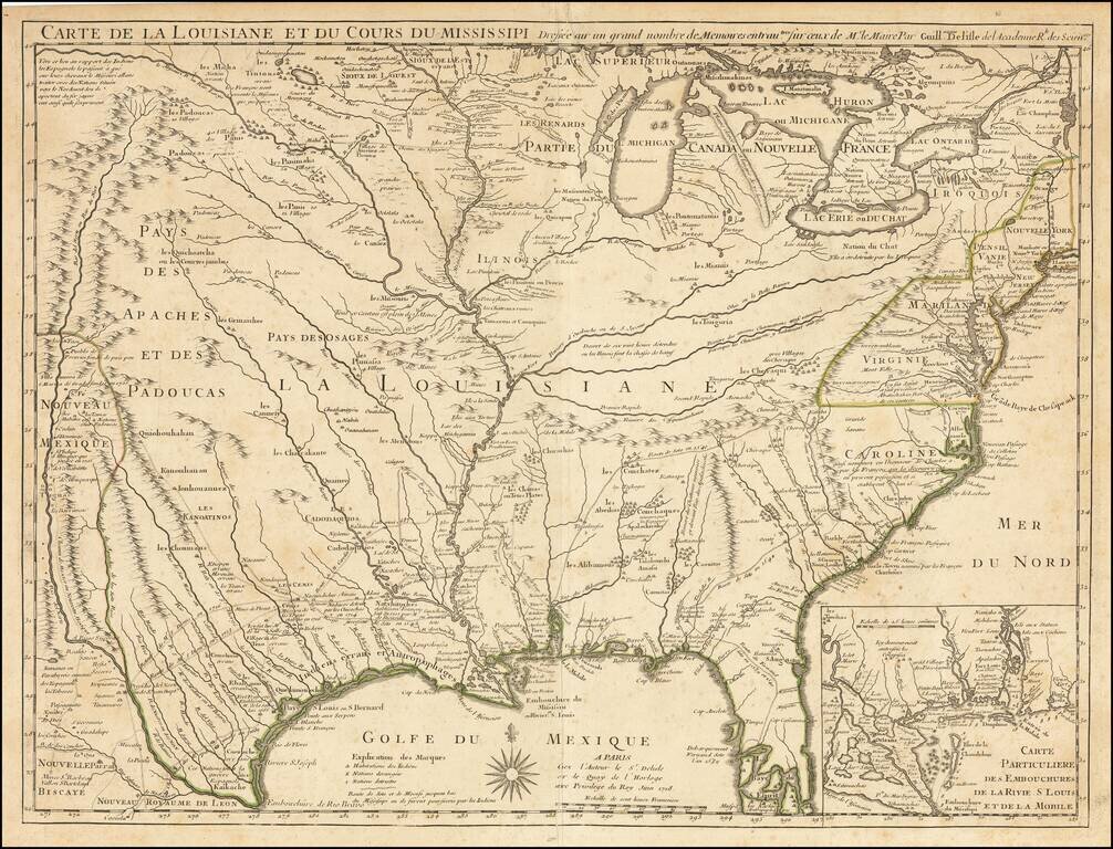
![Carte De La Louisiane Et Du Cours Du Mississipi . . . Juin 1718 [1st State!]](/map/small/62086.jpg)
"The Mother and Main Source of All the Later Maps" of the Mississippi River and Interior Parts of the United States and The First Map to Name Texas First state of De L'Isle's seminal map, one of the most important and influential maps of the 18th...
First Map To Name New Orleans -- "The Mother and Main Source of All the Later Maps" of the Mississippi River and Interior Parts of the United States and The First Map to Name Texas Second state of De L'Isle's seminal map, one of the most important and...
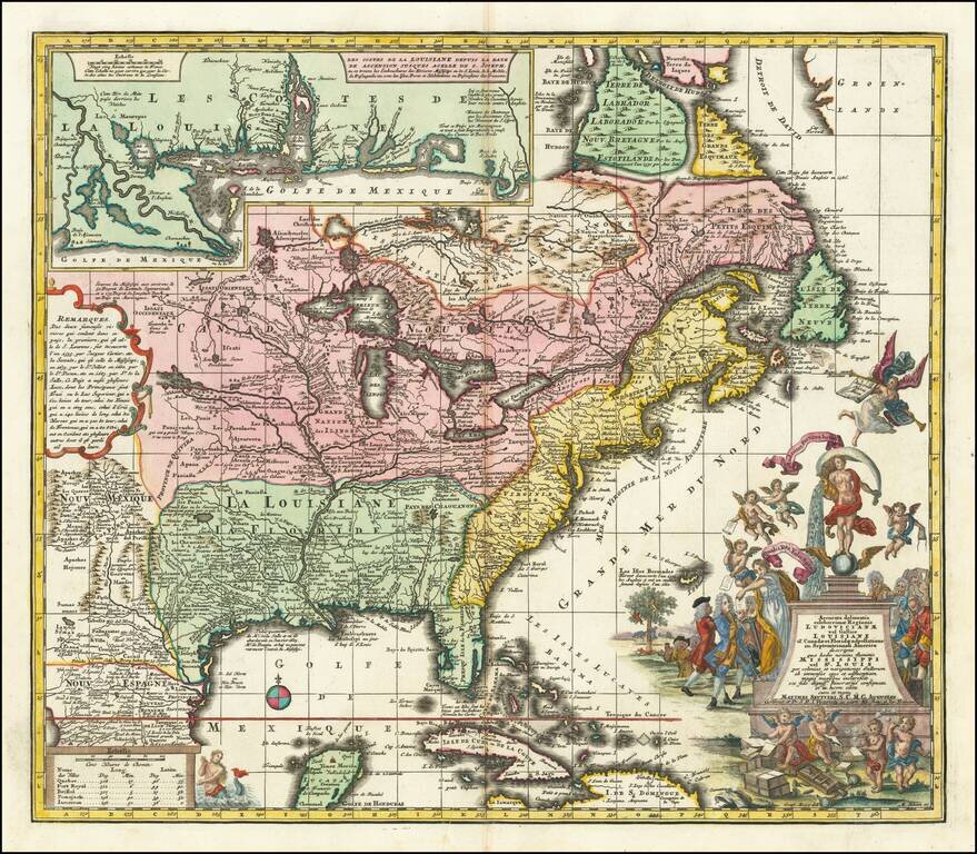
18th-century Map of Eastern North America with a Satirical Cartouche A finely colored example of Seutter's so-called Mississippi Bubble map, depicting the short-lived French financial-colonial scheme masterminded by Scottish financier John Law. The...
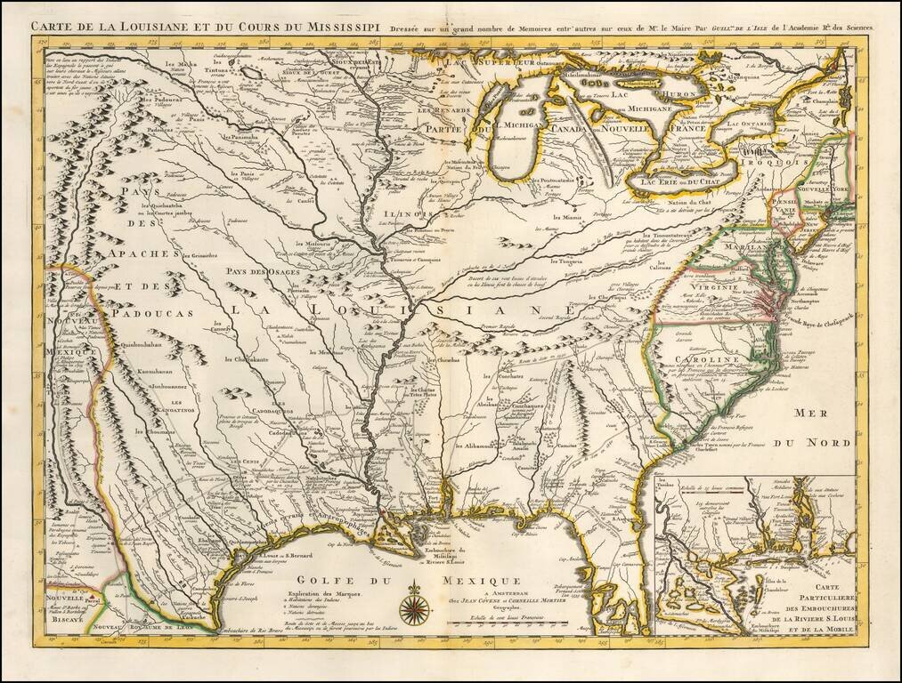
One of the Earliest Appearances of New Orleans Nice old color example of Covens & Mortier's fine edition of Guillaume De L'Isle's seminal map, the most significant map of the Mississippi Valley and Great Lakes published in the early part of the...
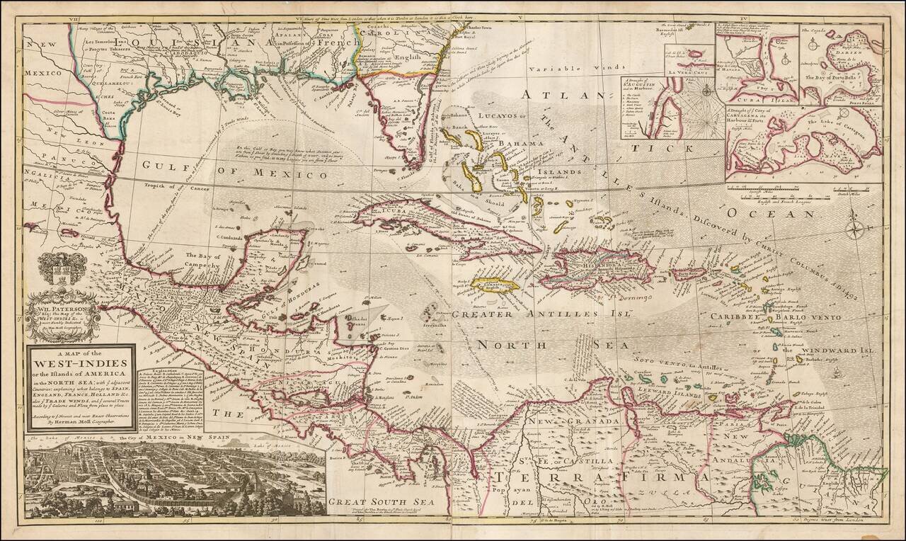
Highly detailed and decorative large format engraved map of the Caribbean by Herman Moll. Moll's map was the most popular large English map of the Caribbean, Florida, the Gulf Coast, Texas, and Central America in its day. It was a central image in the...
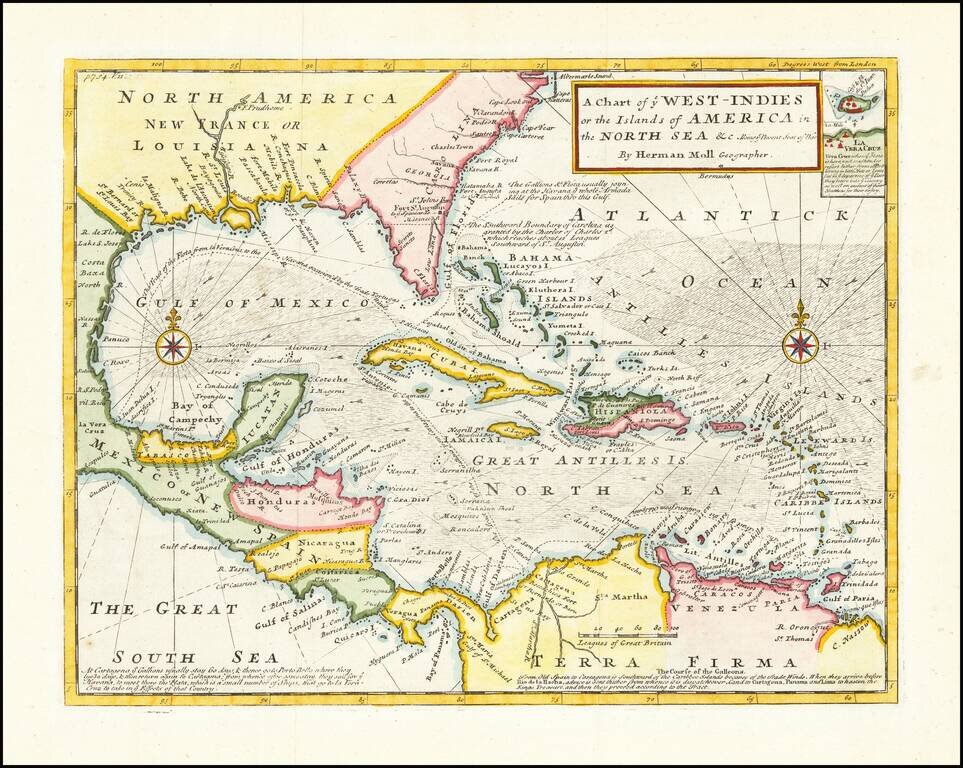
Detailed map designed to show the theater of war for the War of Jenkins's Ear. The War of Jenkins Ear got its name from an event that occurred in 1731, when Robert Jenkins, the captain of the Rebecca, was captured in the West Indies by the Spanish. He...
![A New & Accurate Map of Mexico or New Spain together with California New Mexico &c. [Inset map of the Galapagos Islands]](/map/small/70276.jpg)
Striking map of the Southwestern and Southeastern United States, Baja California, Mexico, Central America and the Gulf Coast region, centered on Texas. Includes nice annotations throughout the map, including annotations describing Kino's expedition to...
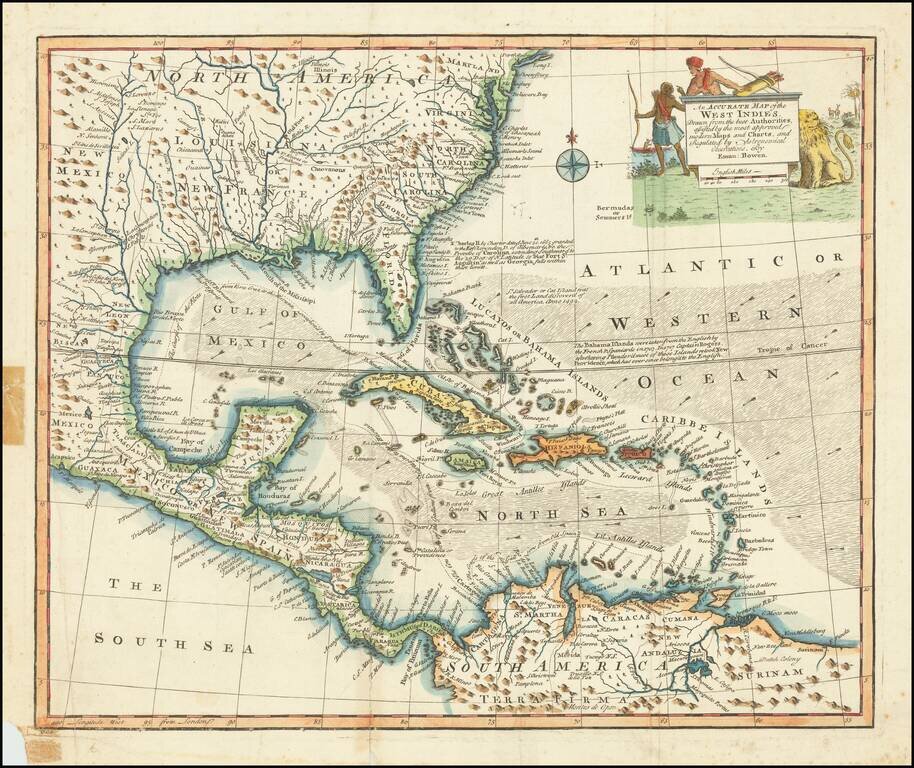
Decorative example of Bowen's map of the Southeastern United States, Florida, Gulf Coast, Texas, Caribbean and Central America. The map is embellished by an elaborate native American scene, along with a depiction of a lion and other indigenous...
Rare Variant edition of Bellin's map of Mississippi River Valley and environs, with the name "Floride" in the title. The normal title for this map is Carte De La Louisiane et Pays Voisins. Fabulous map of most of the US, based upon De L'Isle's...
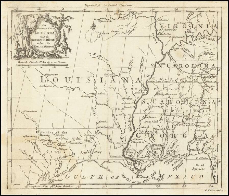
The "Territory In Dispute East" of The Mississippi River Rare map centered on the Mississippi River, showing the "Territory in Dispute" between France and England. The map is centered on the Mississippi River valley and the Gulf Coast, showing the...