Map size in jpg-format: 2.41022MiB
Click to open in high resolution (open in new tab).
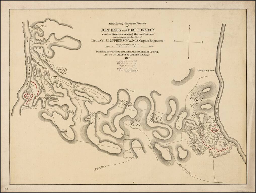
Scarce early battle plan showing the troop positions around Fort Henry and Fort Donelson, between the Tennessee River and Cumberland River.
Includes fortifications in red, roads, rivers, telegraph lines and other topographical details.
If you are a student, write to us in telegram: @antiquemaps and indicate what material you need and for what work you need a map in high detail. We are ready to provide material on special terms. For students only!


