
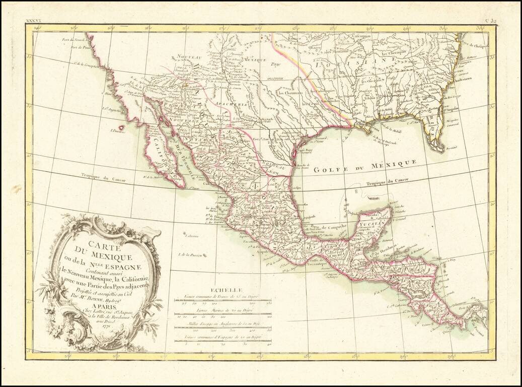
18th Century French Map of Texas, Mexico and the Southwest, etc. Decorative map of the Southwest, Texas, the southern United States, Mexico and Central America. Includes excellent detail in Texas and along the Rio Grande River, Rio Colorado and Gila....
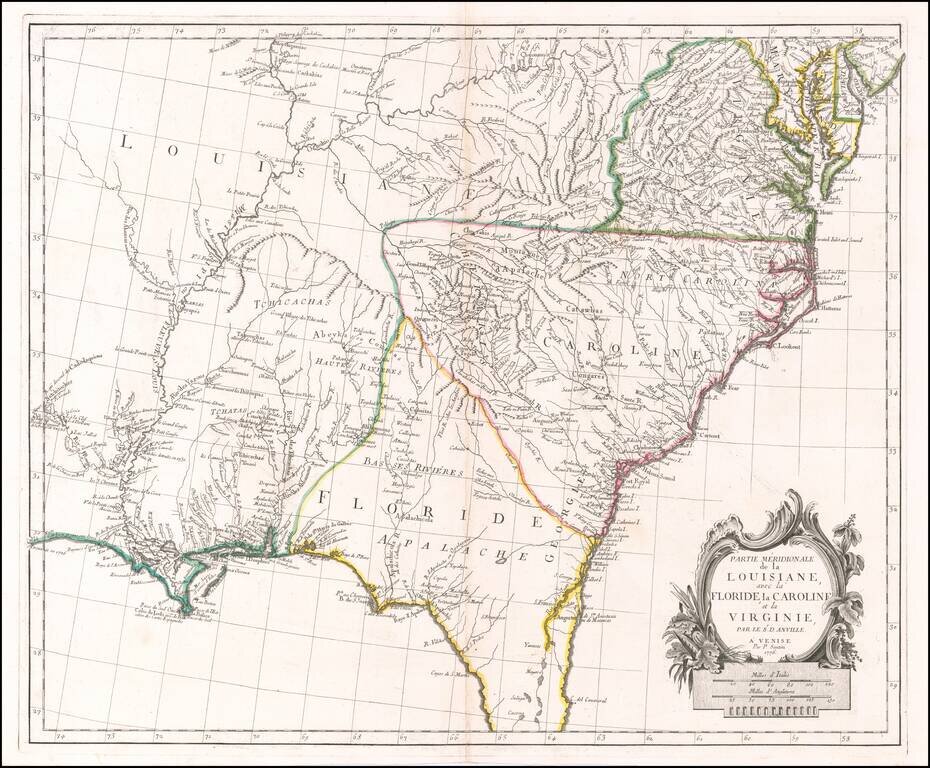
Scarce Italian Map of the Southern Colonies in Colonial America at the Outset of the American Revolution A marvelous map the Southern part of Colonial America, published by Paolo Santini in Venice. The map covers most of Florida, then extending west...
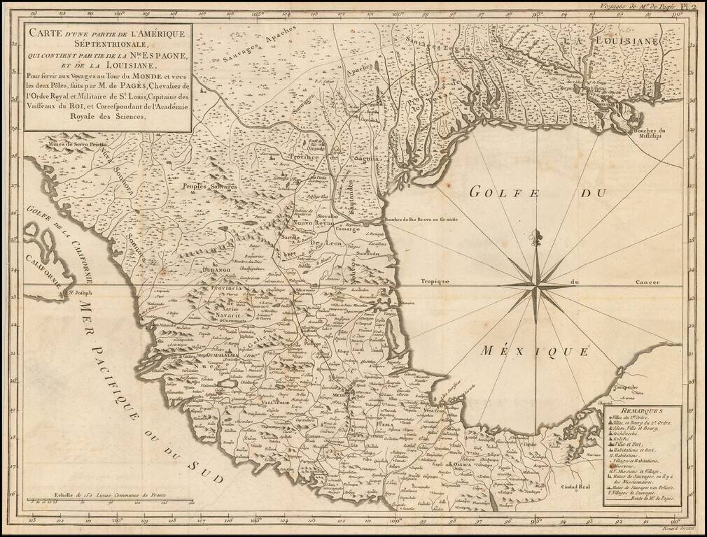
Description of an Overland Expedition Through Texas in 1767. Interesting early map of the Texas, the Gulf Coast and Mexico, from De Pages Voyages Au Tour Du Monde, published in 1782. Pages accompanied the Spanish Governor of Texas on a Journey from...
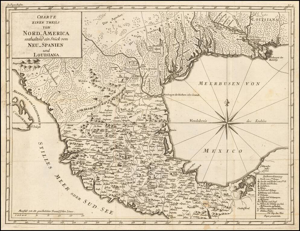
An Description of his Overland Expedition Through Texas in 1767. Interesting early map of the Texas, the Gulf Coast and Mexico, from a German edition of Pierre du De Pages Voyages Au Tour Du Monde, published in 1782. Pages accompanied the Spanish...
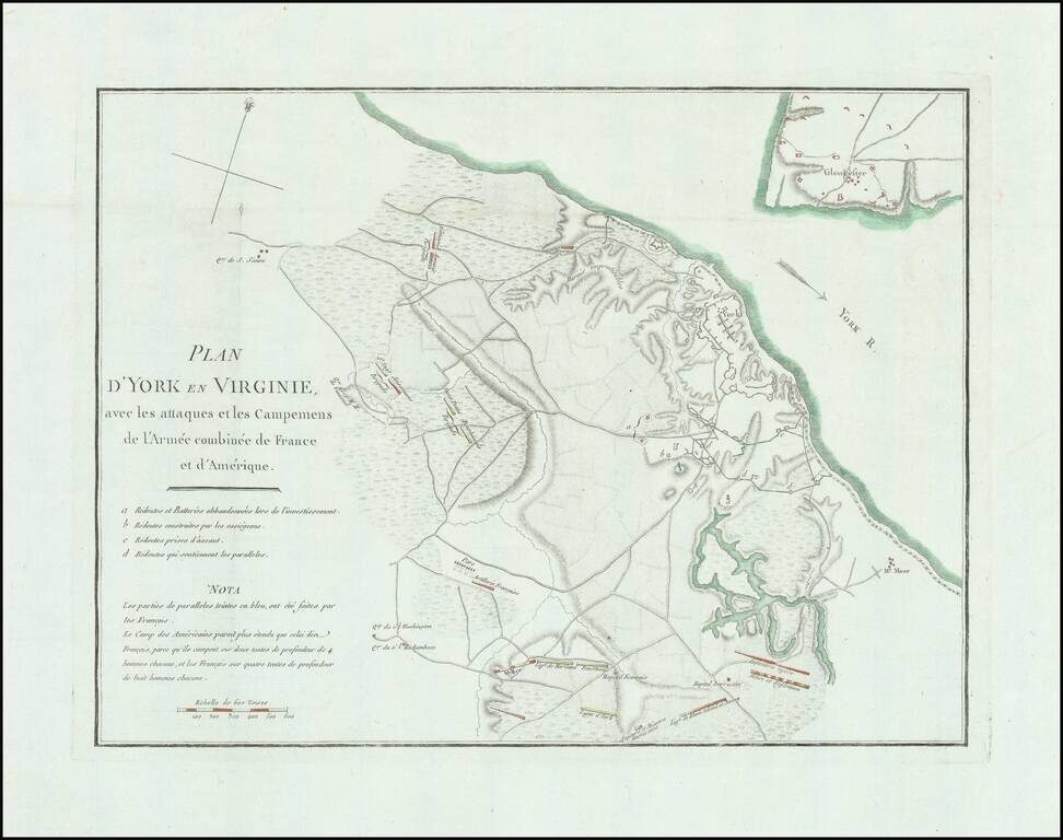
Detailed battle plan of the Battle of Yorktown, the final battle of the American Revolution. The map provides a detailed look at the battle of Yorktown, based upon French sources. The positions of the American, French and English forces and artillery...

Early Map of the America's Southern States and Territories Early American printed map of the Southern portion of the United States, extending from the Atlantic to the Mississippi and showing part of Kentucky. Georgia is now truncated near its current...
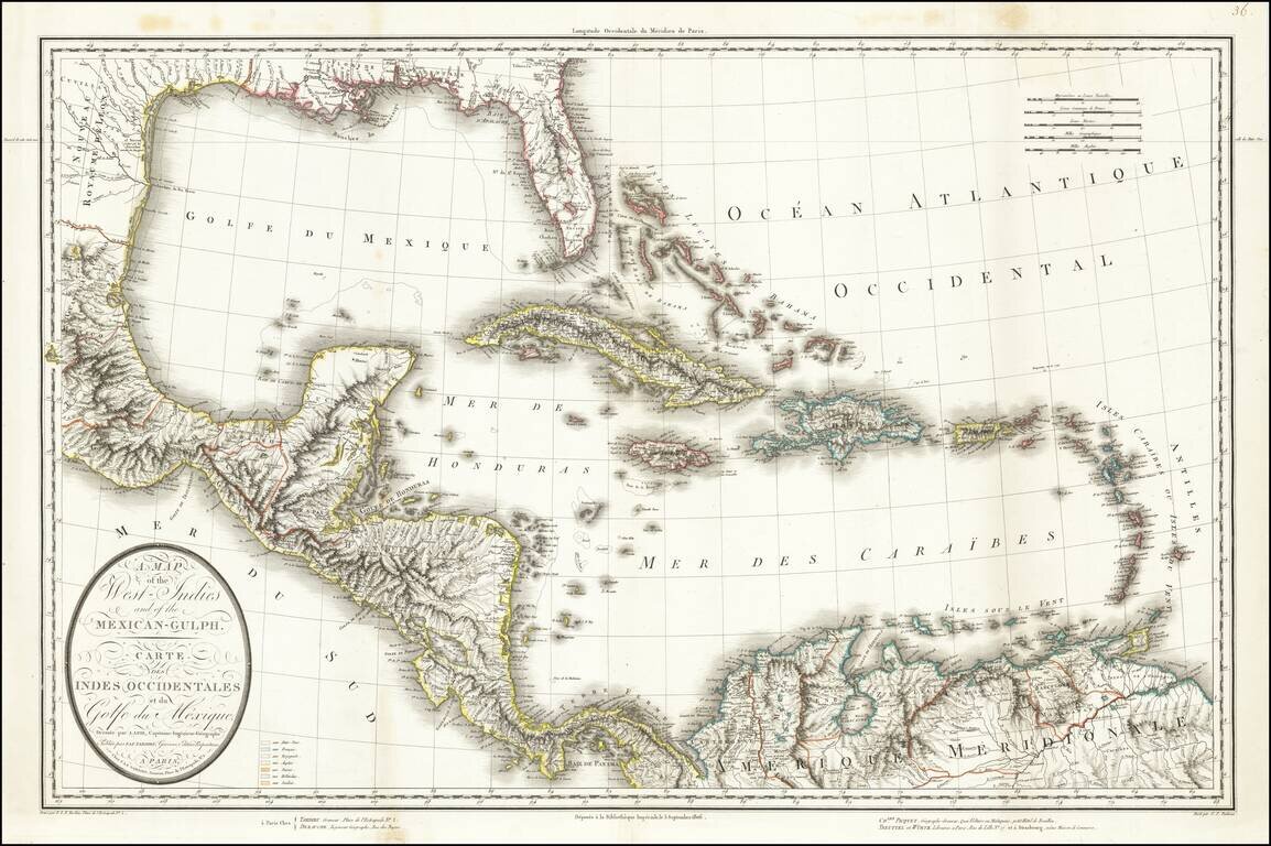
This is a rare separately issued map of the Gulf Coast and the Caribbean by Tardieu. The map was issued shortly after the Louisiana Purchase (1803) and the creation of the Mississippi Territory (1804). The map demonstrates the remarkably fine engraving...

Rare Dutch edition of this highly important map the region, from Pike's account of his expedition to the West . The map shows Pike's route through the region from the west of the Mississippi, from the Missouri River to the Red River, and extending...
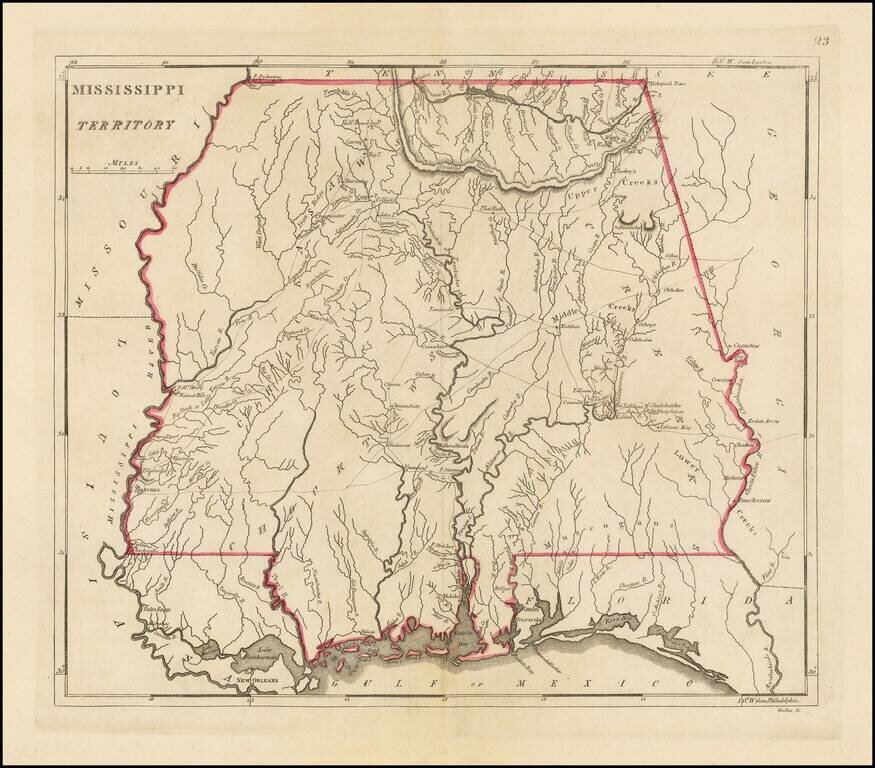
The earliest obtainable large map of Mississippi Territory Fine example of this important early map of Mississippi Territory, from the 1814 edition of Matthew Carey's General Atlas. The map pre-dates the creation of Alabama Territory, extending from...
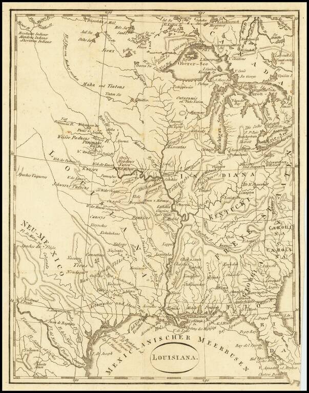
An Early Louisiana Purchase Map Extremely rare little map centered on the Mississippi, apparently based upon the map used to illustrate Berquin-Duvallon's Vue de la Colonie Espagnole du Mississippi, ou des Provinces de Louisiane et Floride...
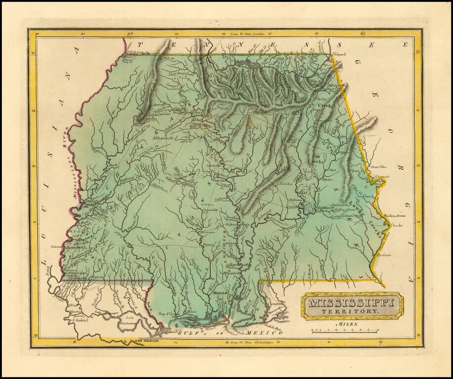
One of the earliest obtainable maps of Mississippi Territory A rare early map of Mississippi Territory, published by Fielding Lucas Jr. in Baltimore, from his New & Elegant General Atlas of the United States . . . The map pre-dates the creation...
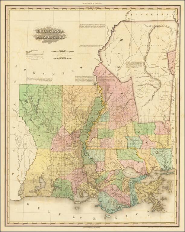
First Appearance of Cherokee Boundary and Choctaw Boundary Fine example of this early state Henry Schenk Tanner's spectacular map of Louisiana and Mississippi. Drawn from Darby's remarkable map of the region and other contemporary sources, the map...
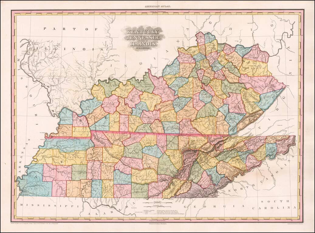
The Best Kentucky, Tennessee & Southern Illinois Regional Atlas Map of the First Half of the 19th Century -- Early Edition with 9 Unnamed Counties in Western Tennessee Gorgeous example of this rare early edition of Tanner's Map of Kentucky,...
![[Alabama, Mississippi, Arkansas, Louisiana and part of Tennessee and Western Florida] Amer. Sep. No. 56 Partie des États Unis](/map/small/54672.jpg)
Fine Map of Mississippi and Alabama from the Distinctive Atlas Universel Highly-detailed regional map focusing on Mississippi and Alabama published in Vandermalean’s important Atlas Universel shortly after they were split into separate territories...
![[Pocket Map] Map Of The States Of Louisiana, Mississippi & Alabama Constructed from the latest Authorities. 1831](/map/small/45190.jpg)
First edition of S.A. Mitchell's folding map of Louisaiana, Mississippi and Alabama, engraved by J.H. Young. A remarkably detailed map of the region, with excellent notes throughout, including details on Steam Boat and Stage Coach Routes, Indian...
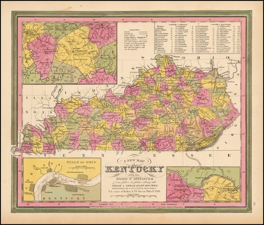
Detailed and interesting map of Kentucky, hand colored by county and showing towns, rivers, lakes, railroads, roads, distances, forts, etc. Tables of Steam Boat routes and distances. Large insets of area around Lexington, the Washington and Clarksburg...