logo

1849. Chart of a Portion of the Savannah River. Surveyed & Dawn under the direction of Col. J.J. Abert by M.L. Smith

  • Chart of a Portion of the Savannah River.  Surveyed & Dawn under the direction of Col. J.J. Abert by M.L. Smith

Chart of a Portion of the Savannah River. Surveyed & Dawn under the direction of Col. J.J. Abert by M.L. Smith information:

Year of creation: 
Resolution size (pixels): 
 6605x4398 px
Disk Size: 
 3.82523MiB
Number of pages: 
 1
Place: 
 Washington
Author: 

Print information. Print size (Width x height in inches):
Printing at 72 dpi 
  91.74 х 61.08
Printing at 150 dpi 
 44.03 х 29.32
Printing at 300 dpi 
 22.02 х 14.66

An example of detailing the file of this map of in a printable high-resolution:

Click to open in high resolution (open in new tab).
Attention! this is just the central piece (central area 960x960 px) of the map file!
This is an example, so that you can see and study the level of detail of a given map. The entire Map will be fully available after payment!

Chart of a Portion of the Savannah River.  Surveyed & Dawn under the direction of Col. J.J. Abert by M.L. Smith

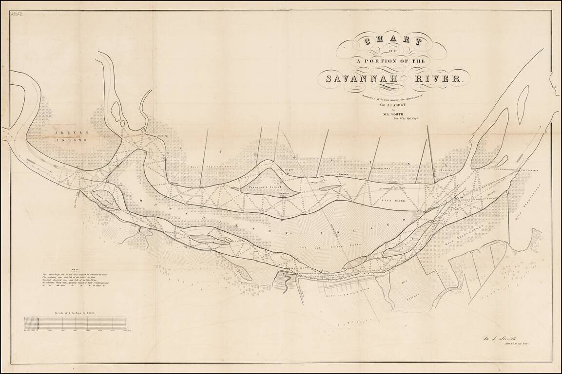
Highly detailed US Government Survey map of part of the Savannah River.

Large map of the part of the Savannah River adjacent to the city of Savannah. Several islands are shown including a large Hutchinson Island. The map is filled with detail, soundings in the river, and plantations along the shores (including the crop type).

AMPR lists 2 appearances of the map in dealer catalogs, none in the past 20 years.

.


Special conditions for students!

If you are a student, write to us in telegram: @antiquemaps and indicate what material you need and for what work you need a map in high detail. We are ready to provide material on special terms. For students only!

Item information:

Year of creation:
Size:
6605x4398 px
Disk:
3.82523MiB
Number of pages:
1
Place:
Washington
Author:
C.B. Graham.
$14.99

Related item