Map size in jpg-format: 193.74MiB
Click to open in high resolution (open in new tab).
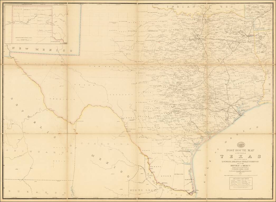
A Texas Sized Postal Map Without Post Routes!
First state of this important early map showing the Official Post Offices and Postal Routes in Texas in the last decade of the 19th Century.
The Key indicates that the map include Railroads, Mail Messengers, and the frequency of delivery, including once a week, twice a week, three times a week, six times a week and "Special Supply." Discontinued Offices are shown, as are the beginnings and ends of each mail route. However, the mail routes are curiously not included, suggesting that this may be a proof state.
Postal Maps in America date back to the mid-18th Century. The first Official Post map of the United States was published by Abraham Bradley in 1794. The tradition of regional Post maps began with David Burr in 1839 and was continued by W.L. Nicholson in the late 1860s. D.M. Key's name appears in the late 1870s. Charles Roeser's name begins to appear on Post Route maps in the 1880s, followed by Von Haake in the mid 1890s.
The present example seem to be the first state of the second postal map of Texas, pre-dating the addition of the actual postal routes, which would appear for the first time in 1879.
States of the Map
We note a Preliminary post route map of the state of Texas : with adjacent parts of Louisiana, Arkansas and Indian Territory by W.L. Nicholson, first published in 1874 (42 x 38 inches).
A new Nicholson Post Route Map of the State of Texas . . . was issued in 1878 (without Post Routes). In 1879 (Yale Copy) and 1880 (New York Public Library copy), the routes were included, with later editions to at least 1884 (including an 1883 edition offered for sale by Eberstadt in 1963 for $100).
The map was again completely revised and re-issued in 1889.
Rarity
All Texas Post Route maps are extremely rare on the market.
If you are a student, write to us in telegram: @antiquemaps and indicate what material you need and for what work you need a map in high detail. We are ready to provide material on special terms. For students only!


