
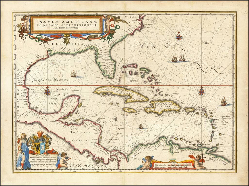
Blaeu's Chart of the Caribbean Nice example of Blaeu's chart of the Caribbean, based on a section of Blaeu's own West Indische Paskaert (ca. 1630) and Hessel Gerritsz' rare chart of 1631. The chart was the most accurate for its time and was used...

First Edition of Sanson's Map of Florida and the Southern parts of North America Striking example of Sanson's important early map of Florida and the Southeast, illustrating a number of early and important cartographic features. The first atlas map...

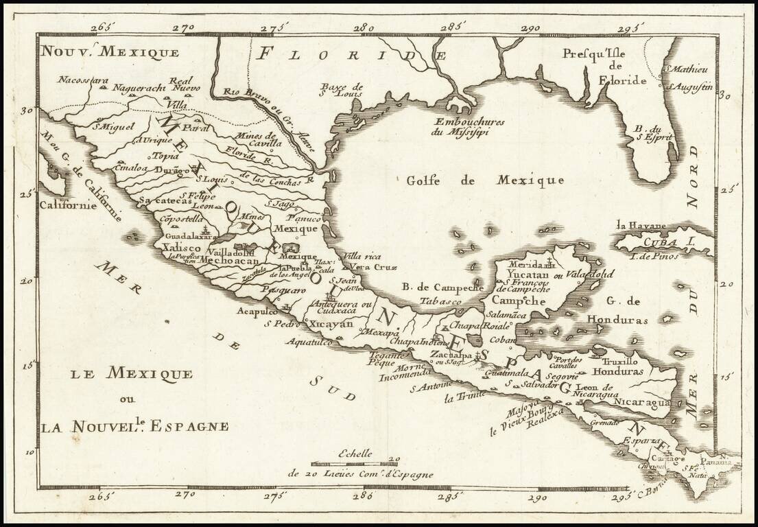
Rare regional map of Florida, the Gulf Coast and Southeastern United States, from Du Val's Le Monde Terrestre. Du Val's map is based upon Sanson's 1657 map. The major difference is the prominence given the Rio del Spiritu Santu (Mississippi River),...
![[Gulf Coast & West Coast of Florida] De Cust van Westindien Van La Desconoscida, tot C. Escondido. . .](/map/small/65741.jpg)
The First Dutch Chart of the Gulf Coast - Texas - West Coast of Florida Roggeveen's chart of the Gulf Coast, etc. is the first sea chart to focus on the region and one of great importance, showing for the first time on a printed Sea Chart the entire...
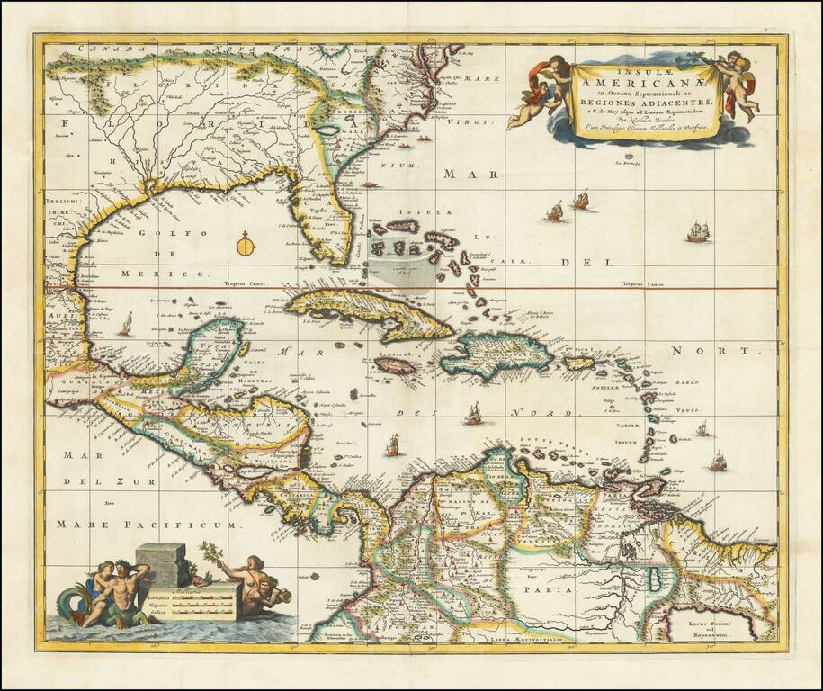
Nice example of Nicholas Visscher's map of the Caribbean, Florida, Southern US, Central America and part of South America. A number of cartographic myths appear on the map, including the large lake which appears in Georgia, a non-existent mountain...
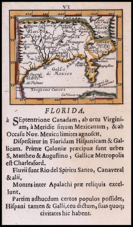
Rare Southeast regional American map, published by Johann Ulrich Muller. Highly coveted miniature map of Florida, the Gulf Coast, Texas, the Mississippi Valley and the Mid-Atlantic, extending northward to Lac du Chat (Ontario?). Excellent detail...
![[Florida Panhandle to Yucatan] Pas-Kaart Van de Golff van Mexico . . .](/map/small/23053.jpg)
The Earliest Obtainable Sea Chart of the US Gulf Coast Unrecorded variant edition of Van Keulen's chart of the Gulf Coast, from the Yucatan to Florida and centered on Texas, the earliest obtainable sea chart to focus this closely on Texas and the...
Rare map of Florida, the Gulf Coast, Texas, Central America and the Caribbean. Florida extends to the Rio Grande River. Only a few settlements shown in Florida and none on the Gulf Coast, apparently pre-dating New Orleans. Reminiscent of De Fer's map...
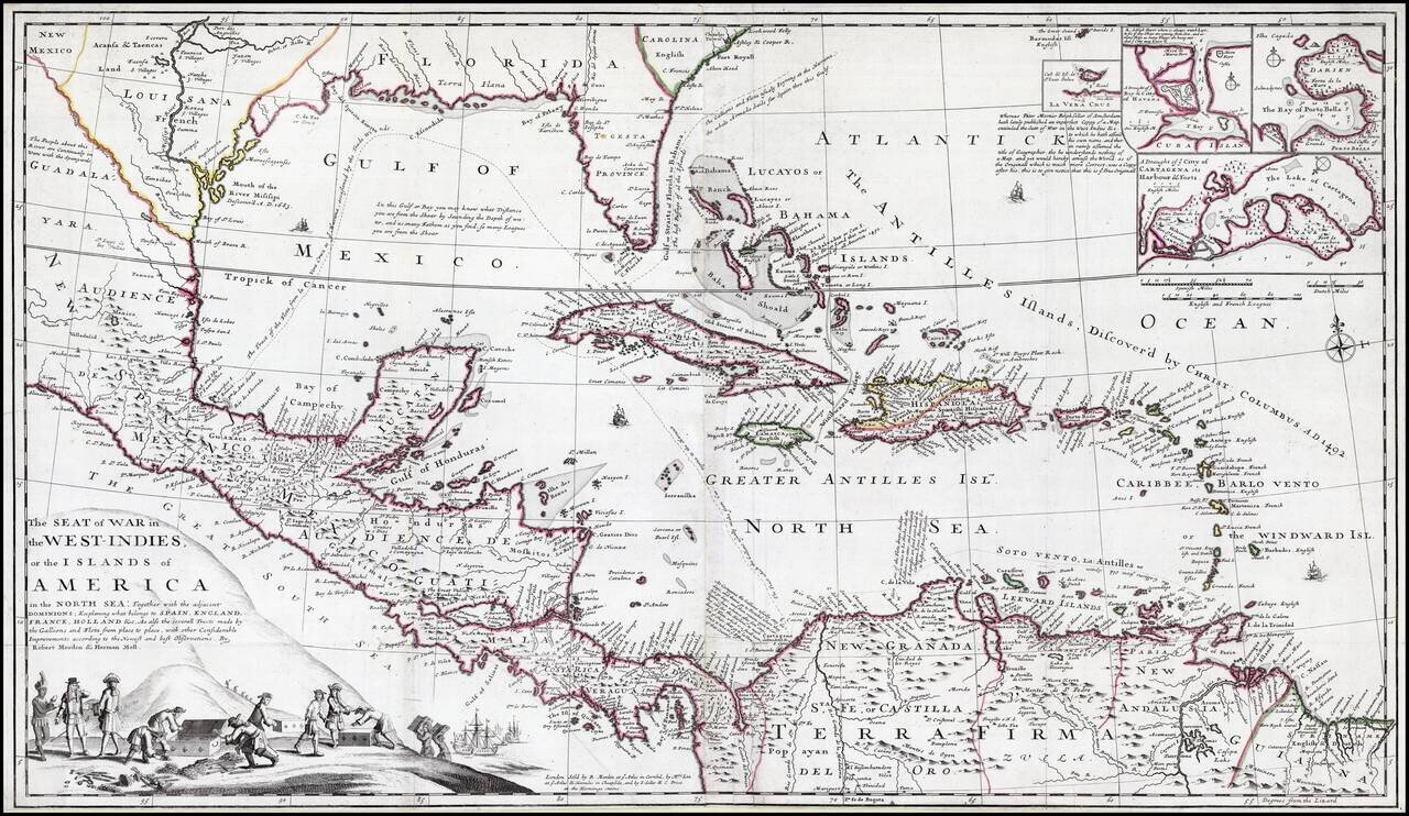
Striking old color example of this rare separately issued map of the Theater of War during the War of Jenkins Ear, published in London circa 1702, by Robert Morden & Herman Moll. A separately published and very rare English produced map of the War...
![[Gulf Coast - Texas - Florida - Yucatan ] Pas-Kaart Van de Golff van Mexico . . . [Rare 4th state!]](/map/small/62736.jpg)
Charting the Gulf Coast in the Early 18th Century Rare fourth state of Van Keulen's map of the Gulf Coast, from Florida and Texas to the Yucatan. The map is oriented with West at the top, Gerard Van Keulen's map of the Gulf Coast is a landmark...
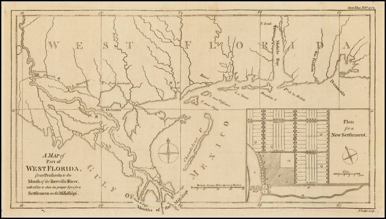
Nice detailed map of the Gulf Coast from Pensacola to the mouth of the Mississippi River, from the February 1772 edition of Gentleman's Magazine, with a nice inset plan for a New Settlement. Extends to west of New Orleans to include Plantations along...
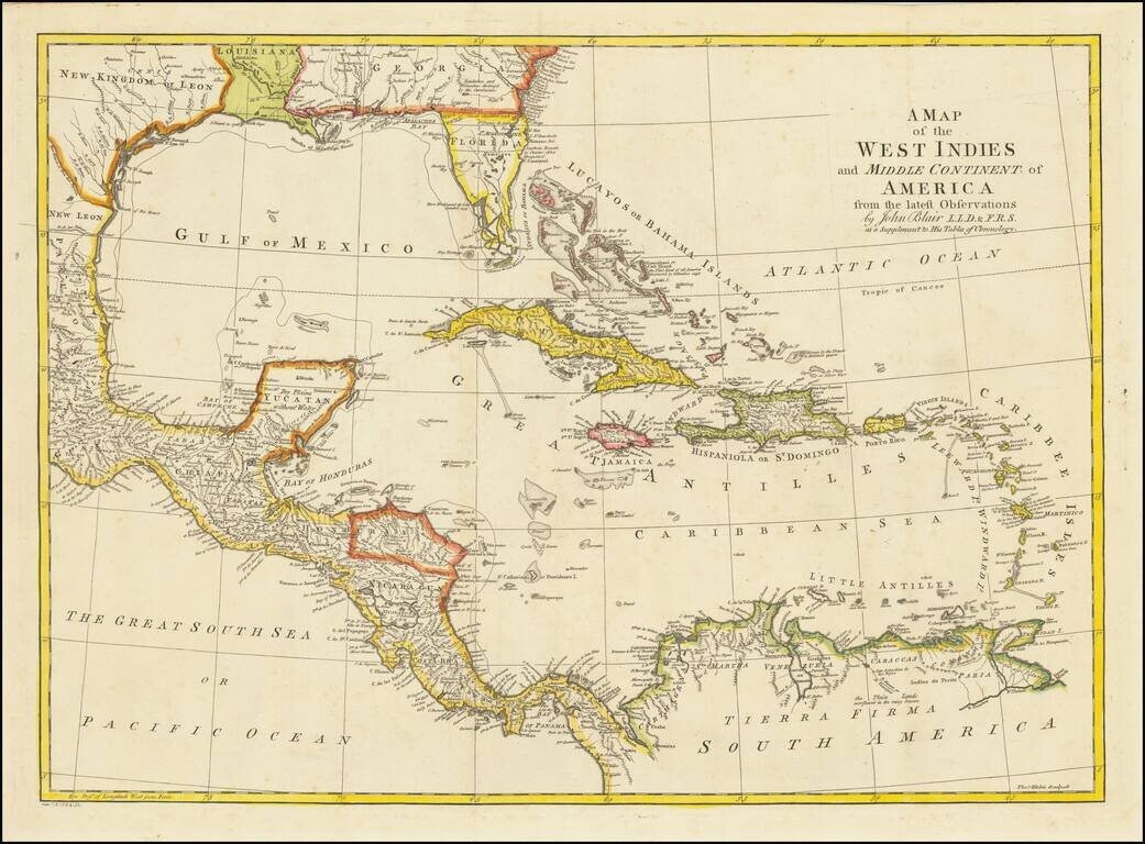
Detailed map of Florida, the Gulf Coast and Caribbean, centered on Cuba colored by regions. Florida is shown as an Archipelago. Georgia extends to the Mississippi River. Massive Kingdom of Leon (Texas). Nice detail in the Bahamas.
![The Coast of West Florida and Louisiana . . . [with] The Peninsula and Gulf of Florida or Channel of Bahama with the Bahama Islands . . .](/map/small/38977.jpg)
18th Century Florida & Gulf Coast Sea Chart Nice example of the Laurie & Whittle significantly revised and updated edition of Thomas Jefferys' 2-sheet map of Florida and the Gulf Coast, from Jeffreys' West India Atlas. This edition of the map...
![The Coast of West Florida and Louisiana . . . [with] The Peninsula and Gulf of Florida or Channel of Bahama with the Bahama Islands . . .](/map/small/66344.jpg)
Florida and the Gulf Coast at the outset of the American Revolution Nice example of this important early 2-sheet map of Florida and the Gulf Coast, from Jeffreys' West India Atlas. Jeffery's map is the earliest obtainable large format map to treat...
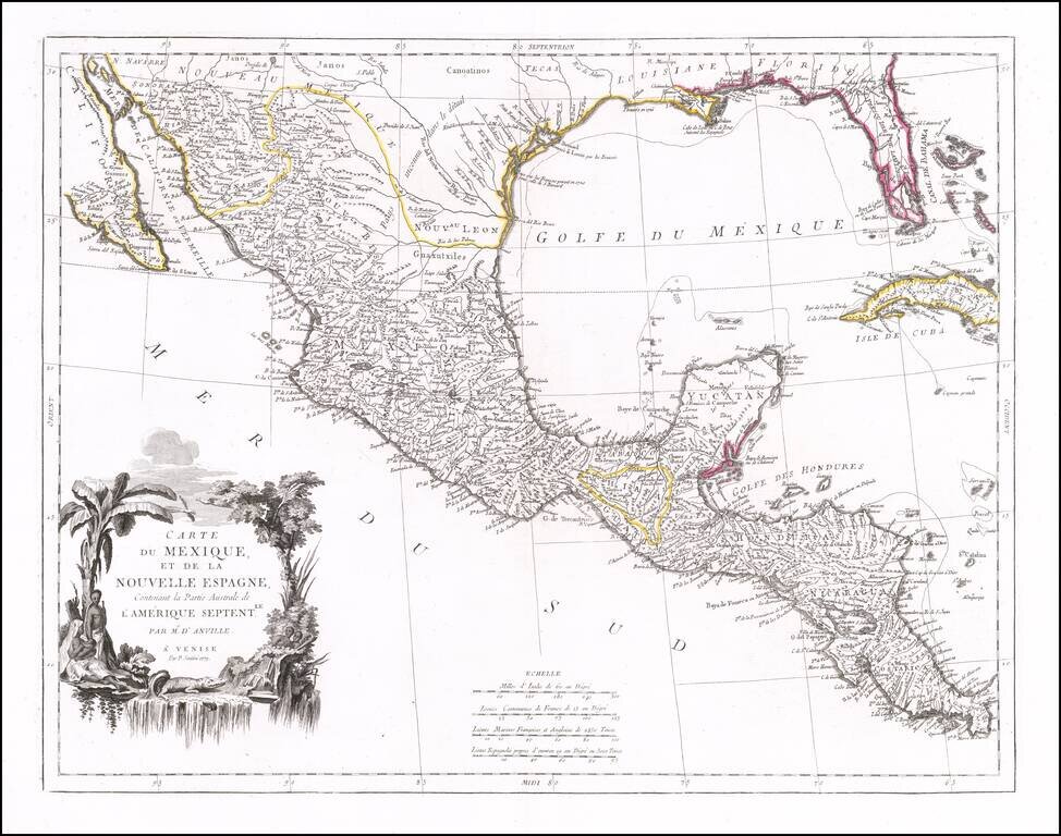
Striking map of Mexico, Texas and the Gulf Coast, including Florida, published in Venice. The map notes that it is based upon the work of J.B.B. D'Anville. Texas is named, with references to La Salle's visit to the region in 1685. Florida is shown...
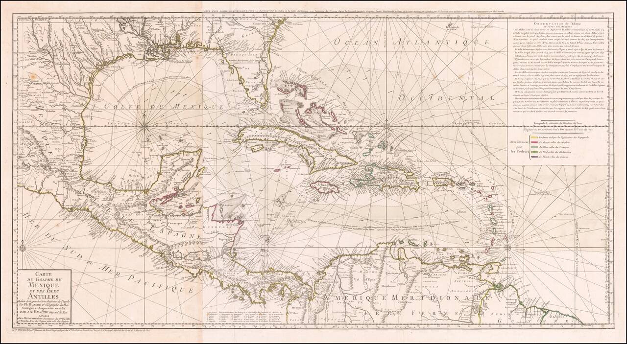
Striking, Intricate Map of the Caribbean Region Scarce and highly-detailed map of the Gulf Coast, Florida, Central America and the Caribbean from J.A. Dezauche, successor to Philippe Buache and Guillaume De L'Isle. The map is incredibly detailed, not...