
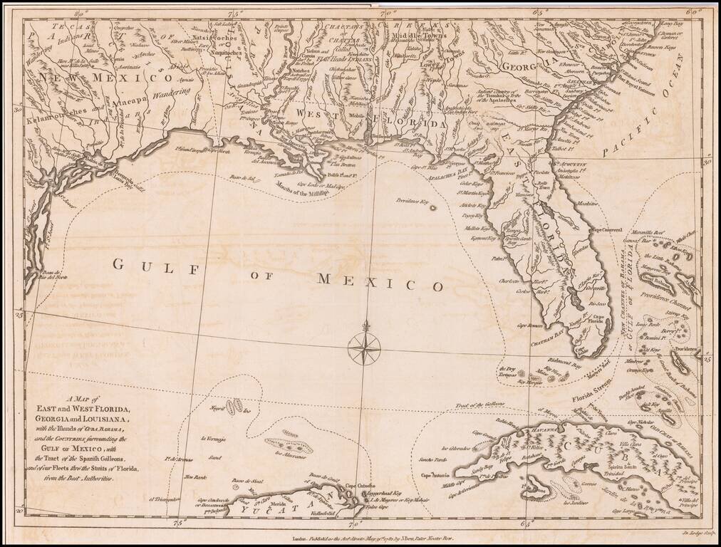
Antique Map of the Southeast United States During The American Revolution. Scarce Revolutionary War period map of the Southeastern part of the British Colonies in North America, Gulf Coast and Caribbean, illustrating the course of the Spanish Galleon...
John Cary's First Printed Map Nice example of John Cary's map of the Southeastern United States, Florida and the Caribbean, published on August 1, 1783. Published in August, 1783, the map was issued one month prior to the signing of the Treaty of...

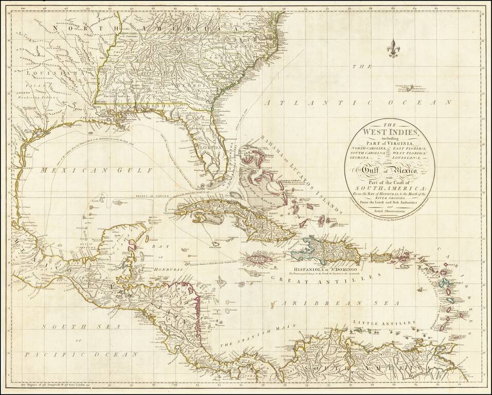
Striking full color example of scarce 1792 edition of Thomas Jefferys' map of the Gulf Coast, from Jeffreys' West India Atlas. Jeffery's map is one of the earliest obtainable large format map to treat the Gulf Coast region with such remarkable detail,...
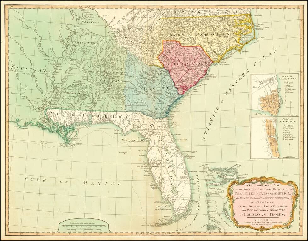
A Fine 18th Century Map of the Southern United States & Florida with Early Plans of Charleston and St. Augustine Laurie & Whittle's edition of this scarce map of the Southern States and Florida, originally compiled by Bernard Romans for the...
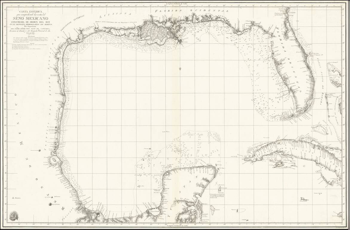
The foundational Spanish sea chart of the Gulf Coast, Florida, Texas, etc. -- One of the six most important maps of Texas (Streeter). This is the first large-scale printed chart of the Texas coast based upon actual soundings and explorations. The map...
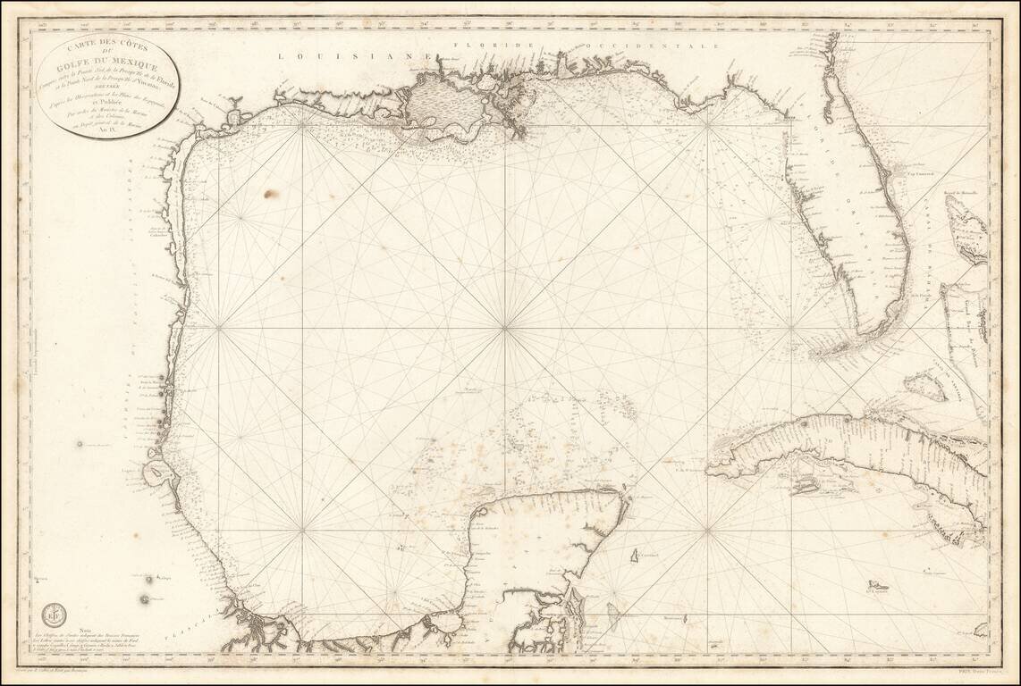
The First Modern French Sea Chart of the Gulf of Mexico Important early chart of the Gulf Coast and Florida, issued in the 9th Year of the French Revolution (An. IX.) The map was issued one year after the Spanish Carta Esferica and draws extensively...
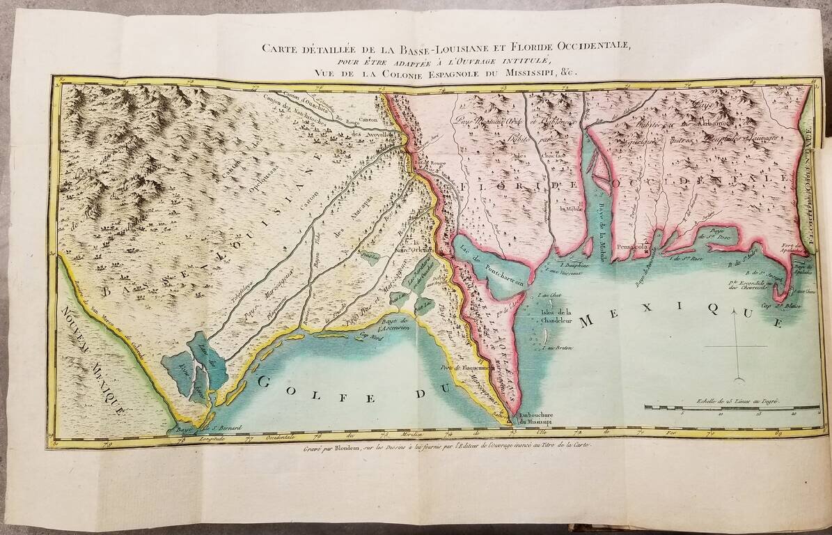
First Edition. Contemporary hand-color. First edition (1803) of this detailed work on Louisiana just before its acquisition by the United States in the Louisiana Purchase. The book was authored Pierre-Louis Berquin Duvallon, who was procureur du roi...
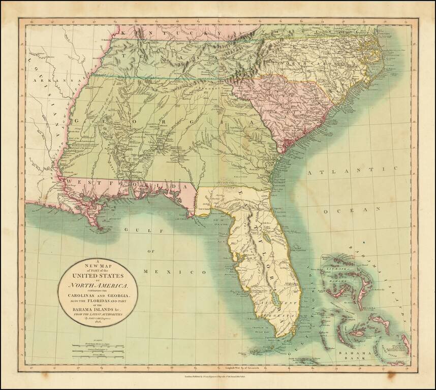
Fine example of the first edition of Cary's map of the Southern United States and Bahama Islands, extending the East Coast to the Mississippi River and from Tennessee and the Carolinas to Florida, the Bahamas and the Gulf Coast. A massive Georgia...
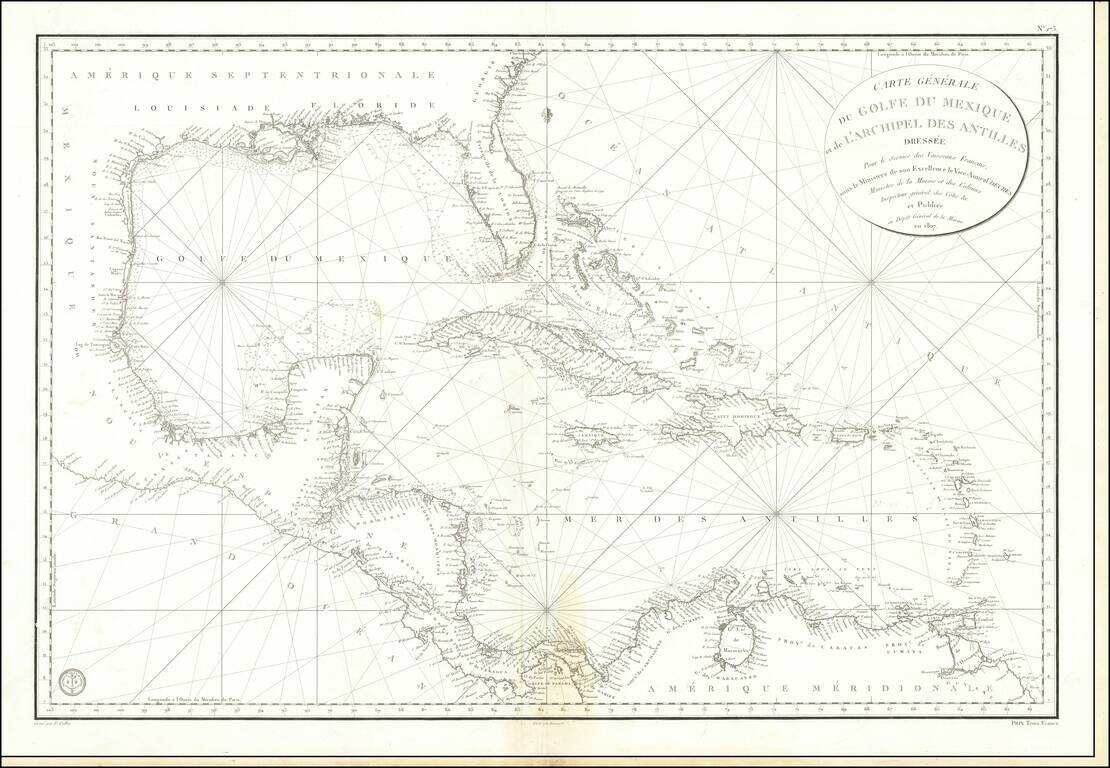
Detailed French Sea Chart of the Caribbean Fine and intricately-drawn French sea chart of the Spanish Main and the Caribbean, published in Paris in 1807. Drawn for the benefit of French vessels, as the cartouche in the upper right explains, the chart...
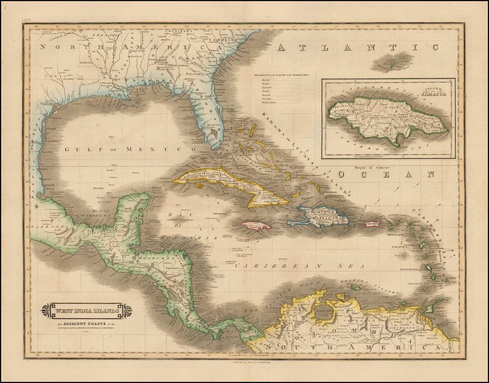
Scarce early edition of Lizars map of the Caribbean and contiguous coasts of Florida, the Gulf Coast, Central and South America, with a large inset of Jamaica. East and West Florida still appear, but both Missisippi and Alabama Territories are...
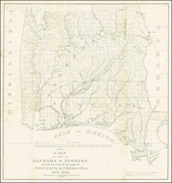
Detailed map of Alabama and western Florida, showing the route of the proposed Columbus & Pensacola Railroad, which accompanied the report of Major J.D. Graham, February 6, 1836. An early and important railroad map of parts of southern Alabama and...
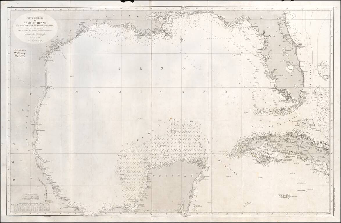
Scarce Spanish Sea Chart of the Gulf of Mexico, from Texas and the Yucatan to Florida and Cuba. Includes notes on the direction of the currents. A note opposite the Florida keys states that "Within these limit the current is directed strongly over...
![County Map of Florida [with inset of Mobile]](/map/small/68210.jpg)
Attractive post-civil war map of Florida, colored by county. Includes large inset of Mobile, Alabama. Shows towns, rivers, railroads, lakes, keys, forts, swamps, etc. The county configurations are still incomplete.
![County Map of Florida [with inset of Mobile]](/map/small/65016.jpg)
Attractive post-civil war map of Florida, colored by county. Includes large inset of Mobile, Alabama. Shows towns, rivers, railroads, lakes, keys, forts, swamps, etc. The county configurations are still incomplete.
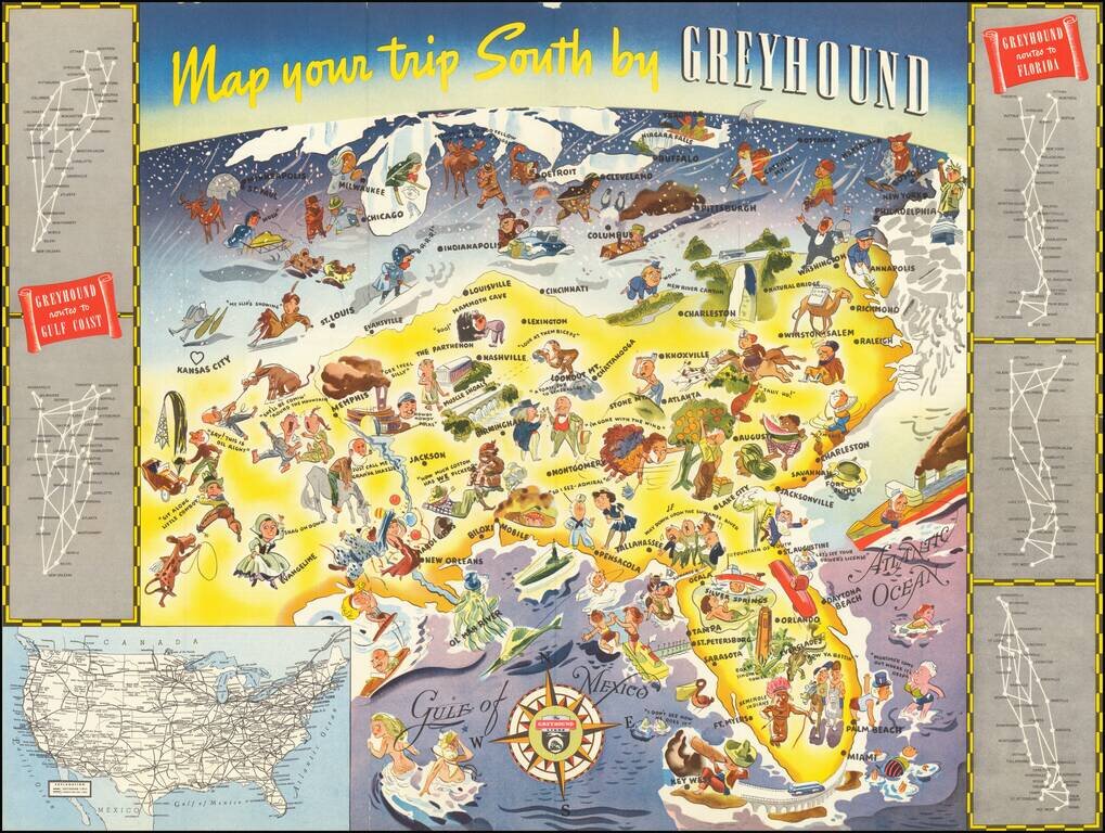
Whimsical map of the American South, promoting Greyhound's routes to Florida and the Gulf Coast in 1938. The image is dominated images of Florida tourist attractions, as well as other southern sites. Further north, the residents of the Midwest,...
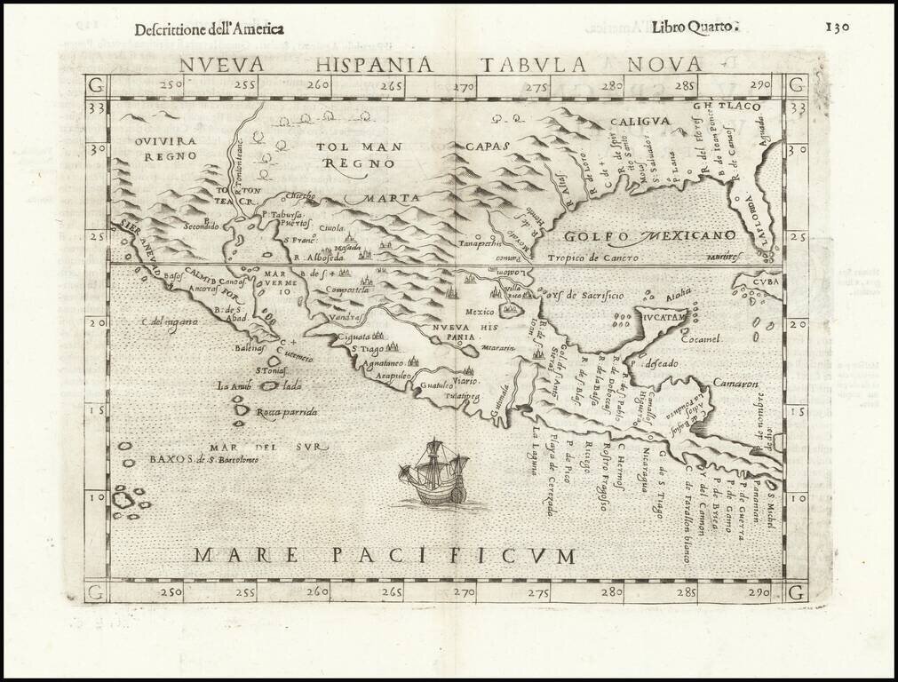
Second Earliest Obtainable Map of Florida, Texas, the Gulf Coast and the American Southwest—Rare Third State! Rare and influential regional map of the American South and Mexico, featured in Ruscelli’s edition of Ptolemy’s Geographia. This is an...