
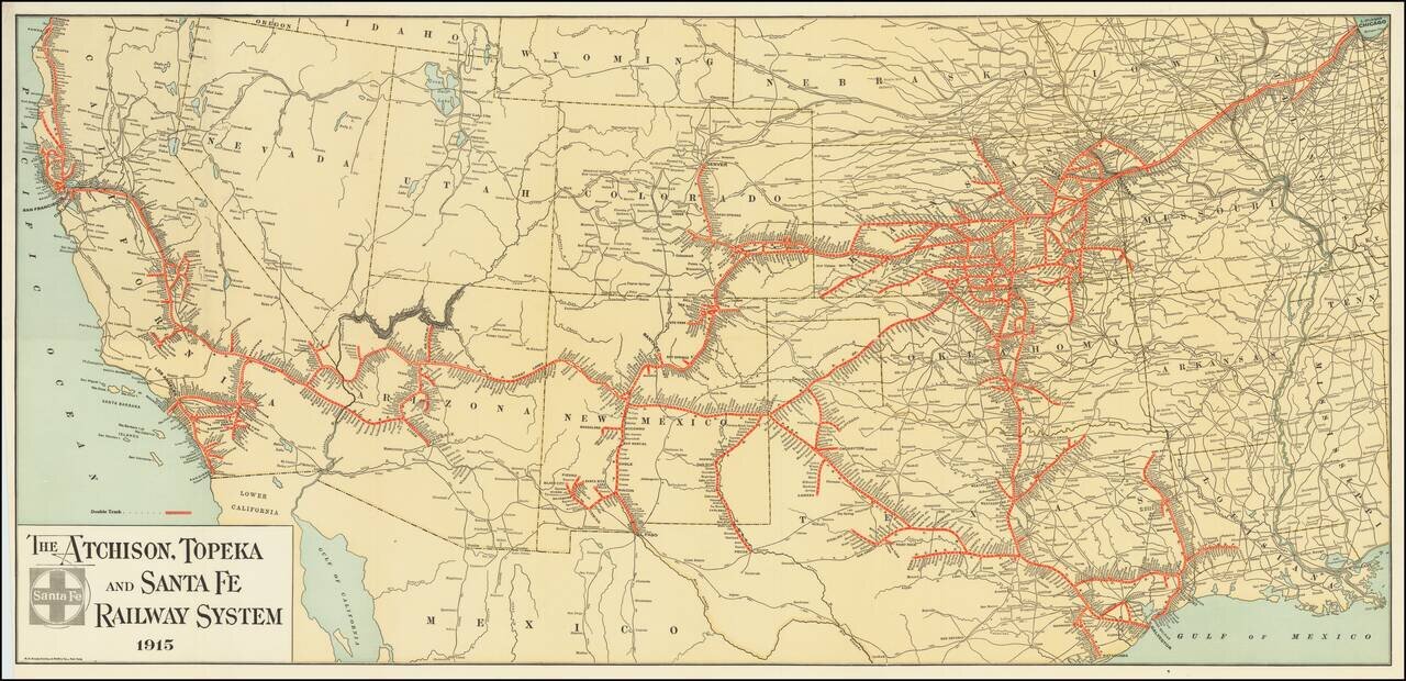
Fine example of The Atchison, Topeka and Santa Fe Railroad's general promotional map for 1915. Includes all the routes and train stations along the route in fine detail.
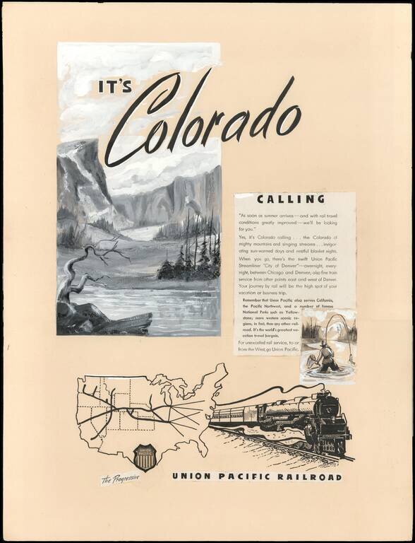
An Interesting Part of U.P.R.R. Advertising and Mapmaking History. This is a circa 1946 manuscript proof for a print advertisement promoting Union Pacific rail service from Chicago, Illinois to Denver, Colorado on the Union Pacific Streamliner 'City...

Detailed, Early Map of Oregon and Washington Territories Striking early J.H. Colton map of Oregon and Washington Territories published four years before Oregon statehood. The map is dated 1853, but it was first published in 1855. Oregon and...
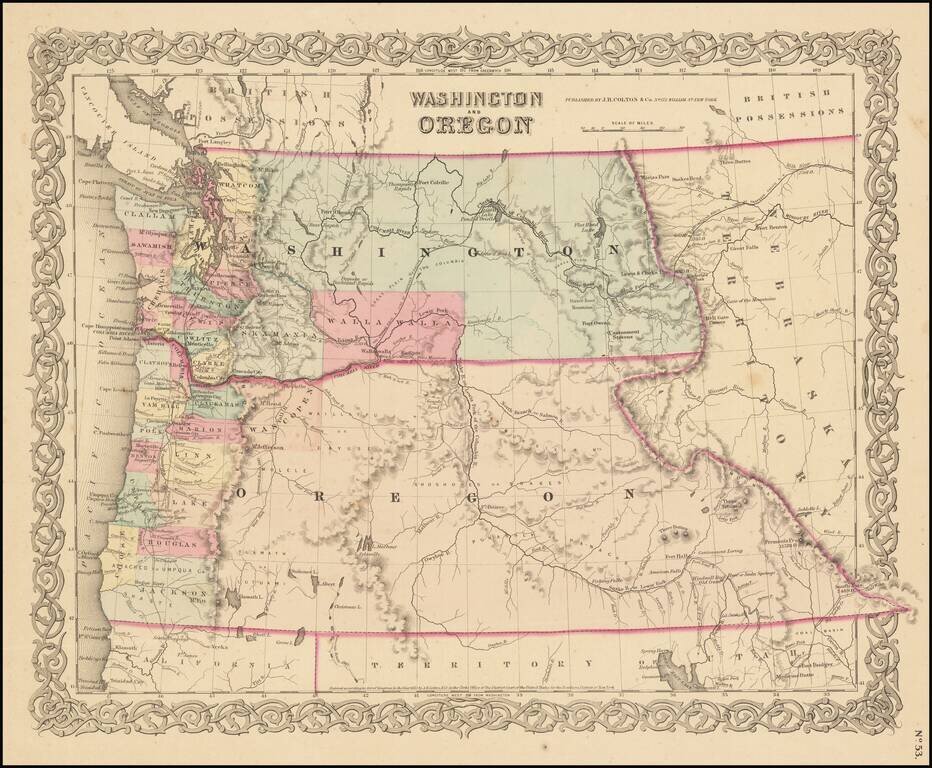
Detailed, Early Map of Oregon and Washington Territories Striking early J.H. Colton map of Oregon and Washington Territories published four years before Oregon statehood. The map is dated 1853, but it was first published in 1855. Oregon and...
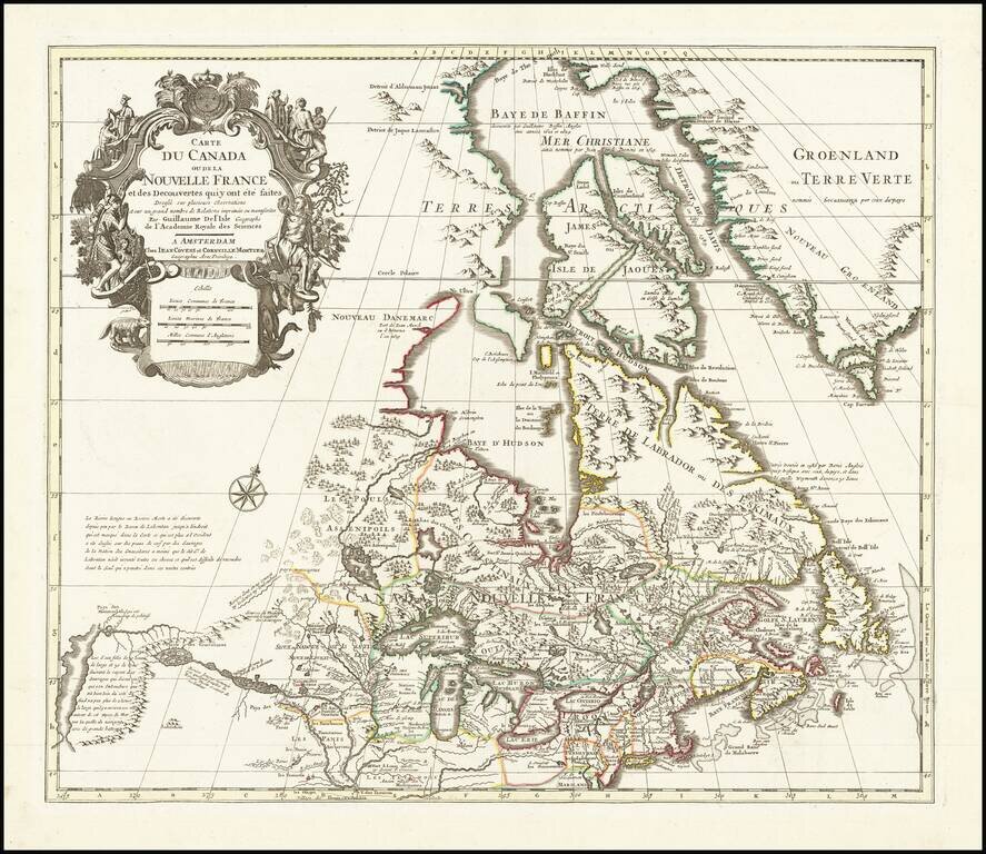
Fine example of Covens & Mortier's edition of De L'Isle's seminal map of Canada, the Great Lakes and Upper Midwest, and one of the most important and influential maps of Canada published in the 18th Century. De L'Isle's map is of seminal...
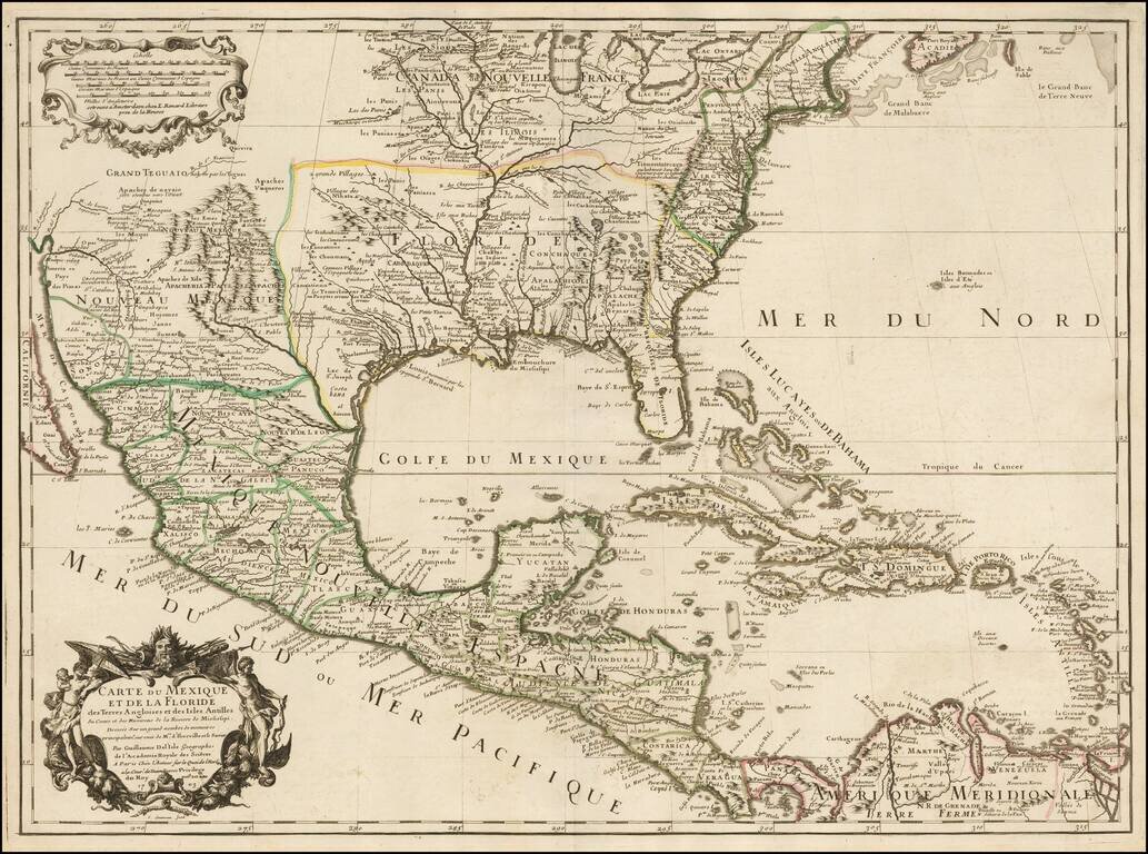
Rare Second State. Fine example of the second state of Guillaume De L'Isle's landmark map, the first printed map to accurately depict the course and mouth of the Mississippi River. De L'Isle's Carte du Mexique . . . is drawn from the reports brought...
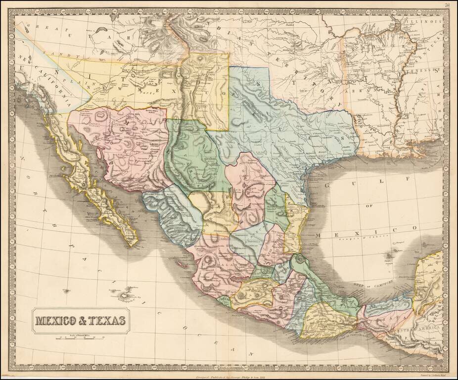
Rare map of Mexico, Texas and the Southwest, from an early edition of Philip's Imperial Atlas. This map is issued shortly before the Gadsden Purchase, and shows a very oddly configured Texas, bounded by a massive Indian Territory and New Mexico...
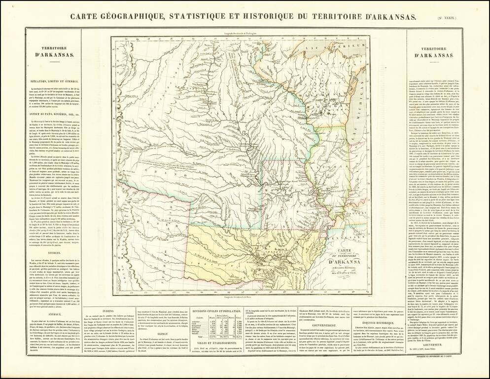
French edition of Stephen Long's seminal map of the region drained by the Arkansas, Kansas, Missouri and Mississippi Rivers, one of the most important maps of the American West. Stephen H. Long led a government expedition to the Rocky Mountains in...
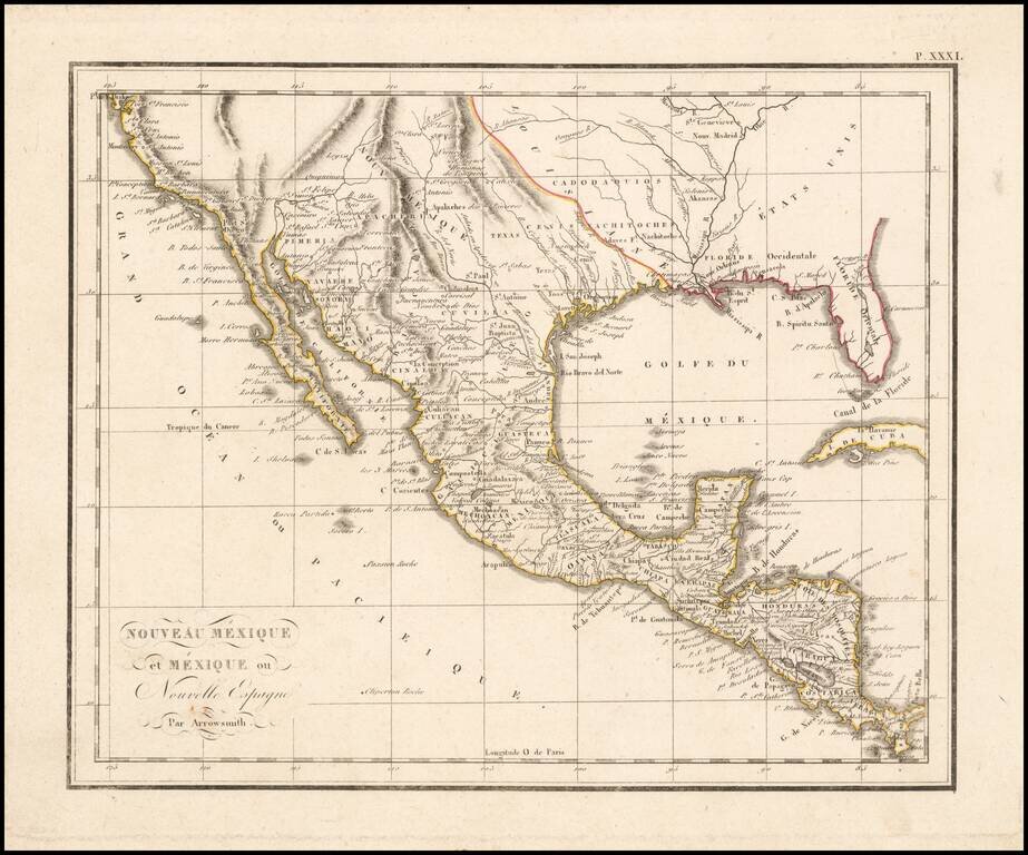
The West at the Time of the Louisiana Purchase Detailed map of Mexico and the American West, published in Paris. The map shows the limits of the United States at the Mississippi River, with Louisiana shown to the west, albeit somewhat vaguely. The...
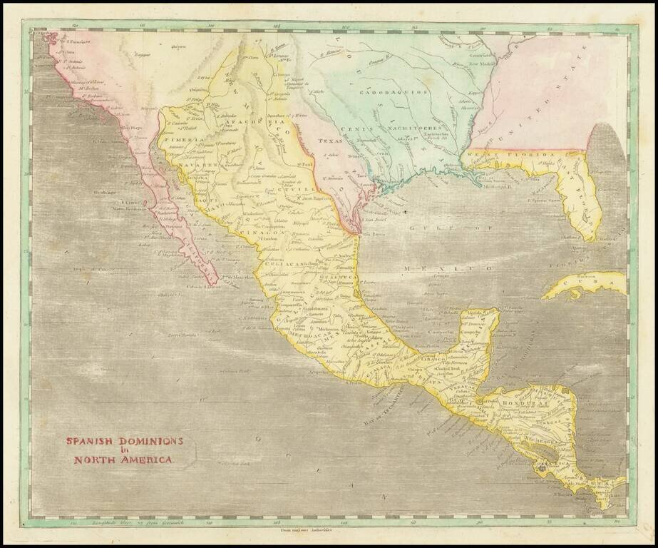
A Fascinating Pre-Louisiana Purchase Map of Texas and the Southwest Scarce early map of Mexico, Upper California, Texas and Louisiana Territory. The map extends on the west coast from San Francisco to Cabo San Lucas, with a detailed account of the...
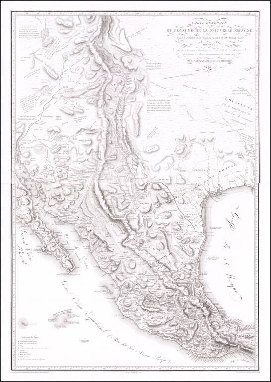
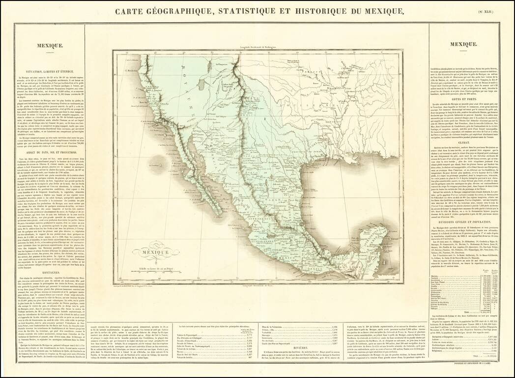
The Most Important Map of the Mexico From The Early 19th Century, By The Father of Modern Geography Nice example of Alexander von Humboldt's monumental 2-sheet map of New Spain. Humboldt's map of New Spain is the first modern geographical treatment...
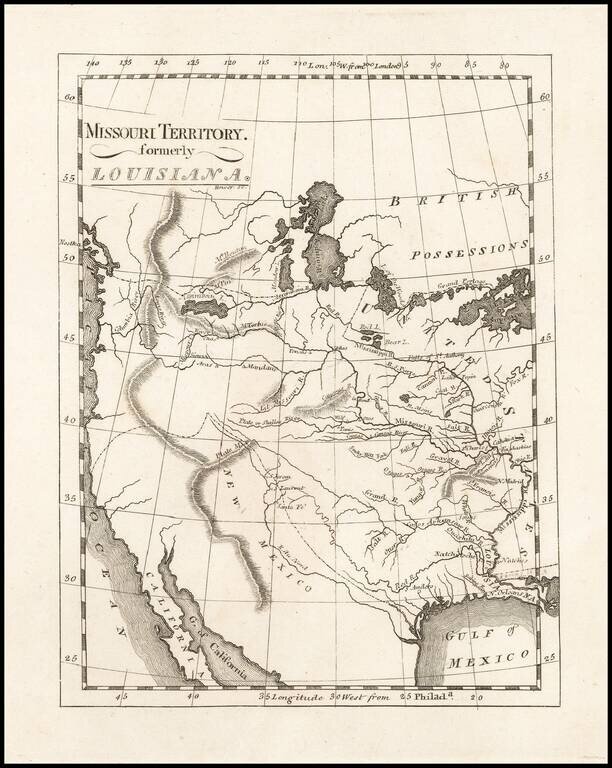
One of the Earliest Maps To Incorporate Lewis & Clark's Reports From Their Expedition Across America To The Pacific Reduced size example of Matthew Carey's map of Missouri Territory, published shortly after the return of Lewis & Clark and in...
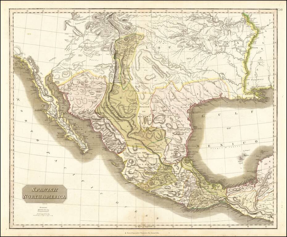
Large detailed English language map of Texas and the Southwest, published in Edinburgh by Thomson. The map is largely based upon the explorations of Humboldt and Long in the Rocky Mountains and the West. It includes extensive notes along the lower...
![[Provincia de Texas] A Map of Louisiana and Mexico. Carte de la Louisiane et Mexique . . . 1820](/map/small/39611dd.jpg)
An Early Appearance of the Provincia de Texas Rare separately issued map of Mexico, Texas, Louisiana, Mississippi, Southern California, Southern Arizona, Southern New Mexico and parts adjacent, published in Paris by Tardieu. As noted on the map This...
Mexico Shortly After Independence From Spain Striking example of Buchon's map of Texas, Upper California and Mexico, from the French edition version Carey & Lea's American Atlas. Both Lake Timpanogos and Teguayo are shown, with still a hint of a...
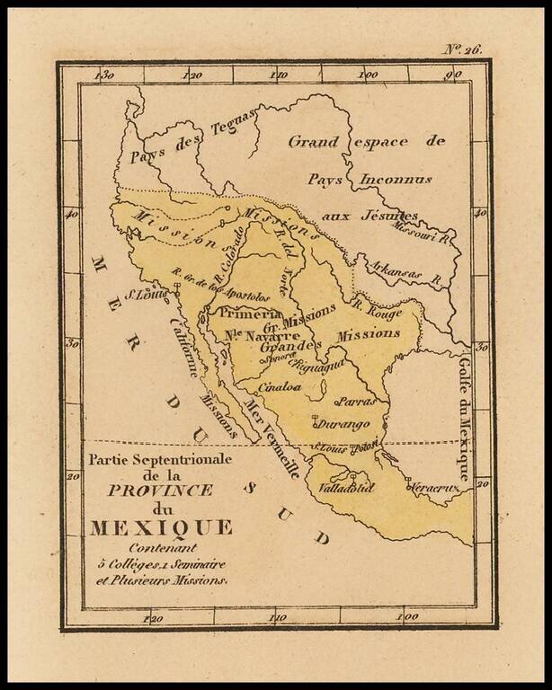
Rare map of Texas, Upper California and Mexico from Louis Denis' Atlas Universel indiquant les établissemens des Jésuites: avec la manière dont ils divisent la terre, suivi desévénemens remarquables de leur histoire. Denis' atlas illustrates the...