Map size in jpg-format: 62.0582MiB
Click to open in high resolution (open in new tab).
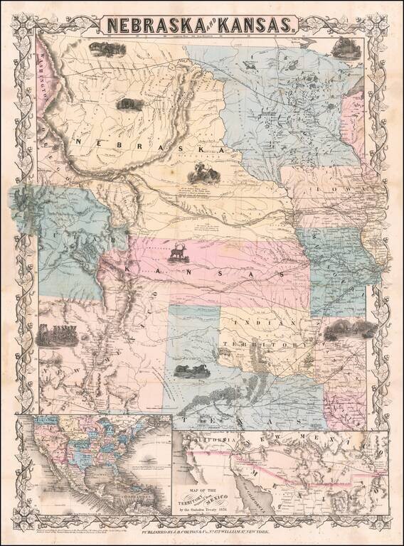
First edition, second state of this rare and important separately issued map of Kansas and Nebraska, published by J.H. Colton in New York.
Colton's map is the first printed map to show the configurations of Nebraska and Kansas after the creation of Kansas Territory. The map encompasses the territories of Nebraska and Kansas as well as the surrounding areas. It extends westward to the Great Salt Lake and to Crockett, Texas in the south with the range extended further south to El Paso in a vignette of the "Territory acquired from Mexico by the Gadsden Treaty" signed the previous year.
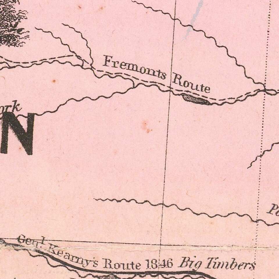
The map also includes an inset of North America and is quite detailed. Details the Sante Fe and Oregon "Routes" as well as listing both Indian and modern names for rivers and such. Also has several decorative scenes of wildlife, Indian dances and buffalo hunting and a wagon train.
One of the most sought after maps of the Transmississippi West. As noted by Rumsey (describing the first state of the first edition):
First map to show the new Kansas and Nebraska; also shows the important Gadsden Purchase of the same year. This state precedes all other copies we have seen - it is an early pull from the late 1854, early 1855 Colton Map of the United States of America... wall map plate (see our #2834, indicating it appeared in middle or late 1854 - see our 1855 wall map copy #2278 for the corrected topography), with the title different from the second 1854 state, in that the letters of Nebraska and Kansas have stars in them and are open as opposed to the black letters of the second state. Also, this first state has numerous areas that are "cleaned up" in the second state: the trail that crosses the two forks of the Colorado in southern Utah near the map edge has the word "Route" on it - this is removed in the second state; the vine border is reversed from the first to the second state; Louisiana is written straight across in the first - it curves down in the second; Bucksport and San Augustine are shown in Texas along the map southern edge in the second state and not in the first; Sacket's Well and Laguna in California in the inset map are given dots for their location in the second state but not in the first. There are other changes. Streeter shows a second edition in 1855, Heaston a third edition in 1856, but both copyrighted 1855. These have various route changes and place names added when compared to the 1854. A fourth edition appeared in 1857 (see Karrow 12-0361.2 and Graff 836) with the inset of the U.S. changed to Eastern Nebraska and Kansas.The map is quite rare on the market, this being the third example we have handled in 25 years.
If you are a student, write to us in telegram: @antiquemaps and indicate what material you need and for what work you need a map in high detail. We are ready to provide material on special terms. For students only!