Map size in jpg-format: 52.5991MiB
Click to open in high resolution (open in new tab).
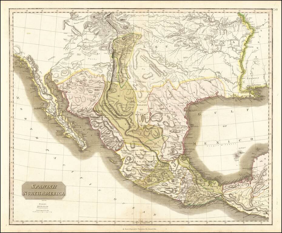
Large detailed English language map of Texas and the Southwest, published in Edinburgh by Thomson.
The map is largely based upon the explorations of Humboldt and Long in the Rocky Mountains and the West. It includes extensive notes along the lower Missouri and Lower Mississippi Rivers and remarkable detail in the Southern Rocky Mountain regions. There are two Salt Lake's and a mysterious river connecting them. Nice detail in Arizona and along the Colorado River and a nice early projection on Baja California.
The results of Zebullon Pike's explorations in the region are also in evidence.
One of the best maps of the region to appear in a commercial atlas in the first quarter of the 19th century.
John Thomson (1777-ca. 1840) was a commercial map publisher active in Edinburgh. He specialized in guide books and atlases and is primarily known for his Atlas of Scotland (1832) and the New General Atlas, first published in 1817 and reissued for the next quarter century. The New General Atlas was a commercial success—it was also published in Dublin and London—and it compiled existing geographic knowledge in compelling ways for a wide audience.
His Atlas of Scotland introduced new geographic information and was the first large-scale atlas of Scotland to be organized by county. It provided the most-accurate view of Scotland available before the Clearances. Work on the atlas began in 1820 and led to Thomson’s bankruptcy in 1830 due to the high costs of gathering the latest surveys and reviewing the required materials. Despite the publication of the atlas, Thomson declared bankruptcy again in 1835.
If you are a student, write to us in telegram: @antiquemaps and indicate what material you need and for what work you need a map in high detail. We are ready to provide material on special terms. For students only!


