logo

1860. Map Showing the Routes travelled by the Command of Maj. E. Steen, U.S. Dragn. against the Snake Indians in 1860 by Lieut Joseph Dixon U.S. Topl. Engrs. from explorations and surveys made by him while attached to this Command . . .

  • Map Showing the Routes travelled by the Command of Maj. E. Steen, U.S. Dragn. against the Snake Indians in 1860 by Lieut Joseph Dixon U.S. Topl. Engrs. from explorations and surveys made by him while attached to this Command . . .

Map Showing the Routes travelled by the Command of Maj. E. Steen, U.S. Dragn. against the Snake Indians in 1860 by Lieut Joseph Dixon U.S. Topl. Engrs. from explorations and surveys made by him while attached to this Command . . . information:

Year of creation: 
Resolution size (pixels): 
 2756x2014 px
Disk Size: 
 1.08836MiB
Number of pages: 
 1
Place: 
 Washington
Author: 

Print information. Print size (Width x height in inches):
Printing at 72 dpi 
  38.28 х 27.97
Printing at 150 dpi 
 18.37 х 13.43
Printing at 300 dpi 
 9.19 х 6.71

An example of detailing the file of this map of in a printable high-resolution:

Click to open in high resolution (open in new tab).
Attention! this is just the central piece (central area 960x960 px) of the map file!
This is an example, so that you can see and study the level of detail of a given map. The entire Map will be fully available after payment!

Map Showing the Routes travelled by the Command of Maj. E. Steen, U.S. Dragn. against the Snake Indians in 1860 by Lieut Joseph Dixon U.S. Topl. Engrs. from explorations and surveys made by him while attached to this Command . . .

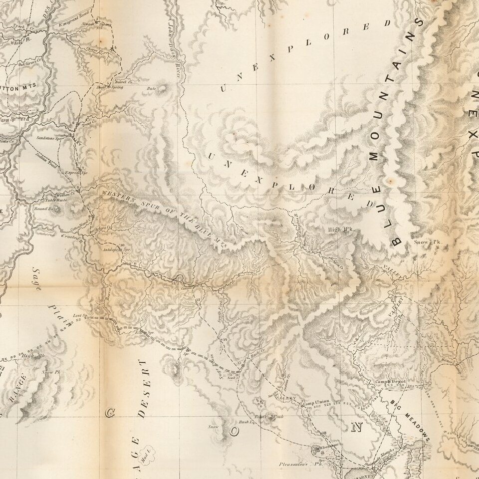
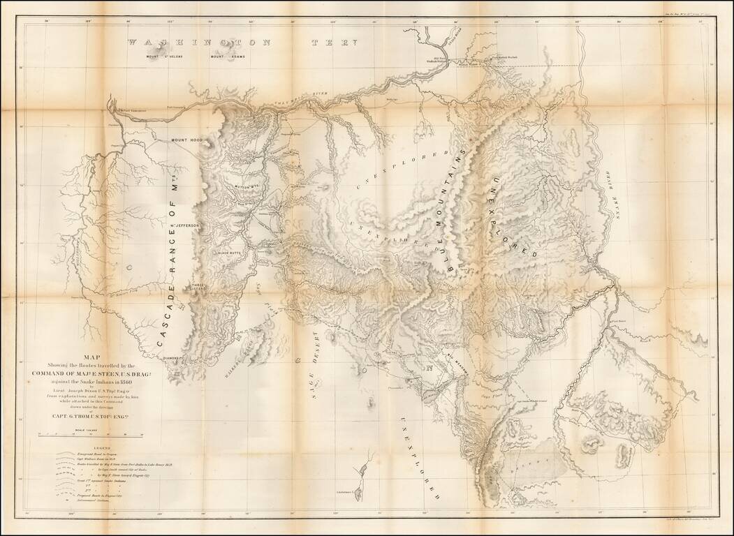
Important early map of Eastern Oregon, bounded by the Willamette, Columbia, and Snake Rivers.

Major Enoch Steen, commander of the U.S. Dragoons, was sent to the area in 1860 to determine the feasibility of routes from the Willamette Valley to southeastern Oregon. However, Steen's historical fame rests on his pursuit, during the expedition, of Paiute (Snake) Indians up the Donner and Blitzen River and into the rough Wildhorse Canyon. According to Wheat, "this was a decisive campaign; the Snakes were defeated and their movements rigorously curtailed."

Steen's report to the Senate of his explorations in Oregon included this highly detailed map by Joseph Dixon. The map depicts the area from Fort Boise on the Snake River, west to Fort Vancouver on the Columbia River. It details the routes of Steen and several scouts against the Snake Indians, as well as showing the Oregon Trail (Emigrant Road), the proposed route to Eugene City, Indian trails, camps, battlegrounds, forts, astronomical stations, topography, and rivers, and it notes several large unexplored regions of the Blue Mountains.

Originally bound into Steen's Topographical Memoir of the Command Against the Snake Indians, under Major E. Steen, United States Dragoons, in the Summer of 1860.


Special conditions for students!

If you are a student, write to us in telegram: @antiquemaps and indicate what material you need and for what work you need a map in high detail. We are ready to provide material on special terms. For students only!

Item information:

Year of creation:
Size:
2756x2014 px
Disk:
1.08836MiB
Number of pages:
1
Place:
Washington
Author:
U.S. War Department.
$14.99

Related item