Map size in jpg-format: 688662B
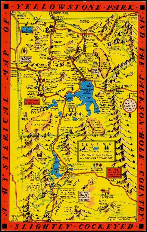
"Drawn in Broken English by Jolly Lindgren," this comic pictorial map is full of puns and comic vignettes related to Yellowstone and environs.
The Lindgren brothers issued a number of other silly whimsical maps of national parks and other parts of the west.
The present example is one of at least 2 Yellowstone maps by the Lindgren brothers, this being the other edition of which we are aware: /gallery/detail/18355
If you are a student, write to us in telegram: @antiquemaps and indicate what material you need and for what work you need a map in high detail. We are ready to provide material on special terms. For students only!

![Carte Du Mexique et de la Floride des Terres Angloises et des Isles Antilles du Cours et des Environs de la Riviere Mississipi . . . Rue Des Canettes . . . 1703 [1st State]](/map/small/66307op.jpg)