logo

1862. Johnson's Washington & Oregon

  • Johnson's Washington & Oregon

Johnson's Washington & Oregon information:

Year of creation: 
Resolution size (pixels): 
 10061x8302 px
Disk Size: 
 23.9069MiB
Number of pages: 
 1
Place: 
 New York

Print information. Print size (Width x height in inches):
Printing at 72 dpi 
  139.74 х 115.31
Printing at 150 dpi 
 67.07 х 55.35
Printing at 300 dpi 
 33.54 х 27.67

An example of detailing the file of this map of in a printable high-resolution:

Click to open in high resolution (open in new tab).
Attention! this is just the central piece (central area 960x960 px) of the map file!
This is an example, so that you can see and study the level of detail of a given map. The entire Map will be fully available after payment!

Johnson's Washington & Oregon

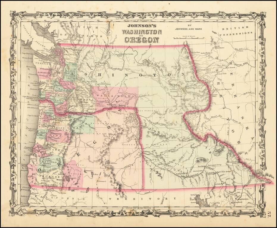
Scarce early edition of Johnson's Washington & Oregon.

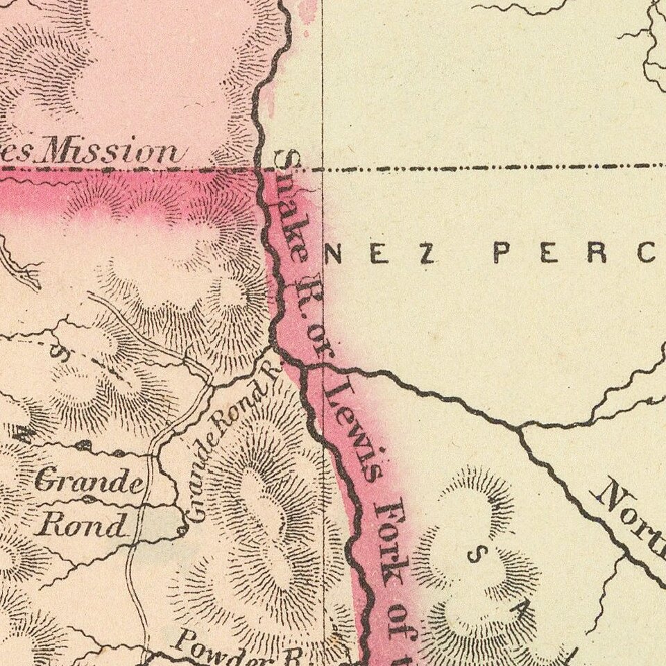
The map is colored by counties. Washington wraps around Oregon to the east of the Oregon State line, including the yet to be formed Idaho Territory. Includes many Indian tribes, forts, roads and early topographical notes. A few early counties east of the Cascades are just appearing, including Skamania, Walla Walla, Josephine and Wasco.

One of the great early ephemeral state/territorial configurations of the Northwest. An essential map for collectors of the region.

States of the Map

There are 9 Johnson & Ward states of the map between 1862 and 1865:

  • State 1: 1862 - Page 53
  • State 2: 1862-63 - Page 57; no text on verso
  • State 3: 1863 - Page 57; Historical and Statistical View of US on verso
  • State 4: 1863 - Page 57; The trail from Boise to South Pass is again a solid line; ID shown
  • State 5: 1863 - Page 57; New counties- WA: Kitsap, Spokane, Klickitat, Snohomish; OR: Umatila, Baker; ID: Nez Perce, Idaho, Missoula, and Shoshone.
  • State 6: 1863-64 - Page 57; :British Columbia” for “British Possessions” in W Canada
  • State 7: 1864 - Page 65;
  • State 8: 1864 - Page 65; “British Columbia” in western CA changed to “British Columbia Possessions”; In title “Idaho” is in dark black, non-italic outlined letters
  • State 9: 1864-65 - Page 65; ID state line present and “IDAHO” is within the state; “DAKOTA TERRITORY” now “MONTANA”; “NEBRASKA” gone, “DAKOTA” now printed horizontally just above 44th parallel; New counties- MT: Missoula- moved for ID
Ira Lurie: http://www.johnsonmapproject.org/map-identifier.php

Special conditions for students!

If you are a student, write to us in telegram: @antiquemaps and indicate what material you need and for what work you need a map in high detail. We are ready to provide material on special terms. For students only!

Item information:

Year of creation:
Size:
10061x8302 px
Disk:
23.9069MiB
Number of pages:
1
Place:
New York
Author:
Benjamin P Ward. Alvin Jewett Johnson.
$14.99

Related item