Map size in jpg-format: 87.0698MiB
Click to open in high resolution (open in new tab).

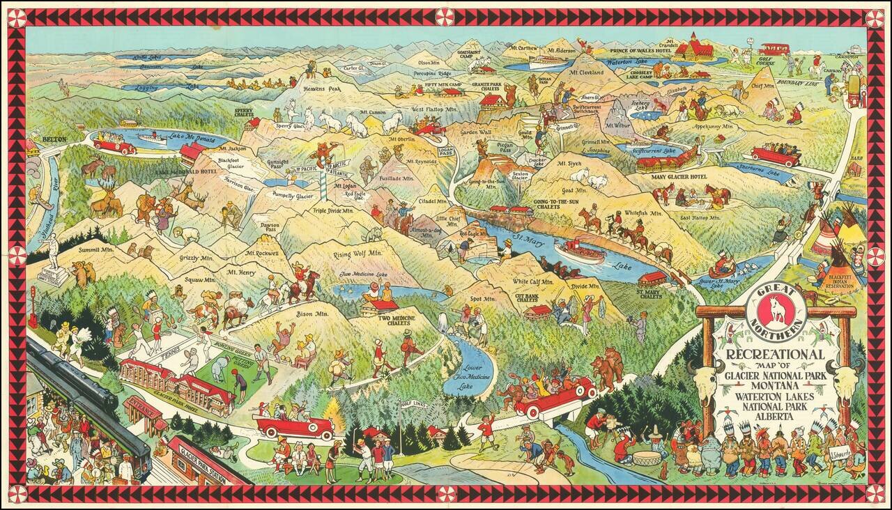
Fine early pictorial map promoting the Great Northern Railway.
The map includes a lively offering of park scenes, including Grizzly Bears confronting tourists on a bridge, yacht rides in the major lakes, and another Grizzly Bear dumping Champagne (?) bottles atop a sign post above Triple Divide Mountain.
The arrival point for the railroad is cheerfully and accessibly placed at the bottom right, with hiking, automobile and horseback treks shown throughout the map. Others scenes show Native Americans, golf and film makers.
Rumsey notes:
Joe Scheuerle was apprenticed to a lithographer and afterwards employed as a commercial artist. He specialized in drawing Indians for posters. In 1900 he moved to Chicago, where he worked as an illustrator and produced Buffalo Bill posters. He made trips West, painting the Sioux Indians in 1909, the Crow and Blackfoot in 1910, the Cheyenne in 1911 and others. He was a friend of C.M. Russell, Gollings, and de Young.If you are a student, write to us in telegram: @antiquemaps and indicate what material you need and for what work you need a map in high detail. We are ready to provide material on special terms. For students only!

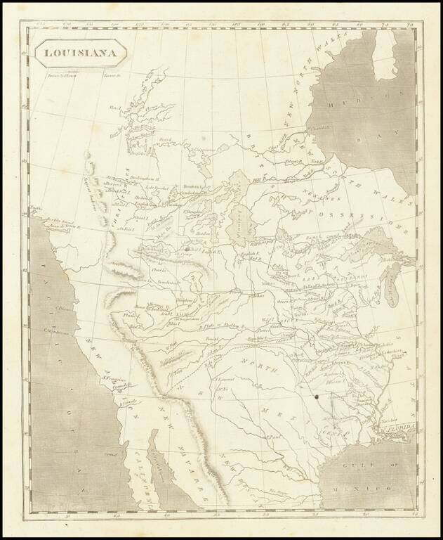
![Carte Du Mexique et de la Floride des Terres Angloises et des Isles Antilles du Cours et des Environs de la Riviere Mississipi . . . Rue Des Canettes . . . 1703 [1st State]](/map/small/66307op.jpg)