logo

1917. State of Iowa. Compiled from the official Records of the General Land Office . . . 1917

  • State of Iowa. Compiled from the official Records of the General Land Office . . . 1917

State of Iowa. Compiled from the official Records of the General Land Office . . . 1917 information:

Year of creation: 
Resolution size (pixels): 
 20839x13602 px
Disk Size: 
 84.4022MiB
Number of pages: 
 1
Place: 
 Washington, D.C.

Print information. Print size (Width x height in inches):
Printing at 72 dpi 
  289.43 х 188.92
Printing at 150 dpi 
 138.93 х 90.68
Printing at 300 dpi 
 69.46 х 45.34

An example of detailing the file of this map of in a printable high-resolution:

Click to open in high resolution (open in new tab).
Attention! this is just the central piece (central area 960x960 px) of the map file!
This is an example, so that you can see and study the level of detail of a given map. The entire Map will be fully available after payment!

State of Iowa. Compiled from the official Records of the General Land Office . . . 1917

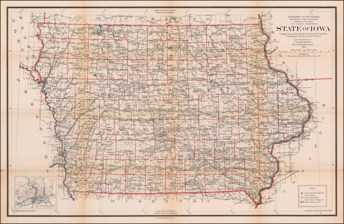
Highly detailed map of Iowa, published by the General Land Office.

Shows county boundaries and railroad land-grant limits are shown in color.

Also shows Private Claims, county names, public land surveys, towns, principal railroad stations, post offices, canals, railroad lines, and physical features.


Special conditions for students!

If you are a student, write to us in telegram: @antiquemaps and indicate what material you need and for what work you need a map in high detail. We are ready to provide material on special terms. For students only!

Item information:

Year of creation:
Size:
20839x13602 px
Disk:
84.4022MiB
Number of pages:
1
Place:
Washington, D.C.
Author:
U.S. General Land Office.
$21.99

Related item