Map size in jpg-format: 5273760B
Click to open in high resolution (open in new tab).
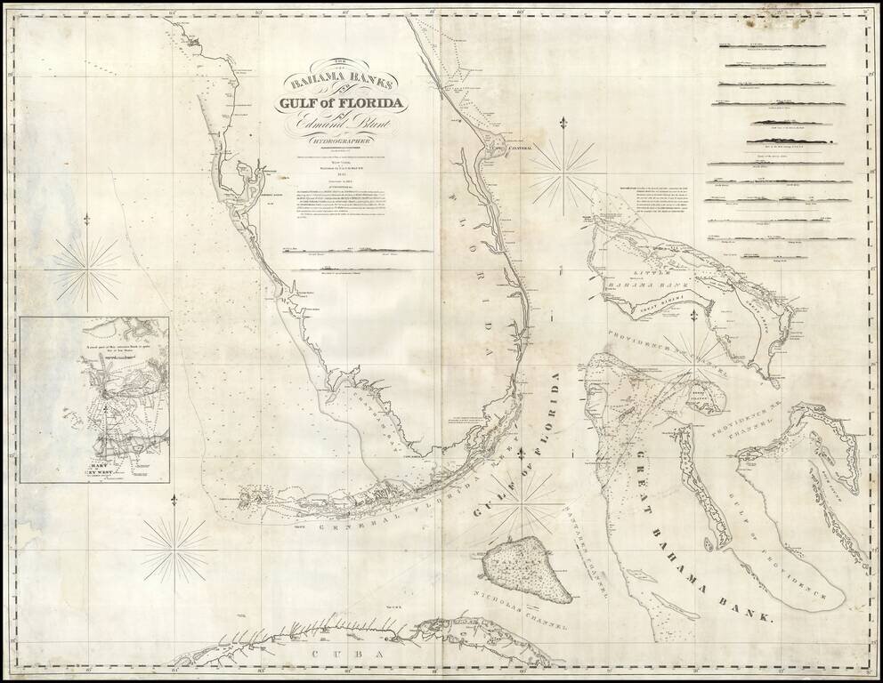
Rare early state of Blunt's sea chart of Florida and the Bahamas, first published in 1833.
Nice coverage of the Bahama Islands. Has a small inset chart of Key West and twelve small recognition views of coastal approaches.
The Coastline of Florida is still sparsely known and highly inaccurate. Even the general shape of the coastline is far wider than its final form. Over the next 15 years, the results of the United States Coast Survey work in the region would radically reshape the coastline and immediate interior features, as the inland waterways, swamps and lowlands became better understood.
If you are a student, write to us in telegram: @antiquemaps and indicate what material you need and for what work you need a map in high detail. We are ready to provide material on special terms. For students only!

![[Wall Map] West-Indische Paskaert waer in de graden der breedde over weder zyden vande middelyn wassende so vergrooten dat die geproportioneert syn tegen hunne nevenstaende graden de lengde.](/map/small/60169.jpg)
