Map size in jpg-format: 41.832MiB
Click to open in high resolution (open in new tab).

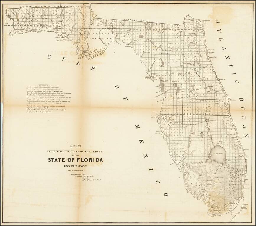
Fine example of this large format map of Florida, showing the extent of the surveys in the state of Florida.
Shows extensive detail throughout Florida, including towns, forts, lakes, rivers, the Arredondo Grant, swamps, lighthouses, landings, etc.
Approved by John Wescott, Surveyor General St. Augustine, September 30th, 1853.
Other editions of the map include the Florida Keys as a part of the main map or an inset, but this edition has neither.
If you are a student, write to us in telegram: @antiquemaps and indicate what material you need and for what work you need a map in high detail. We are ready to provide material on special terms. For students only!

![[Wall Map] West-Indische Paskaert waer in de graden der breedde over weder zyden vande middelyn wassende so vergrooten dat die geproportioneert syn tegen hunne nevenstaende graden de lengde.](/map/small/60169.jpg)
