
Rare old maps of the United States.
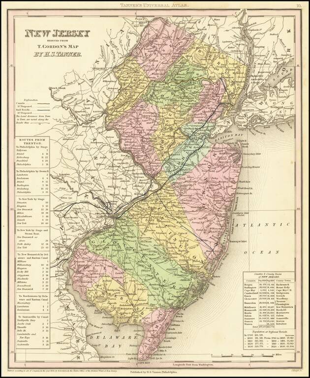
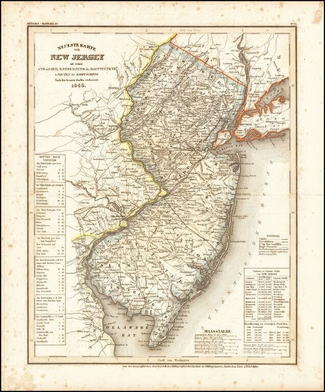
A detailed and attractive map of New Jersey, hand-colored by county, showing roads, canals, towns, steamship routes and other interesting details. Includes railroads and proposed railroads and a number of tables of distances, stage routes, canal...
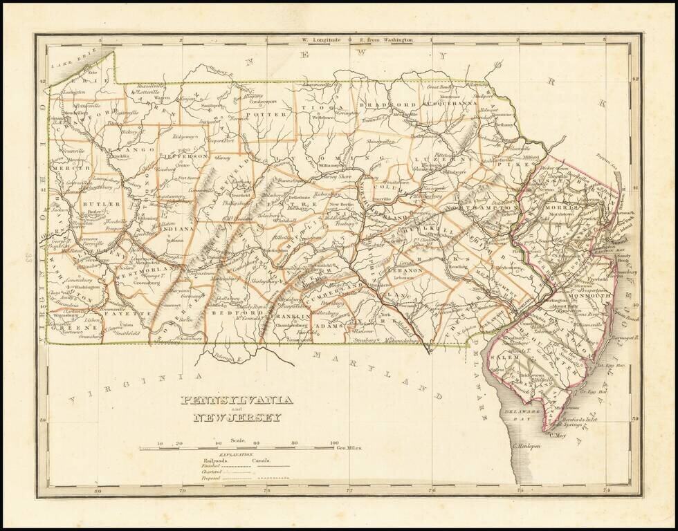
Early map of Pennsylvania and New Jersey, from an early edition of Bradford's Comprehensive Atlas. The map is colored by counties and shows towns, rivers, lakes, bays, harbors, islands and other important places. Bradford's Comprehensive Atlas...
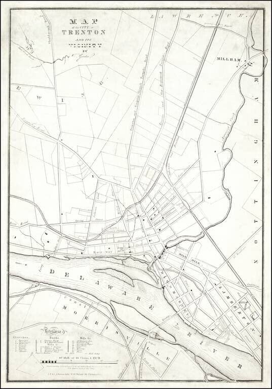
A Trenton Rarity One of the earliest printed maps of Trenton, New Jersey, by one its most important early mapmakers. The map was lithographed by "J.F. & C.A. Watson, Lithrs. No. 62 Walnut Street Philadelphia." The map credits "T Gordon." This...
Marvelous and highly detailed map of New Jersey. Shows towns, roads, rivers, townships, etc. Morse & Breese's North American Atlas was a landmark in American Cartography, being the first atlas to employ the cerographic printing process, which...
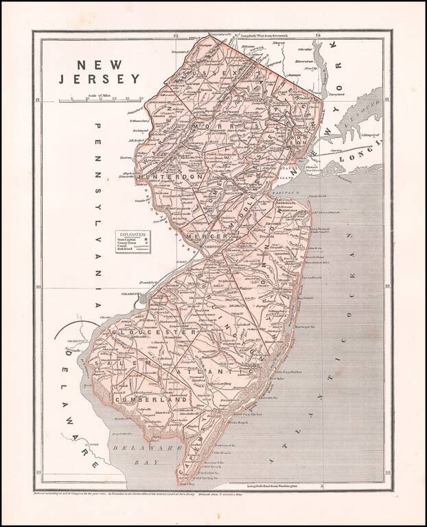
An elegantly engraved and highly detailed map of New Jersey, based upon Tanner's work in the early 1840s. Shows counties, towns, roads, canals, lakes, etc.
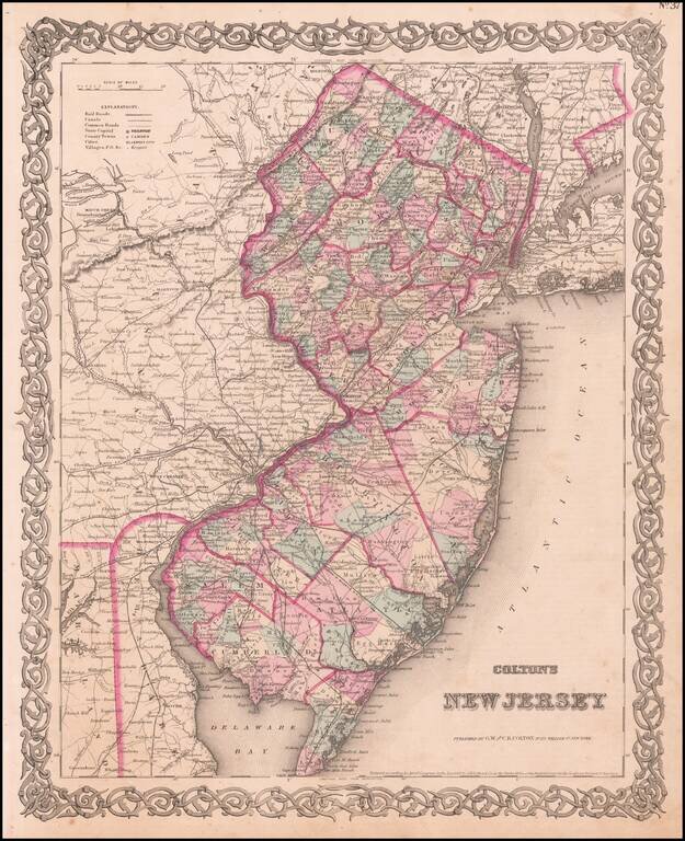
Attractive map of the state, hand colored by counties. Shows towns, rivers, railroads, train stations, islands, some townships, and other fine details. A wide margined example in vivid color. This is the rare 1859 edition which bears Johnson &...
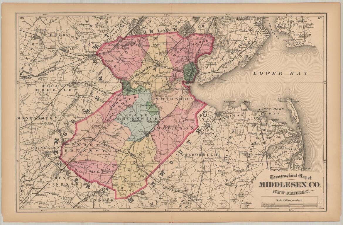
Detailed map of Middlesex County, hand colored by townships.
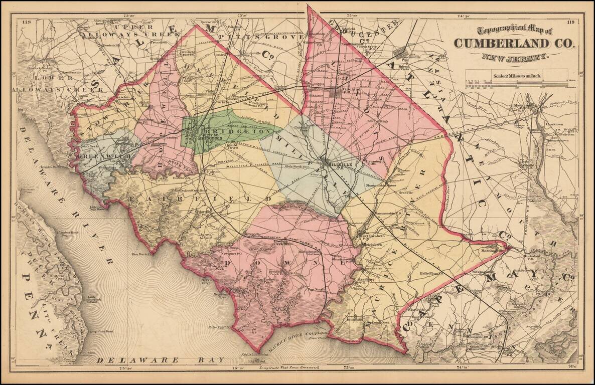
Detailed map of Cumberland County, from Beers Atlas of New Jersey.
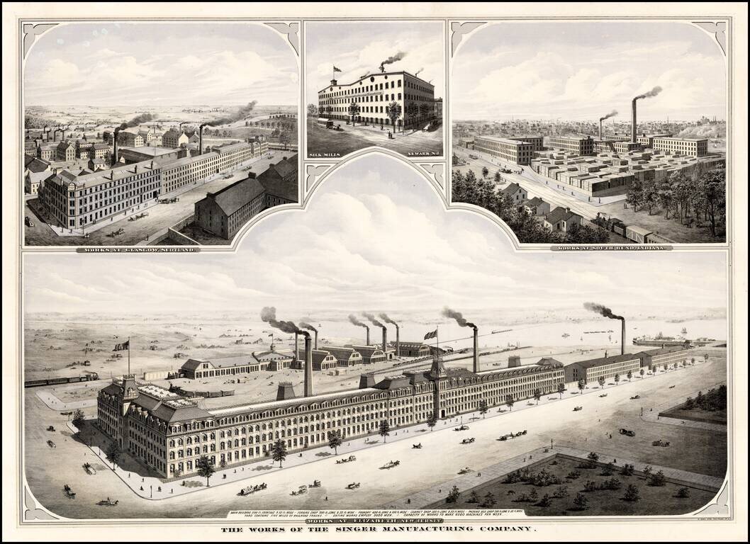
Striking view of the Singer Manufacturing works at Elizabeth, New Jersey. Includes smaller views showing Singer's Silk Mills in Newark, N.J. and its works in Glasgow, Scotland and South Bend, Indiana.
![[Englewood, New Jersey] Commissoner's Sale of Real Estate! By virtue of an order of the Bergen County Orphan's Court . . . Saturday, April 20, 1889 . . . Englewood, N. J . . . Estate of J. L. Cooper . . .](/map/small/50595.jpg)
Early land sale broadside, promoting the sale of Land in Englewood, New Jersey in 1889. The property is located at the intersection of James Street and Palisade Avenue, close to the current location of the Bergen Performing Arts Center.
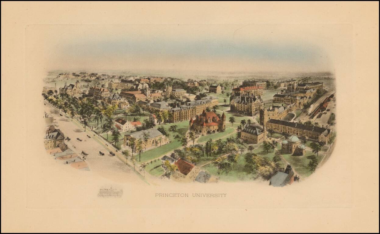
Marvelous early birdseye view of Princeton University. At the turn of the century, Littig & Company commissioned a number of artists, including the accomplished artist Richard Rummell (1848-1924), to create watercolors of some of the nations most...
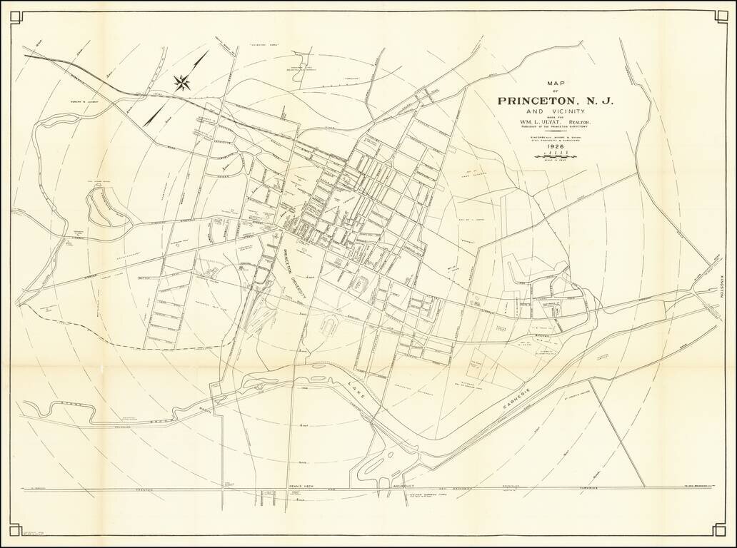
Rare map of Princeton, published in 1926. The map is oriented with Northwest at the top, with concentric circles radiating out from the center of town in 1/4 miles increments. Princeton and many other landmarks located.
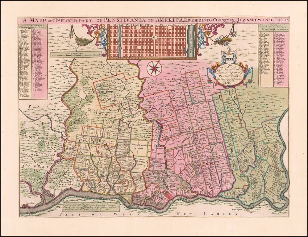
Holme's Map of Philadelphia in Deluxe Contemporary Dutch Color Extraordinary map of the area around Philadelphia, as surveyed by Thomas Holme at the request of William Penn. Offered here in extraordinary original color, quite possibly the finest...
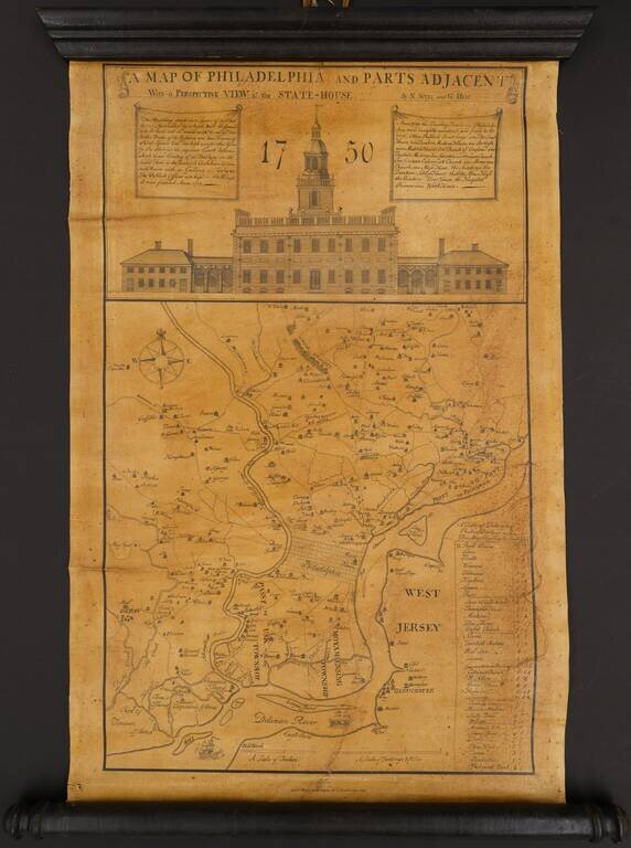
An Interesting Mid-Century Lithographic Edition of the Scull & Heap Philadelphia Interesting Wagner & McGuigan edition of Scull & Heap's seminal Philadelphia map. When first issued in 1752, the famous Scull and Heap plan was intended to...
![[Untitled map of part of Maryland, southeastern Pennsylvania, and the upper Del-Mar-Va Peninsula]](/map/small/35176.jpg)
Important early American map, depicting the prospective road and canal routes linking the Delaware and Chesapeake Bays. The focal point of the map is transportation in the Mid-Atlantic Colonies. Solid lines indicate three proposed canal routes between...
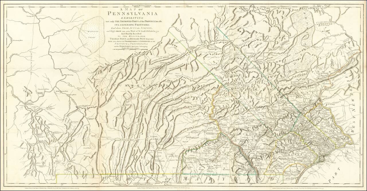
The Province of Pennsylvania on the Eve of the American Revolution Important Revolutionary War-era map of Pennsylvania, compiled by Sayer & Bennett, primarily from William Scull's landmark map. This large and impressive map of the colony of...