
Rare old maps of the United States.
![Delaware and Maryland [with large District of Columbia Inset]](/map/small/51024.jpg)
First edition of Colton's map of Delaware and Maryland. Detailed map of Delaware and Maryland, colored by counties. Shows towns, roads, railroads, rivers, etc. Inset of District of Columbia. Decorative border.
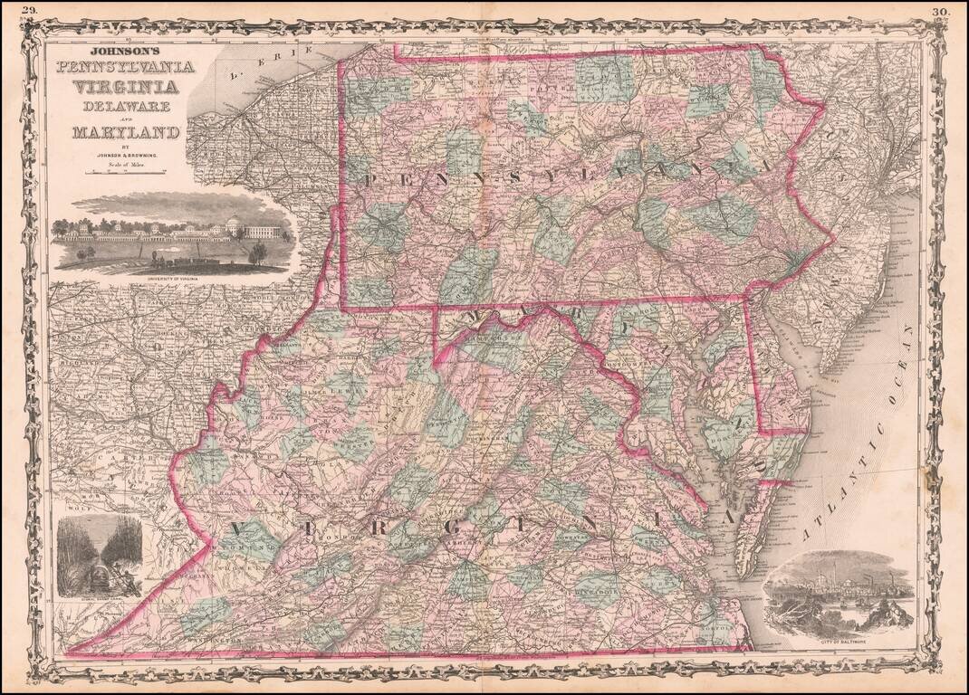
Highly detailed regional map, hand colored by counties, with 3 large vignettes.
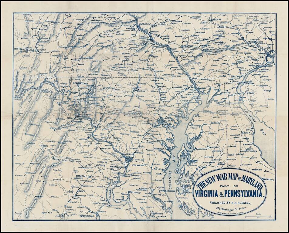
Rare separately issued map of the Mid-Atlantic theater of the American Civil War, published in Boston by Mayer & Co. The map extends south to Fredericksburg and Fairfax and north to Harrisburg and Reading and East to Philadelphia and Delaware Bay,...
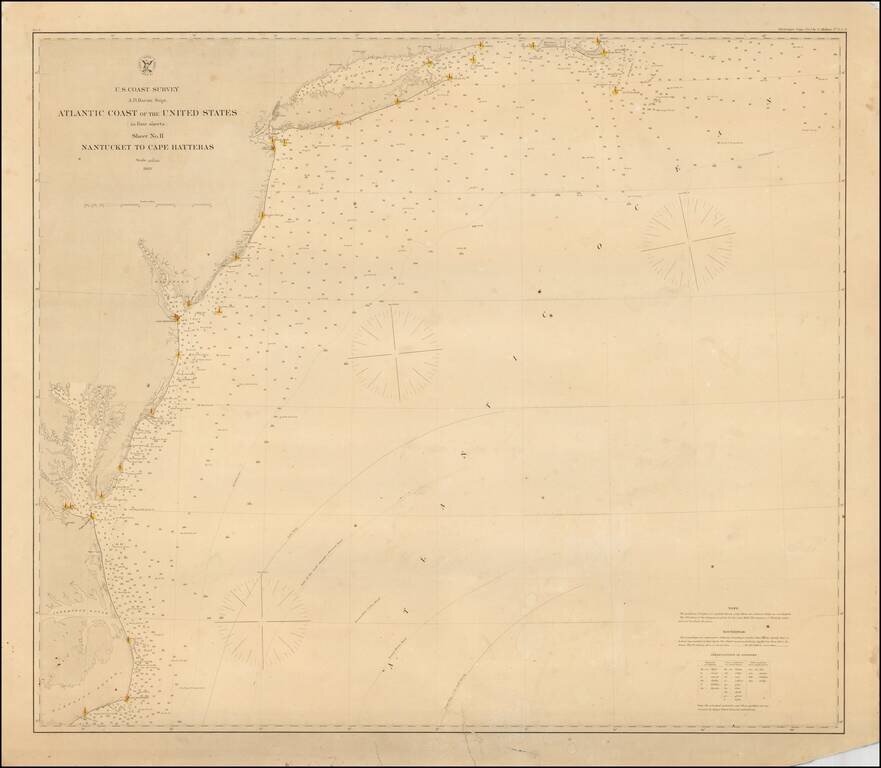
Rare separately issued coastal chart of the Coast of the United States, from Nantucket to Cape Hatteras. Includes lighthouses, soundings, place names, notes and sailing directions. The present example is published on thick paper and was never folded,...
Extremely rare separately issued chart of the eastern part of the United States, from Long Island to Cape Fear, published in New York by Charles Copley. Includes an extensive table of tides and inset maps showing bays and entrances, including...
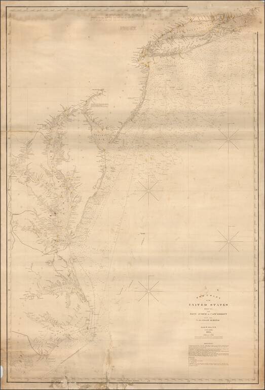
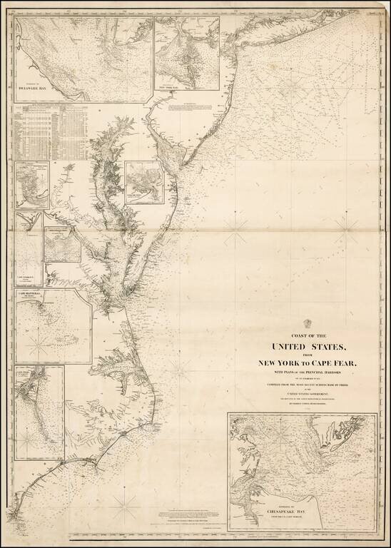
Fine large format sea chart of the coastline from Long Island Sound to the Outer Banks of North Carolina, published by Blunt in New York City, the most famous of American Chart makers of the period. The map shows light houses, light ships and channel...
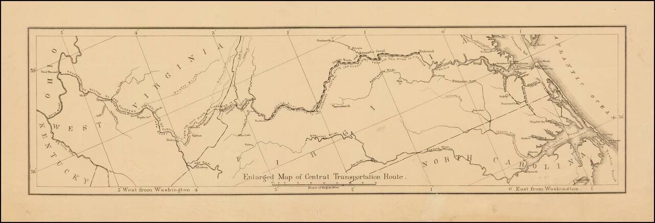
Detailed map showing the ransportation routes from the Ohio River to the James River. The map is ordinarily one of 4 maps on a single sheet. This example is likely an offprint, which was issued separately.
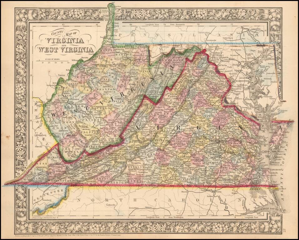
Detailed map of Virginia and West Virginia, hand colored by county, showing towns, roads, railroads, rivers, mountains, forts, etc. All counties except Mingo, Lincoln, Summers, Mineral, and Grant are shown in West Virginia.
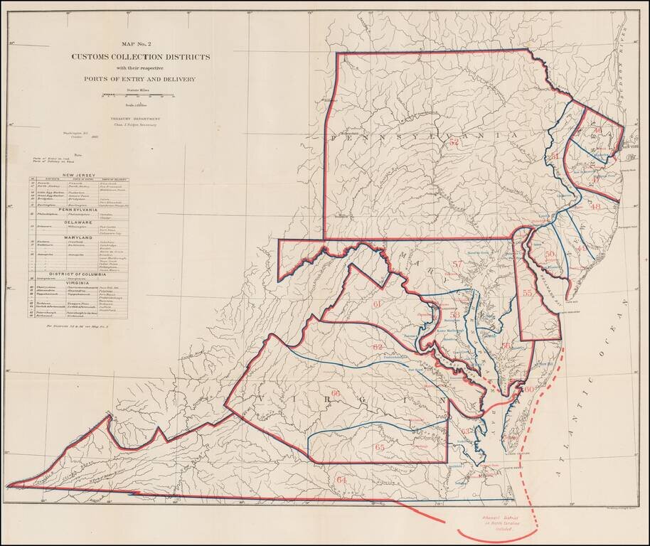
Rare Treasury Department Map of the Mid-Atlantic Region, identifying the customs port of entry. The following are annotated: Ports of Entry (red) Ports of Delivery (blue) The table identifies about 40 different ports districts. A fascinating...
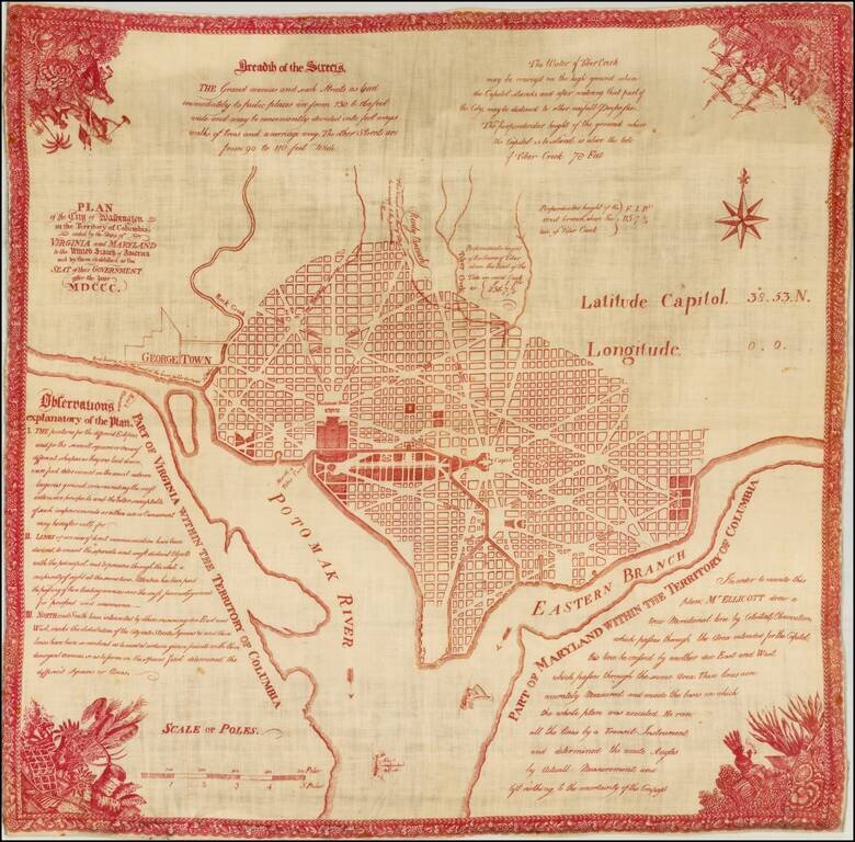
Near flawless example of the souvenir edition Hill's Plan of Washington, printed in red on linen. Hill's Plan of Washington is the earliest official map of the City of Washington, pre-dated only by the pirated miniature magazine edition of the Hill...
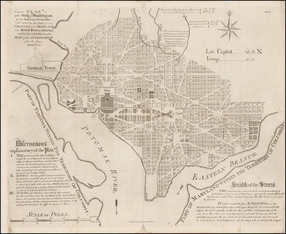
Scarce engraved folding map of Washington, D.C., representing one of the earliest derivations of Samuel Hill's version of the Ellicott plan. In January 1791, President Washington announced that the capital district would be a diamond-shaped tract, 10...
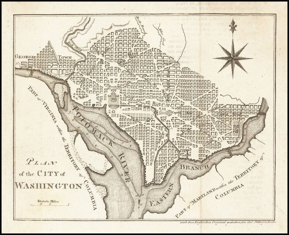
Rare German edition of this finely engraved early plan of Washington DC, based upon Andrew Ellicott's plan of 1792. Shows Georgetown, the street layout, President's House, Capitol, large green, etc. Attractive compass rose. The map is copied from...
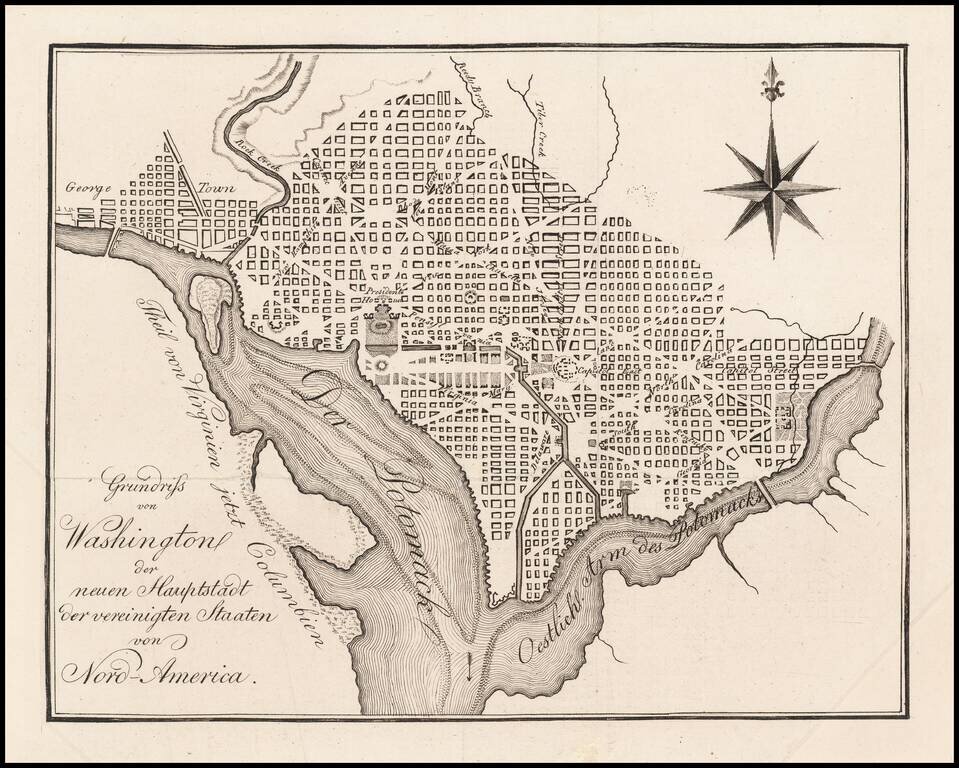
Rare German map of Washington DC, based upon Andrew Ellicott's plan, first published in 1792. The map appeared in Zimmermann's rare Taschenbuch der Reisen...
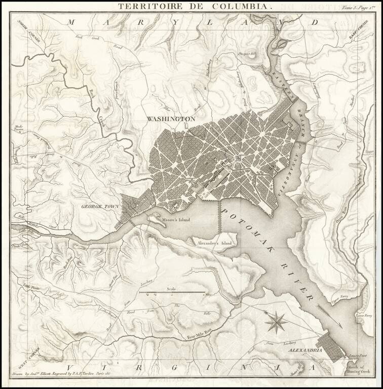
Rare Map of the District of Columbia, "Drawn by Andw. Ellicott" and "Engraved by P.A.F. Tardieu" in Paris. Scarce French edition of Tardieu's detailed map of the Territory of Columbia, showing the extent of the entire Territory, along with an early...
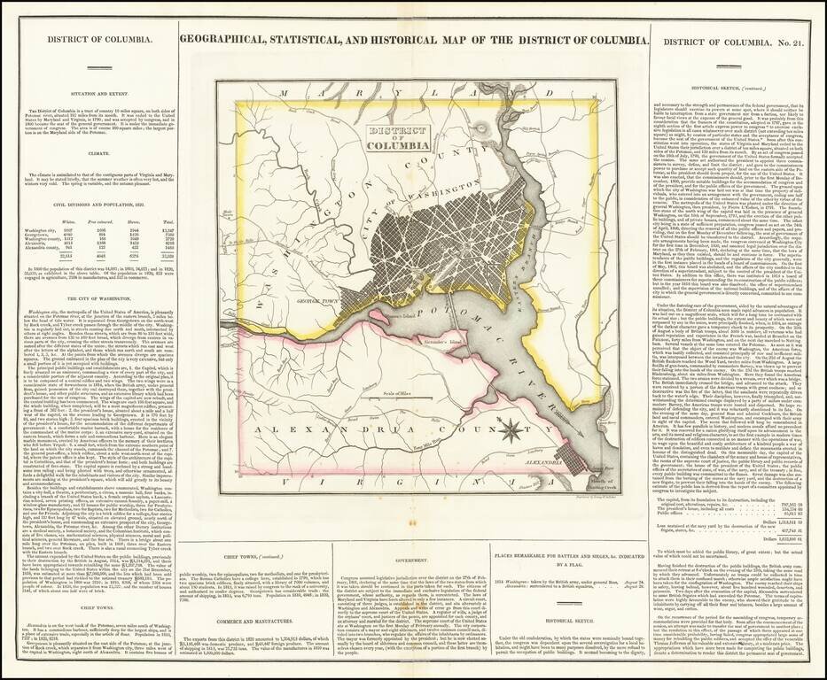
One of the earliest obtainable maps of the District of Columbia to appear in a commercial atlas. Includes a detailed plan of Washington DC, Georgetown and Alexandria and a number of roads and rivers in the District. Muds Tavern is shown just outside...
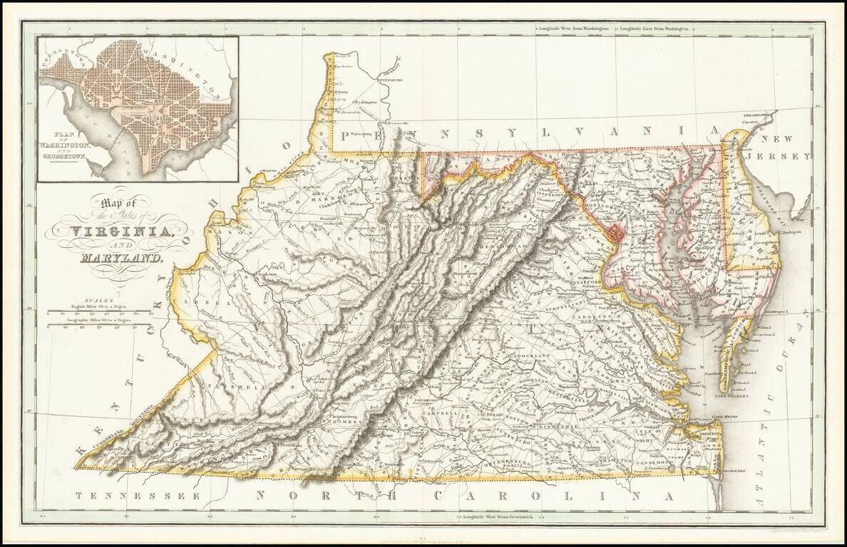
Scarce early map of Virginia and Maryland, showing counties, rivers, towns, mountains, lakes, etc. Includes early roads. This is one of the earliest British publications to show the US by states. Inset of Washington DC.