
Rare old maps of the United States.
![A View and Plan of Mud Island on the Delaware [One of the First Depictions of an American Flag]](/map/small/65207.jpg)
Revolutionary War Manuscript Map of Fort Mifflin, with a very early Drawing of an American Flag Finely-executed Revolutionary War manuscript plan and view of Fort Mifflin on Mud Island on the Delaware River, just below Philadelphia, including a fine...
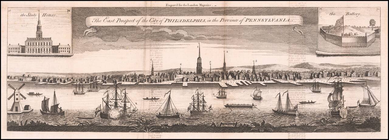
The Earliest Reasonably Obtainable View of Philadelphia Fine large format view of Philadelphia, with inset views of the State House and Battery, which appeared in the London Magazine. The view is based on George Heap's famed drawing of the City,...
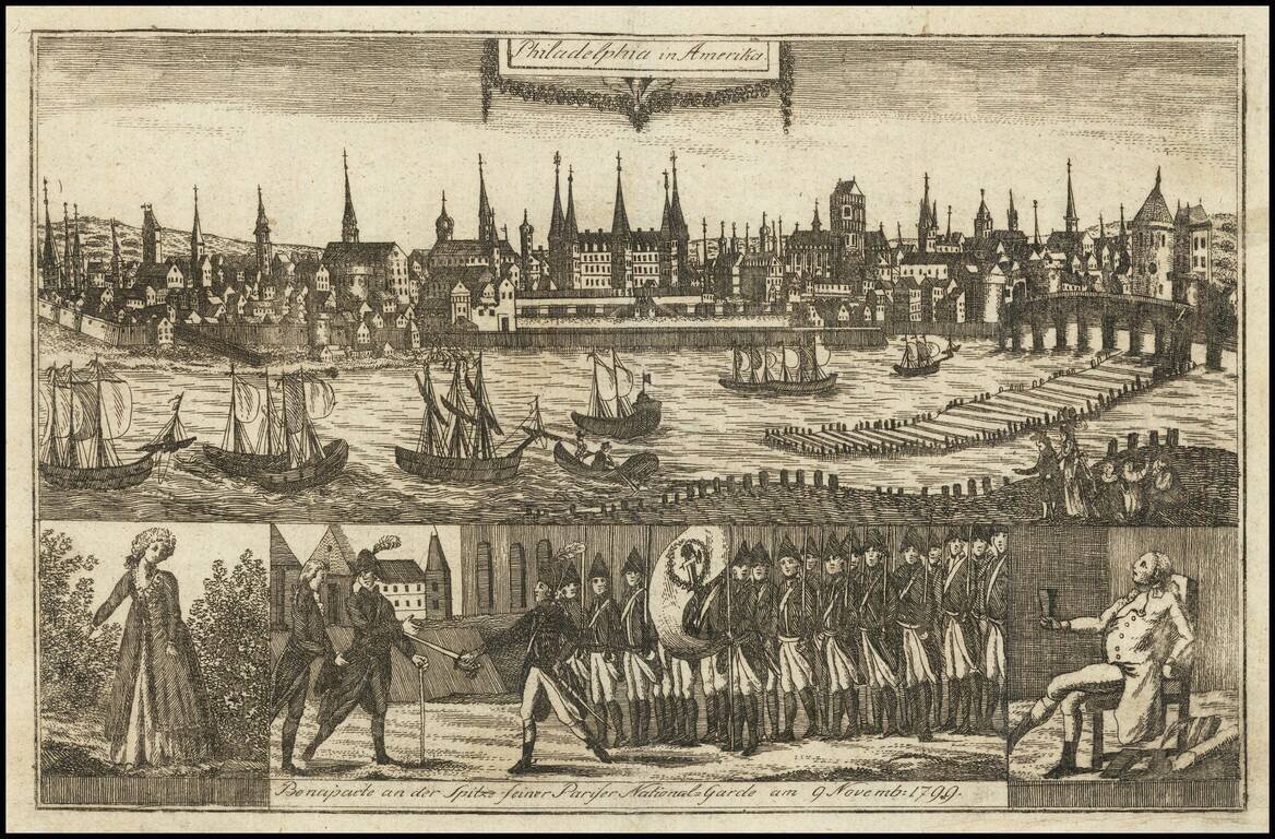
Capital of the United States Rare early view of Philadelphia, then capital of the United States, from a rare German publication The view was published in "Allgemeine Welt-Chronik oder neue und wichtige Zeit-Geschichte aller Länder und Völker." The...
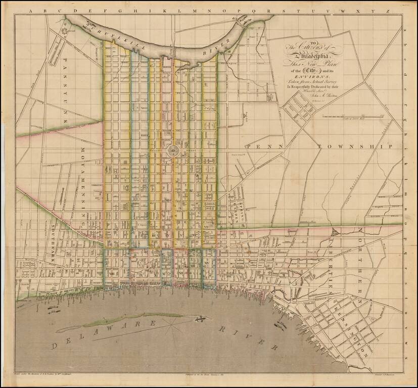
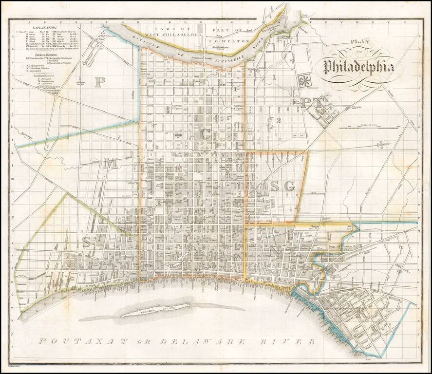
Rare early plan of Philadelphia, which appeared in published by John Paxton and engraved by William Harrison of Philadelphia. The map shows West at the top and provides a very different treatment of the City, when compared to predecessor plans such as...
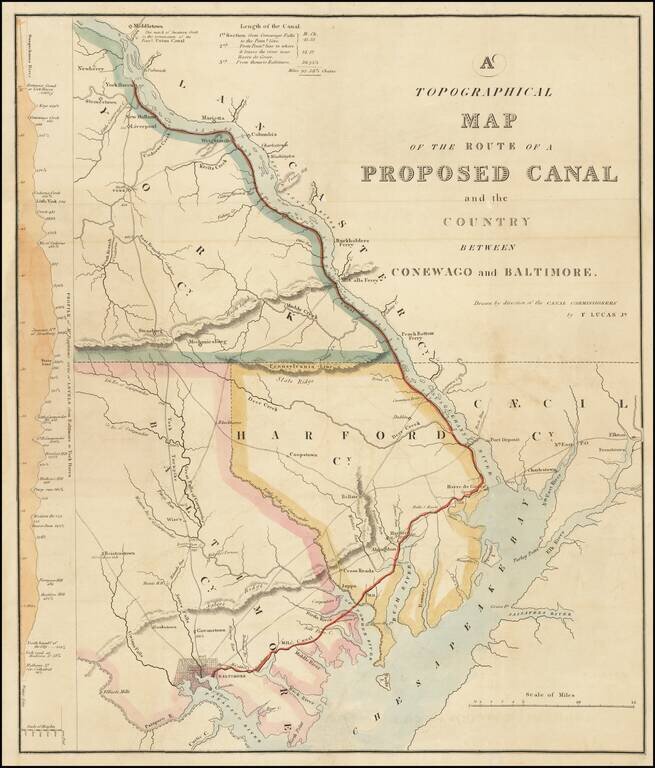
Rare map of the area between Baltimore, Harve de Grace and Middletown, Pennsylvania, drawn by Fielding Lucas Jr. for the Report of the Maryland Commissioners regarding the proposed canal from Baltimore to Conewago, Pennsylvania. The map illustrates...
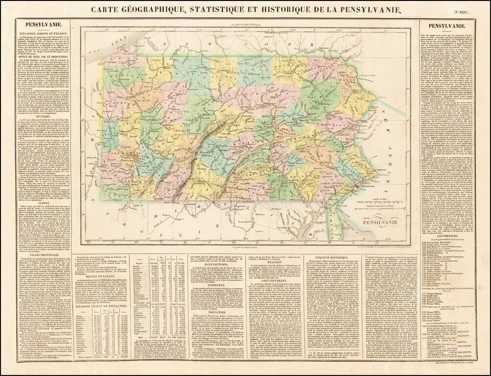
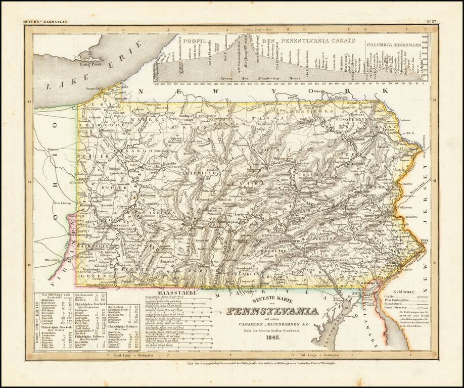
Attractive map of Pennsylanvia, colored by county and showing the various towns, roads, rivers, bridges, and a host of other details. The map is surrounded by text describing the state, its population, governors, religion, education, commerce, climate...
Early map of Philadelphia, published in Weimar, Germany. The map provides a fine picture of Philadelphia at the end of the 1820s. The map appeared in Reise Sr. Hoheit des herzogs Bernhard zu Sachsen-Weimar-Eisenach durch Nord-Amerika in den jahren...
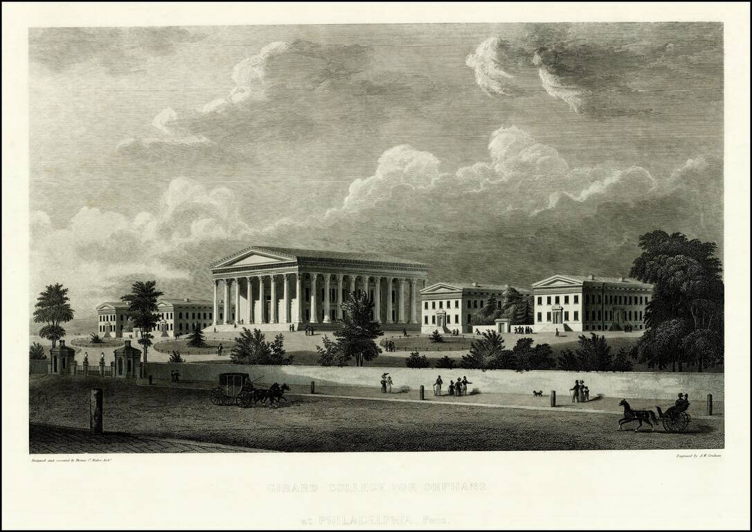
Striking view of the Girard College for Orphans, designed by Thomas Ustick Walter and engraved by A.W. Graham. Girard College was founded in 1833 and opened on January 1, 1848. Founded by Stephen Girard, the school was intended as a school for poor,...
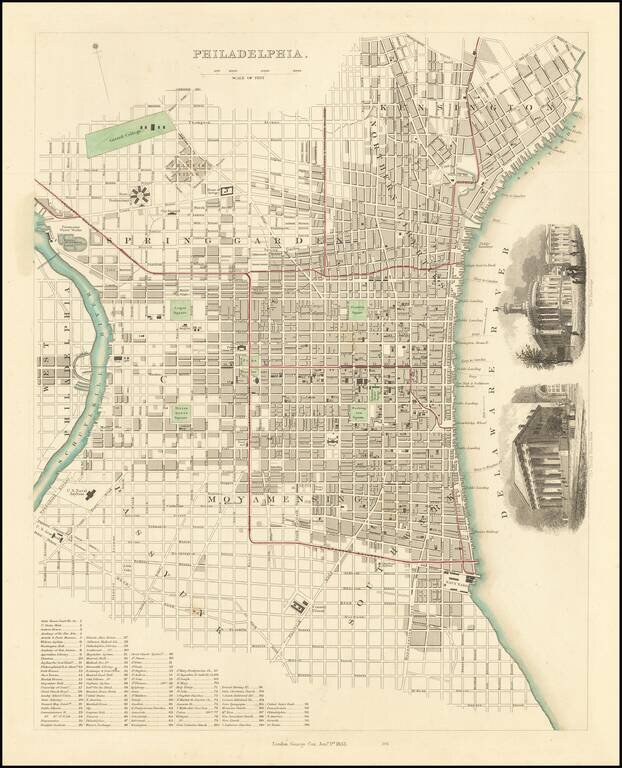
A highly detailed plan of Philadelphia from one of the best 19th-century English commercial atlases. Numerous streets, squares, buildings of historical interest, and railroads are all named. The map includes a key naming ninety buildings and other...
Fine example of this elegantly engraved & detailed map of Pennsylvania, based upon Tanner's work in the early 1840s. Shows counties, towns, roads, canals, lakes, etc. While often referred to as the German Mitchell, this characterization is unfair,...
![The Cities of Pittsburgh and Allegheny with Parts of Adjacent Boroughs [with] The City of Cincinnati Ohio.](/map/small/39410.jpg)
Two nice town maps on a single sheet, each with excellent detail and colored by ward. Early Pittsburgh maps are scarce. Decorative border. A terrific map, from JH Colton, one of the most prolific American mapmakers of the mid-19th century.
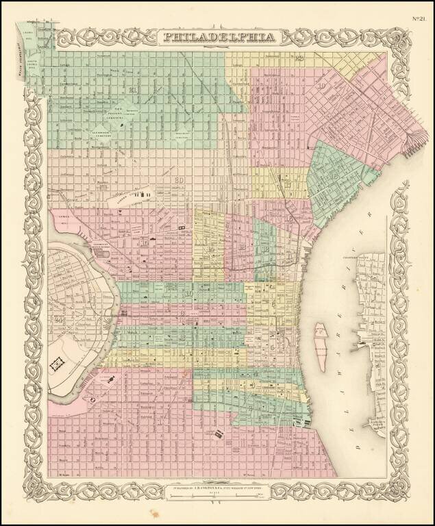
Detailed map of of Philadelphia, colored by wards and showing streets, roads, buildings, rail lines, wharfs, stations and other details. An excellent pre-Civil War map. JH Colton was one of the pre-eminent American map publishing firms in the mid-19th...
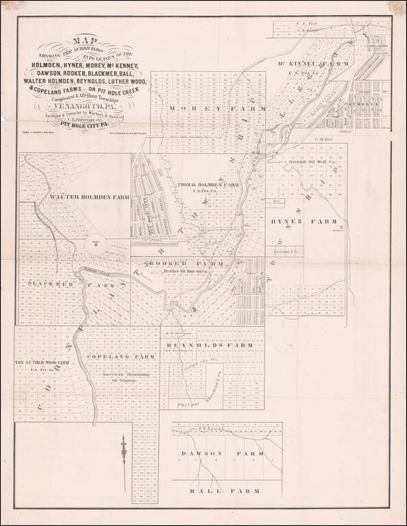
One of the First American Oil Booms - and the Site of John Wilkes Booth's Failed Investment in Oil and the World's First Oil Pipeline. Rare separately published map illustrating the available lands which in and around Pit Hole Creek, following the...
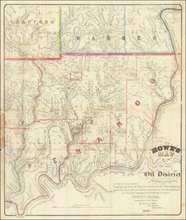
The First American Oil Boom. Rare Titusville-published map of the Pennsylvania Oil Region, the location of the first major oil boom in U.S. history. The map covers portions of Venango, Warren, and Crawford counties, which are outlined in pink, green,...
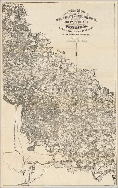
Rare map of the area between the Pamunkey and Ames Rivers, showing the Vicinity of Richmond, Virginia, as surveyed by Jeremy Francis Gilmer, surveyor for the Confederate States of America. The map bears some relationship to Albert H. Campbell's Map of...
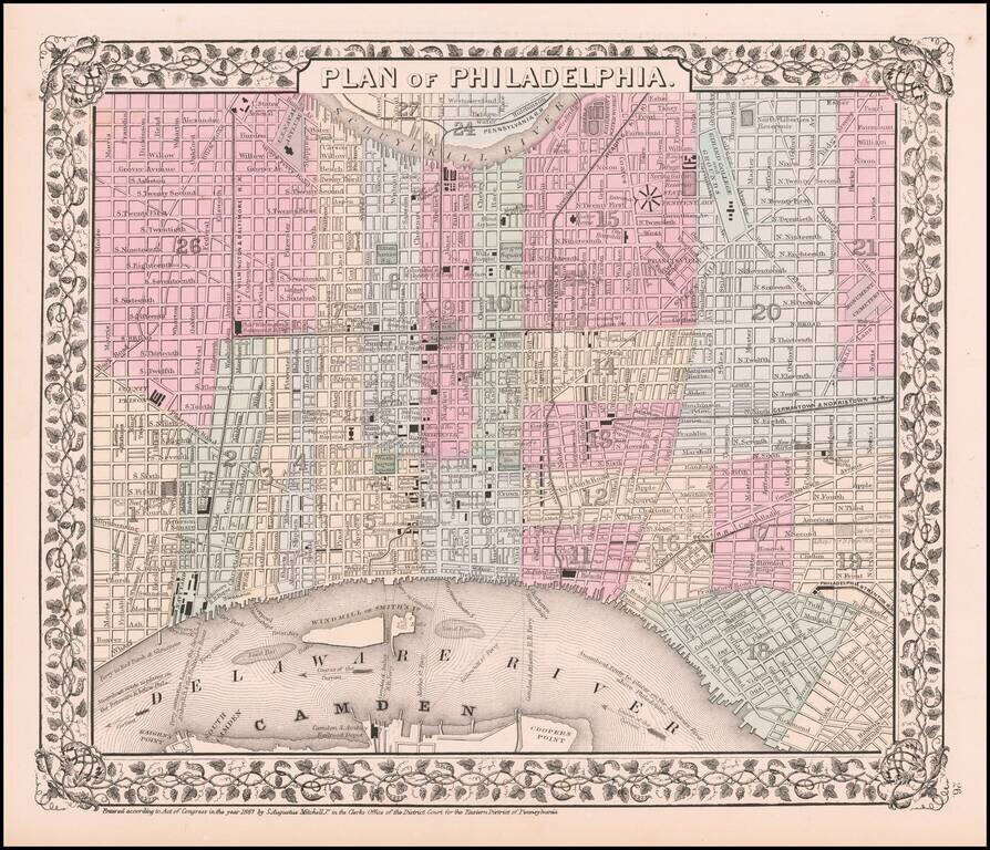
Detailed plan of the City, showing wards, streets, public buildings, ferrys, Windmill or Smith Island, Cooper's Point, Steamboat Routes, warves, and a host of Railroad and other details.